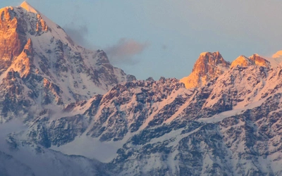
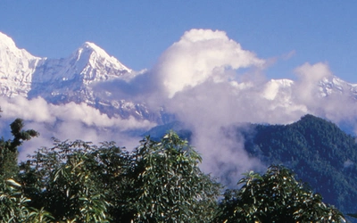
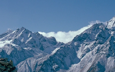
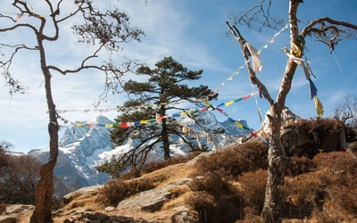
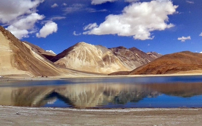
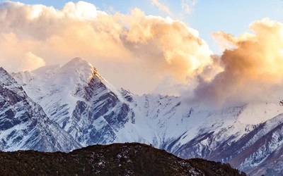
Jordan - Walks, Treks, Caves, Climbs and Canyons

Cover of Jordan – Walks, Treks, Caves, Climbs and Canyons
Availability
Published
Cover
Paperback - Laminated
Published
17 Jul 2008
Edition
Second
ISBN
9781852845209
Expand
ISBN (10)
1852845201
Size
21.0 x 14.8 x 1.5cm
Weight
610g
Pages
336
Originally Published
17 Jul 2008

Jordan – Walks, Treks, Caves, Climbs and Canyons

by Tony Howard, Di Taylor

This guidebook to Jordan describes a variety of walks, treks, caves, climbs and canyons in this wonderful landscape, based around Pella, Ajloun, the Dead Sea Hills, Dana, Petra and Wadi Rum. Covers Jordan's newly created nature reserves. More...

Buy from Cicerone

Printed Book
Adobe Digital eBook  (more)
Printed Book + eBook  SAVE £8.50
 

Seasons

Too hot June–August. Spring (late March to end May)/autumn (late September to mid-November) is Read More... good for walks. There can be flash floods in canyons winter/spring up to April, so summer to early autumn is best for canyoning. Northern hills have snow in winter.

Centres

Pella, Ajloun, Amman, Madaba, Karak, Dana, Wadi Musa, Wadi Rum village, Aqaba

Difficulty

Routes to suit all abilities. Any requiring special skills or equipment are identified as such. Read More... Some routes in remote areas. Route-finding ability often required... good maps are difficult to obtain.

Must See

Flower-carpeted 'alpine meadows' of the north; spectacular Dead Sea canyons; multi-day Dana–Petra Read More... treks; ancient city of Petra; caving and climbing in Jordan's exotic limestone regions; Wadi Rum's world famous Bedouin hunting routes and Jordan's highest mountain; a night in a real Bedouin camp.


View Sample Route Map

Route 1
Ajloun Castle to Kureiyima in the Jordan Valley


Grade      Moderate trek
Details    18km, descending from almost 1000m above sea level to 200m below, with c300m of ascent (sometimes quite steep). It’s well worth   
                  sleeping out on the 740m summit just over halfway for the memorable views of the sunset over Palestine and the lights of the Jordan
                  Valley by night. If you intend to camp leave Ajloun after midday, and walk down to Kureiyima the next morning.
Time         6–7hrs
                  See alternative start to this route, below.


A splendid walk in great mountain scenery, commencing high in the hills at Ajloun Castle and descending to the Jordan Valley, across which there are magnificent views to Eastern Palestine (alias the West Bank). In springtime the oak-forested hills and fertile green valleys with their orchards and olive groves are full of wild flowers. Apart from crossing a couple of country lanes the route keeps to the hills. See map 5.

Special requirements     Route finding is not always obvious, so take care at key points.
Approach    Arriving at the Ajloun roundabout from Jerash (café on right and others just a short way back up the road), turn left and walk or take a taxi up the road for about 2km to the castle. The walk starts along a small track just below its N side (GPS alt. 920m N32° 19.609’ E35° 43.575’), not the big track that leaves the road at the bend lower down.


The route
Follow the track W as it descends the hillside beyond. After about 0.5km it’s more pleasant to leave the track and follow the ridge to the SW (at this point there are a couple of big farm buildings down to the right).


The ridge goes pleasantly through trees and karst boulders, crossing the track again at a small saddle (840m). Continue, still generally SW, along a path on the ridge past a small farmhouse (where you may be offered tea, goat’s milk and cheese, and superb wafer-thin Bedouin bread called shrak). The farm dogs may also give you a noisy welcome! Beyond, the ridge rises slowly up, turning W to a small top at 870m.


It is now necessary to descend into Wadi el Muzeirib. Bear right (N) rather than left as there is a 30m-high overhanging limestone cliff to the left (Thôr Motlagh, ‘Sami’s Cliff’, the first climbing area to be found in Jordan outside Wadi Rum – see the chapter on Climbing in Jordan). Head diagonally down until you find a path going N through trees towards a limestone cliff on the opposite side of the valley. Where it meets the wadi, cross to the W bank and follow a path down the valley for about 0.5km until opposite and below Thôr Motlagh (alt. 550m). Continue on the path through the woods down Wadi el Muzeirib to the little country road near a farmhouse (total approx 6km, GPS alt. 480m N32° 18.648’ E35° 41.271’). The clear spring of Ain ez Zughdiya emerges about 300m down the road to the left (E).


Go right to the farmhouse, asking permission if anyone is around, before following a good track along its right side into olive groves and fields, ending after about 0.5km. An indistinct path then continues in the same direction first across the top of an olive grove, then descending slightly through a field (identified by a boulder-strewn hillside above to the right, and two white houses across Wadi Kufrinja to the left). It ends at another good, wide track, the key to the route.


Turn right up the track which rises up the hillside for about 0.5km, levelling out briefly to the W, then going over a small hill past well-tended olive groves with new walls. (A small road can be seen very close and just below to the left.) Continue steeply up the same good track, which comes to an abrupt end in an oak forest just below an extensive escarpment of steep limestone cliffs, about 20m high with caves at the right end (Wahadina Cliff, with some climbing possibilities – about 3km from the farmhouse, 9km from the start – see Climbing in Jordan).


Shepherds’ paths now continue up through the oaks and rocks to the foot of the cliffs, which are cut by a narrow rocky gorge (GPS alt. 630m N32° 18.229’ E35° 40.065’). Scramble up rocky ledges on the right (E) side of the ravine, following goat tracks, to reach the pleasant, open, hanging valley above, then go left (W) to reach the rounded summit of a hill (740m), with superb views W across the Jordan Valley, SW down Wadi Kufrinja and NE to Ajloun Castle. This is about 10km from the start – a great place to spend the night.


From the hill, a ridge will be seen rolling down the right side of Wadi Kufrinja. Follow it down, keeping to its left side, sometimes near cliffs with great views into the valley, to reach a little road after 1km (houses with wells). Cross the road and continue on a track past the second house and out along the ridge, then down past more old houses in an idyllic rural setting. (If anyone is home you will almost certainly be offered shai (tea) and perhaps something to eat.)


After going over a small rise on the ridge, continue down, passing left of fields and a final house and crossing a small track which leads to it. Still going down, another track will be reached almost 3km from the 740m summit. This is another key point: go right on the track, which forks almost immediately. Take the left fork, which curves left and leads down to fields, above which the track goes left and ends. Walk round the left side of the fields on small paths, just above the cliffs on the upper edge of Wadi Kufrinja, in the side valley of Wadi Shtura. Still heading for what appears to be the final bare, rocky hill at the end of the ridge, continue down slightly rightwards and cross a side wadi just S of a large flat area of fields. (There is said to be a well, or bir, about 5m deep, a short way up the wadi.)


Follow sheep tracks out of the wadi and up left towards the hill, keeping left of the fields, then contour rightwards round the hill on a path, with the fields just below to the right. The path continues to wind round the hill, turning left above a narrow valley and eventually rising up on the far side of the hill to meet the ridge again, once more above Wadi Kufrinja (about 6km from the 740m summit, with excellent views all round).


Still following the same good track, continue down the ridge until the track splits below another top. Take the left fork, down to a saddle. The track continues up and over the final top, and down to Kureiyima and looks straightforward, but we went down into Wadi Kufrinja where a house and gardens can be seen directly below. If you choose this way, to get there from the saddle, follow a little path sharply back left down the hillside, then go right near a little wadi (small cliffs and caves) and scramble down to enter Wadi Kufrinja near the house. From there, a track goes along the side of the stream past orchards and olive groves with cliffs in which there are caves and even a natural rock arch. Kureiyima and the Jordan Valley are just beyond (GPS alt. minus 200m N32° 16.079’ E35° 36.040’).

Return    Regular minibuses go down the Jordan Valley to Deir ‘Alla (10km) from where there is a frequent bus service to Amman.


Site by OUTSRC