Ready for adventure in the Lake District Fells? Cicerone’s Walking the Lake District Fells guides are your ultimate fell-by-fell companions. A series of eight guidebooks, one for each of the main valley bases, cover ALL the routes up ALL the fells in each area – that’s 230 fells in total.
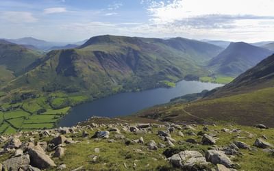
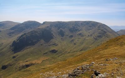
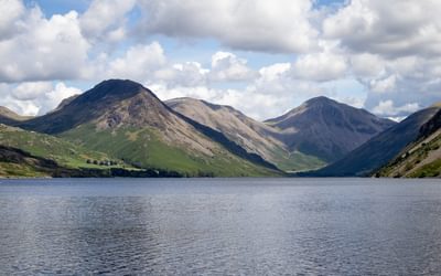
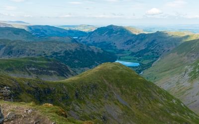
This guidebook covers 25 Lakeland summits that can be climbed from the valleys of Wasdale, Eskdale and Ennerdale. Quieter and wilder than the eastern side of the national park, highlights include Great Gable, Pillar, Yewbarrow and Scafell, as well as England's highest mountain, Scafell Pike. Also included are a handful of classic ridge routes for longer fell days.
Those with some previous hiking experience will find all the info needed to climb the fells with confidence, plus a fresh perspective on both classic and lesser-known fells. Keen summit-baggers can use our tick lists to tick off the fells as they go.
What sets these guidebooks apart from the rest?
- Complete coverage – every route covered, not just the main one.
- Devise your own routes – a variety of ascents, descents, and ridge routes, so you can choose to climb one fell or combine routes to craft your own adventure.
- Up-to-date route information – complete route description and HARVEY mapping for each fell.
- Hand-drawn topos and panoramas – easily see the routes up each fell and views from the top.
- Fell-friendly routes – designed to minimise environmental impact.
CONTENTS
Volumes in the series
Key to maps and topos
Author preface
Starting points
Introduction
Valley bases
Fix the Fells
Using this guide
Safety and access
Additional online resources
Fells
1 Buckbarrow
2 Caw Fell
3 Crag Fell
4 Eskdale Moor
5 Great End
6 Great Gable
7 Great How
8 Grike
9 Haycock
10 Illgill Head
11 Iron Crag
12 Kirk Fell
13 Lank Rigg
14 Lingmell
15 Middle Fell
16 Pillar
17 Red Pike
18 Scafell
19 Scafell Pike
20 Scoat Fell
21 Seatallan
22 Slight Side
23 Steeple
24 Whin Rigg
25 Yewbarrow
Ridge routes
1 The Roof of England
2 The Mosedale Round
3 The Nether Beck Horseshoe
4 The Upper Ennerdale Round
More to explore
Appendix A Useful contacts
Appendix B A fellranger’s glossary
Appendix C Alphabetical list of 230 Fellranger fells
An authoritative, comprehensive, up-to-date guide to all the routes in the fells
Mark Richards is an indefatigable mountain walker. He is also an incurable romantic and his passion for the fells is probably unsurpassed except, perhaps, by his old friend Alfred Wainwright. For Mark, the Lake District is “a land of living dreams”.
He finds: “The trappings of modern life thrust carpet and concrete under our feet and it is always wonderful to walk the region’s sheep trods and rough trails, and to imprint our soles on the fells.” Those imprinted soles, however, bring their own hazard: the well-trodden routes up the fells are becoming too well trodden and it is one of the intentions of this and the other guides in the series to encourage walkers to venture on other less-frequented paths. Mark wants to recommend “fell-friendly routes to each summit which are less susceptible to erosion”. He finds Scafell Pike is not the most beautiful of fells, but it is “the highest, roughest, toughest and assuredly the most revered ground”.
Mark offers routes up from four directions, but you always feel he is a man who has walked the route many times in all sorts of weather, one who understands the problems a person walking that way for the first time might encounter. Walking up from Rossett Gill, he notes that “the terrain here has a nasty habit of confusing even confident ramblers and it is a meeting of the four winds too”.
You feel he is with you as you follow the route: “Weave through the boulders, the path inevitably vague. The boulders relent as the summit of Scafell Pike comes tantalisingly into eye-shot – more distant than you may have hoped.” There are detailed maps to support Mark’s descriptions and some intelligently chosen photographs. The glory of these guides, however, is Mark’s own drawings. Unashamedly imitated from Wainwright, they offer the clearest of visual guides to each route. The guide also includes a selection of inspiring ridge routes. Mark takes the aspiring walker on the Great Langdale Round, the Langdale Pikes, the Easedale Skyline and the Green Burn Horseshoe.
The eight guidebooks in the series are revamped versions of Mark’s Fellranger series of guides published a decade ago. If you require an authoritative, comprehensive, up-to-date guide to all the routes in the fells, then this new, smaller, lighter format of Mark’s Fellranger series of eight guides is among the best.
They are colourful and well-planned. And Mark’s enthusiasm is infectious. You only have to read his description of one of the routes and you’ll be getting out of that cosy chair in front of the fire and reaching for your hiking boots.
Steve Matthews
Bookends, Carlisle and Keswick
www.bookscumbria.com
Possibly the best [guidebooks] we’ve ever seen.
"Two of us were flicking through the books in the Trail office yesterday and came to the conclusion that they were possibly the best of their kind we’ve ever seen. I love how clearly each volume is broken down by recognisable areas of the Lakes, and the level of detail in the descriptions, maps and illustrations is absolutely awesome. Inspirational and instructional – just like a proper guidebook should be!"
Oli, editor at Trail magazine


