Map key
Route Summary Table
Overview map
Introduction
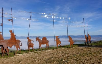
History of the Way
Renewed interest
Historical figures along the Way
Variations to the Way
Walking the Way
When to walk
Where to stay
Refreshments
Waymarking
Maps
Using this guide
Winchester to Canterbury
Stage 1 Winchester to Alresford
Stage 2 Alresford to Alton
Stage 3 Alton to Farnham
Stage 4 Farnham to Guildford
Stage 5 Guildford to Box Hill
Stage 6 Box Hill to Merstham
Stage 7 Merstham to Oxted
Stage 8 Oxted to Otford
Stage 9 Otford to Wrotham
Stage 10 Wrotham to Halling
Stage 11 Halling to Aylesford
Stage 11a Peters Village to Rochester
Stage 12 Aylesford to Harrietsham
Stage 13 Harrietsham to Boughton Lees
Stage 14 Boughton Lees to Chilham
Stage 15 Chilham to Canterbury
London Route
Stage 1a Southwark to Shooters Hill
Stage 2a Shooters Hill to Dartford
Stage 3a Dartford to Otford
Appendix A Itinerary planner
Appendix B Accommodation
Appendix C Further information
Appendix D Further reading
Reassurance at every stage
I'd like to compliment the author, Leigh Hatts, on his route guidance. Particularly eastwards from Farnham, after the Pilgrims' Way leaves the well waymarked St Swithun's path, signage is unreliable. But carefully crafted brief descriptions of junctions and mentions of house names and landscape and built features along the Way provide reassurance at every stage. In 11 days of walking we made only one navigational error, and that was less due to the book than to the tasty distraction of hedgerow damsons beside the path! Thank you Mr Hatts and Cicerone. We enjoyed our walk along this ancient route immensely!
Graham, by email
Very accurate, very up to date, very interesting and a good pocket-size guide.
I have just used Leigh Hatts' guide to the Pilgrims Way and found it very good indeed. Very accurate, very up to date, very interesting and a good pocket-size guide. No need for any updates at all !
David White, by email
This guide book is first class - it has everything
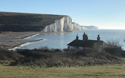
The Pilgrims' Way is an ancient 141-mile route from Winchester Cathedral in Hampshire to Canterbury Cathedral in Kent. Canterbury Cathedral houses the shrine of St Thomas Beckett, who was murdered by knights loyal to Henry II in I 170 after a major and very public split with the king. The route follows ancient byways and scenic countryside but should not be confused with the North Downs Way, the 156-mile National Trail from Farnham in Surrey and which has a Canterbury loop, although both routes do often Coincide.
This is the second guide book by Leigh Hates to be published by Cicerone, following his Thames Path and Lea Valley Walk guides, and it has everything - an extremely thorough step-by-step route description with maps; distances from the various stops; detailed information on places to see en route and background on Becket; transport details and recommended pubs, hotels, guest houses and other accommodation.
There are also full details of the other Pilgrims' Way, a 90-mile route from Southwark Cathedral in London which links with the main route at Otford and which was immortalised by Geoffrey Chaucer in the Canterbury Tales.
This guide book is first class, but the only problem with the Pilgrims' Way - as Leigh Hatts tells us - is that waymarking on the route is rare and often non-existent, and that's such a shame on a trail so rich in heritage.
Graham Smith, Strider
I bought a copy of the new Pilgrims Way guide and am wowed by it. Leigh Hatts has made a cracking job of it, and your team in Milnthorpe has once again came up trumps in putting together another attractive guide that scores on every count. You’ve all done a great service to pilgrims of the future.
By email, Feb 2017
It’s a 136-mile route packed with interest and history, and Leigh Hatts, creator of the Thames Path, is an entertaining and knowledgeable guide.
Outdoor Focus, Summer 2017
"An excellent guide to this English Camino"
The Catholic Herald
"Another great Cicerone publication, in their tradition of producing attractive and accurate walking guides...
Pocket size - but the contents are certainly not pocket size. Inside, on glossy paper, we find a huge amount of information backed by excellent colour photos. There are clear directions [and] the practical things... are all clearly and succinctly presented.
Hatts includes the historical, spiritual and literary background, which makes this book much more than just a guide to walking a footpath. In his introduction and inserted into the walk at strategic points, is fascinating and relevant information about saints, historical figures, churches, writers and artists - enriching the walk both at the planning stage and as it is undertaken. this amount of material makes it also very readable for anyone doing some armchair travelling.
This must be the definitive guide to the Pilgrim's Way... a pleasure to browse, dip into, use for a local walk, or study before or during the walk - highly recommended."
Helen Willson, the Confraternity of Saint James
"Clear descriptions and maps for people seeking to make the pilgrimage in the 21st Century"
The Great Outdoors
"It's a bonus for two routes to be included so you can choose the most relevant one for you. All vital info is included, such as advice on when to walk [the Pilgrim's Way], where to stay and refreshment at each stage. It's the definitive guide for anyone wanting to walk the Pilgrim's Way.
Outdoor Enthusiast
"This guidebook is first class, but the only problem with the Pilgrim's Way - as Leigh Hatts tells us - is that waymarking on the route is rare and often non-existent, and that's such a shame on a trail so rich in heritage.
[This guidebook] has everything - an extremely thorough step-by-step route description with maps; distances from the various stops; detailed information on places to see en route and background on Becket; transport details and recommended pubs, hotels, guest houses and other accommodation."
Graham Smith, the Long Distance Walkers' Association


