CONTENTS
Map key
Overview map
INTRODUCTION
Terrain
Wildlife and plants
History and culture
Getting there
Getting around
The weather and when to go
Where to stay
Preparing your bike
Preparing yourself
Planning your trip
What and how to pack
Riding comfortably
Riding in a group
Using this guide
Maps and itineraries
1 CLYDE AND KINTYRE
Introduction
Link Routes
1A Gourock to Ardrossan
1B Dunoon to Portavadie
1C Auchenbreck to Rothesay
1D Brodick to Lochranza
1E Claonaig to Tayinloan
1F Kennacraig to Oban
Day Routes
1.1 Circuit of south Arran
1.2 Circuit of north Arran
1.3 Circuit of Great Cumbrae
1.4 Circuit of Bute
1.5 Gigha
2 COLONSAY, ISLAY AND JURA
Introduction
Link Routes
2A Port Ellen to Port Askaig
Day Routes
2.1 South coast of Islay
2.2 Circuit of northwest Islay from Bridgend
2.3 Circuit of central Islay from Bowmore
2.4 Circuit of southwest Islay (The Rhinns)
2.5 Craighouse and back from Feolin Ferry
2.6 Circuit of Colonsay
3 MULL, COLL AND TIREE
Introduction
Link Routes
3A Craignure to Tobermory
3B Lochaline to Salen
3C Salen to Kilchoan
3D Salen to Mallaig
Day Routes
3.1 Slate Islands
3.2 Kerrera
3.3 Circuit across Lismore from Oban
3.4 Circuit of central Mull
3.5 Circuit of northern Mull
3.6 Out to Iona
3.7 Coll
3.8 Circuit of west Tiree
3.9 Fishbone ride in east Tiree
4 SKYE AND RAASAY
Introduction
Link Routes
4A Ullapool to Armadale
4B Stromeferry to Uig
Day Routes
4.1 Across the Sleat Peninsula from Armadale
4.2 Elgol and back from Broadford
4.3 A three-legged ride from Carbost
4.4 Around the Duirinish Peninsula
4.5 Circuit of the Trotternish Peninsula
4.6 Circuit of central Skye
4.7 Skye Bridge/Glenelg circuit from Kyle of Lochalsh
4.8 Raasay
5 BARRA AND THE UISTS
Introduction/Planning The Hebridean Way
Link Routes
5A Castlebay to Lochboisdale
5B Dalabrog to Clachan
5C Clachan to Berneray
5D Clachan to Berneray Junction
Day Routes
5.1 Circuit of Barra and Vatersay
5.2 South Uist machair from Tobha Mor
5.3 Circuit of North Uist
6 HARRIS AND LEWIS
Introduction
Link Routes
6A Leverburgh to Tarbert (west)
6B Leverburgh to Tarbert (east)
6C Tarbert to Stornoway
6D Liurbost to Barabhas
6E Stornoway to Butt of Lewis
Day Routes
6.1 Circuit of south Harris
6.2 Huisinis from Tarbert
6.3 Scalpay from Tarbert
6.4 Callanish by the Pentland Road
6.5 West Lewis from Gearraidh na h’Aibhne
6.6 The Bridge to Nowhere from Stornoway
Appendix A Link route summary table
Appendix B Day route summary table
Appendix C Ferry routes
Appendix D Suggested tours
Appendix E Day trips to islands
Appendix F Cycle shops and cycle hire
Appendix G Hostels
Appendix H Tourist information
Appendix I Further reading
Maps and Itineraries
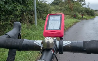
This book is designed to be carried with you either in a pocket of your cycling jersey or in a map case on top of your handlebar bag. Each route is illustrated on an accompanying map based on OS data, and refreshment stops (), cycle shops (), places where cycles can be hired () and cash dispensers () are all indicated. However it is advisable to carry separate maps that cover your intended route. Many seasoned cycle tourists make do with a page from a road atlas or a printout from the internet while others carry a Global Positioning System (GPS) with integrated mapping.
Ordnance Survey’s 1:50,000 Landranger Series provide the right level of detail for both riding and exploring the local area, showing useful information such as hotels and public houses where there may be food and refreshments, tourist information centres and considerable detail about gradients. However if you are covering a wider area, you will need to carry a number of maps and many riders will be content with a touring map on a scale of 1:250,000 or 1:300,000 that provide an overview of the region and are useful for making changes to journey plans to avoid prevailing winds or to curtail your trip at short notice.
If you have mapping software such as Memory-Map on your computer, you can print out your intended route to any scale you wish and cut and paste a number of ribbon strips showing your route on a single side of A4 paper. If you laminate these back to back, you can often get your entire trip covering hundreds of miles on three or four totally weatherproofed sheets. You can even add text boxes containing the contact details of your accommodation. However these sheets do tend to catch the wind and it is advisable to punch a hole in the corners of each sheet and secure them to the top of your bar bag.
The same goes for your itinerary. Download any rail, ferry or bus timetables and accommodation details and contact numbers you need during your trip and cut and paste them on to an A4 sheet so they are legible but not over-large, and you can get all the information you may have to refer to on a couple of sides. This saves having endless pieces of paper that blow away or get wet at the bottom of a pannier.
Ferries are detailed in Appendix C, and the numbers used in Appendix C match the ferry numbers used on the overview maps for each section of this book and in the route tables in the appendices.
"I can't think of anywhere finer to cycle than the Hebrides... This book has it all, as well as good advice on equipment, preparation, [it covers[ travel to the islands and the weather. Highly recommended."
Cameron McNeish, Scots Magazine
For those who have not yet been persuaded to take their bicycles to the Hebrides and have a jolly good ride around, Richard Barrett's Cicerone guide might well just be the final push needed. The book covers an incredibly beautiful and fascinating area, one that is wild, peaceful and relatively remote compared to much of the UK.
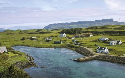
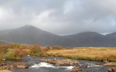
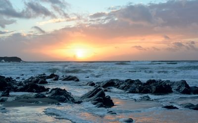
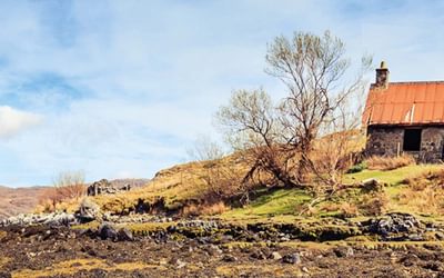
Cycling in the Hebrides will provide any prospective visitor with a host of good ideas and plentiful information. Take a look at some of the photos and put the islands of the west coast of Scotland on your destination list.
Steve Dyster, Seven Day Cyclist
"Cycling in the Hebrides" by Richard Barrett is a lovely little book that will prove an indispensable companion to anyone cycling in the western margins of Scotland: or, indeed, to others touring the area using less energetic and less virtuous modes of transport.
The format of the book is a tried, tested and very effective one... Clear and helpful maps are accompanied by informative gradient tables, text descriptions, overview sections and excellent photography.
Undiscovered Scotland
"Well-researched, well written and copiously illustrated"
Washingmachinepost
"It's highly practical, with its wealth of maps and relief diagrams and advice on what to pack. But it finds room for plenty of anecdotal stuff too."
Scotland Outdoors magazine
An island-hopping guide aimed at regular cycle tourers or those who’d like to try a few bike rides during a Hebridean holiday.
Scottish Memories magazine


