Map key
Overview map
Route summary table
Introduction
The Southern Upland Way
West to east or east to west?
When to go
Ways of tackling the SUW
Luggage transfer and drop-off/pick-up services
Accommodation
Getting to and from the SUW
Planning and preparation
Equipment
Maps
Waymarking and navigation
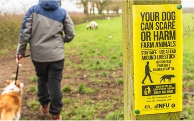
Access in Scotland
Ticks
Completion certificates and SUW badges
A high-level alternative coast-to-coast route
Using this guide
The route
Stage 1 Portpatrick to Castle Kennedy
Stage 2 Castle Kennedy to New Luce
Stage 3 New Luce to Bargrennan
Stage 4 Bargrennan to the Glenkens
Stage 5 Across the Glenkens
Stage 6 The Glenkens to Sanquhar
Stage 7 Sanquhar to Dalveen Pass
Stage 8 Dalveen Pass to Beattock (Moffat)
Rest day – Moffat and environs
Stage 9 Beattock (Moffat) to Ettrick
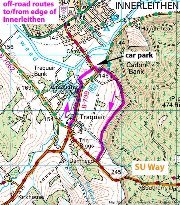
Stage 10 Ettrick to Traquair (Innerleithen)
Stage 11 Traquair (Innerleithen) to Melrose
Stage 12 Melrose to Lauder
Stage 13 Lauder across the Lammermuir Hills to Longformacus
Stage 14 Longformacus to Cockburnspath
Appendix A Itinerary planner
Appendix B Bothies along the SUW
Appendix C Bibliography
Appendix D Useful contacts
This book will be invaluable to any-one planning to walk this trail and I heartily recommend it
The Southern Upland Way at 215 miles is one of Scotland's longest trails. It runs from Portpatrick in the west to Cockburnspath (please do not make a social blunder, it is pronounced Coeburnspath) on the east coast. As it was opened in 1984 an update was necessary and those nice people at Cicerone have obliged. It is the usual format, pocket size with a waterproof cover. For any-one wanting to walk this trail, this book has all the information needed. It gives information on how to reach the start, planning, what equipment needed, where to find accommodation and shops and even the addresses of companies who will transport your rucksack for you. Wild camping is possible in many places so backpacking is an option but unfortunately four youth hostels and Tibbie Shiels Inn near to the SUW have been closed. The route is divided into 14 sections between 9 and 18 miles in length and there are pictures of OS.maps at 1.50,000 with the route overlaid so unless you need to divert from the trail or need to identify other surrounding hills, etc. no other maps would be required. A list of maps is provided should you require them. Distances are in metres and kilometres while summits and heights are given in metres and feet as many walkers find it easier to visualise height in feet.
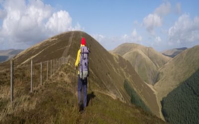
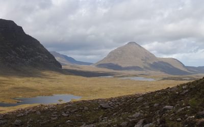
The entire length of the trail is way- marked with the Scottish thistle symbol. It would be advisable to read the summary table at the start of each section before setting off as it gives advice such as problems with swollen rivers and alternative routes etc. There was criticism of the original route running through too much forestry and now the trail has been re-aligned out of many of the forests with even a new high level line over the Ettrick hills. Those who like to use bothies will find five on the route and the book gives distances be-tween them. For those not familiar with bothy life it explains how to use the shelters and how to leave them in a clean condition, etc. Each section includes places of interest on or nearby the trail, i.e. Traquair House, Lead mining museum and Melrose Abbey. Numerous photographs are shown giving an idea of the country you will pass through. While there is no right or wrong way to walk the trail, the prevailing weather comes from the south west, so by starting at Portpatrick the wind and rain, should you encounter it, will be at your back. In order to keep up to date with the route, the book can be registered at Cicerone to get free updates. The latest accommodation updates can be obtained on the SUW website at http://www.southernuplandway.gov.uk.
This book will be invaluable to any-one planning to walk this trail and I heartily recommend it. So, start planning and come and explore a lovely part of Scotland that most people miss on their rush to the Highlands.
John Fitzgerald, Backpack magazine
I strongly recommend the Southern Upland Way
The Southern Upland Way is a 215 mile route from Portpatrick on the west coast of Scotland through the southern uplands to Cockburnspath on the east coast. The route passes through varied and often remote countryside and, with 28,000ft of ascent, goes over a number of hills as well as dropping to visit historic towns such as Melrose and Moffat.
The Way is well-waymarked with the 'thistle' emblem and in general the paths are good and clear to follow, though sometimes boggy. lt is one of the original 'Great Trails' of Scotland, but unlike the West Highland Way it attracts relatively few walkers.
The first edition of this guide was written by Alan Castle, well-known as recorder of the LDWA National Trails Register. After 10 years, changes along the route have inevitably accumulated, and outdoor writer Ronald Turnbull, who also lives close to the Way, has undertaken this revision and update.
The guide adopts the familiar Cicerone format, with a full route description supported by 1:50,000 strip OS maps. Alternative route sections are suggested which may be appropriate when the Scottish wind and rain make higher level parts unattractive. There are notes on the local features and personalities and many colour photographs.
Most importantly the book provides advice on planning the walk: for some stretches accommodation is scarce with stretches of up to 33 miles with nowhere to find a bed. The book includes information on such accommodation as there is (there are several bothies and wild camping is often possible). Where there is no accommodation there are sometimes busses as well as several companies that will get you to and from a guest house off the route or at least provide baggage transfer. The Cicerone website maintains an updates page for the book.
I strongly recommend the Southern Upland Way for those wanting a good challenge, together with this excellent updated guidebook for planning and undertaking the walk.
Ken Falconer, Strider magazine
Couldn’t have done it without your help.
Two days ago I completed the Cape Wrath Trail after completing the Southern Upland Way, John Muir Way, and West Highland Way. Couldn’t have done it without your help.
Thank you for being a part of my journey.
Josh
'A prolific walker and guidebook writer, Alan Castle has walked the Southern Upland Way twice. He describes the route from west to east, each stage has its own 1:50,000 OS mapping with the route clearly overlaid. The guide includes historical background information and local interest information along the way.
The guide is well laid out, easy to follow and the text is accompanied by full colour photographs, all designed to add attraction to the route. Add it to your walks to do in 2008 - and don't forget to take this guidebook with you.'
(Strider / December 2007)
'Cicerone has produced another polished trail guide, this time to Scotland's official coast to coast route. It divides the 212 mile route across southern Scotland into 13 stages and includes not just extensive route descriptions and maps but also detailed breakdown on the distances. There's a handy appendix on the six bothies along the trail, as well as plenty of interesting background information.
(Walk magazine / Winter 2007)


