

At the height of canal mania the Kennet and Avon Canal was a super-highway across southern England. Decline followed the arrival of the railways, and an army of volunteers then restored it. Now it is a multi-faceted jewel for walkers, boaters and wildlife, offering peace, tranquillity and a slower pace of life. This planning guide helps you decide whether to walk the full 150.5km (93½ miles) from Reading to Bristol's Floating Harbour in 7 stages, or to explore it through 20 circular walks. (Last updated: November 2026 · Guidebook edition: 2nd edition, August 2024)
Quick facts
- Distance: 150.5km (93½ miles), Reading to Bristol
- Duration: 7 stages, which can be split or combined to suit; minimum total walking time 39½ hours
- Start: Kennet Mouth, Reading, where the canal and River Kennet join the Thames
- Finish: Neptune statue, Floating Harbour, Bristol
- Stages: 7, plus 20 circular walks of 7 to 15km (4¼ to 9¼ miles)
- High point: low-level terrain, below 286m above sea level
- Difficulty: Fairly easy; stages run from 15.7 to 27km (9¾ to 16¾ miles), and some circular walks have short, steep climbs
- Terrain: Towpath, riverside paths, field edges and urban sections in Reading, Bath and Bristol
- Waymark: The towpath is very well signposted; rights of way are marked with yellow, blue, purple and red arrows
- Accommodation: Youth hostels, campsites, guesthouses, pubs with rooms and hotels
- Best season: Spring and autumn; walkable year-round
- Guidebook: The Kennet and Avon Canal by Steve Davison, 2nd edition, August 2024
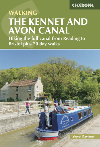
What is the Kennet and Avon Canal?
The Kennet and Avon Canal is a waterway stretching across southern England from Reading to Bristol, formed when the Kennet Navigation and the Avon Navigation were joined by a 91.5km (57 mile) canal between Newbury and Bath. In its early 1800s heyday it carried goods from coal and timber to grain and stone, contributing to the growth of the south in the late Georgian and early Victorian years.
It weaves through a patchwork of countryside, from the rolling chalk contours of the North Wessex Downs to the southern edge of the Cotswolds, passing vibrant towns and cities as well as picture-postcard villages with thatched cottages, ancient churches and cosy pubs. Along the way you pass the world-famous Crofton Pumping Station and Beam Engines, the Caen Hill flight of locks at Devizes, the ornate aqueducts at Avoncliff and Dundas, and the Georgian splendour of Bath.
The widespread use of the canal lasted only a few decades before Brunel's much faster Great Western Railway arrived. By the 1950s the canal was in a very poor state, but plans to abandon it were brushed aside by public support, and volunteers set about its gradual restoration. Queen Elizabeth II reopened the full length in 1990, and the canal celebrated its bicentenary in 2010.
This planning guide answers the most common questions walkers have before setting out. For complete stage-by-stage route descriptions and mapping, see the Cicerone Kennet and Avon Canal guidebook.
How long is the Kennet and Avon Canal?
The walk from Reading to Bristol is 150.5km (93½ miles) and the guidebook divides it into 7 stages of 15.7 to 27km (9¾ to 16¾ miles), with a total ascent of 845m.
| Stage | Distance | Ascent | Time |
|---|---|---|---|
| Reading to Woolhampton | 20.7km (12¾ miles) | 135m | 5½hr |
| Woolhampton to Hungerford | 24.9km (15½ miles) | 125m | 6½hr |
| Hungerford to Pewsey Wharf | 22.8km (14¼ miles) | 150m | 6hr |
| Pewsey Wharf to Devizes | 19.3km (12 miles) | 105m | 5hr |
| Devizes to Bradford-on-Avon | 20.1km (12½ miles) | 100m | 5¼hr |
| Bradford-on-Avon to Bath | 15.7km (9¾ miles) | 100m | 4hr |
| Bath to Bristol | 27km (16¾ miles) | 130m | 7¼hr |
Times are the guidebook's minimum walking times, based on 4km/hour (2½ miles/hour) plus 10 minutes for every 100m of ascent, and do not allow for rests or sightseeing. The longest stage is the final one from Bath to Bristol at 27km (16¾ miles), which follows the River Avon and the Bristol & Bath Railway Path rather than the canal itself. The shortest, Bradford-on-Avon to Bath at 15.7km (9¾ miles), is one of the most picturesque, taking in the Avoncliff and Dundas aqueducts.

Who is the Kennet and Avon Canal walk suitable for?
The Kennet and Avon Canal walk suits most walkers, from first-time long-distance walkers to experienced hikers wanting an easy-going route. The terrain is low-level, below 286m above sea level, on mostly good paths and tracks, and the guidebook notes that the stages are not set day sections, so you choose how far to go each day.
Be realistic about the demands: the long stages, especially Stage 7 at 27km (16¾ miles), add up over consecutive days, and the circular walks include some steep climbs and descents on paths that can be narrow and at times indistinct. Many of the walks pass through fields where cattle may be present, and the guidebook gives clear advice on walking near cows and calves.
How difficult is the Kennet and Avon Canal walk?
The Kennet and Avon Canal walk is fairly easy, with a total ascent of only 845m over 150.5km (93½ miles). The towpath is very well signposted, and the guidebook describes route-finding as straightforward, using map extracts from the OS 1:50,000 Landranger series.
A few points are worth knowing in advance:
- Bruce Tunnel (Stage 3): the 459m tunnel has no towpath, so the route diverts over the top.
- Shared towpath: large sections between Reading and Bath form part of National Cycle Network Route 4, so expect considerate cyclists.
- Stage 7: the Bath to Bristol stage leaves the canal for the Avon Navigation, and the guidebook notes that redevelopment near Temple Meads means the route in Bristol may change.
- Winter: spells of rain can make some paths quite muddy, and some routes may be impassable when rivers flood.
Can I walk a shorter section of the Kennet and Avon Canal?
Yes. Each stage description gives a suggested place to split it, usually where there is parking, a railway station or bus services:
- Stage 1: after 11.2km (7 miles) at Theale, with a railway station, parking and accommodation
- Stage 2: after 10.6km (6¾ miles) at Newbury, with a full range of facilities including a railway station
- Stage 3: after 7.9km (5 miles) at Great Bedwyn, with a railway station and parking
- Stage 4: after 9.5km (6 miles) at All Cannings Bridge, where there is parking
- Stage 5: after 11.5km (7¼ miles) at Semington, with parking, buses (not Sundays) and accommodation
- Stage 6: after 6.8km (4¼ miles) at Dundas, with parking and bus services on the A36
- Stage 7: after 13.1km (8¼ miles) at Keynsham, with a railway station and parking just off route
If you prefer day trips, the guidebook also describes 20 circular walks (see below), most of them reachable by public transport.
What are the 20 circular walks on the Kennet and Avon Canal?
The guidebook's second half describes 20 circular walks of 7 to 15km (4¼ to 9¼ miles), with ascents of 50 to 285m and times of 2 to 4½ hours. They are grouped by area:
- Between Reading and Hungerford (Walks 1 to 7)
- Between Great Bedwyn and Devizes (Walks 8 to 14)
- Between Seend and Bristol (Walks 15 to 20)
The shortest is Walk 1 at 7km (4¼ miles); the longest is Walk 20 at 15km (9¼ miles).

Which direction should I walk the Kennet and Avon Canal?
Either direction works. The guidebook describes the canal from Reading to Bristol and also gives route directions for walking east from Bristol to Reading. Walking west from Reading builds towards Bath and the Bristol Floating Harbour finish, which many walkers will find a satisfying end. One small tip from the guidebook: lock numbers fall as you walk west, from Blake's Lock (107) at Reading to Hanham Lock (1), while bridge numbers rise.
How many locks are on the Kennet and Avon Canal?
The guidebook counts 105 locks to pass between Blake's Lock (107) at Reading and Hanham Lock (1) near Bristol; lock 98 is disused, and locks 8 and 9 have been combined at Bath Deep Lock.
The best known is the Caen Hill flight at Devizes. Designed by John Rennie, the canal's chief engineer, its 16 locks were the last part of the canal to be completed, forming the middle of a 29-lock group that falls 72m in 3.6km. At the other extreme, the canal's longest pound, between Wootton Rivers and Devizes, runs for 24km (15 miles) without a single lock, while at Crofton Top Lock the canal reaches its highest section, the 4km summit pound.
What are the route highlights?
- Crofton Pumping Station and Beam Engines (Stage 3): the 1812 Boulton and Watt engine is the oldest working beam engine in the world, and the engines are still steamed on several occasions each summer
- Caen Hill Locks, Devizes (Stage 5): the great flight of locks, with a view back up the flight from lock 28
- Avoncliff and Dundas aqueducts (Stage 6): two aqueducts designed by John Rennie that carry the canal across the River Avon
- Vale of Pewsey (Stage 4): the canal follows the longest pound, with a short detour up Woodborough Hill for views to the Pewsey Downs and the Alton Barnes White Horse
- Bath (Stage 6 and 7): a World Heritage Site, reached by the Sydney Gardens tunnels and Bath Deep Lock
- Bristol Floating Harbour (Stage 7): the finish at the statue of Neptune, close to the cathedral, museums and the SS Great Britain

When is the best time to walk the Kennet and Avon Canal?
The best time to walk the Kennet and Avon Canal is spring and autumn, though it can be walked at any time of year.
- Spring and early summer: new life along the canal, with colourful flowers, abundant birdsong and many butterflies
- Summer: tends to be fairly dry and mild, with dragonflies and damselflies along the water
- Autumn: cool nights clothe the countryside in shades of russet, gold and brown
- Winter: spells of rain can make paths muddy and floods can close some routes, but a clear, frosty day on the towpath can be magical
How do I find a Kennet and Avon Canal map and GPX route?
The guidebook features extracts from the OS 1:50,000 Landranger series, with overlays showing the route and any detours or shortcuts. It recommends carrying the relevant OS Explorer 1:25,000 map too: Landranger 172, 173, 174 and 175, and Explorer 155, 156, 157, 158 and 159. Heron Maps also publish a Kennet & Avon Canal and River Avon map at 1:50,000, which is useful for the full canal but not for the 20 circular walks.
GPX tracks for the routes are free to download once you have registered your guidebook on the Cicerone website.
What accommodation is available on the Kennet and Avon Canal?
There is a wide range of accommodation, from youth hostels and campsites to guesthouses, pubs with rooms and hotels. The guidebook's itinerary planner gives an overview of what is available at places near the canal, and a separate appendix lists accommodation near the route with phone numbers and websites.
Towns that work well as overnight stops include Reading, Newbury, Hungerford, Great Bedwyn, Pewsey, Devizes, Bradford-on-Avon, Bath, Keynsham and Bristol. Check availability locally and book ahead where you can.
Getting there and back
The Kennet and Avon Canal is well served by rail, and stations that give access to the canal include:
- Reading, Theale, Aldermaston (for Aldermaston Wharf), Midgham (for Woolhampton), Thatcham, Newbury, Kintbury and Hungerford
- Great Bedwyn and Pewsey
- Bradford-on-Avon, Avoncliff, Bath (Bath Spa) and Keynsham
- Bristol Temple Meads
- Melksham, Trowbridge and Freshford, which are off route
The railway line closely follows the canal as far as Pewsey. To reach the start from Reading station, leave by the north (Caversham) exit and follow the Thames Path for 1.7km to Kennet Mouth. At the finish, Temple Meads station is 1.4km from the statue of Neptune, or you can take the ferry from the landing stage near the fountains. Because the route is linear, plan your return by train or bus. Check current timetables with the contacts listed in the guidebook, as services change.
Plan your Kennet and Avon Canal walk with the Cicerone guidebook
The Cicerone guidebook The Kennet and Avon Canal by Steve Davison contains everything you need to plan and complete the walk from Reading to Bristol's Floating Harbour.
- Seven stage descriptions, with route directions for walking in both directions
- Twenty circular walks along the best sections of the canal
- Information boxes giving distance, ascent, time, refreshments, accommodation, transport and suggested split points
- OS 1:50,000 Landranger map extracts with route overlays
- An itinerary planner and an appendix of accommodation near the route
- Background on the canal's history, geology, and plants and wildlife
- Cycling and public transport information, and useful contacts
- Free GPX downloads once you register your book
Available as a printed guidebook or digital eBook.
About Steve Davison, guidebook author
Steve Davison is a writer and photographer who has written a number of books, including several guidebooks published by Cicerone. He has also written articles for a range of outdoor magazines and other publications. A keen hill walker for most of his life, with interests in nature, geology and the countryside, Steve is a qualified Mountain Leader and has also previously worked as a part time outdoor education instructor. He is a member of the Outdoor Writers and Photographers Guild. Find out more about him at www.stevedavison.co.uk.


