

The Stubai Alps hold 130 peaks over 3000m, many carrying glaciers, with the Zuckerhütl crowning the range at 3505m. Yet it is all an hour by bus from Innsbruck, with a hut, a hot meal and a bed at the end of every day. Allan Hartley calls it a splendid area for all mountain enthusiasts, and this planning guide helps you choose between his three treks: the 79km Stubai Rucksack Route, the 60km Stubai Glacier Tour and the 67km Gschnitztal Runde Tour. (Last updated: October 2026 · Guidebook edition: 4th edition, November 2024)
Quick facts
- Location: Stubai Alps, southwest of Innsbruck in the Tirol, Austria
- Treks: 3 hut-to-hut treks (Stubai Rucksack Route, Stubai Glacier Tour, Gschnitztal Runde Tour), plus a South Tirol extension and optional ascents of neighbouring peaks
- Distance: 79km (49 miles) Rucksack Route; 60km (37 miles) Glacier Tour; 67km (42 miles) Gschnitztal Runde Tour
- Duration: 9 days Rucksack Route; 7 days Glacier Tour (11 days with the South Tirol extension); 7 days Gschnitztal Runde Tour, all excluding excursions
- Start and finish: Rucksack Route from Neder to Neustift or Fulpmes; Glacier Tour from Mieders to Ranalt; Gschnitztal Runde Tour from Trins (or Mieders) to Trins or Steinach am Brenner
- Highest peak in the range: Zuckerhütl, 3505m
- Difficulty: mostly easy to moderate mountaineering grade; the Rucksack Route avoids glaciers, the Glacier Tour crosses them
- Terrain: mountain paths, boulder fields, fixed wire ropes, late-summer snow and, on the Glacier Tour, glaciers
- Waymarks: red paint roughly every 100m, with signposts and red-and-white path-number markers at junctions
- Accommodation: Austrian and German Alpine Club huts, with hotels and guesthouses in the valley villages
- Best season: mid June to late September; the author's choice is mid July or the first two weeks of September
- Maps: Alpenvereinskarte 1:25,000 sheets 31/1 and 31/2; the guidebook includes 1:50,000 mapping
- Guidebook: Trekking in Austria's Stubai Alps by Allan Hartley, 4th edition
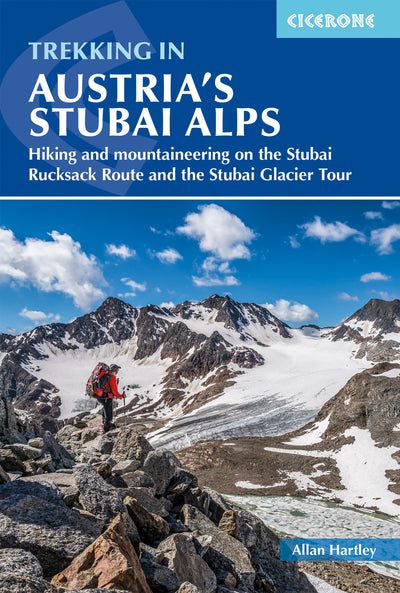
What is trekking in Austria's Stubai Alps?
Trekking in the Stubai Alps means linking the Alpine Club huts of the Stubaital into multi-day tours, with a hot meal and a bed at the end of each day. The range lies southwest of the old Austrian city of Innsbruck, in the Tirol, and the area has no access difficulties: a local bus reaches the valley in about one hour. The Brenner Pass marks its eastern edge, the Soelden valley in the Oetztal mountains its western edge, the mountains of the Italian South Tirol lie to the south, and the Inn valley and Karwendal mountains to the north.

The highest mountain is the Zuckerhütl at 3505m, with a further 130 peaks over 3000m, many of them carrying glaciers and permanent snow. Hartley concentrates on tours within the main Stubaital valley: the Stubai Rucksack Route, known in German as the Stubaier Hoehenweg, which asks for little more than a rucksack and a pair of boots, and the Stubai Glacier Tour, where the glaciers themselves mean you will need mountaineering equipment. This edition adds a third tour, the Gschnitztal Runde Tour, in response to its growing popularity.
The valley has its own story too. Neustift, the main village of the Stubaital, is the second largest village in the Tirol after Soelden, and it was home to Franz Senn, the village priest whose work is largely credited with founding the Austrian Alpine Club in 1862. The Franz Senn Hut, which features on more than one trek, is named in his honour.
This planning guide answers the most common questions walkers have before setting out. For complete stage-by-stage route descriptions and mapping, see the Cicerone Trekking in Austria's Stubai Alps guidebook.
How long are the Stubai Alps treks?
The Stubai Rucksack Route covers 79km in 9 days, the Stubai Glacier Tour covers 60km in 7 days, and the Gschnitztal Runde Tour covers 67km in 7 days, all excluding optional excursions. The tables below give the main-route stages from the guidebook's route summary.
Stubai Rucksack Route (Hoehenweg)
| Stage | Distance | Ascent | Descent | Time |
|---|---|---|---|---|
| 1 Neder to Innsbrucker Hut | 10.3km | 1385m | negligible | 5-6hr |
| 2 Innsbrucker Hut to Bremer Hut | 10.4km | 890m | 850m | 7-8hr |
| 3 Bremer Hut to Nurnberger Hut | 5.7km | 465m | 610m | 4hr |
| 4 Nurnberger Hut to Sulzenau Hut | 4.5km | 395m | 485m | 3-4hr |
| 5 Sulzenau Hut to Dresdner Hut | 4.7km | 505m | 370m | 3-4hr |
| 6 Dresdner Hut to Neue Regensburger Hut | 12.7km | 880m | 900m | 6-8hr |
| 7 Neue Regensburger Hut to Franz Senn Hut | 9.1km | 465m | 605m | 5hr |
| 8 Franz Senn Hut to Starkenburger Hut | 15.8km | 805m | 710m | 6-7hr |
| 9 Starkenburger Hut to Neustift | 5.6km | negligible | 1255m | 3hr |
| Total | 78.8km | 5790m | 5785m | 9 days |
Stubai Glacier Tour
| Stage | Distance | Ascent | Descent | Time |
|---|---|---|---|---|
| 1 Mieders to Franz Senn Hut (figures from Neustift) | 14.5km | 1165m | negligible | 5hr |
| 2 Franz Senn Hut to Amberger Hut | 12.4km | 1075m | 1085m | 6-8hr |
| 3 Amberger Hut to Hoch Stubai Hut | 8.3km | 1110m | 75m | 5-6hr |
| 4 Hoch Stubai Hut to Hildesheimer Hut | 5.9km | 345m | 615m | 5-6hr |
| 5 Hildesheimer Hut to Mueller Hut via the Zuckerhutl | 6.1km | 850m | 600m | 6hr |
| 6 Mueller Hut to Nurnberger Hut | 6.8km | 330m | 1200m | 5hr |
| 7 Nurnberger Hut to Ranalt | 5.9km | negligible | 910m | 2hr |
| Total | 59.9km | 4875m | 4485m | 7 days |
Gschnitztal Runde Tour
| Stage | Distance | Ascent | Descent | Time |
|---|---|---|---|---|
| 1 Trins to Blaser Hut | 4.4km | 1005m | 45m | 2½-3hr |
| 2 Blaser Hut to Padasterjoch Haus | 7.8km | 845m | 790m | 6-7hr |
| 3 Padasterjoch Haus to Innsbrucker Hut | 19.2km | 1160m | 1035m | 6hr |
| 4 Innsbrucker Hut to Bremer Hut | 10.4km | 890m | 850m | 7-8hr |
| 5 Bremer Hut to Austrian Tribulaun Haus | 10.1km | 680m | 1030m | 6-7hr |
| 6 Austrian Tribulaun Haus to Truna Hut | 10.3km | 635m | 980m | 6hr |
| 7 Truna Hut to Trins (or Steinach am Brenner) | 4.5km (7.6km) | 35m (60m) | 530m (215m) | 4hr |
| Total | 66.7km (69.8km) | 5250m (5275m) | 5260m (4945m) | 7 days |
Which Stubai Alps trek should I choose?
Choose the Stubai Rucksack Route if you want a glacier-free hut-to-hut traverse, the Stubai Glacier Tour if you have the skills and kit to cross glaciers, and the Gschnitztal Runde Tour if the limestone peaks of the Serleskamm and Tribulaun appeal most. The table sets the three treks side by side.
| Trek | Distance | Days | Character | Best suited to |
|---|---|---|---|---|
| Stubai Rucksack Route (Stubaier Hoehenweg, or high trail) | 78.8km | 9 | Traverse of the central Stubai without glacier crossings or difficult passes | Fit mountain walkers, families and others with limited alpine experience |
| Stubai Glacier Tour | 59.9km | 7 (11 with the South Tirol extension) | Glacier and high col crossings that call for mountaineering equipment | Walkers and aspiring alpinists with glacier skills, or willing to learn them |
| Gschnitztal Runde Tour | 66.7km | 7 | Limestone scenery of the Serleskamm and Tribulaun, with a choice of gentler or more demanding days | Walkers confident on steep, exposed ground who want the limestone peaks |
Hartley notes that the Rucksack Route and the Glacier Tour each fit comfortably within a two-week holiday. The Glacier Tour is best undertaken in late June or early July, while snow cover on the glaciers is good, so the Rucksack Route is the more flexible choice for August and September. The Gschnitztal Runde Tour has gentler options, but its harder variants need settled weather and confidence on steep ground, so it suits walkers with some alpine experience. The Rucksack Route and the Gschnitztal Runde Tour share the 10.4km stage from the Innsbrucker Hut to the Bremer Hut, so the two can be linked.
Who are the Stubai Alps treks suitable for?
The Stubai Rucksack Route suits fit mountain walkers, families and others with limited alpine experience, because the whole traverse can be completed without crossing glaciers or difficult passes. The Stubai Glacier Tour does not: it crosses glaciers and is for walkers who already have the skills, or who are willing to learn them first.
Hartley is clear that these routes are for people already involved in some regular mountain activity. You need to be used to walking for six hours continuously with a touring rucksack of around 12-15kg, and to carry it for an average of six to seven hours a day. Children can enjoy hut-to-hut touring: the author's own daughter completed the whole Rucksack Route and the Glacier Tour at 14. He advises adding at least one hour to the standard times when walking with children, and suggests a friend to keep them company.
If glaciers are new to you, the guidebook recommends formal training in glacier crossing and crevasse rescue before you go. Courses are run by the Austrian Alpine Club (UK), the National Outdoor Centre at Plas y Brenin and Glenmore Lodge, or you can hire a professional mountain guide.

How difficult are the Stubai Alps treks?
Most of the trekking falls into the mountaineering grade of easy to moderate, with sustained mountain walking, steep ground, fixed wire ropes, late-summer snow and the occasional scramble. The Alpenverein marks paths with a blue, red and black colour code, and most of the trekking in the guidebook follows red and black mountain trails with blue approach routes. Routes onto and across glaciers are black trails for the experienced only, and they are not normally marked because the way can change from year to year.
The optional ascents of neighbouring peaks range from Facile (F) to Peu Difficile (PD) and may need ice axe, crampons and rope. The average altitude on the tours is around 2500-3000m, so serious altitude sickness is uncommon, though you may notice it on the Zuckerhütl or the Wilder Freiger.
Paths are waymarked with red paint roughly every 100m, so navigation is not usually demanding, but route finding becomes much harder in mist, rain and snow. Hartley's times are realistic for a loaded rucksack. To estimate your own, allow 20 minutes per kilometre plus 1 hour per 300m of ascent.
Can I walk a shorter section of the Stubai Alps?
Yes. Apart from the Bremer Hut, every hut on the Stubai Rucksack Route connects directly with the main Stubaital valley, so you can join or leave the route to suit your time. The Rucksack Route can finish at Neustift or Fulpmes, the Glacier Tour finishes at Ranalt, and the Gschnitztal Runde Tour finishes at Trins or Steinach am Brenner. The guidebook also includes day walk suggestions, which are useful for a rest day at a hut or a base in the valley.
Which direction should I walk the Stubai Rucksack Route?
Walk it clockwise, as the guidebook describes it, because that direction is seen as marginally easier. The route can be done in either direction. Since the second edition, Hartley has also suggested starting with stages 1 and 2 of the Gschnitztal Runde Tour from Maria Waldrast Monastery, which adds the Serleskamm ridge, including Serles, and makes better use of a two-week holiday.
When is the best time to trek the Stubai Alps?
The summer season usually runs from mid June to late September, and the best time depends on which trek you choose.
- Mid to late June: early season. Old snow often lies on north-facing slopes such as the Simmingjochl, Grawagrubenneider and Schrimmenneider. This is also when the Glacier Tour is at its best, with plenty of snow cover on the glaciers.
- July: warmer, with the winter snow receding, though there are more people on the hills and in the huts. The author's personal choice for a two-week holiday is the middle of July.
- August: peak season, with the huts at their busiest and the weather at its most settled. Cloud often builds late in the morning and thunderstorms can arrive in the evening. Many Stubaital villages hold summer church festivals (Kirchentage) this month.
- September: the weather is cooler and the huts quieter as the season ends. The first two weeks of September are the author's other preferred window.
What accommodation is available on the Stubai treks?
Accommodation on all three treks is in Austrian and German Alpine Club huts, with the Rucksack Route linking eight of them and the guidebook counting 30 club huts in the Stubai Alps overall. Most open from the end of June to mid September. A hut here is closer to a mountain inn than a shelter: you sleep in a mixed dormitory (Matratzenlager) or a small bedroom, and each hut serves breakfast, lunch and dinner, including vegetarian options. Meals are hearty, and the standard Bergsteigeressen (mountaineers' meal) is a low-cost, filling dinner.
Some practical considerations:
- Book ahead. The huts get very busy at weekends and in August. Groups should enquire up to six months before the trip, and you should reconfirm by phone the day before.
- Bring a sheet sleeping bag. It is compulsory, and the hut will hire you one if you forget.
- Pack hut shoes. Boots stay in the boot room.
- Cancel if you cannot go. Under Austrian law you may still be liable for the cost if you do not turn up.
- Valley bases. Neustift, Telfes, Fulpmes and Mieders all have hotels and guesthouses, and Steinach am Brenner is the starting point for the Gschnitztal Runde Tour.
The guidebook's hut directory and Appendix A list contact details for every hut and for valley accommodation.

Do I need to join the Austrian Alpine Club?
It is not compulsory, but Hartley strongly recommends it for anyone planning a hut-to-hut tour in Austria. Members of the Austrian Alpine Club (UK), Alpenverein Britannia, receive reduced rates at the huts and mountain rescue insurance, which matters because rescue in the Alps is charged to the casualty. The club also has reciprocal rights with the alpine clubs of France, Switzerland, Italy and Germany. Hartley himself is a long-term member and past president of the UK section.
How do I get to the Stubai Alps?
Fly or take the train to Innsbruck, the capital of the Tirol, then continue by bus or train to the start of your trek. Innsbruck is about 2½ hours from Munich airport and about 2 hours from Salzburg, and Innsbruck has its own airport with a shuttle bus to the railway station.
- Rucksack Route and Glacier Tour: take the regular bus up the Stubaital valley from the bus station beside Innsbruck's Hauptbahnhof. The ride to Neder takes about one hour.
- Gschnitztal Runde Tour: take the train from Innsbruck to Steinach am Brenner.
- By rail from the UK: the guidebook describes routes via Paris and Zurich or via Brussels and Munich, each reaching Innsbruck within about 18 hours of leaving London.
- Getting home: the Rucksack Route finishes back in the Stubaital at Neustift or Fulpmes, so the journey to Innsbruck reverses the outward trip. If you are flying, plan an overnight in Innsbruck or Neustift at each end, as it is hard to reach a hut on the day you arrive.
Check current bus and rail timetables on the Postbus, ÖBB and Deutsche Bahn websites before you travel.
What should I pack for a hut-to-hut trek in the Stubai Alps?
Hartley's rule of thumb is one on, one off and the odd spare, in a rucksack of around 50 litres. Stiff four-season boots with good ankle support matter more than weight, and he also recommends microspikes for unseasonal snow in July or August, trekking poles, and an improvised harness made from a 2.4m Dyneema sling and a large screwgate karabiner for clipping into fixed wire ropes. For the huts you will need a sheet sleeping bag, hut shoes and a portable USB battery pack, since charging points are limited. If you plan to cross glaciers or climb peaks, add ice axe, crampons, harness, rope and crevasse rescue equipment, and know how to use them.
What maps do I need for the Stubai Alps?
The guidebook names two Austrian Alpine Club maps as required for the Rucksack Route and the Glacier Tour: Alpenvereinskarte sheet 31/1 Stubai Alpen: Hoch Stubai and sheet 31/2 Stubai Alpen: Sellrain, both at 1:25,000. Sheets 31/3 Brennerberge and 31/5 Innsbruck are also useful, and the Freytag & Berndt, Kompass and Mayr sheets cover the wider region. The guidebook itself includes route mapping at 1:50,000 with elevation profiles for each trek, and GPX files are available to download. Carry a map and compass as well, as the author advises.
Plan your Stubai Alps trek with the Cicerone guidebook
The Cicerone guidebook Trekking in Austria's Stubai Alps by Allan Hartley contains everything you need to plan and complete the three treks, from Neder, Mieders and Trins to Neustift, Ranalt and Steinach am Brenner. The guidebook includes:
- Three hut-to-hut treks: the Stubai Rucksack Route in 9 stages, the Stubai Glacier Tour in 7 (11 with the South Tirol extension) and the Gschnitztal Runde Tour in 7
- Clear route descriptions illustrated with 1:50,000 mapping
- Elevation profiles for each trek
- A detailed summary of each day's challenges and any potential hazards
- Optional ascents of neighbouring peaks, including Habicht, Zuckerhutl and Wilder Freiger
- A comprehensive hut directory
- Day walk suggestions
- Route summary tables, and appendices covering useful contacts, a German-English glossary and further reading
- GPX files available for download
Available as a printed guidebook or digital eBook.
About Allan Hartley, guidebook author
Allan has had a keen interest in mountains and photography since his early teens. He has climbed extensively throughout the Alps. Allan maintains that Austria remains one of mountaineering's best-kept secrets, with its heady mix of superb scenery and top-class huts offering excellent food, and is better suited to the average mountaineer than the higher mountains to the west.
In addition to Austria and the Alps, Allan has climbed across the globe, from East Africa to the Falkland Islands, the greater ranges of Nepal and Pakistan, the lesser-known Zagros Mountains of Iran and the Al Hajar Mountains of the Arabian Peninsula.
Allan is a long-term member and past president of the Austrian Alpine Club (UK), Alpenverein Britannia. He is also a member of the Outdoor Writers and Photographers Guild, a double Associate of the Royal Photographic Society and a holder of the International Mountain Leader Award. His home is on the edge of the Yorkshire Dales.


