

Majestic soaring mountains, rugged valleys and ibex watching your progress from the rocks: Gran Paradiso is Italy's very first national park, with options for all legs and lungs. This planning guide shows you how to choose from its 30 day walks, from a 2.5km waterfall stroll to a 24km royal track, through valleys that are often all your own, even in high summer. (Last updated: October 2026 · Guidebook edition: Fourth edition, May 2025)
Quick facts
- Location: Gran Paradiso National Park, Valle d'Aosta and Piemonte (Piedmont), Graian Alps, north-west Italy
- Total routes: 30 day walks in the Aosta Valley and Piedmont
- Distance range: 2.5km (Walk 1) to 24km (Walk 20), roughly 1.5 to 15 miles
- Typical duration: 1hr 30min to 8 hours
- Difficulty: Grade 1 to Grade 3, from straightforward paths to demanding alpine routes with steep and exposed sections
- Terrain: waymarked paths, old royal hunting tracks, meadows, conifer woods, lakeshores, moraines and, on high routes, snowfield traverses
- Altitude range: 1000m to over 3000m
- Navigation: route maps in the book and GPX tracks for every walk, with a 1:25,000 walking map recommended as a supplement
- Waymarks: red and white paint stripes with a black number in Piedmont; yellow and black arrows and stripes in the Aosta Valley
- Accommodation: village hotels, apartments, B&Bs and campsites, plus rifugi (mountain huts)
- Best season: June to October
- Guidebook: Walking Gran Paradiso National Park by Gillian Price, fourth edition, May 2025
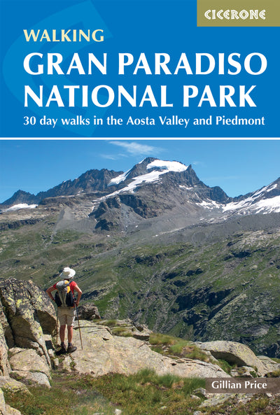
What is Walking Gran Paradiso National Park?
Walking Gran Paradiso National Park is Gillian Price's guidebook to 30 selected day walks across Italy's Gran Paradiso National Park (Parco Nazionale del Gran Paradiso), which spreads over the Valle d'Aosta and Piemonte regions. The routes range from a 1hr 30min waterfall stroll to a whopping 8-hour day, so this Gran Paradiso guide suits walkers who want to base themselves in one valley and head out in a different direction each day.
The park's walking tradition began with the kings. Hunting was banned in 1821 for everyone except royal entourages, and in 1856 Vittorio Emanuele II declared a Royal Game Reserve, with five hunting lodges and 350km of tracks manned by gamekeepers, mostly converted poachers. In 1922 his son gave up his hunting rights and declared Italy's very first national park. Today it covers 700km² and has 470km of marked paths linking alpine meadows, glaciers, wild valleys and traditional hamlets.
Some of those royal tracks are still on the menu: Walk 14 follows the King's Path in Valle delle Meyes, and Walk 20 drops down the royal track to Ceresole Reale. Altitudes in the book run from 1000m to over 3000m, taking in riverside strolls, flowered meadows and conifer woods, steep climbs over rough ground and even cool snowfield traverses. The valleys are often walkers' own, even at the height of the summer season.
This planning guide answers the most common questions walkers have before setting out. For complete walk-by-walk route descriptions and mapping, see the Cicerone Walking Gran Paradiso National Park guidebook.

How do the 30 walks in Gran Paradiso National Park divide?
The 30 walks divide by valley, running from the Vallon di Cogne on the park's northern edge in the Aosta Valley to Valle Soana in Piedmont in the south. All the valleys are inhabited, have beds for all pockets and can be reached by public bus and train, so you can switch base as you go.
- Vallon di Cogne (Walks 1 to 11): farming settlements, waterfalls and a Roman bridge, with Cogne as the bustling hub and Lillaz, Valnontey and Gimillan as quieter bases.
- Valsavarenche (Walks 12 to 15): Dégioz, Eaux Rousses and low-key Pont, the gateway to the Gran Paradiso mountain itself.
- Val di Rhêmes (Walks 16 to 18): the park's westernmost valley, based on Rhêmes-Notre-Dame and dominated by the Granta Parei outcrop.
- Colle del Nivolet (Walks 19 to 21): a high pass at the head of Valle Orco with a rifugio, where Walks 19 and 20 start and Walk 21 follows a glacier-themed path.
- Ceresole Reale (Walks 22 to 24): a lakeside and dam village in Piedmont, with an ibex-themed Park Visitor Centre in its historic Grand Hotel.
- Lower Valle Orco (Walks 25 and 26): the village of Noasca for Walk 25, and the Vallone di Piantonetto from Rosone for Walk 26.
- Valle Soana (Walks 27 to 30): Ronco Canavese as a base for Walks 27 to 29, and quiet Piamprato for Walk 30.
The table below shows eight of the 30 walks, picked to show the range, taken from the guidebook's route summary table.
|
Walk |
Title |
Distance |
Ascent/Descent |
Grade |
Time |
|---|---|---|---|---|---|
|
1 |
The Lillaz Waterfalls |
2.5km |
130m |
1-2 |
1hr 30min |
|
9 |
Punta Pousset |
13.7km |
1570m |
3 |
7hr 30min |
|
11 |
Pont d'Ael's Roman Bridge |
6km |
160m/420m |
2 |
2hr |
|
14 |
The King's Path in Valle delle Meyes |
13km |
830m |
2 |
5hr |
|
18 |
Rifugio Benevolo + Lago Goletta |
13km |
860m |
2 |
5hr |
|
19 |
Lakes above Pian del Nivolet |
6.6km |
260m |
2 |
2hr 30min |
|
20 |
The Royal track to Ceresole Reale |
24km |
1080m/2100m |
2-3 |
8hr |
|
24 |
Ceresole Reale lake circuit |
7.6km |
130m |
1 |
2hr |
How difficult is hiking in Gran Paradiso National Park?
Hiking in Gran Paradiso National Park ranges from Grade 1 strolls to Grade 3 alpine routes, so difficulty depends on which of the 30 walks you choose. The guidebook uses three grades, each matched to the Italian scale:
- Grade 1 is a straightforward path with a moderate slope, suitable for all walkers (T, turistico).
- Grade 2 is a fairly strenuous alpine walk, but not especially difficult (E, escursionistico).
- Grade 3 needs some experience of alpine terrain, with particularly steep and exposed sections where a head for heights and orientation skills help (EE, escursionistico esperto).
The guidebook's walking times do not include rests, meals or photo stops, so add a couple of hours to be realistic. Snow cover and bad weather make any route harder, and early-summer walkers heading high should pack micro spikes in case of ice. Paths are numbered and waymarked, but cairns matter most when mist swallows the paint marks, and there may be no mobile signal in remote valleys.

Which Gran Paradiso walks are best for beginners?
Walkers new to alpine terrain have plenty of choice, because the shortest and flattest walks sit at one end of the range and long, steep days at the other. Start gently, then step up as your legs and lungs allow:
- Beginners and gentle days: Walk 1 (2.5km, 130m of ascent), Walk 21 (4.6km, 160m) and Walk 24 (7.6km, 130m) are the shortest and flattest.
- Fit hillwalkers: Walk 5 (19km, 1200m) and Walk 8 (19.4km, 1100m, 7hr 20min) are long days with big climbs.
- Experienced alpine walkers: Walk 9 to Punta Pousset is the one Grade 3, with 1570m of ascent.
When is the best time to walk in Gran Paradiso National Park?
The best time to walk in Gran Paradiso National Park is June to October, when the winter snow has usually melted and the high-altitude rifugi are open. The park is open all year, but in winter most routes lie under metres of snow and ice.
- June: snow can linger on high routes, so early-summer walkers planning high-altitude days should take micro spikes.
- July: probably the best month for flower lovers, with wildflowers carpeting the meadows.
- August: the busiest month, as it is peak holiday time across Europe.
- Late summer and autumn: crystal-clear days, autumn colours and very few people on the paths. Italy stays on summer time until late October, which adds daylight.
Gran Paradiso weather changes quickly with height. The temperature drops an average of 6°C for every 1000m you climb, and sun, wind, lashing rain, storms and even snow are all possible in a single summer, so carry layers. Rifugi open from roughly June to September or October, and summer bus timetables run from around mid-June to September, so late-season walkers should check services before setting out.
What accommodation is available in Gran Paradiso National Park?
Gran Paradiso National Park accommodation ranges from village hotels, apartments, guesthouses and B&Bs to campsites (many with bungalows) and high-altitude rifugi, which are mountain huts. Book ahead in midsummer. The guidebook lists tourist offices in Appendix B and the rifugi visited on the walks, with contact details, in Appendix C.
Many of the walks visit a rifugio, and staying in one of these huts in Gran Paradiso can be the highlight of a walking holiday. They provide shelter, hot meals, refreshments and beds during the alpine summer, from June to September or October. Some points to know:
- Who runs them: the Italian Alpine Club (CAI), local families and alpine guides, and everyone is welcome.
- What you get: hostel-like dormitories, shared bathrooms and reasonably priced meals. Bring your own sleeping sheet (blankets are plentiful) and a towel.
- Overnight options: you can pay for an overnight stay only (pernottamento) or for half board (mezza pensione), which covers dinner, overnight and breakfast.
- Alpine club membership: CAI is open to all nationalities, brings reductions in huts across the Alps and covers alpine rescue. UK walkers can alternatively join the UK branch of the Austrian Alpine Club.
- Other shelters: a bivacco is a basic bivouac hut left open for self-sufficient walkers, while buildings marked 'Casotto PNGP' are for park rangers only.
Wild camping is strictly forbidden anywhere within the park, and the valleys have good campsites instead.

How do I get to Gran Paradiso National Park?
The easiest way to reach Gran Paradiso National Park is to fly to Torino (Turin) Caselle or to Milan and continue by train, bus or transfer. The guidebook notes that the majority of its walks are easily accessible by bus.
- By air: Torino Caselle is the most convenient airport and is well served from the UK and Europe. Private transfers run direct to Aosta, or you can take local trains and buses to Torino Porta Nuova station. Milan's Malpensa and Linate airports both have direct trains to Milano Centrale, with onward links via Chivasso to the Valle d'Aosta or via Torino Porta Susa for the line to Pont Canavese.
- By train and coach: from the south, trains run via Ivrea as far as Aosta. For the southern flanks of the park, take the train from Torino to Pont Canavese. Coaches serve the Valle d'Aosta from France via Chamonix and from Switzerland via Martigny, and long-distance coaches run from Torino and Milan.
- By car: from France, use the Mont Blanc tunnel or the Piccolo San Bernardo pass; from Switzerland, the Gran San Bernardo pass and tunnel. From the south, the A5 motorway leads via Aosta to Courmayeur, and the SS460 runs from Torino via Cuorgné to Pont Canavese.
Once there, local transport links the main valleys:
- Cogne valley: the free Cogne shuttle bus reaches Valnontey, Lillaz and Gimillan, and SVAP buses run up the valley.
- Valsavarenche and Val di Rhêmes: Arriva buses serve both valleys from Aosta.
- Valle Orco and Valle Soana: GTT buses run to Ceresole Reale and Piamprato, and free summer shuttle buses run from Locana via Ceresole Reale to Colle del Nivolet.
- Between valleys: an on-demand Trekbus minibus links the Cogne, Valsavarenche, Val di Rhêmes and Valgri.
What wildlife can I see in Gran Paradiso National Park?
Ibex, chamois and marmots are the animals you are most likely to see in Gran Paradiso National Park, and watching wildlife at close quarters is one of the main reasons to visit. The ibex is the undisputed star: the guidebook reports around 3000 of them today, up from about 300 in 1893 and 400 survivors after the Second World War, and the park's original ibex went on to repopulate the whole of alpine Europe.
Most animals are masters of disguise, so look carefully. Fawn patches in rock-strewn cirques often turn out to be chamois (a recent count gave 7700 in the park), ibex sentinels watch from rock crests that are worth scanning with binoculars, and grassy ground is pitted with marmot burrows. You will hear the marmot's shrill whistle before you see it. Foxes often turn up outside rifugi at nightfall.
Overhead, the park has 27 pairs of golden eagles and three pairs of lammergeiers (bearded vultures), the largest bird in the Alps. Wolves have spread into the area, with two established packs, and sightings of the lynx have been reported in the Valle d'Aosta, though both are much harder to spot.

Can I climb Gran Paradiso itself?
The guidebook covers day walks rather than climbs, and it advises anyone planning the Gran Paradiso summit to engage a qualified alpine guide for the mixed rock and ice route. At 4061m, the mountain is the only 4000m-plus summit wholly in Italy, and the park takes its name from it. The name probably derives from granta parei, 'great wall', unless it comes from the saintly peaks (San Pietro, San Andrea and Sant'Orso) at the head of Valnontey.
The first recorded ascent was in 1860 by English climbers JJ Cowell and W Dundas with French guides Michel Payot and Jean Tairraz, who had no crampons and had to cut over 1000 steps in the ice. For a Grade 2 walk that heads for the mountain's foot, try Walk 12 from Valsavarenche (14.5km, 1180m of ascent, 6hr).
Is there a long-distance trek in Gran Paradiso National Park?
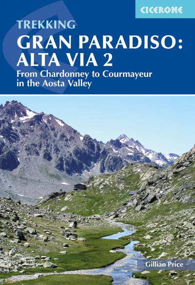
Yes: the Alta Via 2 is a 12-stage, 148km (92 miles) trek from Chardonney to Courmayeur in the Aosta Valley, and Gillian Price describes it in a separate guide, Trekking Gran Paradiso: Alta Via 2. It is a roller-coaster route that dips in and out of the Vallon di Cogne, Valsavarenche and Val di Rhêmes, then continues to Valgrisenche, Valle de la Thuile and Val Vény, with Mont Blanc as the finale.
The trek is strenuous rather than technical. Most of it is Grade 2, with a handful of stages including short demanding sections of unstable terrain and exposure (Grade 3), so it is best suited to trekkers with some alpine experience. The season follows the opening of the high-altitude refuges, from mid-June to late September: July is best for wildflowers, and from August the passes are usually snow-free. Accommodation is in rifugi, small hotels and guesthouses along the way.
This Alta Via 2 is in the Aosta Valley, not the Dolomites.
Plan your Gran Paradiso walks with the Cicerone guidebook
The Cicerone guidebook Walking Gran Paradiso National Park by Gillian Price contains everything you need to plan and walk 30 day routes across the park, from the Lillaz waterfalls in the Vallon di Cogne to Piamprato in Valle Soana.
- 30 graded walks, each with an information box covering start and finish, walking time, distance, ascent and descent, grade and access
- Route maps and GPX tracks for every walk
- A route summary table of all 30 walks
- Advice on the valleys and the best walking bases, plus accommodation guidance, with tourist office details (Appendix B) and rifugi contacts (Appendix C)
- Getting there and local transport information, with most walks easily reached by bus
- Background on geology, history, wildlife, plants and flowers, food and drink, and local traditions
- Practical advice on what to take, dos and don'ts, path marking and emergencies
- An Italian-English glossary (Appendix A)
Available as a printed guidebook or digital eBook.
About Gillian Price, guidebook author
Gillian Price has trekked throughout Asia and the Himalayas, but now lives in Venice and is exploring the mountains and flatter bits of Italy. Starting in the Italian Dolomites, Gillian has written outstanding Cicerone guides to walking all over Italy as well as Corsica and Corfu. An adamant promoter of public transport to minimise environmental impact, Gillian belongs to Mountain Wilderness and is an active member of the Venice branch of CAI, the Italian Alpine Club. Check her out at www.gillianprice.eu.


