

Kev Reynolds's first view of the Engadine came a week before Christmas, with snow lying deep and a big moon hanging over the mountains, and he spent the decades that followed discovering it in every other season. This planning guide to walking in the Engadine helps you choose a base, a month and a route from the 100 walks in his guidebook, which run from gentle valley rambles for a family outing to high-level routes across glacier and rugged pass in this high valley of contrasts. (Last updated: October 2026 · Guidebook edition: 3rd edition, July 2019)
Quick facts
- Location: Engadine valley, canton Graubünden, south-eastern Switzerland, plus neighbouring Val Bregaglia and the Swiss National Park
- Total routes: 100 graded walks in six areas, including a 65km (40.3 miles) Bregaglia Circuit (Route 23) and a 46km (28.6 miles) traverse of the National Park (Route 84)
- Distance range: from 2km (1.2 miles) one way (Route 13) to 21km (13 miles) (Route 41) among the single-day routes checked [verification needed: the full 100-route table has not been checked, and the product page quotes a range of 4 to 16km]
- Typical duration: about 1hr to 8hr of walking time, excluding stops (Route 18 is 9hr, usually taken over two days)
- Difficulty: Grade 1 to Grade 3 on the guidebook's own three-grade scale, with most walks graded 2 or 3
- Terrain: lakeshore and valley paths, alp pastures, forest tracks, high passes and moraine, with glacier crossings on Routes 3, 22 and 23
- Highest point: Piz Languard, over 4,000m
- Navigation: yellow footpath signs at junctions; waymarks are yellow (valley paths), white-red-white (mountain paths) and blue-white (Alpine routes); six Swiss National Survey 1:50,000 sheets cover the area
- Best season: June to October, with high-level routes best from late June or July onwards
- Guidebook: Walking in the Engadine - Switzerland, Kev Reynolds, 3rd edition, 2019
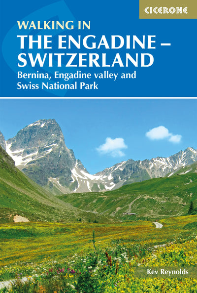
What is Walking in the Engadine?
Walking in the Engadine is Kev Reynolds's guidebook to 100 routes in the south-eastern corner of Switzerland, where the Engadine Valley forms a trench almost 100km long. In it, and on the hillsides that flank it, he finds something for every walker's taste: gentle valley rambles for a family outing, craggy mid-mountain walks for the more adventurous, and high-level routes across glacier, snowfield and rugged pass for the experienced mountain trekker.
Dazzling lakes make tempting picnic sites. Forest paths lead past deer leaping through the undergrowth, and high pastures of ancient haybarns are linked one to another by narrow trails, with snow-peaks gleaming behind. In the Upper Engadine (Engiadina Ota, or Oberengadin) several large lakes almost fill the valley floor at around 1800m, while shapely mountains such as Piz Palü, Piz Roseg and Piz Bernina spawn glaciers that hang like frozen cascades. The Lower Engadine is quieter and greener, with flower-rich meadows, Romansch villages whose sgraffito-decorated houses lean over cobbled squares, and Switzerland's only national park.
The guidebook does not stop at the valley. It reaches south over the Maloja Pass into Val Bregaglia, still Swiss but filled with the soft air of Italy, and east into side valleys where, as Reynolds puts it, a walker may wander for hours without catching sight of another human being. This planning guide answers the most common questions walkers have before setting out. For complete route descriptions and mapping, see the Cicerone Walking in the Engadine - Switzerland guidebook.
How do the 100 Engadine walks divide up?
The guidebook groups its 100 routes into six areas that follow the valley from the Maloja Pass in the south-west to the Austrian border in the north-east. The Upper Engadine runs for 44km from Maloja to Punt Ota, and roughly 55km more of the Lower Engadine follows it.
| Area | Routes | Character |
|---|---|---|
| Val Bregaglia | 1 to 23 | Italian-flavoured valley south of the Maloja Pass: stone villages, chestnut woods, the belvedere alps of Tombal and Plän Vest, the granite of Piz Badile and Piz Cengalo, and four SAC huts |
| Upper Engadine: Lakes Region | 24 to 42 | Lakeshore paths, Val Fex, the alp hamlets of Grevasalvas and Blaunca, and sections of the long-distance Via Engiadina |
| Upper Engadine: Val Bernina | 43 to 61 | The Bernina massif, Val Roseg and Val Morteratsch, the balcony walks of Muottas Muragl, and the Coaz, Tschierva and Boval huts and Berghaus Diavolezza |
| Upper Engadine: Northern Region | 62 to 73 | Quieter side valleys on the north side (Val Bever, Val Chamuera, Val Susauna) and the Es-cha, Kesch and Jenatsch huts |
| Lower Engadine: The National Park | 74 to 85 | Marked paths through the Swiss National Park, wildlife, Blockhaus Cluozza and the Macun lakes |
| Lower Engadine: Northeastern Region | 86 to 100 | Romansch villages such as Guarda and Ardez, the Silvretta glens of Val Tuoi, Val Tasna and Val Sinestra, and Val S-charl |
Reynolds's own hint is to try the walks in the "less-obvious" side valleys, and to give yourself time to sit on a rock and soak in the wonder of it all.

What are the best walks in the Engadine?
The eight walks below give a taste of all six areas, with figures taken from the guidebook's route information.
| Walk | Distance | Height gain | Time | Grade |
|---|---|---|---|---|
| Route 1: Maloja to Lägh da Cavloc and back | 7km (4.3 miles) | 92m | 2hr | 1 |
| Route 13: Soglio to Tombal | 2km (1.2 miles) one way | 450m | 1¼hr | 2 |
| Route 25: A circuit of the Silsersee | 15km (9.3 miles) | 213m | 4–4½hr | 2 |
| Route 31: Sils Maria to Plaun Vadret, through Val Fex | 8km (5 miles) one way | 316m | 3hr | 1 |
| Route 47: Muottas Muragl to Pontresina, by Chamanna Segantini and Alp Languard | 9km (5.6 miles) | 278m | 3½hr | 2 |
| Route 67: Madulain to the Es-cha Hut and back | 14km (8.7 miles) | 910m | 4½–5hr | 2–3 |
| Route 80: Ova Spin to Alp Grimmels and back | 6km (3.7 miles) | 280m | 2–2½hr | 1 |
| Route 91: Guarda to the Tuoi Hut | 7km (4.3 miles) one way | 597m | 2½hr | 2 |
Route 1 reaches a lake that is justifiably popular for family outings and picnics, while Route 13 climbs steeply to Tombal, which Reynolds calls one of those truly magical alps. Route 80 visits a colony of marmots, and Route 91 starts from Guarda, which he describes as the loveliest of Engadine villages.
Who is Walking in the Engadine suitable for?
The guidebook is written for a wide range of walkers. Reynolds's grading puts Grade 1 routes (mostly short distances on gently graded paths or tracks, suitable for family outings) alongside Grade 3 routes that he describes as true Alpine walking. Walkers who want an easy day have plenty to choose from, including the lakeside stroll of Route 24 (6.5km / 4 miles, ideal for families with small children), the Chastè promontory walk of Route 33 and the riverside path of Route 87 from Zernez to Lavin.
Anyone planning a first Alpine holiday should allow for the altitude. Valley level in the Upper Engadine is around 1800m, and Reynolds advises avoiding anything too ambitious for the first few days until you are acclimatised. He also recommends being in reasonably good physical condition on arrival, and not walking alone on remote trails, moraine-bank paths or glaciers.
How difficult are the Engadine walks, and how long do they take?
The guidebook uses three grades. Grade 1 is suitable for family outings. Grade 2 is moderate walking, mostly on clear footpaths with a reasonable amount of height gain. Grade 3 covers more strenuous routes on sometimes rough or unclear paths, with steep ascents and descents, long distances and, occasionally, scrambling, fixed ropes or glacier travel. The majority of the walks are graded 2 or 3, largely because of the landscape itself.
Specific hazards to know about before you choose:
- Glacier crossings: Route 3 (Maloja to the Forno Hut), Route 22 (Albigna Hut to the Forno Hut) and the Bregaglia Circuit (Route 23) all involve crossing ice.
- Exposure and scrambling: Route 17 over the Colle Vial is for experienced mountain trekkers in settled weather, and Route 19 over the South Cacciabella Pass has loose rock
- Guardian dogs: a reader update reports warning notice boards on Route 7 between Maroz Dora and Soglio, where sheep or goats may be guarded
- Route-finding: on the rare routes that leave a clear path, cairns and waymarks act as a guide, and the guidebook urges vigilance in poor visibility
All times in the guidebook are actual walking time only, with no allowance for rest stops or photographs. Reynolds suggests adding 25 to 50% to the times quoted when planning your day.
Which maps do I need for walking in the Engadine?
The guidebook recommends the Swiss National Survey (Landeskarte) walking maps at 1:50,000, which are marked with a T after the sheet number and show main walking routes outlined in red. Six sheets cover the area: 268T Julier Pass, 278T Monte Disgrazia, 258T Bergün, 259T Ofenpass, 269T Passo del Bernina and 249T Tarasp. The Kümmerly + Frey Wanderkarten at 1:60,000 (Oberengadin and Unterengadin) offer a two-sheet alternative, and the guidebook itself provides overview sketch maps for every walk.
Swiss place names and heights change from time to time. A July 2026 update from Cicerone's Jonathan Williams explains that swisstopo follows local dialect spellings recorded by the cantons, and that map heights are re-measured almost every year, so small differences between the guidebook and current maps are to be expected.

Can I walk a multi-day route in the Engadine?
Yes. The guidebook includes two multi-day treks, both graded 3.
The Bregaglia Circuit (Route 23) is a counter-clockwise high-level circuit of 65km (40.3 miles) starting and ending in Maloja, with 4878m of ascent over 6 to 7 days. It links Routes 4, 7, 16, 17, 19, 22 and 3, crossing high passes and the Forno Glacier, and Reynolds recommends mid-July to late September, with later in the season quieter.
The traverse of the National Park (Route 84) runs from S-chanf to S-charl, 46km (28.6 miles) over 3 to 4 days (20 to 21hr of walking). Its stages are the Varusch Hut, Blockhaus Cluozza, Il Fuorn and then S-charl, crossing the passes of Fuorcla Val Sassa, Fuorcla Val dal Botsch and Sur il Foss. The guidebook strongly advises booking accommodation ahead, because camping and bivouacking are prohibited in the park.
For a gentler long walk, sections of the Via Engiadina run along the left flank of the valley, such as the 19km (11.8 miles) between the Signal cablecar above St Moritz and Maloja (Route 40).
Is Val Bondasca open to walkers?
In August 2017 a massive rock fall from Piz Cengalo, estimated by the guidebook at 2 million tonnes, devastated parts of Val Bondasca and the village of Bondo at its entrance. The valley was closed to walkers, and the guidebook notes that Routes 15 to 19 and 23 are affected. Reynolds and Cicerone chose to keep these routes as he last walked them, in the hope that the valley would reopen.
The picture has since changed in part. The Swiss Alpine Club opened a new, longer and more demanding approach to the Sasc Furä hut from Promontogno or Bondo in early summer 2019, while the old path through Val Bondasca remains closed. Bregaglia Maloja Turismo reports that the Capanna di Sciora reopened in July 2025, eight years after the landslide, reached by a newly created path from Bondo. The approaches described in Routes 15, 16, 18 and 23 are therefore likely to differ from the ground, so check current conditions with Bregaglia Engadin Turismo and the SAC before you plan anything in this valley.
When is the best time to walk in the Engadine?
The best months for walking in the Engadine run from June to October, though the high routes keep to a shorter season.
- June: The earliest month to contemplate a walking holiday, as snow departs the high meadows. Valley meadows are full of flowers and the upper slopes are dusted with snow, but some high routes may be out of condition until July. From Easter to the end of May, many hotels and tourist facilities are closed.
- July and August: The peak season, with the highest temperatures and also the highest rainfall. Precipitation can fall as snow in the Upper Engadine and Val Bernina even in summer.
- September: Often more settled than high summer, with prolonged spells of fine weather, though night frosts are to be expected throughout the region.
- October: If the weather is fine, the larchwoods spill gold throughout the Engadine and the deciduous forests of Val Bregaglia show a rich palette of colours. Note: mountain huts may close during October.
Val Bregaglia is lower and warmer, and is often in better condition for high walks earlier than the Engadine. In the Upper Engadine lakes region, strong southerly winds (the "Maloja wind") often blow in the afternoon, and are welcomed by windsurfers on the lakes.
Where can I stay when walking in the Engadine?
Accommodation in the Engadine ranges from basic campsites to luxury hotels, and the guidebook gives bases and tourist office contacts at the start of each area.
- Val Bregaglia: Maloja, Vicosoprano, Stampa, Promontogno, Castasegna and Soglio, plus Casaccia and Pranzaira
- Upper Engadine: Maloja, Sils Maria, Silvaplana, St Moritz, Pontresina, Samedan and Zuoz, with smaller options such as Bever, La Punt-Chamues-ch and Madulain
- Lower Engadine: Zernez, Susch, Guarda, Scuol and Sent, with Lavin, Ardez, Ftan and S-charl as other bases
For high walks the guidebook describes the SAC mountain huts (chamanna or capanna), most of which sleep walkers in mixed-sex dormitories with a full meals service while a guardian is in residence in summer. Take your own sheet sleeping bag, book your sleeping space and any meals on arrival, and expect to pay in cash. Other budget options include youth hostels, Matratzenlager (dormitories in hotels and guesthouses) and holiday apartments. Camping is allowed only on official campsites, since off-site camping in Switzerland is officially forbidden.
How do I get to the Engadine and get around?
The guidebook names Zürich (Kloten) as the most convenient Swiss airport. From the airport, trains run via Chur (or via Landquart and Klosters) to the Rhaetian Railway line for St Moritz, the Upper Engadine railhead. A branch line serves Pontresina and Val Bernina on the way to Tirano in Italy, and the railway also runs down-valley to Scuol, serving most of the larger villages. Samedan also has a small airport, Engadin Airport, which tourist board sources describe as offering a limited number of flight connections plus taxi and sightseeing flights.
Within the region, the Engadin Bus serves the villages between Brail and Maloja, postbuses cover Val Bregaglia and the villages without rail stations, and a car-carrying train runs through the 19km Vereina Tunnel from Klosters to the Lower Engadine. Many walks in the guidebook finish at a different place from where they start, so check bus and train times before you set out.
What are the highlights of walking in the Engadine?
- Fuorcla Surlej: the classic view across Val Roseg to Piz Bernina, Piz Scerscen and Piz Roseg (Routes 36, 37 and 49)
- Soglio and Tombal: a belvedere village, and above it a magical alp with an awesome view of the Bondasca peaks (Routes 7, 8, 12, 13 and 14)
- Val Roseg and the Coaz Hut: a car-free valley leading to a 16-sided hut at the head of the glacier, with Lej da Vadret below (Routes 51 to 54). A July 2025 reader update notes that rockfall currently blocks the path along the valley floor and the lake, so use the signed alternative through the woods. [verification needed: check the guidebook's updates page for the current position]
- The Silsersee and Val Fex: lakeshore paths, alp hamlets and a traffic-free side valley (Routes 24, 25 and 31)
- Berghaus Diavolezza and the Morteratsch glacier: big views of Piz Palü and the Bernina group (Routes 58 to 61)
- The Swiss National Park and Guarda: wildlife in Val Trupchun and Val Cluozza, then the sgraffito-decorated villages of the Lower Engadine
Plan your Engadine walks with the Cicerone guidebook
Walking in the Engadine - Switzerland by Kev Reynolds contains everything you need to plan and walk the 100 routes, from Val Bregaglia to the Lower Engadine.
- 100 graded routes in six areas, each with distance, height gain, time and a Grade 1 to 3 rating
- The Bregaglia Circuit (Route 23) and a traverse of the National Park (Route 84) for multi-day walkers
- Overview sketch maps for every walk, with recommended Swiss National Survey and Kümmerly + Frey maps
- Introductory sections on getting there, travel within Switzerland, accommodation, weather, languages, notes for walkers, a safety checklist and a suggested equipment list
- Area introductions with bases, tourist information, access and mountain hut details
- Alternative and extension routes from many of the huts
- Appendices covering useful addresses, a bibliography, a glossary of German and Romansch words and a route index
Available as a printed guidebook or digital eBook.
About Kev Reynolds, guidebook author
A lifelong passion for the countryside in general, and mountains in particular, drove Kev's desire to share his sense of wonder and delight in the natural world through his writing, guiding, photography and lecturing. Spending several months every year in various high-mountain regions researching guidebooks made him The Man with the World's Best Job.
Kev enjoyed a fruitful partnership with Cicerone from the 1970s, producing 50 books, including guides to five major trekking regions of Nepal and to numerous routes in the European Alps and Pyrenees, as well as walking guides for Kent, Sussex and the Cotswolds. 'A Walk in the Clouds' is a collection of autobiographical short stories recording 50 years of mountain travel and adventures. He was also the contributing editor of the collaborative guide 'Trekking in the Himalaya' and Cicerone's celebratory anniversary compilation 'Fifty Years of Adventure'.
A frequent contributor to outdoor magazines, Kev also wrote and illustrated brochures for national tourist authorities and travel companies. When not away in the mountains, Kev lived with his wife in a small cottage among what he called 'the Kentish Alps', with unrestricted walking country on the doorstep. But he also travelled throughout Britain during the winter months to share his love of the places he wrote about through a series of lectures.
Sadly, Kev passed away in 2021. He will be remembered fondly by all who knew him and by many more he inspired through his writing and talks.


