

Ancient paths, griffon vultures circling above the peaks, a white-washed village folded into the hillside and not another walker in sight: that is an ordinary day in the Sierras of Extremadura, in Spain's least-known and least-visited region. This planning guide shows you how to walk there, from choosing a base and the right season to reaching the sierras. Gisela Radant Wood's guidebook describes 32 mainly circular walks of 6km to 19km, and she says none who go leave disappointed. (Last updated: November 2026 · Guidebook edition: 1st edition, October 2017)
Quick facts
- Location: Extremadura, western Spain (the provinces of Cáceres and Badajoz)
- Total routes: 32 mainly circular half and full-day walks, plus 8 link routes
- Distance range: 6km (Walk 12) to 19km (Walks 1 and 30), or 4 to 12 miles; link routes reach 28km (17 miles)
- Typical duration: 1½ to 6 hours per walk (link routes up to 9 hours)
- Difficulty: not graded; suitable for anyone with a reasonable level of walking fitness, with no mountaineering skills needed
- Terrain: ancient paved and earth paths, oak and pine forest, river valleys, rolling pasture, mountain tracks and village lanes
- Highest point: 1,605m, on Walks 7 and 8 around La Muela
- Navigation: 1:50,000 mapping in the book, plus GPX downloads after purchase
- Best season: September to June for the northern and central sierras; October to May for the southern sierras
- Guidebook: The Sierras of Extremadura by Gisela Radant Wood (1st edition, October 2017)
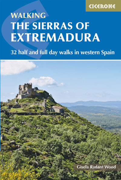
What are the Sierras of Extremadura?
The Sierras of Extremadura are the hills and mountains that run across the provinces of Cáceres and Badajoz in western Spain. They reach from the forested, snow-capped Sistema Central in the north, through the granite sierras of the Montes de Toledo in the middle, to the Sierra Morena on the Andalucian border in the south. Ancient paths cross them, many part of a communication network from the days when people walked everywhere. The oldest are paved with granite, others are soft earth, and many are shaded by trees with verges full of flowers in season.
What lies between the villages is open country: mountains, hills, valleys, lakes, rivers, forests and pasture, crossed by thousands of kilometres of paths. The highest peaks, in the Sistema Central, rise above 2,000m and are snow-covered for up to six months of the year, while the Sierra de Montánchez, in the middle, reaches a respectable 994m. Granite boulders feature on almost every walk in the northern and central sierras. In Las Villuercas the rock is slate and quartzite instead, and the walking is very different underfoot.
Then there is the quiet. Extremadura has 26 residents per square kilometre, where England has 406. Most people live in small towns or villages, each with its own character and quite separate from the next. Ribbon development does not exist.
This planning guide answers the most common questions walkers have before setting out. For complete route descriptions and mapping for 32 half and full-day walks across the sierras, see the Cicerone guidebook The Sierras of Extremadura by Gisela Radant Wood.

Where is Extremadura in Spain?
Extremadura is an autonomous region of western Spain, lying west of Madrid and east of the Portuguese border. It is the fifth largest autonomous region in Spain, divided into two provinces, Cáceres and Badajoz. At 41,633 square kilometres it is just larger than Switzerland, and it measures 280km from the border with Castile and León in the north to the Andalucian border in the south.
On a map the region looks like a layered cake, with mountains and river basins stacked from north to south. South of the northern mountains lies the Tajo river basin, home to the longest river in the Iberian peninsula. Further south is the Guadiana basin, where the river turns south to form the border with Portugal. The Sierra Morena, on the Andalucian border, is the watershed between the Guadiana to the north and the Guadalquivir to the south.
Why walk in Extremadura?
Extremadura remains Spain's least-known and least-visited region, and that is the case for going. The guidebook introduction gives plenty of reasons:
- Empty roads. Driving in Extremadura is a real pleasure, as there are so few vehicles on the roads compared with almost every other European country.
- Protected landscapes. Monfragüe National Park, famous as a nesting site for raptors, sits where the Tiétar and Tajo rivers meet. The region also has the Tajo International Natural Park, Los Barruecos, Cornalvo Natural Park, La Garganta de los Infiernos Natural Park in the Jerte valley, and a GeoPark formed in 2011 uniting Las Villuercas, Los Ibores and Jara. All have signed walking paths.
- Genuinely wild wildlife. Cranes feed in their thousands in the wetlands, storks nest on churches and castles alike, and griffon vultures can be seen from many of the walks. Red deer, wild boar, genet and mongoose may be seen, depending on habitat and season.
- Flowers. In spring it is hard to do many of the walks without stepping on carpets of colour. The Jerte valley under cherry blossom is described as unforgettable.
- History underfoot. The countryside has cave paintings and dolmens. Roman Mérida, Renaissance Cáceres and Guadalupe are all World Heritage Sites, and Trujillo, Coria, Plasencia and Jerez de los Caballeros are among the other towns worth exploring on foot.
- A warm welcome. The people of Extremadura are open and friendly, and fiercely proud of their home villages.
Gisela Radant Wood notes a growing realisation that centuries of isolation have handed down a precious heritage, with enormous tracts of Extremadura still untouched.
What kinds of walks are there in the Sierras of Extremadura?
The walks range from short half-day outings to full days in the hills and mountains. The Cicerone guidebook groups its 32 mainly circular walks of 6km to 19km (4 to 12 miles) into three parts, with 8 link routes that join walks into longer days of up to 28km (17 miles). They are a selection, not a full count: thousands of kilometres of paths cross the region, so many more routes are possible. Walk 12 is the shortest at 6km and 1½ hours. Walks 1 and 30 are the longest at 19km.
| Part | Sierras | Walks | Distance | Time | Highest point | Walking bases |
|---|---|---|---|---|---|---|
| The Northern Sierras (Sistema Central) | Sierra de Gata, Sierra de Béjar, Sierra de Gredos | 1 to 14 | 6km to 19km | 1½ to 6 hrs | 1,605m | San Martín de Trevejo, Gata, Robledillo de Gata, Baños de Montemayor, Hervás, Jerte, Jarandilla de la Vera |
| The Central Sierras (Montes de Toledo) | Montánchez, Campillo and Juncaldilla, Guadalupe, Pela | 15 to 26 | 7.5km to 17.5km | 2½ to 5½ hrs | 1,230m | Montánchez, Almoharín, Guadalupe |
| The Southern Sierras | Peñas Blancas and Juan Bueno, Hornachos, Sierra Morena | 27 to 32 | 7.5km to 19km | 2½ to 6 hrs | 1,091m | Alange, La Zarza, Hornachos, Monesterio |
Walk 5 has the most ascent of any single walk (960m over 16km). Not every walk is a loop: because the sierras of Las Villuercas run parallel to each other, some routes there, such as Walk 25 from Navezuelas to Guadalupe, run from village to village.
How difficult are the walks in Extremadura?
The walks are not graded, but anyone with a reasonable level of walking fitness can do them. All involve ascent and descent, and some are very hard, but they are walks, not mountain climbs, and need no mountaineering skills. Information on refreshments, access, parking and water sources is given for every route, and the mapping is at 1:50,000.
- Gentler options: Walk 12 (6km, 1½ hours, 270m ascent), Walk 6 (7km, 2 hours, 220m) and Walk 26 (7.5km, 2½ hours, 340m) are among the shortest and lowest-ascent routes in the book.
- Longer, harder days: Walk 5 (16km, 6 hours, 960m ascent), Walk 14 (11.5km, 6 hours, 840m, reaching 1,475m), Walk 3 (16km, 6 hours, 800m) and Walk 1 (19km, 6 hours, 710m).
- Link routes: the biggest days in the book are the link routes, such as Walks 24 and 25 together at 28km, 9 hours and 1,370m of ascent (1,470m of descent).

Can I link the walks into longer routes?
Yes. Appendix B of the guidebook lists 8 link routes that combine neighbouring walks, from 16.5km to 28km:
- Walks 6, 7 and 8 (El Nevero, the valley route and La Muela): 24km, 7½ hours
- Walks 10 and 11 (Los Pilones and Puente Nuevo): 16.5km, 5 hours
- Walks 13 and 14 (the Jaranda valley, Guijo de Santa Bárbara and El Trabuquete): 26km, 8 hours
- Walks 24 and 25 (Cabañas del Castillo, Navezuelas and Guadalupe): 28km, 9 hours
The remaining four link routes are Walks 6 and 7, Walks 6 and 8, Walks 7 and 8, and Walks 18 and 19. The author has since noted that a bridge has replaced the ford that could make linking Walks 10 and 11 difficult when the water was high.
What are the highlights of walking in Extremadura?
The guidebook's highlights are spread across all three parts:
- Pico Jálama (Walk 2): a 9km, 3 hour walk to 1,487m in the Sierra de Gata.
- El Chorrituelo de Ovejuela: Extremadura's highest waterfall, near the village of Ovejuela in the Sierra de Gata.
- Cascadas Nogaleas (Walk 9) and Los Pilones (Walk 10): Walk 9 ends beside waterfalls that feed a small pool, and Walk 10 goes on to Los Pilones and Puente Sacristán in the Sierra de Tormantos.
- Montánchez castle: the hill town and its castle in the central sierras, linked with Torre de Santa María on Walk 16.
- Guadalupe (Walk 25): the monastery town, a World Heritage Site and a centre for pilgrimage since 1326.
- The south: the rock paintings of the Sierra de Peñas Blancas (Walk 27) and Pico Tentudía with its monastery (Walk 30).
When is the best time to walk in Extremadura?
The best time is spring and autumn, with September to June suiting the northern and central sierras and October to May suiting the southern sierras. Month by month, the guidebook says:
- Spring (March to June): warm and sunny with occasional showers in March and April, which are lovely months for wild flowers and nesting birds. Flowers continue in May and June, but it can be hot and dry.
- Summer (July and August): very hot, with walking only possible early or late in the day, preferably by a river or under shady trees in the northern sierras.
- Autumn (September to December): cooler from September, though the countryside stays dry until the rains, generally in October or November. November and December are glorious, with forested slopes ablaze with autumn colour and migrating birds visiting.
- Winter (January and February): cold with showers, but flowers start to bloom alongside the almond blossom. The northern sierras can see substantial snow, while it is not usual in the central and southern sierras.
The Jerte valley is at its prettiest, and busiest, at cherry blossom time in April and May. Check forecasts village by village at eltiempo.es before you set out.
Where should I stay in Extremadura?
Stay in one of the walking bases the guidebook describes. The walks are grouped around central places to stay, which should aid planning and, in some cases, make daily transport arrangements unnecessary.
- Northern sierras: San Martín de Trevejo, Gata and Robledillo de Gata in the Sierra de Gata are old villages with historical character, squares, places to eat and a few shops. La Garganta has no accommodation, so use Baños de Montemayor or Hervás, both with banks, cash machines, shops, restaurants and tourist offices. Jerte is a popular, busy town, so book early for cherry blossom season. Jarandilla de la Vera is another excellent centre, with a 15th-century Parador.
- Central sierras: Montánchez and Almoharín are small towns with banks, shops, cafés, bars and restaurants, and a good choice of village and rural accommodation. Guadalupe is an international tourist centre with a hospedería, a parador and numerous hotels and casas rurales, and a very good tourist office.
- Southern sierras: Alange, La Zarza and Hornachos have a full range of facilities, and Mérida, the regional capital, is not far. Monesterio is an excellent base, with a tourist office in the Jamón Museum where English is spoken.
There are three main types of accommodation. Hospederías are government-owned hotels of good quality, in modern buildings or well-converted old ones. Paradors are also government-run, in historic buildings such as convents, monasteries and castles. Casas rurales range from grand farmhouses to modern houses in the countryside or small villages, graded one to three oak trees, and can be rented as a whole building or by the room. Many hospederías and paradors offer reduced prices mid-week, Tuesday to Thursday. Appendix D lists tourist office contacts, and the author recommends accommodation at walkingextremadura.com.

What food should I try in Extremadura?
Extremaduran food is built on the region's agriculture, things not to miss: jamón (ham) from Montánchez and Monesterio, Torta de Casar sheep cheese, figs (especially the chocolate variety) from Almoharín, cherries from the Jerte valley, raspberries from La Vera and jams from Guijo de Santa Bárbara. For red wine, look for Badajoz province, especially Monasterio de Tentudía in the blue bottle.
How do I get to and around Extremadura?
Fly to Madrid, Lisbon or Seville and continue by car, train or bus. Extremadura has no international airport, and the only airport in the region, at Badajoz, handles a limited number of domestic flights
- By rail: trains from Madrid run to Plasencia, Cáceres, Mérida and Badajoz. The guidebook advises getting off at Navalmoral de la Mata or Plasencia for the northern sierras, Cáceres for the central sierras and Mérida for the southern sierras, then continuing by bus or hire car. Renfe has since added faster Alvia services between Madrid and Badajoz.
- By bus: services run from Madrid's Estación Sur (Metro stop Mendez Alvaro), from Seville, and from Lisbon with Avanzabus, though the Lisbon service has limited stops in Extremadura.
- By car: drivers from the north head for Burgos, Valladolid and Salamanca and join the N-630 Ruta de la Plata or the E-803/A-66 motorway, entering Extremadura at the Puerto de Béjar.
Once there, a car is the most practical way to get around. The motorways and main roads are excellent and quiet, and minor roads between villages are generally good and scenic. Even the smallest villages where walks start have bus stops, but services may be limited to one bus a day in each direction and do not run on public and local holidays. Expect slow tractors on village roads during the olive harvest in December and January. Be patient. See Appendix D for car hire and transport contacts.
Plan your Extremadura walks with the Cicerone guidebook
The Cicerone guidebook The Sierras of Extremadura by Gisela Radant Wood contains everything you need to plan and walk the area, from the Sierra de Gata in the north to the Sierra Morena in the south. It includes:
- 32 mainly circular walks of 6km to 19km, in three parts: northern, central and southern sierras
- 8 link routes in Appendix B for longer days of up to 28km
- 1:50,000 mapping and GPX downloads, with notes on refreshments, access, parking and water sources for every route
- Route summary tables (Appendix A and B) with distances, times, highest elevations and ascent
- Introductions to geology, animals and birds, flowers and plants, and human history
- Planning chapters on getting there, getting around, when to go, bases and accommodation, food and drink, language, money, communications and health and emergencies
- Appendix C on additional waymarked routes in the area, Appendix D on useful contacts and Appendix E, a topographical glossary
Available as a printed guidebook or digital eBook.
About Gisela Radant Wood, guidebook author
Gisela Radant Wood is a walker, writer, photographer and passionate advocate for Extremadura, where she has lived for nearly 20 years. Born and raised in the West Country, England, she is now based in the Sierra de Montánchez, where she regularly walks in the surrounding countryside she knows so well. Home is a finca outside Almoharín, shared with her husband, a dog, a few sheep, hens and many olive trees. In 2007, she created the website www.walkingextremadura.com, which now attracts thousands of visitors each year and promotes the region as a walking paradise. Over countless kilometres, she has explored Extremadura's landscapes, wildlife and traces of ancient civilisations. Reading, writing, photography and daily walks continue to shape her life in rural Spain.


