

Walking Lake Como and Maggiore means leaving the ferry crowds behind within a few steps. Beyond the famous villas and gardens lies a quieter world of old mule tracks, mountain hamlets and big alpine views, and nearly all of it can be reached by ferry, train, bus or cable car. This guide covers 28 day walks of 3 to 20km plus the 5-day, 54.3km Sentiero del Viandante trek. There really is something for everyone. (Last updated: October 2026 · Guidebook edition: 2nd edition, September 2023)
Quick facts
- Location: Lago Maggiore (Piemonte and Lombardia) and Lago di Como (Lombardia), northern Italy
- Total routes: 28 day walks (12 on Lago Maggiore, 16 on Lago di Como) plus the 5-day Sentiero del Viandante trek
- Distance range: 3km to 20km (about 2 to 12 miles) for the day walks; 54.3km (33.7 miles) for the full trek
- Typical duration: 1 hour to 5 hours 20 minutes of walking time per day walk, not including stops
- Difficulty: Grade 1 to 3 on the guidebook's scale; the walks in the route summary table run from Grade 1 to Grade 2-3, and the trek is Grade 2
- Terrain: old paved mule tracks, woodland paths, lakeside promenades and mountain ridges
- Panoramic summits: Mottarone, Monte Carza, Sasso del Ferro, Monte Grona, Monte San Primo
- Navigation: a sketch map for every walk; many routes are waymarked with red and white CAI paint stripes and a route number
- Getting around: every walk starts and finishes at a point reached by public transport
- Best season: March to June and September to October for most walks; lower walks are possible all year, but snow closes the high routes in winter
- Guidebook: Walking Lake Como and Maggiore by Gillian Price, 2nd edition, September 2023
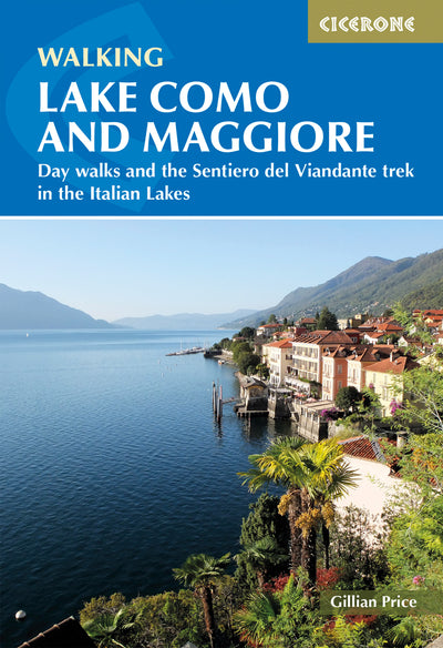
What is Walking Lake Como and Maggiore?
Walking Lake Como and Maggiore is a Cicerone guidebook by Gillian Price to 28 day walks and one 5-day trek around two of northern Italy's most celebrated lakes. Lago Maggiore and Lago di Como have drawn English-speaking visitors since the days of the Grand Tour, and the walks follow a vast network of age-old paved mule tracks that once linked remote hamlets and alpine valleys for trade, pilgrimage and travel.
The two lakes feel surprisingly different. Maggiore, at 66km the longest lake in Italy, is laid-back, with picturesque island villages and old hamlets backed by lofty mountains. Como, shaped like an upturned Y and split in two by the Bellagio promontory, is pure elegance in its villas and gardens, yet its shores also hold sheer cliffs and dramatic pathways. Both lie at the foot of the Alps, where glaciers carved deep, fjord-like troughs beneath ridges rising well over 2000m.
What sets this guide apart is the logistics. All the walks were researched using public transport, so you never need a car, and the second edition adds the complete Sentiero del Viandante trek along Lake Como's eastern shore.
This planning guide answers the most common questions walkers have before setting out. For complete route descriptions and mapping for every walk, see the Cicerone Walking Lake Como and Maggiore guidebook.
What are the best walking trails on Lake Como and Lake Maggiore?
The guidebook splits its 28 day walks between the two lakes: 12 on Lago Maggiore and 16 on Lago di Como, followed by the 5-day Sentiero del Viandante trek on Como's eastern shore.

Lake Maggiore walks (Walks 1 to 12)
The Maggiore walks range from the 9km (5.6 miles) woodland stroll between Stresa and Belgirate to the 20km (12.4 miles) Val Cannobina walk, the longest in the book. Three mountains stand out as superb belvederes: the Mottarone (Walk 2), Monte Carza (Walk 8) and Sasso del Ferro (Walk 12), which makes use of the open-sided cable car at Laveno. Other routes visit the Sacro Monte sanctuary above Ghiffa (Walk 5), the paved mule tracks around Cannero Riviera and Cannobio (Walks 6, 7 and 10) and the car-less village of Monteviasco (Walk 11).
Lake Como walks (Walks 13 to 28)
The Como walks include the Grade 1 Greenway from Colonno to Cadenabbia (Walk 15, 10.5km), the old Strada Regia mule track from Pognana Lario to Torno (Walk 27) and a Walk 28 that begins with the funicular ride from Como up to Brunate. There is a gentle circuit around Bellagio (Walk 24), and bigger mountain days to Monte Grona (Walk 20) and Monte San Primo, the highest point on the Triangolo Lariano peninsula (Walk 26).
How long is the Sentiero del Viandante trek?
The Sentiero del Viandante is a 5-day, 54.3km (33.7 miles) trek from Lecco to Colico along the eastern edge of Lago di Como, with 2170m of ascent and descent and 19hr 10min of walking time. Known as the Wayfarer's Path, it follows historical tracks that once linked Lombardy with the alpine valleys and Switzerland. It is far from a lakeside stroll: the route alternates climbs to old mountainside hamlets with panoramic traverses and descents into waterfront villages clustered around tiny harbours.
| Stage | Distance | Ascent | Time |
|---|---|---|---|
| 1: Lecco to Abbadia Lariana | 7.7km (4.8 miles) | 150m | 2hr 40min |
| 2: Abbadia Lariana to Lierna | 10.8km (6.7 miles) | 300m | 3hr 15min |
| 3: Lierna to Varenna | 10.3km (6.4 miles) | 780m | 4hr 15min |
| 4: Varenna to Dervio | 12.5km (7.8 miles) | 530m | 4hr 45min |
| 5: Dervio to Colico | 13km (8 miles) | 440m | 4hr 15min |
Stage 3 is the hardest: it has 780m of relentless ascent, the only Grade 2-3 stretches on the trek and a final descent that can be tough on the knees, though every metre is rewarded by lookouts. Stage 4 is the longest in time at 4hr 45min, and Stage 5 is the longest in distance. The high point is the chapel of San Pietro at 992m in Stage 3. The trek is well signposted, follows wide paved tracks and narrower mountain paths, and every stage end has accommodation and evening meals.

How difficult are the walks, and who are they suitable for?
Most of the walks are Grade 1-2 or Grade 2, so they suit anyone with a reasonable level of fitness, but a handful are genuinely strenuous. In the route summary table, four walks are Grade 1 (Walks 15, 18, 21 and 24), eight are Grade 1-2, eleven are Grade 2, three are Grade 2+ (Walks 2, 20 and 26) and two are Grade 2-3 (Walks 3 and 8). No walk in the table is rated higher.
The guidebook defines Grade 1 as easy routes on clear tracks and paths suitable for beginners, Grade 2 as hill and mountain paths with plenty of ups and downs, and Grade 3 as strenuous routes with exposed stretches or prolonged ascent. For a gentle day, choose the Greenway (Walk 15), the short 3.5km Crocetta walk (Walk 18, 1 hour), the 3km walk to the Santuario di Breglia (Walk 21) or the 6km Bellagio circuit (Walk 24).
If you want a challenge, look at Monte Carza (Walk 8, 17km, 900m of ascent, 5 hours), Monte Orfano (Walk 3, 13km, 600m), Monte Grona (Walk 20, 950m of ascent) and the Belvedere del Monte Nuvolone (Walk 25, 1130m of ascent). Walking times in the guidebook do not include stops, so add a good couple of hours when planning your day, and allow about 1 hour for every 300m of ascent. Lightweight boots or shoes with good grip are essential, trekking poles help on the high routes, and mobile signal is often missing in the mountains.
Which map do I need for walking around Lake Como and Maggiore?
Every walk in the guidebook has its own sketch map, which in many cases is enough when used with the route description. The guidebook also recommends carrying a larger-scale walking map for orientation and for planning your own variations. For Lago Maggiore, the 1:50,000 Kompass map no. 90 covers every route except Walk 3. Each lake chapter lists further map options, some available overseas and some sold locally at the lakes.

Can I walk a shorter section of the Sentiero del Viandante?
Yes, the Sentiero del Viandante can easily be walked in single-day stages, because every stage starts and ends at a railway station, with occasional ferries as well. Trains from Milano Centrale run to Lecco and all stations to Colico, so you can base yourself in one place and return each night. If you prefer a quieter start, catch a train or ferry to Abbadia Lariana and begin with Stage 2, as Stage 1 runs close to a busy highway in places. You can also leave the route at Bellano, around halfway through Stage 4, for its railway station and ferry wharf.
When is the best time for a walking holiday on Lake Como and Maggiore?
March to June and September to October are the best months for most walkers, but the lakes' mild climate means there is something to walk in every season. Temperatures run from around 13°C in December to the high 20s in July.
- Spring (March to June): Recommended for walking, with brilliant green vegetation and blooming flowers. Wildflowers appear from April and May at lower altitudes, and the main alpine display begins in June.
- Summer (July and August): Low-altitude walks can reach 30°C, though an afternoon breeze is nearly always guaranteed. Escape the heat on higher routes or with a swim: the lake waters reach about 24°C by midsummer.
- Autumn (September and October): Wonderful walking, with marginally fewer visitors and clear, crisp conditions once the summer haze clears. October brings russet colours to the woods.
- Winter (November to March): High-altitude routes are out of bounds because of snow, but crisp, sunny days suit low-level walks. Ferry services are cut back, and much accommodation, many villas and gardens close.
Full ferry timetables run from March or April to October or November. The lakes get very busy on the main Italian public holidays, including Easter, 25 April, 1 May, 2 June and Ferragosto on 15 August.
What accommodation is available around Lake Como and Maggiore?
The lakes offer a huge range of accommodation, from hotels and B&Bs to hostels, self-catering apartments, campsites and even mountain huts. Mid-range suggestions are given in the introduction to each lake chapter, and for the Sentiero del Viandante, options are listed at the end of each stage.
Good bases include:
- Stresa, the most-visited town on Lago Maggiore, with trains, ferries and access to the Borromean Islands
- Pallanza and Intra (Verbania), both described as excellent bases for the central part of Maggiore
- Cannero Riviera and Cannobio, the starting points for several walks on the western shore
- Como, a lovely and convenient base at the foot of the lake, with ferries and the funicular to Brunate
- Menaggio, perfectly placed for walks on the western side of Como and good for an extended stay thanks to its public transport
- Bellagio, a wonderful place to stay, though accommodation and restaurants are not budget-priced
Book well ahead around Italian public holidays and in the peak months of May and September. If you phone from overseas, add +39 and keep the initial 0 of the area code. See the guidebook's lake chapters and stage listings for specific places to stay.
How do I get to Lake Como and Maggiore, and get around without a car?
Both lakes are easy to reach from Milan, and you can get around the shores by ferry, train, bus, cable car and funicular. Milan Malpensa and Linate airports are handy for both lakes, and Bergamo's Orio al Serio airport can also be used for Lago di Como.
- Train to Maggiore: The Brig to Milano Centrale line via Domodossola calls at Stresa. Trenord trains from Milano Cadorna terminate at Laveno.
- Train to Como: Direct Zurich to Milano Centrale trains via Chiasso stop at Como San Giovanni, and Como's second station, run by Trenord, serves Milano Cadorna.
- Buses and ferries: SAF and VCO buses cover Maggiore, and ASF buses run from Como to Menaggio and Colico. Full ferry services run from March or April to October or November.
- Cable cars and funiculars: Highlights include the Como to Brunate funicular, the Argegno to Pigra cable car and the open-sided cable car at Laveno. The Stresa to Mottarone cable car was due to reopen in 2024, so check its status before you go.
Bus timetables follow the Italian school year, with reduced summer timetables from mid-June to mid-September. Validate your train ticket at the platform machine before boarding to avoid a fine.
What are the highlights of walking Lake Como and Maggiore?
The guidebook's highlights combine mountain panoramas, sanctuaries, villages and lakeside promenades.
- Mottarone and the Borromean Islands: a cable car from Stresa to a breathtaking panorama, with Isola Bella, Isola dei Pescatori and Isola Madre nearby
- High-altitude sanctuaries: the Sacro Monte above Ghiffa on Maggiore (Walk 5) and San Martino on Como (Walk 16)
- Val Cannobina and Monteviasco: an ancient pilgrim route and the car-less village (Walks 9 and 11)
- The Lake Como Greenway: a lakeside stroll past villas from Colonno to Cadenabbia (Walk 15)
- The Strada Regia and Brunate: old mule-track routes above Torno (Walks 27 and 28)
- The Linea Cadorna: First World War defences along the mountain ridges, visited on Walks 3, 7, 8 and 18
Plan your walk with the Cicerone guidebook
The Cicerone guidebook Walking Lake Como and Maggiore by Gillian Price contains everything you need to plan and complete the walks, from Stresa on Lago Maggiore to Colico at the head of Lago di Como.
- 28 day walks and the complete 5-day Sentiero del Viandante trek, with full route descriptions
- A sketch map for every walk, drawn by Nicola Regine
- An information box for each walk with start, finish, distance in km and miles, ascent and descent, grade, walking time and public transport access
- A route summary table (Appendix A) and an Italian to English glossary (Appendix B)
- Lake introductions covering transport, tourist offices, accommodation and maps
- Accommodation options listed at the end of every trek stage
- Practical advice on when to go, food and drink, what to take, plants, wildlife and emergencies
- Free updates and, where available, GPX files when you register your purchase
Available as a printed guidebook or digital eBook.
About Gillian Price, guidebook author
Gillian Price has trekked throughout Asia and the Himalayas, but now lives in Venice and is exploring the mountains and flatter bits of Italy. Starting in the Italian Dolomites, Gillian has written outstanding Cicerone guides to walking all over Italy as well as Corsica and Corfu. An adamant promoter of public transport to minimise environmental impact, Gillian belongs to Mountain Wilderness and is an active member of the Venice branch of CAI, the Italian Alpine Club. Check her out at www.gillianprice.eu.


