

Tucked away in the southern corner of County Down, the Mourne Mountains are, in author Kieron Gribbon's words, one of the best hillwalking areas in Ireland, "if not THE best". This compact granite range packs in 30 routes (plus 70+ variations), from 7.8km (4.8 miles) woodland rambles to the 32km (19.9 miles) Mourne Wall Challenge, and takes in all 14 Hewitt summits, topped by Slieve Donard at 850m. (Last updated: October 2026 · Guidebook edition: 1st edition, October 2026)
Quick facts: Walking the Mourne Mountains
- Location: Mourne Mountains, County Down, Northern Ireland (about 50km south of Belfast and 120km north of Dublin)
- Total routes: 30 primary day routes plus 70+ variations, giving more than 100 unique walks
- Distance range: 7.8km (4.8 miles) to 32km (19.9 miles)
- Typical duration: 2hr 45min to 12hr 30min (indicative, calculated with Naismith's Rule, stops not included)
- Difficulty: Easy, Moderate, Hard and Very hard (1 easy, 11 moderate, 11 hard and 7 very hard routes)
- Terrain: forest paths, clear tracks, rocky granite ridges and peat-covered high ground, with the Mourne Wall as a handy navigational aid on many high-level routes
- Highest point: Slieve Donard, 850m, the highest mountain in Northern Ireland
- Navigation: very few waymarked trails (the main one is the 37km Mourne Way), so a printed map and compass are essential
- Best season: year-round, with June to August the busiest and longest days (about 17hr of daylight)
- Guidebook: Walking the Mourne Mountains by Kieron Gribbon, 1st edition, 256 pages
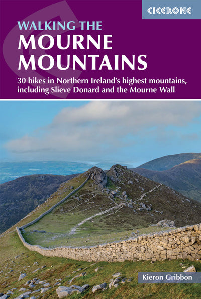
What is Walking the Mourne Mountains?
Walking the Mourne Mountains is the new Cicerone guidebook to the Mournes, with 30 primary routes and 70+ variations covering 30 hikes from Tollymore Forest Park in the east to Rostrevor on Carlingford Lough in the west. The routes range from 7.8km hill and forest walks to a challenge walk of 32km, and every route starts and finishes at an official car park. Together they take in all 14 of the range's official mountains (Hewitts), as well as the Mourne Wall, the Silent Valley reservoirs and the forests that fringe the range.
The Mournes are small but packed with walking. Gribbon describes a compact range that offers hillwalkers more opportunities per square kilometre than any other Irish upland area. The summits vary in character, from the rounded, peat-clad granite domes of Donard and Commedagh to the rugged rocky tors of Binnian and Bearnagh. An extensive network of clear tracks and paths connects the summits, cols, ridges and valleys, so walkers can plan hundreds of bespoke walks of their own from the routes in the book.
Two things make this guide distinctive. It is the first walking guidebook to give the story of the Mournes' water projects the attention it deserves, identifying reservoirs, air wells, tunnels and pipelines in the route descriptions. It also introduces the Mourne Ultra, a challenge route created by the author and published here for the first time, set out as five interconnected one-day loops.
This planning guide answers the most common questions walkers have before setting out. For complete route descriptions and mapping, see the Cicerone Walking the Mourne Mountains guidebook.
How are the Mourne Mountains walks divided?
The 30 routes are grouped into four sections, and the guide is set out so you can shorten a route or link neighbouring routes using the shortcut turn-offs and connection points marked in each description.
| Section | Routes | What to expect |
|---|---|---|
| Eastern Mournes | 1 to 18 | The most popular and best-catered-for hillwalking area in Ireland, with 12 of the range's 14 Hewitts (including the 11 highest). Tollymore Forest Park, Silent Valley and the summits of Donard, Binnian and Doan are here. |
| Western Mournes | 19 to 24 | Hills reached from Spelga, Rostrevor, Leitrim Lodge and Hen Mountain car parks, from Slievemartin to the Rocky River Horseshoe. |
| The Mourne Wall | 25 | The Mourne Wall Challenge, 32km with 2555m of ascent. |
| The Mourne Ultra | 26 to 30 | Five interconnected loops (TMU1 to TMU5) covering the full 75.6km challenge. |
The grades, based on length, ascent, terrain, path conditions and navigation, break down like this:
| Grade | Routes | Who it suits |
|---|---|---|
| Easy | 1 route | All recreational walkers |
| Moderate | 11 routes | All hillwalkers with basic navigation skills |
| Hard | 11 routes | Regular hillwalkers with good fitness and navigation skills |
| Very hard | 7 routes | Challenge hillwalkers with excellent fitness and navigation skills |
Distances run from 7.8km (Route 24, Hen Mountain, Cock Mountain and Slievenamiskan, 2hr 45min) to 32km (Route 25, the Mourne Wall Challenge, 12hr 30min). The biggest days out are the 27.1km Silent Valley Horseshoe with 2265m of ascent (Route 13, 11hr) and the Annalong Valley Horseshoe at 21.3km with 1635m (Route 7, 8hr).

Who is Walking the Mourne Mountains suitable for?
The Mournes suit everyone from first-time hill walkers to experienced challenge walkers, but the routes are not all equal. There is only 1 easy route (Tollymore Forest Park highlights, 11.5km, 3hr 30min), so beginners should start with that and the 11 moderate routes before moving up.
- Beginners and families: Route 1 in Tollymore is the gentlest day, and Routes 6, 12 and 24 are among the moderate walks that stay at lower levels or are short.
- Regular hillwalkers: the 11 hard routes include Slieve Donard from Newcastle (Route 3, 11.6km, 995m, 4hr 45min) and Slieve Binnian from Silent Valley (Route 10).
- Challenge walkers: the 7 very hard routes, including the Mourne Wall Challenge, need excellent fitness and navigation skills.
- Dog walkers: keep dogs on a lead at all times. The book advises never taking a dog where you are likely to meet livestock at close quarters, and ground-nesting birds live among the heather.
Gribbon is clear that skills matter as much as fitness: always carry a printed map and a magnetic compass, tell someone your route, and if you are new to hillwalking consider a mountain-skills course.
How difficult are the Mourne Mountains walks?
The Mourne Mountains walks are graded Easy, Moderate, Hard and Very hard, with 18 of the 30 routes graded Hard or Very hard in total (11 hard, 7 very hard). Ascent ranges from 315m (Route 1) to 2555m (Route 25).
- Few trails are waymarked, so navigation is a real consideration on the higher routes, even though the Mourne Wall helps along many ridges.
- A couple of the more challenging routes involve crossing fences where gates and stiles are not currently present, so they suit capable, highly experienced hillwalkers.
- Routes on the high ground can be boggy, particularly in autumn and spring.
- Every route has an information box giving the grade, distance, ascent and descent, and indicative time. Distances and ascents come from accurate GPX tracks, and times use Naismith's Rule (15min per 1km plus 10min per 100m of ascent, rounded up to the nearest 15min).
Can I walk a shorter section, or plan a multi-day trip to the Mourne Mountains?
Yes: the guide includes a Multi-day itineraries section, and the long routes can be shortened using marked shortcuts. Easy and moderate out-and-back options are also possible by walking only the first or last sections of the harder routes.
- Best of the Mournes: eight hand-picked routes (Routes 1, 3, 8, 12, 14, 15, 21 and 24), each with at least one best, highest or largest feature in the range, from the best woodland in Tollymore to Hen Mountain, the best small hill.
- All 14 Mourne Hewitts over a few days: a suggested itinerary links Routes 4 (with extension), 8, 11, 14, 20 and 27.
- The full Mournes: Routes 26 to 30, the five Mourne Ultra loops, make a five-day itinerary. Adding the Annalong Valley Horseshoe (Route 7) and a day exploring Silent Valley would give a full week.
- Plan your own: one route per day is probably plenty, although short out-and-back sections from different routes can be combined.

What is the Mourne Wall Challenge?
The Mourne Wall Challenge is the Mournes' longest-established hillwalking challenge, a walk along the 31.4km (19.5 miles) dry-stone Mourne Wall. Built between 1904 and 1922 over 18 years, the Wall passes over 10 official summits and is a Listed Historical Building. The book describes three versions: the Challenge Route (26.6km of the Wall, Route 25), the Maximised Route (29.4km) and the Entire Mourne Wall (all 31.4km).
Route 25 is 32km with 2555m of ascent and an indicative 12hr 30min, so it is a very hard day. A high level of fitness is required for one-day attempts, and two-day attempts with a night under canvas are popular. There are no formal campsites along the Wall (the nearest is Meelmore Lodge, about 3km off route), no tap water on the route, and the book recommends doing complete circuits in summer when daylight is longest. The book also explains why many websites wrongly quote the Wall as 22 miles long: the correct length is 19.5 miles.
What is the Mourne Ultra?
The Mourne Ultra (TMU) is a 75.6km double coast-to-coast crossing of the Mournes, combining the signposted Mourne Way (37km) with the unsignposted Mourne High Ridge Traverse (38.6km), a ridge route devised by the author in 2024 and first published in this book. The High Ridge Traverse follows the main ridgeline over 16 official summits from Rostrevor to Newcastle.
The book presents the Ultra as five interconnected one-day loops (Routes 26 to 30), so any confident navigator can walk part of it, while hill runners and experienced challenge walkers can link loops into fewer days. Loops one, three and four (Routes 26, 28 and 29) could each be considered a standalone challenge walk, and the book recommends full circuits in summer.
When is the best time to walk in the Mourne Mountains, and what is the weather like?
The best time to walk in the Mourne Mountains depends on what you want: the Mournes are beautiful all year round, with June to August the busiest and generally best time to go.
- Spring (March to May): the hills start to get busy and daylight lengthens quickly. Boggy ground can be soft as it thaws, and bluebells flower in Tollymore in May.
- Summer (June to August): the longest days (about 17hr of daylight at the solstice), warmest weather (up to about 25°C) and firmer ground. Haze can limit views, especially to the south, and heather turns the hills purple.
- Autumn (September to November): the Mournes get quieter, views are clearer and forests colour up in October and November. Boggy areas are likely to be at their softest.
- Winter (December to February): the quietest time, with just 7hr 30min of daylight on the shortest day. Frozen ground can firm up boggy routes, but smooth rock gets slippery, and snow can lie a few days longer on the summits.
The weather is changeable. Ireland receives Atlantic weather systems first, but being on the east coast the Mournes tend to receive less rain than the western ranges. There are no defined wet or dry seasons, so always carry a waterproof layer. It is also cooler at the summit: never assume that a hot day in Newcastle means a hot day on Slieve Donard. The book recommends the Met Office mountain forecast for the Mournes at weather.metoffice.gov.uk/specialist-forecasts/mountain/mourne-mountains.

What maps do I need for the Mourne Mountains?
You need a printed map and a magnetic compass, and the book lists three maps that each cover the whole range: the Harvey Superwalker Mourne Mountains map at 1:25,000, the Ordnance Survey of Northern Ireland Discoverer Sheet 29 at 1:50,000, and the OSNI Activity series 1:25,000 Mournes including Slieve Croob. The route illustrations in the guidebook are based on the Harvey map at 1:32,000. GPX files are available to download, and the book is also available in the Cicerone app for offline navigation, but the author advises never relying solely on a phone or GPS device.
Can I walk freely in the Mourne Mountains?
Walking in the Mournes is widely welcomed but there are very few legal rights of access: recreational walking is generally permitted through the goodwill of public and private landowners. Large areas belong to Northern Ireland Water, the Northern Ireland Forest Service, the National Trust and the Woodland Trust, where walkers are generally free to roam but encouraged to keep to established paths.
On privately owned high ground, stiles usually indicate that walkers are welcome. Obey any signs, close gates, keep dogs under control, and greet people you meet on farmland, as one may be the landowner. If you need help in the hills, call 999 and ask for the police, who will put you through to the Mourne Mountain Rescue Team, a charity that does not charge for call-outs.

What accommodation is available in the Mourne Mountains?
The Mournes and the surrounding lowlands have a wide variety of accommodation, including hotels, guest houses, B&Bs, self-catering, hostels, glamping and camping. Most is concentrated in nearby towns and villages such as Newcastle, Bryansford, Rostrevor, Kilkeel and Annalong, with Newry the closest city.
Some trailheads have their own facilities. Meelmore Lodge and Carrick Little offer on-site accommodation and cafés, and the Hare's Gap Bistro at Meelmore Lodge serves food near the Mourne Way. There are designated campsites at Tollymore Forest Park, Meelmore Lodge and Kilbroney Park in Rostrevor. Wild camping is widely tolerated in the Eastern Mournes, especially alongside the Mourne Wall, but permitted wild camping opportunities are sparse in the Western Mournes. The book points you to trusted online listings through its Useful links appendix.
How do I get to the Mourne Mountains?
The Mournes lie about 50km south of Belfast and 120km north of Dublin. Newcastle, at the foot of Slieve Donard, is the main gateway from the north, and Rostrevor is the main entry point from the south and west.
- By bus: Newcastle bus station is the public transport hub, with regular services to Belfast, Newry, Downpatrick, Banbridge, Kilkeel and Bryansford. Buses on the Belfast to Dublin route stop at Newry bus station, with connections to Newcastle, Rostrevor and Kilkeel.
- By train: the nearest station is Newry, on the Belfast to Dublin line, with an 8min bus connection to Newry bus station.
- By air: Belfast International (BFS), Belfast City (BHD) and Dublin (DUB) are the closest airports, with bus links to Belfast Grand Central Station or Newry. There is no direct service to Newcastle or Rostrevor.
- Getting around: in summer the Mourne Rambler bus loops through the range, connecting Newcastle with many popular start points. Having a car gives the most flexibility, and every route in the book starts at an official car park (listed in Appendix A, with Google Maps QR codes).
What are the highlights of the Mourne Mountains?
- Slieve Donard (850m): the highest mountain in Northern Ireland, rising steeply from the Irish Sea (Routes 3, 4 and 18).
- The Mourne Wall: 31.4km of dry-stone wall crossing summit after summit, featuring in 21 of the 30 primary routes.
- Slieve Binnian: the guide's choice for the best big mountain (Route 8).
- Silent Valley: reservoirs, a mountain park and the Silent Valley Horseshoe (Routes 10 to 13).
- Tollymore Forest Park: the best woodland walking in the range (Route 1).
- Hen Mountain: the guide's best small hill (Route 24).
Plan your walk with the Cicerone guidebook
The Cicerone guidebook Walking the Mourne Mountains by Kieron Gribbon contains everything you need to plan and complete day walks across the Mournes, from Tollymore Forest Park to Rostrevor and the Mourne Wall.
- 30 primary routes and 70+ variations, graded Easy, Moderate, Hard and Very hard
- Route information boxes with distance, ascent and descent, and indicative times
- GPX-measured distances and ascents
- Route mapping based on the Harvey Superwalker map at 1:32,000
- Planning chapters on transport, parking, seasons, accommodation and access
- The Mourne Wall Challenge (Route 25) and the new Mourne Ultra (Routes 26 to 30)
- Appendix A car parks with Google Maps QR codes, a glossary and useful links
- GPX files to download and Cicerone app integration for offline navigation
Available as a printed guidebook or digital eBook.
About Kieron Gribbon, guidebook author
Kieron Gribbon is a hill-walker, map enthusiast, writer, photographer and online content creator. He lives in Belfast with his wife and two sons.


