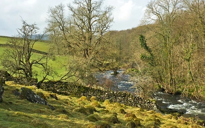
Coast to Coast Path: a complete planning guide
The Coast to Coast Path is a tantalising and inspiring excursion across northern England, running from the pebbled shores of St Bees on the Irish Sea to Robin Hood's Bay on the North Sea. Covering 293km (182 miles) in 13 stages, the route links the Lake District, Yorkshire Dales and North York Moors national parks, and today ranks among the finest long-distance trails in Britain. (Last updated: August 2026 · Guidebook edition: 5th edition, 2026)
Walking the Coast to Coast path, quick facts:
- Distance: 293km / 182 miles
- Duration: around 2 weeks, with alternative itineraries of 15 or 19 days
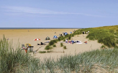
- Start: St Bees, Cumbria
- Finish: Robin Hood's Bay, North Yorkshire
- Stages: 13 (plus three approved alternative stretches, including a high- and low-level split between Keld and Reeth)
- Difficulty: Moderate to challenging, with sustained multi-day ascent and descent
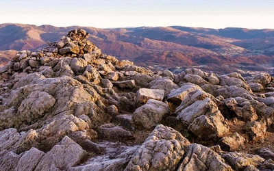
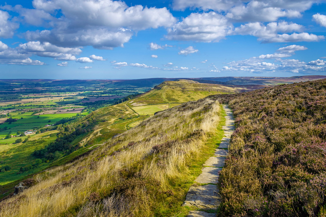
- Terrain: Fells and mountain passes, limestone uplands, river dales, farmland and open heather moorland
- Waymark: National Trail acorn
- Accommodation: B&Bs, guesthouses, pubs, small hotels and hostels in villages and towns along the route
- Best season: May, June, September and October, avoiding the peak crowds of July and August
- Guidebook:Walking the Coast to Coast Path, Terry Marsh, 5th edition, Cicerone Press, 2026
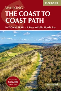
Walking the Coast to Coast Path
NATIONAL TRAIL - St Bees to Robin Hood's Bay
£18.95
Guidebook to walking the Coast to Coast Path, a 182 mile (293km) national trail across northern England from St Bees in the west to Robin Hood's Bay in the east. Described in 13 stages with additional itineraries of 15 to 19 days, the route crosses the Lake District, Yorkshire Dales and North York Moors national parks. With 1:100,000 mapping.
More information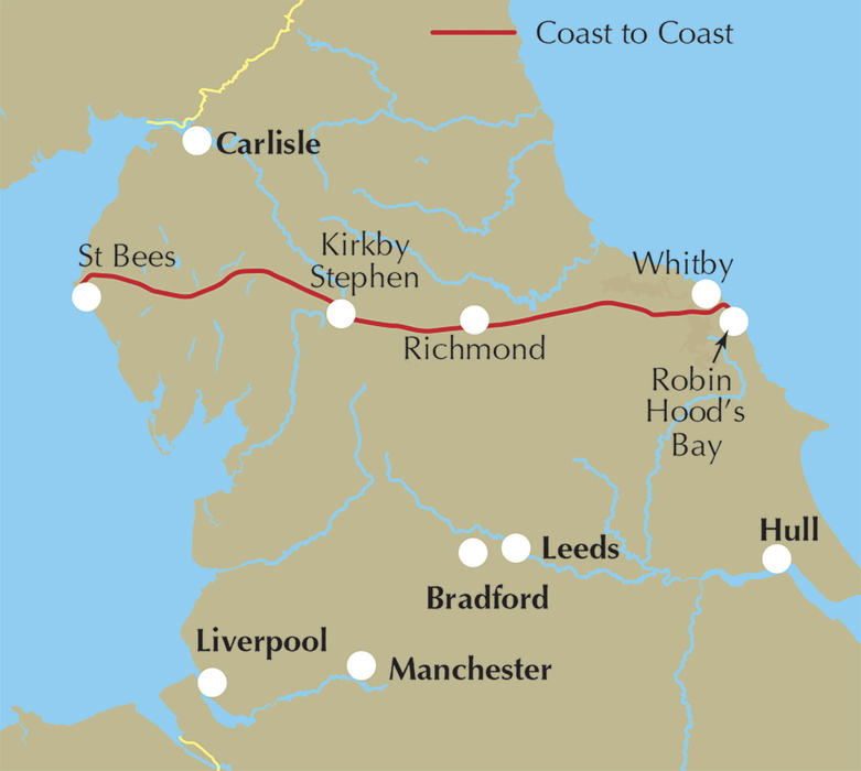
What is the Coast to Coast Path?
The Coast to Coast Path is a 293km (182 mile) National Trail across northern England, running from St Bees on the Cumbrian coast to Robin Hood's Bay on the Yorkshire coast. It links three of England's finest national parks, the Lake District, the Yorkshire Dales and the North York Moors, and is widely regarded as one of the best long-distance walks in the country.
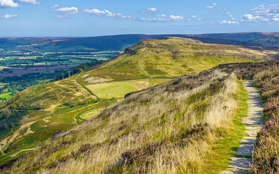
The route avoids towns wherever it can and consistently favours high ground over low, so walkers move through granite mountains, glaciated valleys, limestone dales, quiet farmland and heather moorland in the space of a fortnight. Author Terry Marsh, who has walked and written about the trail since the first edition of this guidebook in 1993, describes it as ground that "many would say" is the loveliest in England, and argues that the country beyond the Lake District, the Dales, the Vale of Mowbray and the North York Moors, is every bit as captivating as the mountains that come first.
In 2022 the Coast to Coast Path was designated a National Trail under the National Parks and Access to the Countryside Act 1949, and improvements to paths, gates and waymarking were carried out through 2024, 2025 and 2026 to bring the whole route up to national trail standard. This planning guide answers the most common questions walkers have before setting out. For complete stage-by-stage route descriptions and mapping, see the Cicerone Walking the Coast to Coast Path guidebook.
How long is the Coast to Coast Path?
The Coast to Coast Path covers 293km (182 miles) and is described in the guidebook as 13 stages, with a total ascent and descent of 8330m (27,340ft). Three stretches have approved alternative lines: a variant avoiding the climb over Dent Fell on Stage 1, a choice of north or south shore around Ennerdale Water on Stage 2, and a high- or low-level split between Keld and Reeth on Stage 7.
| Stage | Distance | Ascent | Time |
|---|---|---|---|
| St Bees to Ennerdale Bridge | 24km (15 miles) | 815m (2670ft) | 7hr |
| Ennerdale Bridge to Rosthwaite (south shore) | 24km (15 miles) | 630m (2070ft) | 6hr |
| Ennerdale Bridge to Rosthwaite (north shore) | 23.5km (14.5 miles) | 600m (1970ft) | 6hr |
| Rosthwaite to Patterdale | 23.5km (14.5 miles) | 1160m (3810ft) | 7hr |
| Patterdale to Shap | 24.5km (15.3 miles) | 1105m (3630ft) | 7hr |
| Shap to Kirkby Stephen | 31km (19.2 miles) | 655m (2150ft) | 8hr |
| Kirkby Stephen to Keld | 18km (11 miles) | 630m (2070ft) | 6hr |
| Keld to Reeth (high-level) | 17.5km (10.8 miles) | 630m (2070ft) | 6hr |
| Keld to Reeth (low-level) | 19.3km (12 miles) | 430m (1410ft) | 6hr |
| Reeth to Richmond | 16.7km (10.2 miles) | 375m (1230ft) | 4hr 45min |
| Richmond to Danby Wiske | 22.7km (14 miles) | 22.7km (14 miles) | 7hr |
| Danby Wiske to Ingleby Cross | 14.2km (9 miles) | 100m (330ft) | 5hr |
| Ingleby Cross to Blakey Ridge | 32km (20 miles) | 1175m (3850ft) | 8hr 15min |
| Blakey Ridge to Grosmont | 21km (13 miles) | 190m (620ft) | 6hr |
| Grosmont to Robin Hood's Bay | 24.2km (15 miles) | 695m (2280ft) | 7hr |
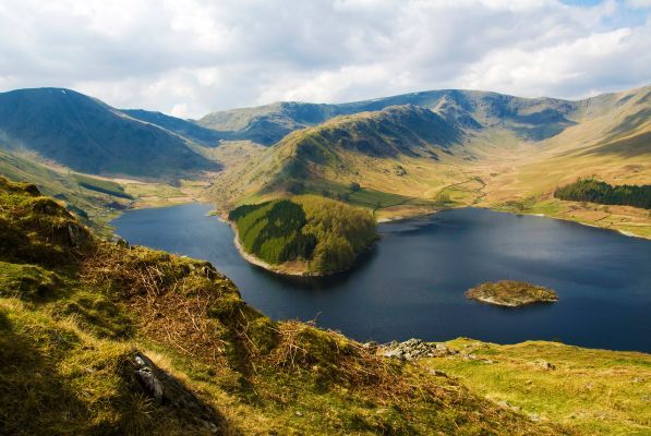
The two toughest days are Stage 3 (Rosthwaite to Patterdale) and Stage 4 (Patterdale to Shap), each involving over 1000m of ascent through the heart of the Lake District fells. Stage 11 (Ingleby Cross to Blakey Ridge), the longest single stage at 32km (20 miles), is the last major test before the walking eases off across the North York Moors.
Who is the Coast to Coast Path suitable for?
The guidebook describes the trail as being within the reach of any fit and well-prepared novice, while seasoned walkers should experience few real difficulties. It is not, however, a route on which to "cut one's trail-walking teeth": Terry Marsh recommends the Dales Way or the West Highland Way for that. Anyone tackling the Coast to Coast should be comfortable with consecutive long walking days and rough, sometimes remote terrain, particularly across the fells of Lakeland and the high moorland south of Nine Standards Rigg.
Walkers who prefer gentler terrain can use the approved alternative routes: avoiding Dent Fell on Stage 1, taking the low-level Ennerdale Water shore on Stage 2, or following the low-level Swaledale route between Keld and Reeth on Stage 7B rather than the higher mining-route alternative.
How difficult is the Coast to Coast Path?
Difficulty is rated moderate to challenging, reflecting sustained multi-day walking with significant cumulative ascent and descent rather than any single technical section. The most demanding days are through the Lake District (Stages 1 to 4), where steep fell crossings and exposed high ground make careful planning essential. Navigation is generally straightforward thanks to excellent waymarking, but the guidebook flags the peat bog and occasional route uncertainty on the high ground south of Nine Standards Rigg in poor visibility, which is why the highest and driest of the historic seasonal route options has now been formally paved and adopted as the trail's approved line.
Which direction should I walk the Coast to Coast Path?
The guidebook, in common with most walkers, describes the route running west to east, from St Bees to Robin Hood's Bay. Walking in this direction means tackling the concentrated climbing of the Lake District early, while legs are fresh, before the terrain gradually eases through the Dales, the Vale of Mowbray and the North York Moors towards the sea.
When is the best time to walk the Coast to Coast Path?
- May, June, September and October tend to bring the most settled weather and are the guidebook's recommended windows.
- July and August, the main UK tourist months, are best avoided if possible, as accommodation along the route comes under real pressure.
- Starting mid-week rather than at a weekend helps avoid accommodation congestion in the small villages the trail passes through.
- Winter walking is possible but demanding, with shorter days and some accommodation closed on the more remote sections.
- Britain's weather is genuinely changeable; the guidebook notes that several different conditions can be experienced within a single day, so checking a dedicated forecasting app (the Met Office app, the BBC app, or Weather Live) before setting out each morning is worthwhile.
Can I walk a shorter section of the Coast to Coast Path?
Yes. The trail passes through several towns with good rail or bus links, making it practical to split the walk into instalments rather than one continuous fortnight. Kirkby Stephen and Richmond are the only two towns on the route with full banking facilities and are natural break points, while St Bees (start), and the connections around Grosmont (Esk Valley Railway) near the finish, also make convenient access points. Walking the route in stages over multiple trips is entirely valid: it allows more time to explore, and the flexibility to skip a day if the forecast turns poor.
What accommodation is available on the Coast to Coast Path?
Accommodation along the route is present but not abundant, running mainly to B&Bs, guesthouses, pubs, small hotels and hostels concentrated in the villages and small towns the trail passes through, including St Bees, Grasmere, Patterdale, Shap, Kirkby Stephen, Richmond, Ingleby Arncliffe, Grosmont and Robin Hood's Bay. Booking ahead is strongly advised, particularly in the main summer season, and some accommodation closes altogether in quieter months. Not all providers offer breakfast as standard, especially in the shoulder seasons, so this is worth checking when booking. A number of specialist companies offer baggage transfer services along the route for walkers who would rather not carry a full pack. Full listings are given in Appendix B of the guidebook.
Getting to and from the Coast to Coast Path
St Bees, the western start point, sits on the Cumbrian Coast Line and has its own railway station in the village centre, served by Northern Rail with more than 20 trains a day between Preston and Carlisle (there is no Sunday service, though nearby Whitehaven has a Sunday train to Carlisle). International travellers usually find Manchester Airport the most convenient gateway, with a direct rail connection around the coast to St Bees. By road, the village lies on the B5345 just south of Whitehaven.
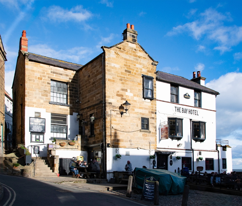
Robin Hood's Bay, the eastern finish, has no station of its own; the nearest is Whitby, reached via the Esk Valley Railway, or by Arriva bus services running between Scarborough and Middlesbrough through Robin Hood's Bay and Whitby. Because the walk is linear, returning to collect a car left at St Bees involves a long cross-country rail journey, so many walkers rely on public transport at both ends rather than driving.
Is the Coast to Coast Path a National Trail?
Yes. In 2022 the Coast to Coast Path was formally designated a National Trail under section 51 of the National Parks and Access to the Countryside Act 1949. To bring the route up to national trail standard, improvements to paths, gates, signposting and waymarking were carried out during 2024, 2025 and 2026, and several map realignments moved the legal route onto the line walkers had already been using for years. The result is that the entire trail is now a legal right of way. One practical consequence still being resolved at the time of the fifth edition is the crossing of the busy A19 in North Yorkshire: until a permanent solution is completed, an interim waymarked route loops north to use an existing bridge.
What are the route highlights?
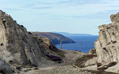
- An airy clifftop start above St Bees Head and a matching clifftop finish into Robin Hood's Bay
- The remote, fell-bounded heart of Ennerdale, reached via pedestrian-only Black Sail youth hostel
- Grisedale Tarn, on the atmospheric high crossing beyond Patterdale
- Nine Standards Rigg and the historic mining landscape of upper Swaledale
- Richmond, with its castle and centuries of largely unaltered character
- The wide, open heather moorland of the North York Moors, shared in part with the Cleveland Way and the Lyke Wake Walk
Plan your walk with the Cicerone guidebook
The Walking the Coast to Coast Path guidebook by Terry Marsh contains everything you need to plan and complete the route, from St Bees to Robin Hood's Bay.
- 13 stage-by-stage route descriptions covering the full trail
- Alternative itineraries of 15 and 19 days for a more relaxed pace
- 1:100,000 route mapping plus a detailed 1:25,000 OS map booklet
- Downloadable GPX files for GPS devices and smartphone apps
- Practical planning advice on fitness, accommodation, transport and daily logistics
- Stage summaries covering distances, ascent, facilities and accommodation
- Background on the geology, wildlife and history of the landscapes crossed
- A full accommodation listing for the route in Appendix B
Available as a printed guidebook (£18.95) or digital eBook (£18.95). A separate Walking the Coast to Coast Path Trail Map (£12.95), a 1:25,000 OS trail map covering the full route and divided into the same 13 daily stages, is also available. The route is also available as a Cicerone app guide (£9).
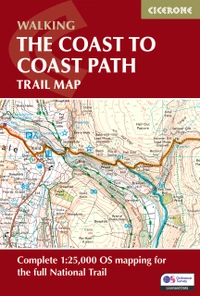
Walking the Coast to Coast Path Trail Map
Complete 1:25,000 OS trail map for the full National Trail
£12.95
Trail map of the Coast to Coast Path, a 182 mile (293km) national trail across northern England from St Bees in the west to Robin Hood's Bay in the east. Included with the Cicerone guidebook and separately as a standalone purchase, it shows the full route on OS 1:25,000 maps. This popular long-distance route typically takes a fortnight to walk.
More informationAbout Terry Marsh, guidebook author:
Lancashire-born writer and photographer Dr Terry Marsh specialises in the outdoors and travel. He has been writing guidebooks since the mid-1980s, and is the author or revision author/editor of over 100 titles including the award-winning Cicerone guides to the Coast to Coast Walk (first published in 1993), The Shropshire Way (1999) and Great Mountain Days in the Pennines (2013).
Terry has a long-standing interest in Cumbria and the Lake District and the Yorkshire Dales. Academically, he is an historical geographer holding a Master of Arts degree with Distinction in Lake District Studies and a PhD in Historical Geography. He is a fellow of the Royal Geographical Society (FRGS) and a Life Member of the Outdoor Writers and Photographers Guild (owpg.org.uk).