Five of the best short walks in Nidderdale
Are you visiting Nidderdale and want to see the best of it? Or looking for an easy walk suitable for beginners or families? Here are five short walks (3.5hrs or less) that showcase the best that the area has to offer.
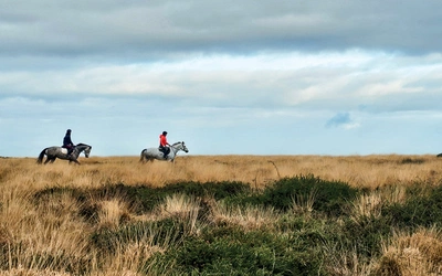
Nidderdale Area of Outstanding Natural Beauty (AONB) in North Yorkshire spans about 600 sq km, covering the eastern Yorkshire Dales and extending towards the Vale of York. Its varied landscape includes heather moorlands, steep river valleys, woodlands, rolling pastures, drystone walls, field barns, towns, and villages. The River Nidd is central to the AONB, which also includes Wensleydale, Colsterdale, and the River Ure with its tributaries. The southern Washburn valley, dominated by four reservoirs, feeds into Wharfdale. This diverse landscape supports rich wildlife and plant life, housing nine Sites of Special Scientific Interest (SSSI). Shaped by gritstone over limestone, the area has a history of farming, mining, quarrying, and tourism, leaving a heritage of significant buildings and landscapes like Fountains Abbey and Brimham Rocks, distinguishing it from the Yorkshire Dales National Park.
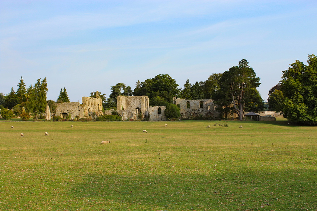
1. JERVAULX ABBEY
A scenic walk through farmland, offering glimpses of ancient history in a lovely landscape
Start/finish: Jervaulx Abbey
TIme: 3hr 20min
Distance: 11.5km (7.25 miles)
Climb: 110m
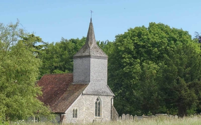
This gentle walk starts and finishes at the ruins of an 11th-century abbey. It incorporates a Norman bridge built over a Roman ford, a 9th-century church and a 15th-century manor house, Danby Hall. In between is gently rolling farmland and riverside paths along the River Ure in Swaledale. The walk is well signposted and mostly paved but some of it is cross farmland so can be muddy at certain times of year. Take time to walk around the abbey ruins at the start or end of the walk.
Fun fact: Jervaulx Abbey is a Cistercian monastery that was ruined as part of the dissolution of the monasteries in the time of Henry VIII. Material from the ruins can be seen in churches in the surrounding area.
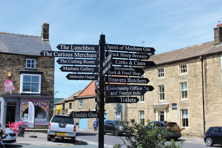
2. MASHAM RIVER WALK
A gentle river walk from the cricket club to the town square along the rivers Ure and Burn, with some locally quarried artwork to see
Start/finish: Riverside in Masham
TIme: 1hr 30min
Distance: 5.5km (3.5 miles)
Climb: 30m
A gentle walk around this lovely town takes in two rivers and some artwork. The town even has two famous breweries. Finish the walk with an amble around the Georgian town square, thought to be one of the largest in England. The walk is well signposted but can be muddy in places. The path is close to the river and where the river meanders, over time, this may move the path.
Fun fact: Masham can be considered the home of English beer, with two famous breweries (Theakstons & Black Sheep).
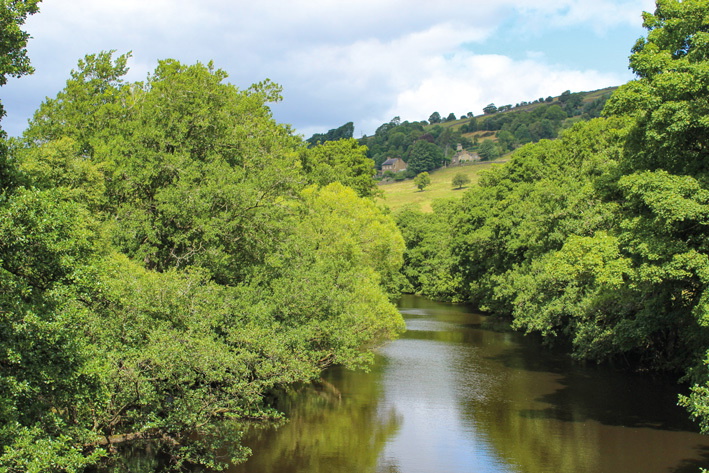
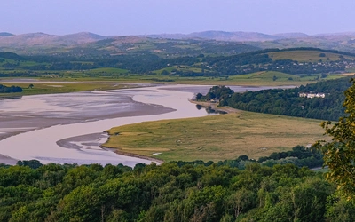
3. PATELEY BRIDGE RIVER WALK
A mellow walk in two different directions along the River Nidd, offering local art, architecture and industrial history
Start/finish: Bridge over Nidd, Pateley Bridge
TIme: 1hr 30min
Distance: 5km (3 miles)
Climb: 60m
This route explores two different faces of the river and town. The out-and-back walk goes towards Glasshouses and incorporates a sculpture and some industrial history, while the circular walk heads in the opposite direction, offering peace and quiet along the wooded riverside. The tracks are well maintained and level, but Pateley Bridge is a popular destination so can get very busy. When you have finished the walk take time to wander around this picturesque town.
Fun fact: The walk at Glasshouses ends at an old mill that is now residential housing. In its day, the mill produced cotton and then flax and hemp rope – it is claimed that rope from Glasshouses was supplied to the Titanic.
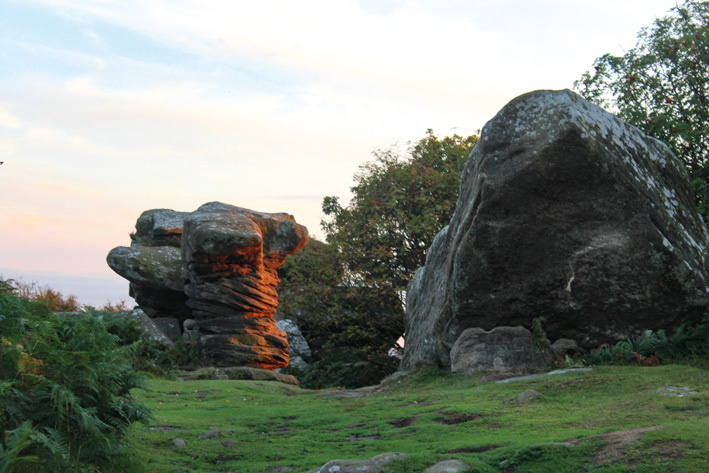
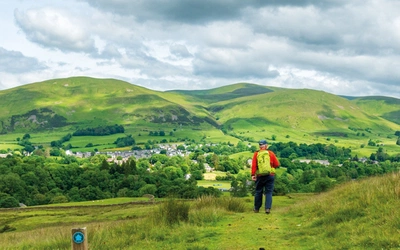
4. BRIMHAM ROCKS
An exciting walk which crosses woods, moors and farmland before sampling the dramatic formations of Brimham Rocks
Start/finish: Brimham Rocks
TIme: 1hr 20min
Distance: 4km (2½ miles)
Climb: 140m
This walk offers everything about the Nidderdale AONB in miniature. In the space of a few kilometres the walk covers woodland, moors and farmland, with fabulous views north and west over Nidderdale and south over Harrogate. It finishes at the spectacular Brimham Rocks with its weird and wonderful rock formations. The walk is well signposted. Allow extra time at the end if you want to explore more of the sculpted rocks.
Fun fact: Brimham is a Site of Special Scientific Interest (SSSI). The area is home to a variety of wildlife...
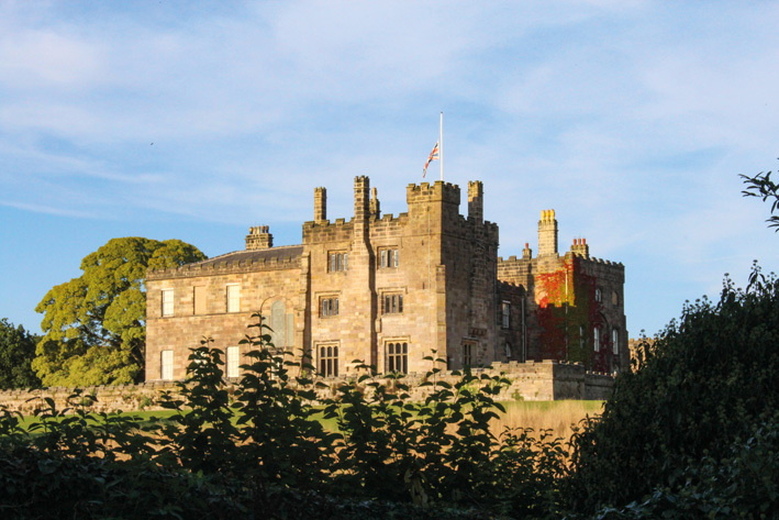
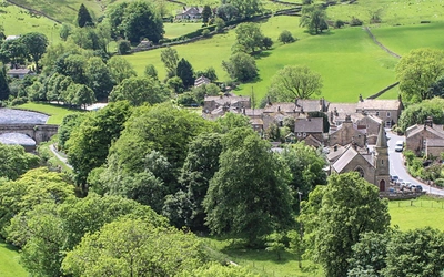
5. RIPLEY CIRCULAR
A short wander through a picturesque village and around an historic estate offering plenty of views and history
Start/finish: Ripley
TIme: 1hr 15min
Distance: 4.5km (2¾ miles)
Climb: 100m
This short walk delivers views across the lower Nidd and some interesting history along the way. It starts and ends in the picturesque estate village of Ripley that is home to a 14th-century church and Ripley Castle, one of the finest historic houses in England, then goes through the Ripley Estate, giving an insight into local history and the Nidd valley. The way is well signposted and mostly on good tracks. In spring the bluebells in the woods are amazing.
Fun fact: Henry Ingilby of Ripley Castle collected taxes for Edward III (1312-1377) and helped the King to finance the construction of Windsor Castle.
All these walks (plus 10 more!) are included in our guidebook to Short Walks in Nidderdale. The walks are designed to showcase Nidderdale's beauty and have been chosen to reflect the varied nature of the area. They are broadly divided into three areas: Lower Swaledale, Nidderdale and the Washburn Valley. Easy-to-read maps and clear route descriptions make them perfect for beginners and families. No specialist gear is needed and facilities, parking and highlights are given for every route.
15 Short Walks in Nidderdale
£9.95
Explore 15 of the best short walks around Nidderdale in the Yorkshire Dales. Each walk comes with easy-to-read Ordnance Survey maps, clear route description and lots of images, plus information on local beauty spots and tasty refreshment stops. No challenging terrain or complicated navigation means walks can be enjoyed by everyone.
More information