Discover the Via Francigena — everything you need to know
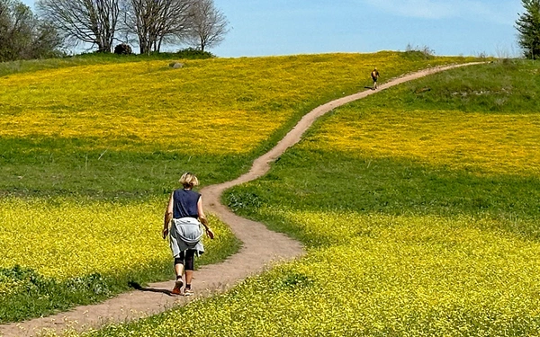
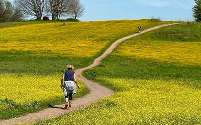
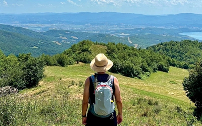
The Via Francigena is one of Europe’s great pilgrimage routes — a journey through landscapes rich in history, culture and natural beauty. From Canterbury Cathedral to Rome, then beyond to the heel of Italy, it crosses the Alps, winds through quiet countryside and mountain passes, and takes in well-loved regions like Tuscany and Lazio. Less travelled than other Caminos, it's ideal for those seeking a quieter, more varied experience. Whether you're planning to walk the full route or take it one section at a time, this page brings together all our guidebooks and articles to help you prepare.
Essential facts
What? A historic pilgrimage route from Canterbury to Rome and on to the southern tip of mainland Italy, passing through England, France, Switzerland and Italy.
Where? Across western Europe, linking the UK to Puglia via the Alps, the Po Plain, Tuscany, Lazio and the Adriatic coast.
Start point? Traditionally Canterbury Cathedral, England.
End point? Santa Maria di Leuca, Puglia — though many finish in Rome.
Distance? Around 3200 km (1980 miles).
Completion time? Typically walked in stages over multiple trips; each of the four parts takes 3–8 weeks.
Do I have to walk the whole thing? No — most pilgrims walk one section at a time. Our guidebooks divide the route into four logical parts.
Is it suitable for beginners? Yes — much of the route is manageable with moderate fitness, though some mountain sections are more demanding.
Can I cycle it? Yes — many sections, especially in France and northern Italy, are suitable for cycling.
When’s the best time to go? Spring (April–June) and autumn (September–October) are ideal for most sections, avoiding summer heat and winter snow.
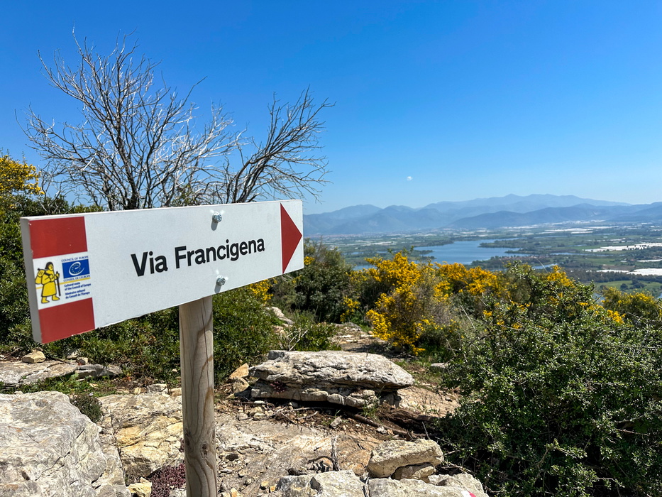
Is it waymarked? Yes — the route is increasingly well signposted, especially in Italy, though signage can vary across regions and countries.
Why this route? The Via Francigena is a quieter, more varied alternative to the Camino, offering Alpine passes, Roman roads, medieval cities and rich cultural history — all across four countries.
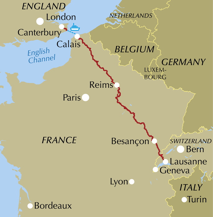
Part 1 – Canterbury to Lausanne (1090km)
The Via Francigena begins in Canterbury, one of England’s most historic cities, with a gentle walk through the Kent countryside to the iconic white cliffs of Dover. After crossing the English Channel, pilgrims turn inland into northern France, passing through peaceful farmland, First World War battlefields, and quiet villages on the way to two of France’s finest medieval cathedrals — in Laon and Reims.
The route then winds through ancient forests to the fortified hilltop town of Langres, before reaching Besançon and following the Loue river deep into the Jura. From here, the scenery shifts dramatically as the trail enters the mountains, passing beneath dramatic limestone cliffs and through the narrow Gorge de l’Orbe — one of the most striking natural sections of the route.
This first stage of the Via Francigena ends on the shores of Lake Geneva in Lausanne, a vibrant and cosmopolitan Swiss city. Covering around 1090km, it takes roughly two months on foot, though much of it can also be cycled.

Walking the Via Francigena Pilgrim Route - Part 1
Canterbury to Lausanne
£18.95
Guidebook to the first 1090km of Canterbury-Rome pilgrimage route the Via Francigena, covering from Canterbury to Lausanne. The route passes through England, France (Nord-Pas-de-Calais, Picardie, Champagne-Ardenne and Franche-Comte) and Switzerland to finish by Lake Geneva. Described in 52 stages, with information on facilities and pilgrim hostels.
More information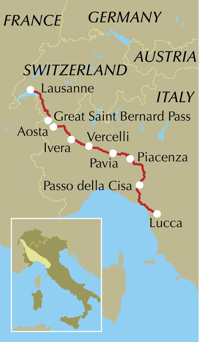
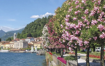
Part 2 – Lausanne to Lucca (725 km)
From the terraced vineyards above Lake Geneva, the Via Francigena enters one of its most spectacular stretches. This section crosses the Alps at the legendary Great Saint Bernard Pass (2469m), then descends into Italy’s stunning Aosta Valley, framed by snow-capped peaks and dotted with Roman ruins and castles.
After the mountains, the route flattens out across the fertile Po River Plain, passing through elegant cities like Vercelli, Pavia and Piacenza. Pilgrims then climb into the Apennines, crossing the densely wooded Cisa Pass, before descending into Tuscany, where olive groves, vineyards and far-reaching views lead to the medieval city of Lucca.
Covering around 725km, this section takes just over a month on foot, though some stretches are also suitable for cycling. With its Alpine passes, forested hills and sweeping countryside, it offers some of the most varied and memorable scenery of the entire Via Francigena.

Walking the Via Francigena Pilgrim Route - Part 2
Lausanne and the Great St Bernard Pass to Lucca
£18.95
Guidebook to the Via Francigena pilgrim route from Lausanne to Lucca. Starting at Lake Geneva (Lac Léman), this 725km section crosses the Alps at the historic Great Saint Bernard Pass, descends the Po Valley, then climbs to cross the Cisa Pass into Tuscany. Described in 32 stages, with information on facilities and pilgrim hostels.
More information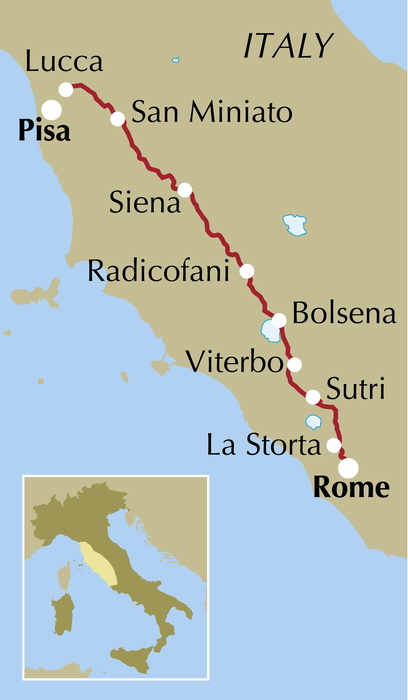
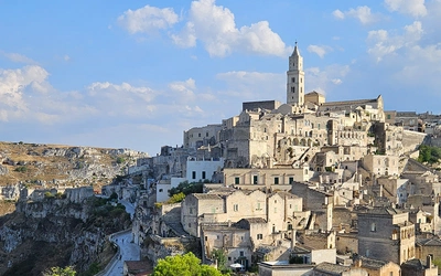
Part 3 — Lucca to Rome (410km)
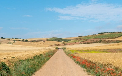
From Lucca to Rome, the Via Francigena passes through the cultural heart of central Italy. This 410km section leads through the iconic landscapes of Tuscany, where cypress-lined ridges and vineyard-covered hills guide pilgrims to famous towns like San Gimignano and Siena, and smaller medieval gems such as Monteriggioni, San Quirico d’Orcia and Radicofani.
Crossing into Lazio, the scenery shifts to rolling volcanic ridges, chestnut groves and crater lakes. Highlights include the deep-blue waters of Lake Bolsena, the ancient streets of Sutri, and the historic towns of Acquapendente, Viterbo and Montefiascone.
This stretch is rich in beauty and history, and nothing compares to the final walk into Rome, where 2500 years of culture, architecture and spiritual significance await at the journey’s end.
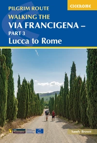
Walking the Via Francigena Pilgrim Route - Part 3
Lucca to Rome
£18.95
Guidebook to the 400km third part of the Via Francigena pilgrim route from Lucca to Rome. Crossing Tuscany in the heartland of Italy, the route goes through two of the region's most important cities, Lucca and Siena, and visits San Gimignano, Monteriggioni and Radicofani. Described in 18 stages, with information on facilities and pilgrim hostels.
More information
Part 4 — Rome to Santa Maria di Leuca (940km + variant)
The Via Francigena in the South extends the pilgrimage beyond Rome through the lesser-known regions of Lazio, Campania and Puglia, ending at Santa Maria di Leuca on the southernmost tip of mainland Italy. Covering 940km, this section retraces ancient Roman roads like the Via Appia and Via Traiana, connecting pilgrimage with deep layers of classical and early Christian history.
From the hill towns of Sermoneta and Nemi to the vibrant coastal cities of Bari, Brindisi and Lecce, the route combines inland beauty with stretches along the Tyrrhenian, Adriatic and Ionian coasts. Olive groves, sea cliffs and whitewashed villages give the final stage its distinct southern character.
An optional 252km variant leads to Monte Sant’Angelo, a UNESCO World Heritage site and one of Italy’s most important religious centres. Whether ending at Leuca or the Sanctuary of Saint Michael, this final part offers a powerful and unforgettable close to the Via Francigena journey.

Walking the Via Francigena Pilgrim Route - Part 4
Rome to Monte Sant’Angelo, Bari, Brindisi and Santa Maria di Leuca
£18.95
Guidebook to the final 940km of the Via Francigena pilgrimage route, from Rome to the heel of Italy. The route passes through Lazio and into Campania before traversing Puglia, where it concludes at Santa Maria di Leuca. Described in 52 stages (including alternative routes) with information on facilities and pilgrim hostels.
More information