The Snowdonia Way: everything you need to know
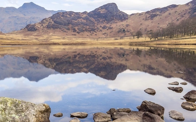
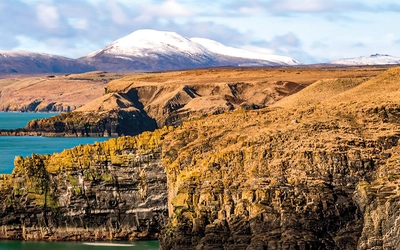
The Snowdonia Way is a fantastic long-distance walking trail that spans the full length of the National Park, offering a journey through diverse landscapes – mountains, valleys, woodlands, and coastline – rich in nature and history, with opportunities to summit several peaks. Within a short walk, you can transition from the sandy shores of Tremadoc Bay, through the forested gorge of Aberglaslyn Pass, up to Yr Wyddfa (Snowdon), the highest peak in Wales. Here's everything you need to know.
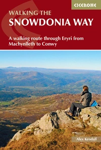
The Snowdonia Way
A walking route through Eryri from Machynlleth to Conwy
£16.95
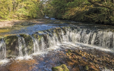
Guidebook to walking the Snowdonia Way in Wales, a long-distance route through Eryri (Snowdonia) National Park from Machynlleth to Conwy. The low-level route of 97 miles (6 to 8 stages) includes the Pass of Aberglaslyn, the Ogwen Valley and Aber Falls. The mountain route is 122 miles in 9 stages, including Cadair Idris, Yr Wyddfa (Snowdon) and the Glyders.
More information
Where does the Snowdonia Way start and finish?
The Snowdonia Way route start point is Machynlleth in the south and the route finishes in Conwy in the north.
Why should you walk the Snowdonia Way?
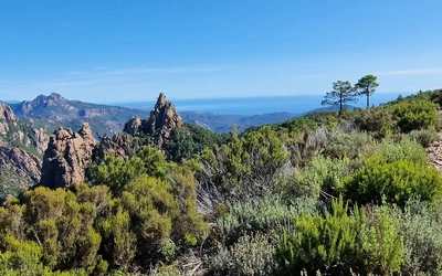
Eryri (Snowdonia) has that perfect mix of wilderness and accessibility, whilst containing everything from high rocky peaks, to forests and sandy estuaries. Hiking in Snowdonia means you really feel that you are out in the remotest corner of the world, before abruptly finding yourself in a village with brilliant pubs, cafés and accommodation. On every day of the walk there is a different feature of huge historical, geological or cultural interest. It's astounding how much there is, and how regularly you come across sites in the landscape that on their own are worth travelling across the country to see. Neolithic remains, Edward I's castles and the great spoil tips of abandoned slate mines are just a few examples.
How hard is the Snowdonia Way?
The main route, although low-level, varies between good tracks and indistinct paths, with everything in between. The trails can be uneven underfoot and the stages are full days of walking, typically with long stretches between shelter. Anyone of average fitness and stamina can complete the route – although the stronger your legs, the more you’ll enjoy the uphills. To do this route, you should be comfortable walking for up to 8 hours per day in undulating terrain, carrying a pack.
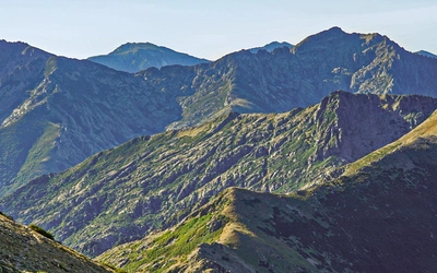
The mountain route is, by definition, over the mountains, and is therefore much more challenging. Some of the stages are long and remote – especially Stage 6B – and you should have good fitness and stamina to attempt any of them. There are often sections of risk, close to steep drops and crags, the paths are frequently obscure or non-existent, so good navigation is paramount. The ability to keep comfortable in changing weather, sometimes hours from shelter, is vital. To do this route, you should be comfortable walking for up to 10 hours per day over high peaks and moorland, with a suitable pack.
When to walk the Snowdonia Way?
Being on the west coast of Britain, Eryri (Snowdonia) has a mild climate, where rain can fall at all times of year. Walking in Snowdonia means snow on the mountains frequently during the winter and sometimes down to the passes and valleys. Despite the stereotype that the UK’s mountains are cold and wet, the spring, summer and autumn can be regularly warm and cloud-free. The low route of the Snowdonia Way walk is possible to attempt all year round, although during very cold periods there can be snow on the passes. The high route stages are only possible in winter conditions with a full knowledge of winter mountaineering and appropriate equipment, including crampons and ice axe.
Mountain weather can change rapidly; low cloud, strong winds and heavy rain are possible at all times of year, but then again the risk of sunburn is more common than you might think.
How does the main route compare to the mountain route?
| - | Snowdonia Way Standard Route | Snowdonia Way Mountain Route |
|---|---|---|
| Distance | Approximately 97 miles (156 km). | Approximately 122 miles (196 km). |
| Duration | Typically completed in 6 days. | Typically completed in 9 days. |
| Terrain | Primarily a low-level route that follows valley tracks, hillside paths, old rights of way, and even Roman roads. | A high-level route designed for those who want to climb mountains along the way, including famous peaks like Yr Wyddfa (Snowdon), Cadair Idris, Cnicht, and the Glyders, as well as less-visited summits. |
| Difficulty | Includes some steep ascents and descents but avoids mountain peaks, making it accessible for those who prefer a scenic journey through valleys, forested slopes, and historical landscapes. | More challenging, with rugged terrain and significant elevation changes. (Intersects with the Standard Route regularly, allowing you to switch between them based on your preference or weather conditions. The only significant divergence is after Stage 1A in Abergynolwyn, where the high-level route stays far from the low-level path.) |
| Experience | Offers stunning views of the mountains from the valleys, providing a tranquil experience without the intense physical demands of mountain climbing. | Provides a spectacular journey over Eryri's mountains, offering both popular and remote peaks, often with fewer crowds, and breathtaking views. |
Snowdonia Way Route – Stage Summaries
The Snowdonia Way stages - Main Route Summary
| Stage | Distance | Ascent | Approx time |
|---|---|---|---|
| 1 Machynlleth to Dolgellau | 15½ miles (24.7km) | 2460ft (750m) | 7–8hr |
| 2 Dolgellau to Trawsfynydd | 14 miles (22.6km) | 2590ft (790m) | 7hr |
| 3 Trawsfynydd to Beddgelert | 18½ miles (29.5km) | 3050ft (930m) | 8–9hr |
| 4 Beddgelert to Dolwyddelan | 12¾ miles (20.6km) | 2625ft (800m) | 6–7hr |
| 5 Dolwyddelan to Bethesda | 15½ miles (25.1km) | 2165ft (660m) | 7–8hr |
| 6 Bethesda to Conwy | 21 miles (33.6km) | 4855ft (1480m) | 10–11hr |
| Total | 97¼ miles (156.1km) | 17,745ft (5410m) | 45–50hr |
The Snowdonia Way stages - Mountain Route Summary
| Stage | Distance | Ascent | Approx time |
|---|---|---|---|
| 1A Machynlleth to Abergynolwyn | 12 miles (19.5km) | 3575ft (1090m) | 6–7hr |
| 1B Abergynolwyn to Dolgellau | 14¾ miles (23.6km) | 4890ft (1490m) | 8hr |
| 2A Dolgellau to Trawsfynydd | 16½ miles (26.6km) | 4560ft (1390m) | 9hr |
| 3A Trawsfynydd to Penrhyndeudraeth | 11¾ miles (18.9km) | 2855ft (870m) | 6–7hr |
| 3B Penrhyndeudraeth to Beddgelert | 15¾ miles (25.2km) | 4495ft (1370m) | 7–8hr |
| 4A Beddgelert to Pen-y-Pass | 11¼ miles (17.9km) | 4855ft (1480m) | 6–7hr |
| 4B Pen-y-Pass to Capel Curig | 9½ miles (15.5km) | 4165ft (1270m) | 5–6hr |
| 5A Capel Curig to Bethesda | 12¾ miles (20.4km) | 5380ft (1640m) | 7–8hr |
| 6A Bethesda to Conwy | 18 miles (28.7km) | 5215ft (1590m) | 9–10hr |
| Total | 122¼ miles (196.3km) | 39990ft (12,190m) | 63–70hr |
The Snowdonia Way
A walking route through Eryri from Machynlleth to Conwy
£16.95
Guidebook to walking the Snowdonia Way in Wales, a long-distance route through Eryri (Snowdonia) National Park from Machynlleth to Conwy. The low-level route of 97 miles (6 to 8 stages) includes the Pass of Aberglaslyn, the Ogwen Valley and Aber Falls. The mountain route is 122 miles in 9 stages, including Cadair Idris, Yr Wyddfa (Snowdon) and the Glyders.
More informationUseful Links:
The Snowdonia National Park Authority
The Long Distance Walkers Association
For Snowdonia Way maps and GPX files in our guidebook