An introduction to the John o' Groats Trail
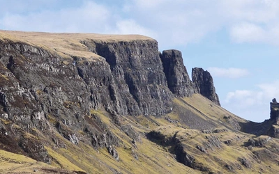
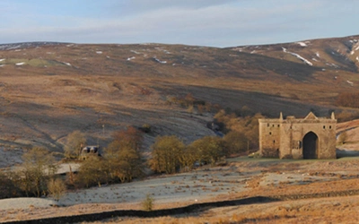
The John o' Groats Trail offers walkers a wonderful route between Inverness and John o' Groats at the north-eastern tip of mainland Britain. The Trail takes in beautiful woodland, miles of dunes and extensive deserted sandy beaches, but its most distinctive feature is the wild and spectacular cliff walking on its northern half, with ruined castles on the cliff edges and many sea arches and stacks. Read on to find out key information about this challenging route.
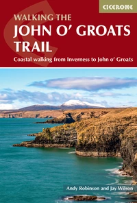
Walking the John o' Groats Trail
Coastal walking from Inverness to John o' Groats
£16.95
SALE
£13.56
Guidebook to the John O' Groats Trail, a 235km long-distance walk from Inverness to John O' Groats in the far north of Scotland. The trail boasts stunning coastal scenery and fantastic cliff-top walking, while attractive towns and villages offer accommodation. It can be completed in around a fortnight.
More information
How long is the John o' Groats Trail?
The John O' Groats Trail covers a distance of 233km (145 miles).
Where does it start and finish?
The trail starts in Inverness and ends in John o' Groats.
How long does it take to walk the John o' Groats Trail?
The trail takes around 2 weeks to hike. There are 14-day stages that each have accommodation at or near the end. Faster walkers may want to double up on some shorter stages. If you go wild camping, you have the flexibility to walk at your own pace. However, the scenery, especially on the northern stages, is so beautiful we recommend walkers take their time to enjoy the views.
What's the history of the trail?
For thousands of years, people have walked this coast as a natural route connecting coastal settlements. In the 19th century, the herring fishery on this coast became a massive industry, and seasonal migratory workers walked along the coast for days to reach the harbours. However, the routes walkers followed in earlier days gradually turned into main roads, and there has never been a separate footpath. It was not until 2014 that work began on developing the Trail; before its creation, much of this walk was impractical, and walkers were forced onto main roads for a lot of the way.
The first recorded walk between John o’ Groats and Land’s End was in 1871. Although ‘End to End’ walkers have been covering the ground between Inverness and John o’ Groats ever since, the launch of the Trail represents an important development for them: thanks to the newly developed footpaths, they no longer have to follow the busy coastal roads on the section north of Inverness.
How difficult is the John o' Groats Trail?
There are a few things you need to be aware of before committing to this walk, as it is particularly challenging in a number of respects. Not all of it is easy to follow as most established long-distance footpaths. This is partly because the Trail is a new one, and is still being developed, but it is also due to the challenging nature of the terrain covered in the northern half of the Trail. Although the terrain is fairly level overall, rough ground and some steep slopes and exposed cliff-top walking mean the route is best suited for experienced walkers.
Which direction should the trail be walked in?
The majority walk the Trail from south to north for various reasons, including that the prevailing wind is from the southwest and the finish at John o’ Groats is spectacular. However, the trail is marked in both directions.
What accommodation options are available?
Accommodation is available every night but may lie a short way off-trail. A variety of hotels, B&Bs and wild camping possibilities are available.
Why walk the trail?
Some of the most spectacular cliffs in Britain are to be found along the coast of Caithness, but these remain largely hidden from drivers on the coastal roads. Only along the cliff tops can walkers begin to see the secret delights of the north. Sprinkled along the Trail are also striking cultural remains, including old fishing harbours and ancient dwellings. A thick vegetation cover and gentle slopes above the cliffs make for frequent, comfortable spots to sit and admire the scenery.
What are the stages of the John o' Groats trail?
| Stage | Locations | Distance (km) | Time |
|---|---|---|---|
| 1 | Inverness to Culbokie | 25 | 4½–7hr |
| 2 | Culbokie to Alness | 15 | 2½–4hr |
| 3 | Alness to Tain | 21 | 3½–5½hr |
| 4 | Tain to Dornoch | 14 | 2½–4hr |
| 5 | Dornoch to Golspie | 22 | 4–6hr |
| 6 | Golspie to Brora | 10 | 2–3hr |
| 7 | Brora to Helmsdale | 20 | 4½–7hr |
| 8 | Helmsdale to Berriedale | 14 | 4–6hr |
| 9 | Berriedale to Dunbeath | 10 | 2½–4hr |
| 10 | Dunbeath to Lybster | 14 | 3½–5½hr |
| 11 | Lybster to Whaligoe | 12 | 4–6hr |
| 12 | Whaligoe to Wick | 17 | 4½–7hr |
| 13 | Wick to Keiss | 18 | 4–6hr |
| 14 | Keiss to John o’ Groats | 21 | 5–7½hr |
| Total | Inverness to John o’ Groats | 233 | 14 days |
Walking the John o' Groats Trail
Coastal walking from Inverness to John o' Groats
£16.95
SALE
£13.56
Guidebook to the John O' Groats Trail, a 235km long-distance walk from Inverness to John O' Groats in the far north of Scotland. The trail boasts stunning coastal scenery and fantastic cliff-top walking, while attractive towns and villages offer accommodation. It can be completed in around a fortnight.
More informationFriends of the John o' Groats Trail
The Friends of the John o’ Groats Trail (also known as the Association of Northern Trails Scotland) is a registered Scottish charity (charity number SC049061), set up to develop and maintain the Trail. Please check their website before setting out on the Trail, where you'll find lots more information about the Trail and the Friends of the Trail, including the latest guidebook updates.

