An introduction to the Dartmoor Way
Circling one of Britain’s most atmospheric national parks, the Dartmoor Way is a 109 mile (175km) long-distance walking route that offers an unforgettable journey through wild moorland, wooded valleys, picturesque villages and a rich tapestry of history. Whether you’re planning to tackle the full circuit in one go, dip into day walks, or break it into stages over several weekends, this route is both accessible and rewarding. In this Q&A guide, we’ll cover everything you need to know before setting off – from how long it takes and when to go, to what the highlights are and how to get there by public transport.
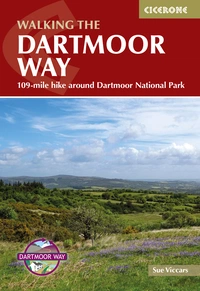
Walking the Dartmoor Way
109-mile hike around Dartmoor National Park
£16.95
Guide to the Dartmoor Way, a waymarked 175km (109 mile) circular walking route around the edge of Devon's beautiful Dartmoor. Presented in 10 stages (plus the High Moor Link which can be used to create two shorter loops), the route takes in wooded valleys, sparkling streams, moorland, farmland and attractive towns and villages.
More information
Where does the Dartmoor Way start and finish?
The Dartmoor Way is a circular route, starting and ending in Ivybridge, Devon. However, as it's a circular route, you can begin and end wherever suits you best, depending on transport, accommodation or personal preference. Many walkers choose to start in towns like Okehampton or Bovey Tracey, too.
How many stages does the Dartmoor Way have?
The Dartmoor Way is split into ten stages, ranging from 8 miles (12.75 km) to 12¾ miles (20.5 km). Most stages begin and end in towns or villages, with access to public transport and parking, making them ideal for day walks or a section-at-a-time approach. This flexibility means the route works equally well for walkers planning a multi-day hike or those keen to dip in and out over weekends.
Is it possible to walk the Dartmoor Way in a week?
Yes – if you're on a one-week break and happy with longer days, the route can be completed in seven stages. If you'd like a more leisurely pace, the trek planner in our guidebook can help you group the official stages to suit your timeframe, walking pace, and accommodation preferences.
What’s the best direction to walk the Dartmoor Way?
The route is most commonly walked anticlockwise, which gives a more manageable ascent profile and some of the best views. That said, you can walk it in either direction. The guidebook's stage descriptions include notes on walking the route clockwise, and in many places it's worth pausing to look back – the reverse views can be just as spectacular.
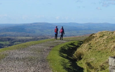
How difficult is the Dartmoor Way?
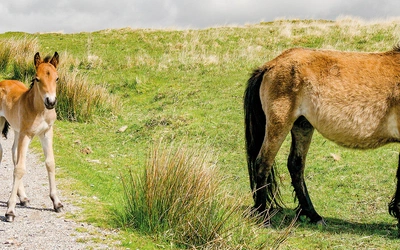
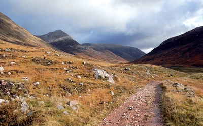
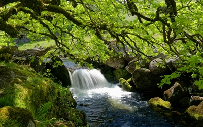
The route includes short but steep ascents and descents, but the route is well signposted and split into easily manageable day walks. Alternative low-level routes listed for days when visibility is poor, and navigation may be a challenge. The route mixes quiet country lanes, bridleways, woodland tracks, moorland paths and old railway lines. You’ll pass through farmland and wooded valleys as well as the edges of open moor. While some sections are quite gentle underfoot, others can be boggy, stony, or overgrown, particularly after heavy rain. A decent pair of waterproof walking boots is essential.
When is the best time to walk the Dartmoor Way?
The Dartmoor Way can be walked year-round, but the best conditions are usually found in spring (April to early June) and autumn. Spring is particularly beautiful, with mild weather and vibrant wildflowers. Summer can also be pleasant, though popular spots like Haytor and Fingle Bridge can be busy on warm days. That said, even at peak times, the route itself remains relatively quiet for walkers. Weather on Dartmoor can be unpredictable year-round — especially on the higher, western side — so always check the forecast before setting out. The Met Office provides reliable local updates. Walking in winter is possible, but be prepared for shorter days, wet ground and occasional mist or low cloud.
What accommodation options are available?
Along the Dartmoor Way, there’s a wide range of accommodation, including pubs, B&Bs, campsites, self-catering cottages, and Airbnbs. It’s wise to book ahead, especially during holidays, as availability can be limited, and some places may not accept one-night stays. More providers now welcome walkers with dogs, but always check in advance. Some accommodation may close between late autumn and Easter.
Luggage transfer services are available (such as Luggage Transfers), or your host may be able to help move your bags. If planning the route feels daunting, consider a self-guided holiday package from a specialist company where accommodation booking will be taken care of for you.
Wild camping is also permitted in certain areas of Dartmoor, under specific conditions. Campers must stay in designated zones, out of sight of roads, for no more than two nights and leave no trace. For full details and a camping map, visit the Dartmoor National Park website.
Is the route accessible by public transport?
Yes – for the most part. The Dartmoor Way is surprisingly well served by public transport around the moor’s edges. Towns like Ivybridge, Tavistock and Okehampton are especially well connected, with bus and rail services linking to major routes. Ivybridge, the official start point, is on the main London–Penzance railway line and also accessible via the A38.
That said, services to smaller villages can be infrequent, rarely run on Sundays, and often stop by late afternoon, so it’s important to plan ahead. Some remote points, like Shipley Bridge (Stage 1) and Shaugh Bridge (Stage 9), have little or no public transport, so you may need to arrange a lift or taxi.
The revived Dartmoor Line (Exeter to Okehampton) and the seasonal Dartmoor Explorer bus provide additional options. For up-to-date info, check Travel Devon.
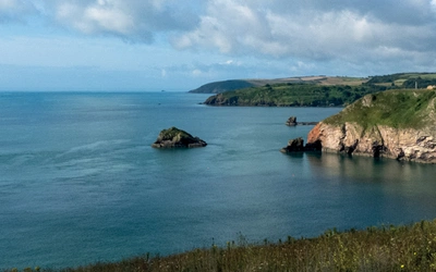
What are the highlights of the Dartmoor Way?
The Dartmoor Way offers an impressive mix of natural beauty, industrial heritage, and historical landmarks. Along the route, you’ll encounter iconic sights like Haytor Rocks and the Haytor Granite Tramway, built in 1820, and the remote Redlake Tramway, once used for transporting china clay.
The walk also takes in Buckfast Abbey, the dramatic Teign Gorge, Cranbrook Iron Age hillfort, and the striking Castle Drogo, perched above the River Teign. You’ll pass through ancient woodland in Belstone Cleave, follow the Taw River, and visit the ruins of Okehampton Castle before crossing the Meldon Viaduct — particularly beautiful in bluebell season.
The route skirts High Willhays, Dartmoor’s highest point, and passes Lydford Castle, the dramatic outcrop of The Dewerstone, and the working china clay pits at Lee Moor. Princetown stands out near the moor's centre for its historic Napoleonic prison and its windswept, high moorland setting.
What are the stages of the Dartmoor Way?
| Stage | Start/Finish | Time | Distance |
|---|---|---|---|
| 1 | Ivybridge to Shipley Bridge | 5hr | 10 miles (16km) |
| 2 | Shipley Bridge to Ashburton | 6hr | 10½ miles (16.75km) |
| 3 | Ashburton to Bovey Tracey | 6½hr | 12¼ miles (19.75km) |
| 4 | Bovey Tracey to Moretonhampstead | 5½hr | 10½ miles (16.75km) |
| 5 | Moretonhampstead to Chagford | 4½hr | 8 miles (12.75km) |
| 6 | Chagford to Okehampton | 6½hr | 12¼ miles (19.75km) |
| 7 | Okehampton to Lydford | 5hr | 9¾ miles (15.75km) |
| 8 | Lydford to Tavistock | 6hr | 12¾ miles (20.5km) |
| 9 | Tavistock to Shaugh Bridge | 6hr | 11¾ miles (18.5km) |
| 10 | Shaugh Bridge to Ivybridge | 6½hr | 12 miles (19.25km) |
Walking the Dartmoor Way
109-mile hike around Dartmoor National Park
£16.95
Guide to the Dartmoor Way, a waymarked 175km (109 mile) circular walking route around the edge of Devon's beautiful Dartmoor. Presented in 10 stages (plus the High Moor Link which can be used to create two shorter loops), the route takes in wooded valleys, sparkling streams, moorland, farmland and attractive towns and villages.
More information