An introduction to The South Downs Way
Remaining within the South Downs National Park for almost its entire length, the official South Downs Way leads for 100 miles (160km) between Eastbourne and Winchester, following the northern escarpment for much of the way and rarely descending to habitation except where river valleys interrupt the regular course of the Downs.

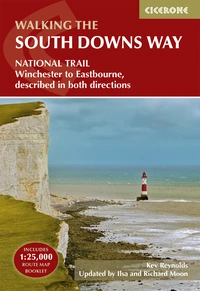
The South Downs Way
Winchester to Eastbourne, described in both directions
£17.95
SALE
£14.36
Guidebook to walking the South Downs Way National Trail, a 100 mile (160km) route between Winchester and Eastbourne through the South Downs National Park, described in both directions over 12 stages. Easy walking on ancient and historical tracks, taking in wooded areas, delightful river valleys and pretty villages. With 1:25K OS map booklet.
More informationOpened in 1972, the South Downs Way originally finished in Buriton, near the Sussex–Hampshire border, but by the end of 1987 proposals for an extension to Winchester had been approved by the Secretary of State for the Environment. The South Downs Way was the first National Trail to be developed as a bridleway throughout its entire length. In a few places the bridleway and footpath routes diverge but, apart from the initial (eastern) stage between Eastbourne and Alfriston, these are temporary alternatives only, and by far the majority of the Way is shared by ramblers, horse riders and cyclists.
How long is the South Downs Way?
The South Downs Way runs between Winchester and Eastbourne, completely within the South Downs National Park. The 100 mile (160km) route can be walked in either direction in around 12 days.
Why should you walk the South Downs Way?
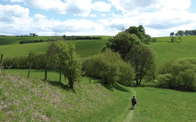
The route is surprisingly rural, rarely encountering towns and villages, and provides an excellent retreat from city living. At the same time as giving a sense of the wild, it is a generally easy walk and well-waymarked. None of the stages are more than 12 miles and the complete walk can be done in a leisurely 12 days.
Best time to walk the South Downs Way?
This National Trail can be walked at any time of the year although each season will bring its own particular style. The route passes through one of the driest and warmest parts of the country, and for the most part bridlepaths will be firm underfoot, but following rain the bare chalk tracks soon become very slippery, which can cause problems on steep descents.
Under ‘normal’ summer conditions there will be little mud, while exposed flints will prove uncomfortable unless you are well shod. For long periods the traveller along the South Downs Way will be fully exposed to the elements with neither shelter nor shade for several miles. This can create problems in summer as in winter – bright sunshine can be as debilitating on a long walk as cold winds and rain. Be prepared for all eventualities.
Where should you stay?
Numerous options exist along or close to the route, including hotels, B&Bs, guest houses, youth hostels, camping barns and campsites, up-to-date details of which are available via the South Downs Way website. Booking in advance is essential because of the popularity of the region in general and the SDW in particular, and as prices vary considerably, do check when making your reservation.
A few campsites will be found close to, or within a mile or two of, the route, and these are listed on the national trail website mentioned above. Wild camping along the South Downs Way is not really an option.

Route Summaries
The following route summaries follow the South Downs Way in both West and East directions. These stages are well described by the Cicerone Guide.
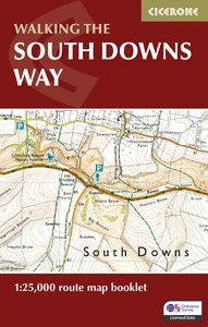
The South Downs Way Map Booklet
1:25,000 OS Route Mapping
£12.95
SALE
£10.36
Map of the 100 mile (160km) South Downs Way National Trail, between Eastbourne and Winchester. This booklet is included with the Cicerone guidebook to the trail and shows the full route on OS 1:25,000 maps. The trail typically takes a week to walk and is suitable for most levels of ability.
More informationThe South Downs Way – Westbound
| Stage | Start/Finish | Distance (miles/km) | Approx. time |
|---|---|---|---|
| 1 | Eastbourne to Alfriston via Seven Sisters | 10½ (17) | 4–5hr |
| 1a | Eastbourne to Alfriston (bridleway) | 8 (12.5) | 3½–4hr |
| 2 | Alfriston to Southease | 7 (11) | 3–3½hr |
| 3 | Southease to Housedean (A27) | 6 (9.5) | 2½–3hr |
| 4 | Housedean (A27) to Pyecombe | 8½ (13.5) | 3½–4hr |
| 5 | Pyecombe to Botolphs | 7½ (12) | 3–3½hr |
| 6 | Botolphs to Washington | 7 (11) | 3–3½hr |
| 7 | Washington to Amberley | 6 (9.5) | 2½–3hr |
| 8 | Amberley to Cocking | 12 (19) | 6–7hr |
| 9 | Cocking to South Harting | 7½ (12) | 3–3½hr |
| 10 | South Harting to Buriton (Queen Elizabeth Forest) | 3½ (5.5) | 1½–2hr |
| 11 | Buriton to Exton | 12 (19) | 6–7hr |
| 12 | Exton to Winchester | 12 (19) | 6–7hr |
The South Downs Way – Eastbound
| Stage | Start/Finish | Distance (miles/km) | Approx. time |
|---|---|---|---|
| 1 | Winchester to Exton | 12 (19) | 6–7hr |
| 2 | Exton to Buriton (Queen Elizabeth Forest) | 12 (19) | 6–7hr |
| 3 | Buriton to South Harting | 3½ (5.5) | 1½–2hr |
| 4 | South Harting to Cocking | 7½ (12) | 3–3½hr |
| 5 | Cocking to Amberley | 12 (19) | 6–7hr |
| 6 | Amberley to Washington | 6 (9.5) | 2½–3hr |
| 7 | Washington to Botolphs | 7 (11) | 3–3½hr |
| 8 | Botolphs to Pyecombe | 7½ (12) | 3–3½hr |
| 9 | Pyecombe to Housedean (A27) | 8½ (13.5) | 3½–4hr |
| 10 | Housedean (A27) to Southease | 6 (9.5) | 2½–3hr |
| 11 | Southease to Alfriston | 7 (11) | 3–3½hr |
| 12 | Alfriston to Eastbourne via Seven Sisters | 10½ (17) | 4–5hr |
| 12a | Alfriston to Eastbourne (bridleway) | 8 (12.5) | 3½–4hr |

