The Coast to Coast Cycle Route – essential facts & top tips
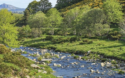
The 139 mile C2C route is the most well-loved short cycle tour in the UK, and for good reason. Taking you from the Irish sea at Whitehaven or Workington to the North Sea at Tynemouth or Sunderland, the ride weaves through the Lake District National Park before venturing into the wild and wonderful northern Pennines, until eventually giving way to over 30 miles of traffic-free cycling leading to the coast. Read on to find essential facts and top tips to help you plan your ride.
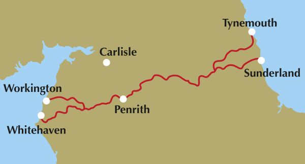
Arcing its way from Irish Sea to North Sea across an absorbing and beautiful swathe of northern England, the 139-mile Sea to Sea Cycle Route (or ‘C2C’) is an essential rite of passage for cycle enthusiasts.
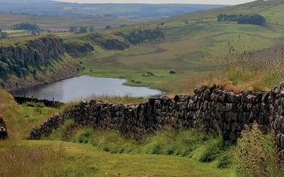
From a west-east direction, the route strikes eastwards from the Cumbrian coast. Beyond the Lake District, the route bridges across the verdant Eden Valley – via Penrith – and ventures into the wild beauty of the lesser-known northern Pennines. The challenging traverse of the spine of England culminates at the remote Parkhead Station – a relic of an improbable upland mining railway. From Parkhead, the route commences a delightfully elongated descent towards the North Sea, wending its way along more than thirty miles of adapted former rail lines and cycle paths to the coast.
Which direction should you cycle the route?
The C2C has signage that works in either direction. To take advantage of Britain’s prevailing westerly winds, the route is best tackled west–east. This direction has the advantage of leaving a last thirty or so miles that are either downhill or flat. Nonetheless, prevailing easterlies are not unheard of in Britain and the C2C is perfectly viable east to west. The main disadvantage east–west is that the ascent of Hartside in this direction involves 3 miles of slow climbing on an A Road which zips by in the opposite direction.
Where is the best place to start and finish the route?
The choice of where to start (Whitehaven or Workington) and finish (Tynemouth or Sunderland) requires a spot of contemplation. To reflect the more popular choices made by C2C riders, the primary description of our guidebook begins in Whitehaven and ends in Tynemouth. Conversely, Workington and Sunderland, which both have their individual merits, are included as fully described alternatives.
How difficult is the route?
The Coast to Coast is an achievable goal for most, and the advent of e-bikes has broadened its accessibility. The C2C offers a good balance of challenge over a three-day tour and is an attainable goal for most regular cyclists. If you can comfortably ride 40 miles with 1000m of ascent and still clamber back onto your saddle the next day, then you will be more than able to tackle the three-day itinerary.
What kind of bike do you need for the Coast to Coast?
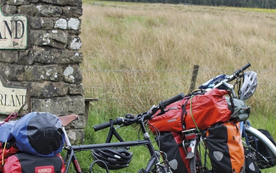
While the ride is more commonly tackled by cyclists on road bikes, the route nonetheless presents a series of alternative unsurfaced off-road options. A version of the C2C is absolutely possible on whatever type of bike you have, however, careful reading of the 'Unsurfaced off-road options section' of the guidebook should help planning and bike selection.
How steep is the elevation on the Coast to Coast cycle route?
On Day 1, crossing the Lake District is an unsurprisingly fairly hilly affair. Riders are confronted with one truly daunting big climb – the ascent of Whinlatter Pass (258m height gain). While Whinlatter is a great climb and a good challenge, it is the tamest and least gruelling of the big Lakeland passes. Day 2 of the C2C is, simply put, a beast. Hills abound – if you do not like them, you may regret not opting for Norfolk or Holland. Yet these grand ascents are what give the route its character and legendary status.
How long does it take to cycle the Coast to Coast?
The majority of cyclists opt to ride the C2C in three days and do so mostly choosing the road and well-surfaced traffic-free options described as the primary route in this book. A four-day ride is also a good choice for those coming from further afield, cyclists completing their first tour or less confident about the hills, or heavily loaded cycle-campers, as well as those wanting to tackle all the unsurfaced off-road alternatives.
How do I travel to the start and end points?
For small groups and solo travellers, the train is a viable and environmentally friendly option to get to and from the start of the route. Whitehaven and Workington are connected to the West Coast Mainline at Lancaster and Carlisle by the slow and looping Cumbrian Coast Railway. Tynemouth and Sunderland connect to the East Coast Mainline at Newcastle.
Driving to the start of the route and returning by train at the end is a fairly popular option. It is also worth considering combining the C2C with one of two other classic Sustrans coast-to-coast routes: viable options are Hadrian’s Cycleway or the Reivers Route.
What accommodation is available on the route?
There are bed and breakfasts, pubs, hostels, self-catering accommodation, and campsites to choose from along the route. Advanced accommodation booking is recommended, even if camping. If you are prepared to be flexible about where you stay, there is ample accommodation on route for two, three and four day itineraries. Late bookers will always find somewhere to stay in Keswick, Penrith, or Alston, when the smaller villages on route are full.
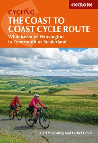
The Coast to Coast Cycle Route
Whitehaven or Workington to Tynemouth or Sunderland
£16.95
Guidebook to cycling the Sustrans Coast to Coast Cycle Route across the north of England, from Whitehaven or Workington to Newcastle or Sunderland, passing through the northern Lake District, the Pennines and County Durham. The 137 mile route is presented in 3 stages, with alternative start and finish stages, and is suitable for all bikes.
More information