The Rhine Cycle Route: ultimate planning guide
The Rhine Cycle Route, passing through six countries, is a delightful journey that takes in stunning scenery, including the castle-studded Rhine gorge and many historic towns and cities. In this post we cover all the key facts you need to know about the route.

| What? | The Rhine Cycle Route |
| Where? | From source to sea through six countries (start in Switzerland, end in the Netherlands) |
| How many countries? | Six (Switzerland, Germany, France and the Netherlands, with short sections in Liechtenstein and Austria) |
| Start point? | Oberalppass, Switzerland |
| End point? | Arnhem, Netherlands |
| How long is the route? | 1368km |
| How long to complete? | 2-3 weeks |
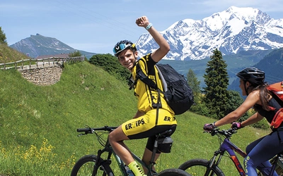
| How hard is the route? | The route follows a river from source to sea with a prevailing downhill gradient. There are a few gentle ascents, all within the abilities of leisure cyclists. Stamina is the key requirement as the route takes two to three weeks to complete. |
| Is the route waymarked? | The Rhine Cycle Route mostly follows Swiss, German, French and Dutch national cycle trails, with a high standard of waymarking throughout. |
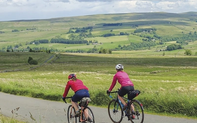
| What are the surfaces like? | The cycling is straightforward, with much of the route following well-surfaced cycle tracks, often along the riverbank or flood dykes. |
| What type of bike do I need? | The ride is best undertaken on trail, touring or hybrid bikes. |
| How fit do I need to be? | Good fitness and stamina required to complete the entire route. However, this route is suitable both for experienced long-distance cyclists and those who have done only a little cycle touring and wish to attempt something more adventurous. |
| How many stages are there? | 27 stages, averaging just over 50km per stage |
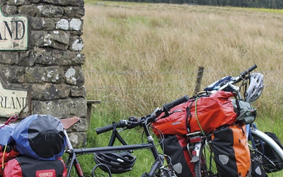
| What accommodation is available? | 35 Hostelling International youth hostels (and many backpacker hostels) to B&Bs, guesthouses and hotels. If you do not mind the extra weight of camping gear, there are many official campsites. |
| What time of year? | Except for the first stage in the Swiss Alps, where snow lingers until May, the route is best ridden between April and October |
| What languages do I need? | English is widely spoken, almost universally in Switzerland and the Netherlands. |
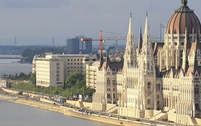
| Route highlights? | Swiss Alps, Lake Constance, Rhein falls, Basel, Strasbourg, Rheingau wine region, Rüdesheim, Rhine gorge, Loreley rock, Bonn, Cologne, Kinderdijk windmills, Rotterdam |
| Why do this route? | The Rhine is rightly one of the world’s greatest rivers and one of the most visited by tourists. Many travel by boat, disembarking only at tourist honey-pots and eating international food on-board. By cycling the length of the river you will have a completely different perspective, passing through smaller towns, meeting local people and eating local food. |
Rhine Cycle Route: Background
In the guidebook the English spelling of Rhine is used, except for in proper nouns such as Rheinquelle, Canal du Rhône au Rhin, Neder Rijn, where the appropriate national spelling is used. On the maps, Rhein is used in German-speaking areas, Rhin in France and Rijn in the Netherlands.
Geographically the Rhine has six distinct sections:
- Alpenrhein (Alpine Rhine) is the combination of the Vorderrhein and Hinterrhein tributaries that flow rapidly down the north side of the Alps, along deep glacial valleys, into Bodensee.
- Hochrhein (Higher Rhine) continues descending through broad wooded gorges providing the border between Switzerland and Baden-Württemberg (Germany) from Bodensee to Basel.
- Oberrhein (Upper Rhine) meanders north from Basel across a broad plain, between the Vosges mountains in French Alsace and the German Black Forest, as far as Mainz.
- Mittelrhein (Middle Rhine) is a picturesque stretch from Mainz to Bonn, where the river has cut the Rhine Gorge between the Hunsrück/Eifel mountains (west) and the Taunus/Siebengebirge ranges (east).
- Niederrhein (Lower Rhine) crosses the North German Plain from Bonn to the Dutch border.
- Delta Rijn (Rhine Delta) is the Dutch part of the river, which divides into five different arms to reach the North Sea.
However, the Rhine is more than just a river. Flowing through the heart of Western Europe, it has significance far beyond its relatively modest 1232km length. It can be described as four rivers in one. Firstly it functions as an important national border; secondly it is the source of many of the myths and legends central to European culture; thirdly it is a great commercial artery and location for industry; and fourthly it has a magnetic attraction to tourists and pursuers of leisure activities.
| Stage | Start | Finish | Distance |
|---|---|---|---|
| 1 | Oberalppass summit (2046m) | Ilanz square (705m) | 52km |
| 2 | Ilanz square (705m) | Chur station (585m) | 35km |
| 3 | Chur station (585m) | Buchs station (449m) | 48km |
| 4 | Buchs station (449m) | Bregenz station (398m) | 54.5m |
| 5 | Bregenz station (398m) | Konstanz, Schottenplatz (402m) | 58km (+4km ferry) |
| 6 | Konstanz, Schottenplatz (402m) | Schaffhausen bridge (392m) | 47km |
| 7 | Schaffhausen bridge (392m) | Waldshut town hall (341m) | 60.5km (49km via Lottstetten) |
| 8 | Waldshut town hall (341m) | Basel cathedral (263m) | 66.5km |
| 9 | Basel cathedral (263m) | Neuf-Brisach, Place d’Armes (194m) | 67km |
| 10 | Neuf-Brisach, Place d’Armes (194m) | Strasbourg, Quai Louis Pasteur (140m) | 67.5km |
| 11 | Strasbourg, Quai Louis Pasteur (140m) | Drusenheim ferry (124m) | 33km |
| 12 | Drusenheim ferry (124m) | Karlsruhe station (115m) | 56.5km |
| 13 | Karlsruhe station (115m) | Speyer, Klipfelsau (97m) | 51.5km |
| 14 | Speyer, Klipfelsau (97m) | Worms, Ludwigstrasse (91m) | 48.5km |
| 15 | Worms, Ludwigstrasse (91m) | Mainz town hall (86m) | 54km |
| 16 | Mainz town hall (86m) | Bacharach station (79m) | 49km |
| 17 | Bacharach station (79m) | Koblenz, Deutsches Eck (65m) | 50km |
| 18 | Koblenz, Deutsches Eck (65m) | Remagen, Rheinpromenade (59m) | 46km |
| 19 | Remagen, Rheinpromenade (59m) | Köln railway bridge (42m) | 57.5km |
| 20 | Köln railway bridge (42m) | Düsseldorf, Schlossturm (35m) | 52km |
| 21 | Düsseldorf, Schlossturm (35m) | Duisburg, Königstrasse (31m) | 32km |
| 22 | Duisburg, Königstrasse (31m) | Xanten main square (29m) | 48.5km |
| 23 | Xanten main square (29m) | Arnhem station (23m) | 65.5km |
| 24 | Arnhem station (23m) | Wijk bij Duurstede, Dijkstraat (7m) | 50.5km |
| 25 | Wijk bij Duurstede, Dijkstraat (7m) | Schoonhoven ferry (−2m) | 48km |
| 26 | Schoonhoven ferry (−2m) | Rotterdam, Erasmus bridge (1m) | 37km |
| 27 | Rotterdam, Erasmus bridge (1m) | Hoek van Holland ferry terminal (0m) | 32.5km |

The Rhine Cycle Route
Cycle touring EuroVelo 15 through six countries
£17.95
SALE
£15.26
Guidebook to cycling the River Rhine from source to sea, through Switzerland, Germany, France and the Netherlands. The 1368km route from the summit of Oberalppass to the Hook of Holland is split into 27 stages, mostly following well-surfaced cycle tracks. Includes information on facilities, useful contacts and a language glossary.
More information