Cycling the Pennine Bridleway: a complete planning guide
Running along the spine of England from Rochdale to the edge of the Yorkshire Dales and on into Cumbria, the Pennine Bridleway was purpose-built for mountain bikers, and it shows: well-drained surfaces, easily opened gates, and a route that rewards a modest level of fitness with genuinely wild, big-sky riding. The waymarked trail covers 176km (109 miles) from Summit, near Rochdale, to Ravenstonedale, taking in the Mary Towneley Loop, the gritstone moors above Burnley, and the limestone heart of the Yorkshire Dales. Most riders complete it over 5 to 6 days, though 11 shorter circular routes make it just as accessible for a single day out. (Last updated: July 2026 · Guidebook edition: 1st edition, May 2012, reprinted 2017)
Cycling the Pennine Bridleway, quick facts:
- Distance: 176km (109 miles) linear route; 384km (239 miles) in total including all 11 day rides
- Duration: 5 to 6 days for the full linear route, or tackle it as individual day sections
- Start: Summit, near Rochdale
- Finish: Ravenstonedale, Cumbria
- Stages: 6 suggested day-length sections (the Mary Towneley Loop, plus 5 stages from Hurstwood to Ravenstonedale)
- Day rides: 11 additional circular routes of 12km to 27km (8 to 16¾ miles)
- Difficulty: Graded ● (easy), ■ (moderate) or ▲ (challenging), from family-friendly rides to tough, technical days
- Terrain: Waymarked bridleways, limestone tracks and moorland trails, much of it well-drained and up to 90% off-road
- Waymark: National Trail acorn, alongside a blue arrow (bridleway) or red arrow (byway, open to motorised traffic too)
- Accommodation: Pubs, B&Bs and bunkhouses along most of the route, becoming scarce north of Horton-in-Ribblesdale
- Best season: Late spring to early autumn
- Guidebook:Cycling the Pennine Bridleway by Keith Bradbury, 1st edition (Cicerone Press)
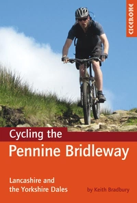
Cycling the Pennine Bridleway
Lancashire and the Yorkshire Dales, plus 11 day rides
£15.95
A guidebook for cycling the Dales section of the Pennine Bridleway National Trail. Over 140km of mountain biking riding through Lancashire and the Yorkshire Dales, along with an anti-clockwise route round half of the Mary Towneley Loop. 11 circular day MTB routes in the Yorkshire Dales using the Bridleway are also included.
More information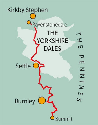
What is the Pennine Bridleway?
The Pennine Bridleway is a National Trail designed from the outset for cyclists, horse riders and walkers, rather than adapted from an existing footpath network. Its 176km northern section runs from the village of Summit near Rochdale, across the gritstone moors of the South Pennines and the pastoral farmland of Lancashire, before climbing into the limestone country of the Yorkshire Dales and finishing on the outskirts of Ravenstonedale, near Kirkby Stephen in Cumbria.
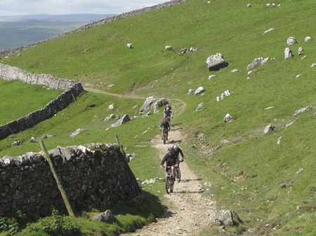
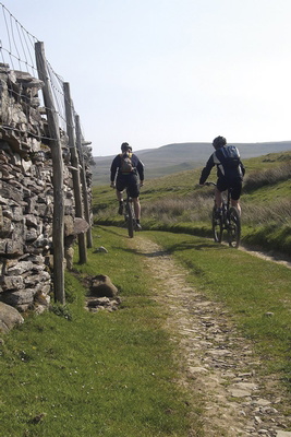
The trail's defining feature is its riding surface. Because much of it has been purpose-built or upgraded in recent years rather than worn in by centuries of foot traffic, it stays well-drained and rideable even after typical British rain, a rarity among British off-road cycling routes. That said, the exposed moorland of the northern Pennines can turn hazardous quickly in poor weather, and limestone surfaces become slippery when wet.
This planning guide answers the most common questions riders have before setting out. For complete stage-by-stage route descriptions and mapping, see the Cicerone Cycling the Pennine Bridleway guidebook.
How long is the Pennine Bridleway?
The full linear route covers 176km (109 miles) and is broken into 6 suggested day-length stages, starting with an anti-clockwise loop of the Mary Towneley Loop before heading north through Lancashire and into the Yorkshire Dales.
| Stage | Distance | Time |
|---|---|---|
| Mary Towneley Loop: Summit to Hurstwood (anti-clockwise) | 30km (18¾ miles) | 6–8hrs |
| Lancashire Link Part 1: Hurstwood to Barnoldswick | 28.5km (17¾ miles) | 5–7hrs |
| Lancashire Link Part 2: Barnoldswick to Long Preston | 26.75km (16½ miles) | 3–5hrs |
| Yorkshire Dales Part 1: Long Preston to Horton-in-Ribblesdale | 41.75km (26 miles) | 7–9hrs |
| Yorkshire Dales Part 2: Horton-in-Ribblesdale to Garsdale Head | 26.5km (16½ miles) | 4hrs 30mins–6hrs 30mins |
| Yorkshire Dales Part 3: Garsdale Head to Ravenstonedale | 21.75km (13½ miles) | 3–5hrs |
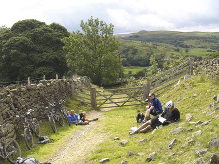
The longest and toughest day is Yorkshire Dales Part 1, from Long Preston to Horton-in-Ribblesdale, which climbs steeply out of Long Preston past the old quarries at Hunter Bark before crossing classic Craven Fault limestone country. It is also the most navigationally varied day, threading through Settle, Stainforth, Feizor, Austwick and Clapham along the way.
Who is Cycling the Pennine Bridleway suitable for?
The guidebook is written specifically for mountain bikers, though walkers and horse riders share the same bridleways and byways. Riders of modest fitness with some off-road experience will manage the suggested day stages comfortably; those who have not ridden off-road since school are likely to find the distances and climbing harder going than they expect.
Newcomers and families are well catered for by the 11 shorter day rides, several of which are graded ● (easy) and stay under 20km. The linear route itself can also be split into shorter days: the demanding Long Preston to Horton stage, for example, can be broken with an overnight stop, or the gentler Barnoldswick to Long Preston day extended onward to Settle or Stainforth.
How difficult is the Pennine Bridleway?
Each route and day ride carries an overall grade of ● (easy), ■ (moderate) or ▲ (challenging):
- ● Climbs and descents rideable by anyone with modest fitness, on smooth, well-graded tracks.
- ■ More technical: steeper climbs may need an occasional push, descents are rideable with care and growing confidence.
- ▲ Most riders will push up the steepest climbs, and some descents suit experienced, skilled riders only.
Among the day rides, Route 5 (Ribblehead to Ling Gill), Route 6 (Ribblehead to Dentdale via the Craven Way), Route 9 (Garsdale to Dentdale via Dandra Garth) and Route 11 (Ravenstonedale, Pendragon Castle and High Dolphinsty) are all graded ▲, with ascents of 550m to 657m. On the linear route, the final climb of the last day, up to the High Dolphinsty pass beyond Lady Anne's Highway, catches many riders out: it feels disproportionately hard after several days of accumulated fatigue.
Can I ride a shorter section?
Yes. The Pennine Bridleway divides naturally into the 6 day-length stages above, and any can be ridden in isolation using the Settle–Carlisle railway line, which shadows much of the Yorkshire Dales section and allows bikes to be carried (subject to space and advance booking).
For an even shorter introduction, the guidebook's 11 circular day rides use sections of the main bridleway as their base, ranging from the easy 17.5km Horton-in-Ribblesdale, Helwith Bridge and Sulber Nick loop to the challenging 25.75km Ribblehead to Ling Gill and Horton-in-Ribblesdale route. These are ideal for riders based in the Dales for a weekend rather than tackling the trail end to end.
Which direction should I ride the Pennine Bridleway?
The guidebook describes the Mary Towneley Loop anti-clockwise from Summit, since this gives the shortest distance to the continuation of the bridleway northwards at Hurstwood. From there, the linear route runs south to north, from Hurstwood through the Lancashire Link and into the Yorkshire Dales, finishing at Ravenstonedale.
Riding north to south is possible but loses the natural progression from gritstone moorland to limestone Dales scenery that the route is designed around, and the guidebook's directions, waymarking notes and facilities information are all written for the northbound journey.
When is the best time to ride the Pennine Bridleway?
- Late spring to early autumn is the ideal window, when the Dales are at their best and the trail's well-drained, well-surfaced sections stay firm underfoot.
- Summer brings the longest days and busiest accommodation, particularly around events on popular sections such as the Mary Towneley Loop or the Yorkshire Three Peaks; it is worth checking with local Tourist Information offices before booking.
- Winter riding is possible and can be spectacular, with snow-wreathed fells and empty trails, but the northern Pennines see genuinely hazardous weather and this is not a season to underestimate.
- Once off the main waymarked bridleway, limestone surfaces become treacherously slippery after rain, and low-lying sections can turn boggy; the guidebook flags these areas route by route.
What accommodation is available?
Settle and Kirkby Stephen offer the most extensive amenities along the route, with Austwick, Clapham, Horton-in-Ribblesdale and Ravenstonedale providing pubs, village shops and B&Bs. North of Horton, options thin out quickly: a short diversion reaches bunkhouse accommodation at Gearstones or the Station Inn at Ribblehead, while Garsdale Head has no shops and relies on the Moorcock Inn for food and cycle-friendly beds. Between Garsdale Head and Ravenstonedale the trail is entirely without facilities, so a packed lunch and self-sufficiency are essential.
Advance booking is strongly recommended throughout, especially at weekends and during school holidays, when many establishments impose a two-night minimum stay. Full listings are provided in the guidebook's accommodation appendix.
Getting there and back
Summit (the southern start point, near Littleborough) is reached via Junction 20 of the M62 and the A627(M), or by rail to Littleborough station on the Manchester Victoria to Leeds line. Hurstwood Reservoir, where the Mary Towneley Loop meets the main linear route, lies a few miles from Burnley, itself served by rail via Preston. Long Preston, the start of the Yorkshire Dales section, sits on the A65 and on the Settle–Carlisle railway line, which also serves Horton-in-Ribblesdale, Ribblehead, Dent and Garsdale, making it possible to access almost any stage by train.
Because the route is linear, riders not using a support vehicle should plan return transport carefully. The Settle–Carlisle line is a considerable asset here: most Yorkshire Dales day stages begin and end close to a station, which also simplifies dealing with breakdowns or injuries mid-ride. Cycle spaces on trains are limited and should always be booked in advance, particularly for larger groups.
What are the route highlights?
- The wild, rugged gritstone moorland of the Mary Towneley Loop above Rochdale and Burnley
- The Yorkshire Three Peaks country around Ingleborough, Pen-y-ghent and Whernside
- The dramatic Ribblehead Viaduct, seen from several of the day rides
- The Craven Fault limestone scars and quarries around Long Preston and Hunter Bark
- The remote, trail-only landscape of Garsdale and the Mallerstang valley
- The historic drove road of Lady Anne's Highway and the climb to High Dolphinsty
Plan your ride with the Cicerone guidebook
The Cycling the Pennine Bridleway guidebook by Keith Bradbury contains everything needed to plan and complete the route, from Summit to Ravenstonedale.
- Full linear route description across the Mary Towneley Loop, the Lancashire Link and the Yorkshire Dales, broken into day-length stages
- 11 additional circular day MTB routes, graded from easy family rides to tough, technical challenges
- OS 1:50,000 map extracts and elevation profiles for every route
- Distance, ascent, grade, estimated time and percentage of off-road riding given for each ride
- Practical information on accommodation, local facilities, bike shops and useful contacts throughout Lancashire, the Yorkshire Dales and Cumbria
- Guidance on waymarking, access rights and the trail's grading system
- IMBA's rules of the road for responsible off-road riding
Available as a printed guidebook (£15.95) or digital eBook (£15.95).
Cycling the Pennine Bridleway
Lancashire and the Yorkshire Dales, plus 11 day rides
£15.95
A guidebook for cycling the Dales section of the Pennine Bridleway National Trail. Over 140km of mountain biking riding through Lancashire and the Yorkshire Dales, along with an anti-clockwise route round half of the Mary Towneley Loop. 11 circular day MTB routes in the Yorkshire Dales using the Bridleway are also included.
More informationAbout Keith Bradbury, guidebook author:
Originally hailing from Sunderland, Keith's early interest was in white-water and sea canoeing. After a spell trekking in Nepal and canoe guiding in France, a teaching job in Kendal established him firmly in the Lake District. Walking, rock climbing and cycling became his new passions until a chance introduction to caving led to a rekindled love affair with the Yorkshire Dales. The last 20 years have been a delightful exploration of the lesser-known parts of these two areas, either underground with helmet and lamp, or above, on his (t)rusty mountain bike. Keith is a member of the Outdoor Writers and Photographers Guild and prides himself on an unrivalled knowledge of the bridleways of the Lake District and the Northern Dales.