Tour of Monte Rosa experience: tackling the ultimate Alpine trek
We caught up with Maddy Williams to hear about her experience trekking the Tour of Monte Rosa while researching and writing our TMR guidebook. As one of the most spectacular multi-day hikes in the Alps, the TMR spans two countries and circles some of Europe’s highest peaks, offering breathtaking scenery and a quiet yet challenging trek for walkers. Maddy shares her insights on trek planning, route highlights, and offers valuable advice for first-time trekkers, including tips on accommodation, acclimatisation, and how to make the most of the trail. Read on to discover her reflections on this route and what makes the TMR a must-do trek.

Hi Maddy, the Tour of Monte Rosa looks spectacular. What inspired you to do the trek?
I’ve previously hiked in the area, both on the Swiss and Italian sides, so I knew it offered some unparalleled Alpine walking. I’d also crewed my brother Joe during the Ultra Tour Monte Rosa (UTMR) a few years ago and knew the whole route was an epic adventure — but I preferred a slower pace than running it! The chance to complete the Tour (TMR) in full and prepare a new guidebook for it was hard to resist.
Have you done any comparable treks?
Quite a few! In the Alps alone, I’ve done the Tour du Mont Blanc, Chamonix to Zermatt, the Alta Via 1 in the Dolomites, about half of the Swiss Via Alpina, and a few self-devised treks. One of those was a traverse of the Italian valleys, starting from Saas Fee and ending in Chamonix, which covered some of the same ground as the Tour of Monte Rosa.
What time of year did you go?
I researched the trek over two separate trips. One started in late August and ran into the first week of September — always a quieter time in the Alps. Aside from a fresh batch of snow reaching even the valleys, the weather was bright, with an autumnal chill setting in and the hillsides turning gold and copper. The other trip was in early August, during the height of the summer season. By then, the previous season’s snow had largely melted, the days were warm and sunny, and plenty of other trekkers were enjoying the route.
Who is the Monte Rosa tour suitable for?
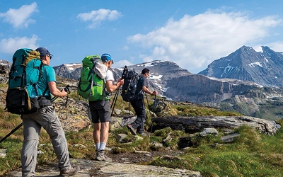
The TMR is an incredible Alpine trek, but it’s one of the more challenging ones. With an average ascent and descent of 1000m per day and walking times of up to 7 hours 30 minutes (not including breaks!), there are unavoidable back-to-back, long, and technical days. In total, the trek takes 10 to 11 days, though this can vary depending on preference.
Until 2023, the TMR presented an immovable challenge: a high glacier crossing that hikers had to tackle. This required glacier equipment (at minimum, crampons or good microspikes) and the skills to traverse a glacier safely. Now, with the opening of a cable car linking Zermatt in Switzerland to Breuil-Cervinia in Italy, the glacier crossing can be skipped, making the route more accessible to hikers who prefer to avoid the ice.
The TMR is ideal for experienced Alpine walkers — those who have completed a similar trek before and enjoyed it. Mountaineers looking for a varied but non-technical route, or fastpackers seeking a challenging itinerary with classic Alpine accommodation along the way, will also find plenty to love about this trek.
How does Monte Rosa compare to the TMB? How much more challenging is it?
While the TMR is a similar distance to the Tour du Mont Blanc, it includes over 1000m more ascent and descent. It also spends more time at altitude, crosses higher passes, and traverses a couple of glaciers.
It’s an excellent choice for those looking for their next adventure after completing the Tour du Mont Blanc or the Chamonix-Zermatt route. There’s a natural progression between these three treks: a Mont Blanc trekker will spend a day or two sharing trails with those on the Chamonix-Zermatt route, often discovering it for the first time. Then, at the end of their journey, Chamonix-Zermatt trekkers will find themselves walking along the Europaweg alongside Monte Rosa and Tour of the Matterhorn hikers — just as they start thinking about their next summer trek, they’re introduced to new possibilities.
How did you prepare, and what essentials did you pack?
Aside from the standard gear I’d bring for an Alpine trek (everyone has their own preferences, and the guidebook suggests a kit list), I also needed spikes or crampons for the glacier crossing. If trekking in the early season with significant snow cover, I may have needed full glacier gear, including crampons, an ice axe, a harness, and a rope.
The TMR includes long, challenging days with tricky terrain, so it’s best to have a good level of fitness and confidence in walking for consecutive long days with a pack without pain or blisters. The best way to prepare for a long trek is simply by walking! For me, this meant long walks in the local fells, regular runs, and daily dog walks while wearing my rucksack.
Is it a self-guided trek?
Yes, the vast majority of hikers complete it as a self-guided trek.
How did you plan the route?
The TMR is an established and well-waymarked route. Much of the path, particularly on the Italian side, follows ancient passes that have been used for centuries, with key sections quite literally set in stone!
There are a few variations, and part of my preparation involved deciding how to check them out while also covering the main route. One major variant is in the area south of Saas Fee. The ‘official’ route follows the valley from the border crossing with Italy down towards Saas-Fee, taking a day of walking. But there’s also an alternative high-level route that can cross a couple of glaciers and stop off at the iconic Britanniahütte, which takes about a day and a half.
Planning my stages required plenty of time with a map and carefully considering key accommodation stops. Some days on the TMR have very few — if any — facilities along the way, making some long days unavoidable.
Best and worst parts of the trek?
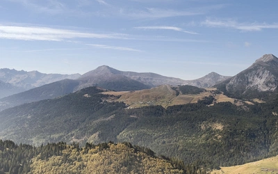
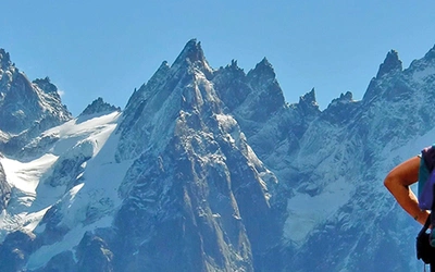
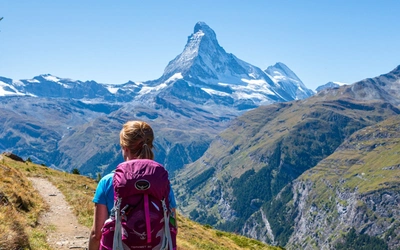
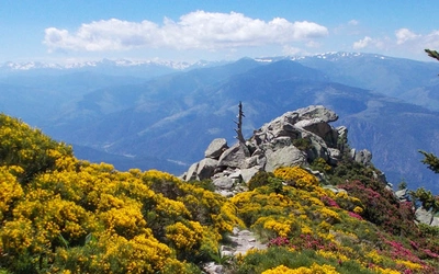
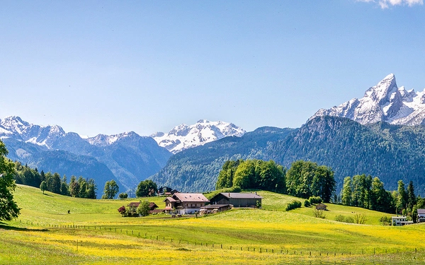
It’s an obvious answer, but the mountains and the views are the real highlights of the Tour of Monte Rosa (TMR). This route offers unparalleled views of seven of the top ten highest peaks in the Alps. Nowhere else in the Alps is there such a high concentration of 4000m summits – this truly is a journey among giants. These are some really iconic mountains from the Matterhorn to the Weisshorn, the Monte Rosa massif, the Dom, and the Rimpfischhorn. The east face of Monte Rosa really has to be seen to be believed. It’s the largest mountain wall in Europe, Himalayan in scale, and it dominates the horizon with its sheer granite and ice.
But there’s also a less obvious, yet equally remarkable highlight: the history and culture of the Walser people, who have settled the high valleys for centuries. They journeyed from Switzerland into the Italian valleys, leaving their mark on the landscape. Throughout the trek, you can’t help but feel that you’re walking in the footsteps of history, whether crossing grand passes like the Passo del Turlo or descending into ancient alpine settlements in the valleys below.
Sadly, the worst part of the trek is a brief section around the Laghi delle Cime Bianche, where ski piste maintenance has left some scars on the landscape. But this is a quick section to pass through and doesn’t take away from the overall experience.
What was the food and accommodation like?
The accommodation on the TMR is a mix of mountain huts and valley towns or villages. Some of the huts are located at high altitudes where water is scarce, and guests may have early starts to climb nearby peaks. It’s a wonderful taste of Alpine hospitality, but be prepared for no showers and early nights!
In the huts, you can expect traditional Valaisian food, with more pasta and polenta as you move into Italy. Several huts along the route are renowned for their food, like Gandegghütte, high above Zermatt, or Oresteshütte in Italy, which offers a full vegan menu (though it's slightly off the main route).
Where there any logistical challenges? How did you travel to the start and end points?
The easiest way to access the Tour of Monte Rosa (TMR) is by starting and finishing in Zermatt. Zermatt is well-connected by regular trains to the Swiss rail network, with direct links to Geneva, Bern, Zurich, and Basel, all of which have international airports.
If you’re starting in Italy, the logistics are a bit trickier, but there are good bus connections up the Italian valleys, which link into Italy’s rail system and airports.
What was the camaraderie like with other hikers on the trail?
It was fantastic! The best time for meeting and chatting with fellow hikers is in the mountain huts at the end of a long day, over drinks and shared stories of the day’s hike. The hut staff usually organises dinner seating, so you’ll often find yourself sitting with new people and engaging in conversations – frequently in a mix of languages!
Any safety aspects to be aware of as a young woman walking alone?
Not particularly – whether walking or using public transport, this is a very safe area to travel in. You might find yourself staying in mixed dormitories from time to time, which is quite normal.
The main safety concern is on the trail itself, especially in the high mountains. If you’re travelling alone, whether male or female, it’s important to let someone know your route and your destination. This could be the staff at your next accommodation, so if anything goes wrong, there will be people who know where to look for you.
Why should people hike the Tour of Monte Rosa?
Because it has everything a classic, unforgettable Alpine trek should have. The route dips and weaves over ancient passes, follows airy traverses, and crosses boulders, bridges, moraines, and even glaciers. It spans two countries and multiple languages and takes in some of the most iconic refuges and mountain villages—all under the towering presence of some of the highest mountains in Europe. The TMR is a true adventure, offering both challenge and delight to those who take it on.
What advice would you give someone attempting the trail for the first time?
The best way to fully enjoy the TMR is to be well-prepared. That means having a good level of fitness but also planning properly — knowing your stages, packing the right gear, deciding whether you're comfortable crossing glaciers, booking accommodation in advance, and having a plan for when things don’t go as expected. This is where a good guidebook can be invaluable. Another great tip is to spend a day or two acclimatising before starting the trek. It makes a huge difference when you set off and is well worth factoring into your plans.
It sounds like an incredible experience, all the best with your next adventure!
Thank you.
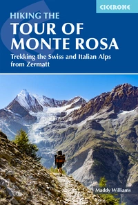
Hiking the Tour of Monte Rosa
Trekking the Swiss and Italian Alps from Zermatt
£18.95
Guidebook to the Tour of Monte Rosa (TMR), a 174km (108 mile) circular trek through the Swiss and Italian Alps. Presented in 11 stages with variants and two optional glacier crossings, the route includes several iconic alpine passes. With trek planning resources, an accommodation guide and 1:100,000 maps for each stage.
More information