Ready to step up? Discover your next walking adventure
Many walkers begin with a classic like the Camino Francés, the Tour du Mont Blanc, the West Highland Way. But what happens after you’ve ticked one of these off? For those ready to take the next step, there are trails that build on your experience and lead you further — longer distances, wilder landscapes, greater challenges, and new rewards. From the rugged passes of Corsica to the far reaches of Scotland, here are some remarkable routes to aim for once you’ve completed the favourites.
Camino Francés ➝ Camino Primitivo
The Camino Francés is the most famous pilgrimage route across Spain, with bustling albergues and camaraderie at every stage. If you’re ready for a wilder, hillier camino, the Camino Primitivo is the natural next choice. It’s shorter but tougher, with steep climbs and quieter trails through the Asturian mountains — a true test of your camino spirit.
| - | Camino Francés | Camino Primitivo |
|---|---|---|
| Where? | Spain | Spain |
| How long? | 784km | 355km |
| How many days/weeks? | 4-5 weeks | 2 weeks |
| How hard? | The walk is suitable for all walking levels. | Difficult - daily stages often include steep ascents and descents in the Asturian mountains. |
| Season? | The route is best experienced in spring or autumn, though summer months are most popular. Winter pilgrims may encounter snow at higher elevations. | Summer/late spring/early autumn are best, because of the weather and because much of the accommodation closes in winter. |
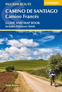
Camino de Santiago: Camino Frances
Guide and map book - includes Finisterre finish
£17.95
Guidebook and map book to walking the 784km Camino Frances from St Jean-Pied-de-Port in southern France to Santiago de Compostela in Spain, including an additional route to Finisterre. Split into 6 sections and 36 customisable stages, the guide lists over 500 pilgrim hostels. The map book covers the entire route, which can be walked in 4-5 weeks.
More information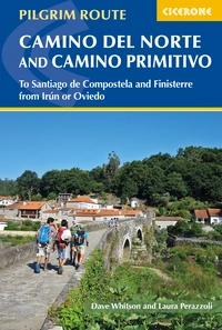
The Camino del Norte and Camino Primitivo
To Santiago de Compostela and Finisterre from Irun or Oviedo
£18.95
Guidebook to walking the Camino del Norte and Camino Primitivo pilgrim routes to Santiago de Compostela in northwest Spain. The 820km Camino del Norte from Irún via Bilbao and Santander takes around 5 weeks to complete. The 355km Camino Primitivo takes about 2 weeks. Includes the Camino Finisterre from Santiago to the coast.
More informationTour du Mont Blanc ➝ Chamonix to Zermatt / Grande Traversata delle Alpi
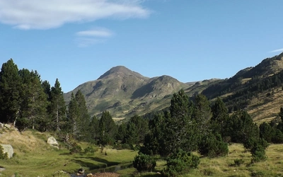
The Tour du Mont Blanc (TMB) is the classic Alpine circuit, achievable in two weeks and within reach of most walkers. Once you’ve enjoyed its high passes and sweeping valleys, you might look to the classic walker's haute route, which crosses higher ground between Chamonix and Zermatt, or the Grande Traversata delle Alpi (GTA) — a rugged, remote journey along Italy’s western Alps. Both routes are longer, tougher, and full of unforgettable mountain moments.
| - | Tour du Mont Blanc | Chamonix to Zermatt | Grande Traversata delle Alpi |
|---|---|---|---|
| Where? | France, Italy and Switzerland | France and Switzerland | Italy |
| How long? | 170km | 215km | 809km |
| How many days/weeks? | 11 days | 2 weeks | 6-10 weeks |
| How hard? | Much of the TMB follows clear, well-graded paths suitable for fit walkers. | For experienced mountain walkers only, it's a fairly tough trek with high alpine mountain walking and some sharp cols. | This route with strenuous daily ascent/descents is best for fit and experienced alpine trekkers. |
| Season? | With high passes to negotiate, this is a summer-only route, best tackled between early July and end of September. | Alpine summer walking, so mid-June to mid-September; snow could remain on higher passes well into July. | The route is best walked from early June, when any snow on high passes is diminishing, until late-September, when declining weather, and limited accommodation becomes a factor. |


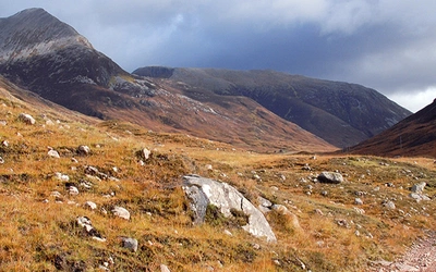
West Highland Way ➝ John O’ Groats Trail
The West Highland Way is Scotland’s most popular long-distance route — a perfect introduction to multi-day trekking. But the John O’ Groats Trail takes things further. Stretching north along cliff tops, beaches, and moorland, it’s wilder, longer, and less waymarked. Expect tidal crossings and remote sections that demand confidence, but also a powerful sense of Scotland at its most untamed.
| - | West Highland Way | John O' Groats Trail |
|---|---|---|
| Where? | Scotland | Scotland |
| How long? | 96 miles | 233km |
| How many days/weeks? | 6-9 days | 2 weeks |
| How hard? | The walking is not difficult for anyone accustomed to regular walks longer than 10 miles. | Suitable for experienced walkers. The northern half of the Trail is challenging, mainly following rough clifftops, often close to the edge and across rough ground. |
| Season? | May-June and September-October avoid the worst of the midges, but suitably experienced backpackers can do this walk at any time of year. | Spring is the best time for this walk, with a lot of daylight. There is more undergrowth in the summer, and more visitors means accommodation may be harder to find. |

The West Highland Way
Scottish Great Trail - Milngavie (Glasgow) to Fort William
£17.95
Guidebook to walking the West Highland Way National Trail, a 96 mile Scottish Great Trail route from Milngavie near Glasgow to Fort William, passing Loch Lomond and crossing Rannoch Moor. Suggested itineraries over 6 to 9 days. Includes accommodation guide and pull-out 1:25K OS map booklet.
More information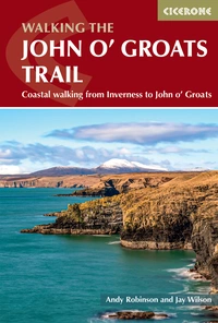
Walking the John o' Groats Trail
Coastal walking from Inverness to John o' Groats
£16.95
Guidebook to the John O' Groats Trail, a 235km long-distance walk from Inverness to John O' Groats in the far north of Scotland. The trail boasts stunning coastal scenery and fantastic cliff-top walking, while attractive towns and villages offer accommodation. It can be completed in around a fortnight.
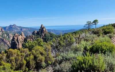
More informationMallorca GR221 ➝ Corsica GR20
The GR221 in Mallorca is a rewarding island trek, blending mountain ridges with Mediterranean views. To push your walking further, the GR20 in Corsica is widely considered Europe’s toughest waymarked trail. With rugged granite ridges, long climbs, and exposed scrambles, it’s demanding — but completing it is one of the great achievements in European trekking.
| - | GR221 Drystone Route (Mallorca) | GR20 Corsica |
|---|---|---|
| Where? | Mallorca | France |
| How long? | 140km | 190km |
| How many days/weeks? | 8-10 days | ~16 days |
| How hard? | The whole route can be completed by anyone with a little previous long-distance walking experience. | The GR20 is a challenging walk involving plenty of hands-on scrambling, through isolated mountain terrain. For experienced, fit walkers only. |
| Season? | Possible nearly all year round, but it can be very hot in summer, while rare winter snowfall can cover the paths on the higher parts. | Possible June to mid-October; June or September is ideal, with July and August being the hottest and busiest months. |
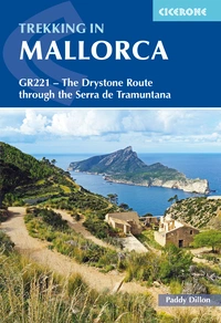
Trekking in Mallorca
GR221 - The Drystone Route through the Serra de Tramuntana
£18.95
SALE
£16.11
Guidebook to walking the GR221 Drystone Route (Ruta de Pedra en Sec) traversing Mallorca's Serra de Tramuntana between Pollença and Andratx. Following rock, paved paths and mule tracks between welcoming villages, the 140km (87 mile) trek is in 10 day stages and showcases the island's forests, mountains and drystone structures.
More information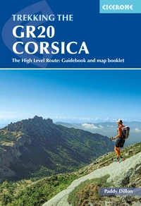
Trekking the GR20 Corsica
The High Level Route: Guidebook and map booklet
£18.95
Guidebook to Corsica's GR20, one of Europe's classic treks. The most challenging of the GR long-distance routes, the trail crosses remote mountain terrain and involves plenty of hands-on scrambling. Includes information about accommodation, refreshments and facilities and a separate booklet showing the entire route on IGN 1:25,000 maps.
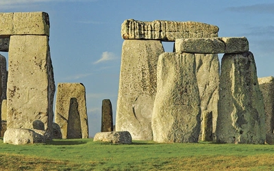
More informationShort Walks Winchester ➝ The Sarsen Way (or another Long-Distance Path)
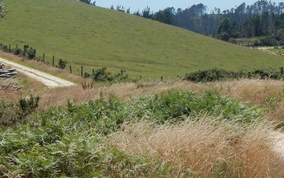
If you’ve enjoyed a series of day walks and feel ready for more, a medium-distance route like the Sarsen Way makes an ideal next step. Linking Salisbury and Avebury, it follows ancient tracks through rolling countryside and past Neolithic monuments. Long enough to stretch your stamina but still manageable, it’s a great introduction to the world of long-distance walking.
| - | Short Walks Winchester | The Sarsen Way |
|---|---|---|
| Where? | Winchester and Central Hampshire | England |
| How long? | Each under 3 hours | 79km |
| How many days/weeks? | 1 day or less | 1 week (or less) |
| How hard? | Suitable for beginners | Suitable for all abilities |
| Season? | Anytime of year | Anytime of year |
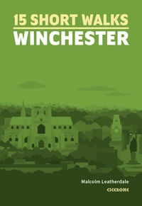
15 Short Walks Winchester
£9.95
Discover 15 of the best short walks around Winchester and central Hampshire. Each walk comes with easy-to-read Ordnance Survey maps, clear route description and lots of images, plus information on beauty spots and refreshment stops. No challenging terrain or complicated navigation means walks can be enjoyed by everyone.
More information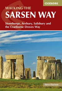
Walking the Sarsen Way
Stonehenge, Avebury, Salisbury and the Cranborne Droves Way
£14.95
Guidebook to the Sarsen Way (79km) from Coate Water Park to Salisbury and the Cranborne Droves Way (28km) connecting Salisbury to Wessex Ridgeway at Win Green. These long-distance paths are part of the Great Chalk Way. Suggested 2-8 day itineraries, OS maps, accommodation options, and reverse route descriptions are included.
More information