The Ribble Way: everything you need to know
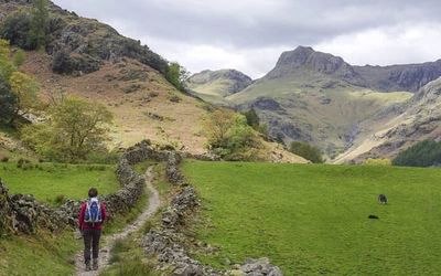
Although Lancastrians might like to claim it as their own, the River Ribble actually springs from limestone high on Cam Fell in the heart of Three Peaks country, in the Yorkshire Dales. Gathering water from the countless streams that spill from this sombre upland, the river quickly asserts its identity as it forces a passage between high, rugged moorland hills. The 72-mile route does not always follow the river closely but stays within the valley, offering expansive views of the surrounding countryside. Here's everything you need to know.
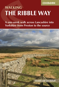
Walking the Ribble Way
A one-week walk across Lancashire into Yorkshire from Preston to the source
£16.95
Guidebook to walking the Ribble Way, a 72 mile route following the Ribble valley, from the estuary mouth near Preston to the river's source on Cam Fell in the Yorkshire Dales. The book contains OS map extracts and full route description split into 7 convenient stages, with suggestions for day walkers.
More informationThe History of the Ribble Way
The idea for a long-distance footpath along the River Ribble began in the 1960s with the Preston and Fylde group of the Ramblers’ Association. Initially, a route was planned from the river's mouth to its source, but over half relied on private fishermen’s paths, causing difficulties. In the 1980s, an alternative route using existing rights of way gained support. The first section, over 40 miles from Longton to Gisburn Bridge, was opened on 1 June 1985 by Mike Harding, president of the Ramblers’ Association, and Derek Barber, chairman of the Countryside Commission. Industrial land and Preston Docks led to starting the path along the river’s southern bank. The Dolphin Inn at Longton, dating from the early 19th century, was chosen as the start point to avoid a 5-mile inland detour from Banks on the coast. Soon after opening, the path was extended beyond Gisburn Bridge to the river’s source, following a route by Gladys Sellers, author of the first Cicerone guide to the Ribble Way.
How long is the Ribble Way?
The Ribble Way is 72 miles (116km) long. It begins in Longton and concludes at Ribblehead.
How difficult is the Ribble Way?
The Ribble Way is one of the country’s shorter ‘long-distance’ walks, and thus an ideal choice for newcomers to long-distance walking. It runs through countryside for virtually its entire length, but the path is rarely far from ‘civilisation’, and only in its higher reaches does it pass through a wild landscape. For the most part it is gently pastoral, although this does not mean that the challenge it offers should be underestimated.
When should I walk the Ribble Way?
When to walk the Ribble Way is a matter of personal choice and preference. Spring and Autumn are perhaps the best times of year to enjoy the colours of the landscape, while a good Summer can be idyllic. Winters are generally mild, although the higher reaches of the walk are subject to the extremes of British hill weather. Excessive rainfall can be a problem at any time of year. Very heavy downfalls or prolonged wet periods can significantly raise the level of the river to the extent that sections of the path can become flooded and impassable.
Can the route be accessed by public transport?
The Way is also very well suited to day walking, as it generally enjoys good public transport connections and many sections offer a wide choice of other paths from which to create a range of circular walks. Suggestions for day walkers, highlighting available transport and possible return routes, are given at the end of each chapter, and ‘end to enders’ might find this information useful in allowing them to extend their stay to see some of the countryside beyond the official route. Longridge Fell, Pendle Hill, Pen-y-ghent, Ingleborough and Whernside are obvious attractions, all readily accessible from the route, while any number of uncrowded paths range across the lesser hills.
These are the main access points served by public transport:
- Longton – Bus
- Preston – Bus and rail
- Ribchester – Bus
- Hurst Green – Bus
- Clitheroe – Bus and rail
- Sawley – Bus
- Gisburn – Bus
- Rathmell – Bus
- Settle – Bus and rail
- Horton in Ribblesdale – Rail and infrequent bus
- Ribblehead – Rail and infrequent bus
What accommodation is available?
Bed and breakfast, pub and hotel accommodation, as well as several convenient campsites and bunkhouses, are scattered along the route, enabling a range of possible itineraries. While some establishments, particularly at weekends, are reluctant to take bookings for a single night, staying an extra day here and there opens opportunities to explore the surrounding countryside and bag some of the splendid hills that stand beside the route.
What are the stages of the Ribble Way?
Stage 1 - Longton to Penwortham Bridge
- Distance: 8¼ miles (13.3km)
- Total Ascent: 190ft (60m)
- Time: 3½ hrs
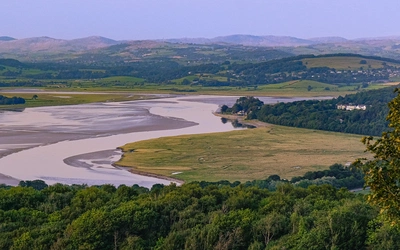
Beginning along the edge of the marsh overlooking the confluence of the River Ribble and the River Douglas, the walk later turns beside the Ribble to follow it in an almost dead-straight line towards Preston.
Stage 2 - Penwortham Bridge to Ribchester
- Distance: 12¼ miles (19.7km)
- Total Ascent: 720ft (220m)
- Time: 5¾ hrs
The route past Preston is a surprising haven of calm compared to the frenetic activity of the nearby city centre. It follows quiet streets and passes through pleasant parks along the banks of the river, and also heralds a change in the character of the Ribble valley, for it marks the point at which the river breaks free from the surrounding hills.
Stage 3 - Ribchester to Brungerley Bridge
- Distance: 12½ miles (20.1km)
- Total Ascent: 900ft (275m)
- Time: 6 hrs
For the next few miles the Ribble Way follows the river more closely, winding with it through a succession of lazy bends amid attractive countryside. Further on, having climbed away from the river above a bend, you might return briefly along the opposite bank to look at the Sale Wheel, a noted local beauty spot.
Stage 4 - Brungerley Bridge to Gisburn Bridge
- Distance: 9½ miles (15.3km)
- Total Ascent: 760ft (230m)
- Time: 4½ hrs
For the first part of this leg the Ribble Way follows the river quite closely, often shadowed by a similar path on the opposite bank, and even the extensive quarry workings north of Clitheroe have little impact on the beauty of this stretch of water.
Stage 5 - Gisburn Bridge to Settle
- Distance: 12½ miles (20.1km)
- Total Ascent: 740ft (225m)
- Time: 5¾ hrs
The route follows a pleasant path through Gisburne Park, avoiding the busy A682 along a path in the bordering field. Beyond Paythorne the nature of the countryside changes once more as the slopes enclosing the valley move back, leaving the river to pick its own course across the base of a broad, flat vale. At last, on Paythorne Moor, you enter Yorkshire.
Stage 6 - Settle to Horton in Ribblesdale
- Distance: 7¾ miles (12.5km)
- Total Ascent: 890ft (270m)
- Time: 4 hrs
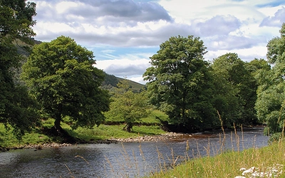
Settle lies at the edge of the Yorkshire Dales National Park, one of the country’s most popular walking areas. The hills, up until now seen only from afar, quickly close around the valley and usher you into true Dales country. Below the town the broad, flat-bottomed vale of the Ribble rapidly dwindles to a relatively narrow gap, yet for a time at least the valley retains its gentle pastoral charm, a patchwork of lush woodland and bright-green riverside fields.
Stage 7 - Horton in Ribblesdale to the source and back to Ribblehead
- Distance: 17 miles (27.4km) *
- Total Ascent: 2020ft (615m)
- Time: 8¾ hrs **
* including 6¼ miles (10.1km) back to Ribblehead
** including 3¼ hours back to Ribblehead
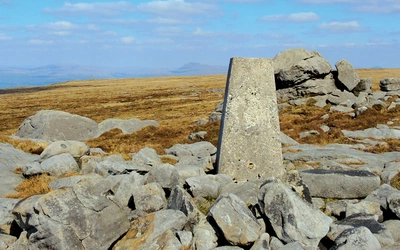
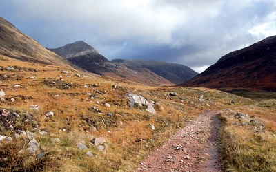
At the head of Ribblesdale is a vast moorland wilderness, distantly bounded by Whernside, Crag of Blea Moor and Cam Fell. Here the river changes both course and identity, abruptly turning onto the moor and successively assuming the names Thorn Gill, Gayle Beck, Long Gill and ultimately Jam Sike in tracing its course to the source.
Useful resources:
Walking holiday companies (including baggage transfer):
Tourist Information:
Preston Visitor Information Centre
Clitheroe Tourist Information Centre
Public Transport:
Walking the Ribble Way
A one-week walk across Lancashire into Yorkshire from Preston to the source
£16.95
Guidebook to walking the Ribble Way, a 72 mile route following the Ribble valley, from the estuary mouth near Preston to the river's source on Cam Fell in the Yorkshire Dales. The book contains OS map extracts and full route description split into 7 convenient stages, with suggestions for day walkers.
More information