The Skye Trail: Everything you need to know
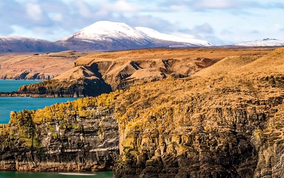
The Isle of Skye holds a special place in many people’s hearts. Its majestic mountains, stunning coastline, and Gaelic language and culture draw people back time and time again. Many rush around the island's best-known sights in a few days, but for those who wish to experience Skye properly, there can be few better ways than tackling a long-distance walk.
The Skye Trail
A challenging backpacking route from Rubha Hunish to Broadford
£14.95
SALE
£12.71
This guidebook describes The Skye Trail, a challenging week-long trek across the largest island in Scotland's Inner Hebrides, the Isle of Skye. From Rubha Hunish in the north, the Skye Trail heads along the Trotternish Ridge and past the Cuillin to Broadford in the south. Suitable for experienced backpackers and mountain walkers.
More information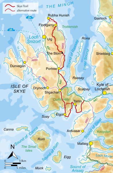
How long is the Skye Trail?
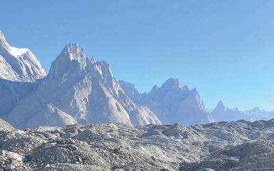
The 80-mile (128km) trail begins with a spectacular and relatively undiscovered coastal section before taking to the Trotternish Ridge – regarded by many as among the very finest ridgewalks in the UK. After another coastal section, the route takes in the picturesque capital of Skye – Portree – before running through the sheltered Braes district. Soon, the route continues in the shadow of the mighty Cuillin – the most Alpine mountain in the UK – to reach Elgol, which is celebrated for its view across Loch Scavaig. There follows an atmospheric section through two deserted villages – a reminder of the Highland Clearances and the darker side of the island’s history – before arrival at Broadford and the journey’s end.
The route has been designed so that, with some careful planning, it is possible to have somewhere to stay each night. However, it also makes a superb backpacking expedition, with plenty of opportunities for wild camping and the option of a couple of campsites and a bothy.
How hard is the Skye Trail?
The Isle of Skye Trail is a tough, uncompromising week-long route requiring self-reliance, good equipment, navigation skills and previous experience of hillwalking and backpacking. If you have previously completed other Scottish long-distance routes such as the West Highland Way or the Great Glen Way then do not expect similar facilities or terrain. This is an unwaymarked trail – often on pathless ground – passing through some fairly remote areas, and the weather is notoriously unpredictable.
When to walk the Skye Trail?
Unpredictability is the one thing you can be sure of when it comes to Skye weather. However, generally speaking, spring and summer are likely the best months for walks on the Isle of Skye, with early May being popular to avoid the midges. The long daylight hours from June to the end of August make it possible to cover large distances. Accommodation can be booked in July and August, as well as peak weekends throughout the year.
Although not impossible, walking on Skye in winter is likely extremely challenging given the very short daylight hours, closure of some accommodation and facilities, and the probability of winter storms. The wind—with frequent storms—in particular can become a major problem, as can the possibility of snow and ice on the hills.
How to prepare to walk the Skye Trail?
A lot will depend on whether you are backpacking the route and need to carry camping equipment, but in general, your enjoyment of the route will be enhanced by getting the balance right between carrying as lightweight a pack as possible while still having enough gear to be safe and comfortable. Using a baggage transfer service to move your bags between accommodation is also an option.
What accommodation is available?
The Skye Trail has been designed so that accommodation is accessible from the end of every stage. However, in the peak summer months, accommodation can be full to capacity, and therefore, booking ahead is advisable.
Bed and breakfasts are a good option. Not all B&Bs serve evening meals, and you may have to ask in advance if you want a packed lunch for the next day. Hotels provide the opportunity to mix with other travellers and provide an evening meal. There are hostels at Flodigarry, Portree, Sligachan, and Broadford, and these, too, often need to be booked in advance.
Is the route accessible by public transport?
Citylink buses ply their way direct to Portree from both Glasgow and Inverness. These are an excellent option for those attempting the Skye Trail as you can take the Citylink bus to Portree and then use the local bus which loops around the Trotternish peninsula to reach Duntulm at start of the trail. The Citylink bus can then be picked up from the trail's end in Broadford for the return trip.
All the roads crossed on the route are served by local buses, some with more regular services than others – check timetables with Stagecoach Highlands.
What about money?
There are banks (with 24-hour ATMs) in Portree and Broadford and post offices in Staffin, Portree, Elgol, and Broadford. Some B&Bs, campsites, and smaller cafés do not take card payments, so it is useful to have a good supply of cash. Cash is also useful for washing machines and honesty boxes along the trail.
The Skye Trail
A challenging backpacking route from Rubha Hunish to Broadford
£14.95
SALE
£12.71
This guidebook describes The Skye Trail, a challenging week-long trek across the largest island in Scotland's Inner Hebrides, the Isle of Skye. From Rubha Hunish in the north, the Skye Trail heads along the Trotternish Ridge and past the Cuillin to Broadford in the south. Suitable for experienced backpackers and mountain walkers.
More informationWhat are the stages of the Skye Trail?
Stage 1 - Rubha Hunish to Flodigarry
- Distance 11.5km (7½ miles) (excludes detour out to the point)
- Total Ascent 290m
Rubha Hunish is one of the most magical spots on Skye. Every visit to this most northerly tip of the island rewards with different sights, sounds and windy blasts. The hardy can wild camp right out on the headland or use the tiny old coastguard lookout turned walkers’ bothy, but others may prefer to start after catching the morning bus from Portree which loops around the Trotternish peninsula. Either way make sure you leave plenty of time to enjoy this special place before beginning the long walk south in earnest.
After the visit out to the headland, the majority of the walk follows the clifftops of the dramatic coastline.
Stage 2 - Flodigarry to the Storr
- Distance 28.5km (17¾ miles)
- Total Ascent 1750m
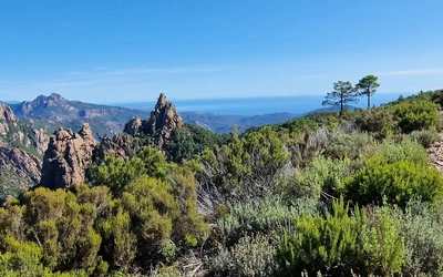
This is the most challenging stage of the Skye Trail as it climbs from Flodigarry through the astonishing rock formations of The Quiraing before heading up onto the great escarpment that is the Trotternish Ridge. Often rated as one of the best ridgewalks in Britain, the tough going is rewarded by fabulous views. However, it should be borne in mind that the route is long, very exposed to the elements and difficult to navigate on in poor conditions.
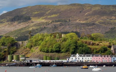
Stage 3 - Storr to Portree via the coastline
- Distance 14km (8¾ miles)
- Total Ascent 510m
Leaving the Trotternish Ridge behind, the third day of the Skye Trail takes to the coast once more, crossing rough and pathless moorland above dramatic cliffs with breathtaking views. If you have plenty of time and the weather is fair you can include a detour via a steep descent to Bearreraig Bay, a perfect arc of pebbly shore favoured by fossil hunters and also good for a spot of otter watching.
Stage 4 - Portree to Sligachan
- Distance 19km (11¾ miles)
- Total Ascent 275m
The fourth stage of the Skye Trail starts by skirting the salt marsh at the edge of Portree Bay before taking to the tarmac – thankfully a narrow, quiet ribbon winding its way through the fine scenery and small crofting settlements of the Braes. The final section follows a rough path along the shores of Loch Sligachan, with views to the Red Hills and the Black Cuillin.
Stage 5 - Sligachan to Elgol
- Distance 18km (11¼ miles)
- Total Ascent 310m
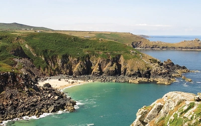
The fifth day follows dramatic Glen Sligachan, a great trench dividing the forbidding mountain ranges of the Red and Black Cuillin, to reach the beautiful bay at Camasunary. From here the main route follows a vertiginous cliff path to reach the small settlement of Elgol.
Stage 6 - Elgol to Torrin
- Distance 16.5km (10¼ miles)
- Total Ascent 370m
This stage presents relatively straightforward walking. Hugging the coast for much of the way, there are views across the water to the Sleat peninsula as well as the Small Isles of Rum, Eigg, Muck and Canna. After a brief road section a much rougher path leads to the remains of a cleared village before the route descends to rejoin the road around the head of Loch Slapin.
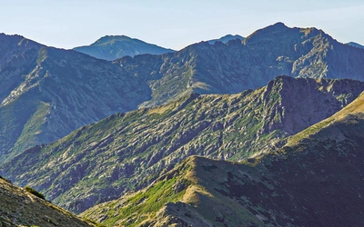
Stage 6B - Bla Bheinn alpine variant – Camasunary to Torrin
- Distance 11km (7 miles)
- Total Ascent 970m
Terrain Bla Bheinn involves exceptionally rough and rocky walking, and very careful navigation and experience is required. There is a hard scramble between the two summits, particularly tricky with a pack and the descent involves loose rock and scree
This stage will appeal to very experienced hillwalkers who wish to climb one of Skye’s major mountain summits as part of the route.
Stage 7 - Torrin to Broadford
- Distance 20km (12½ miles)
- Total Ascent 480m
The final stage of the Skye Trail follows the coastline through the atmospheric cleared villages of Suisnish and Boreraig where sheep now wander among the ruined houses. The path runs close to the water at times and there is the added chance that you may spot otters, or more likely seals and numerous seabirds, as you meander along Loch Eishort.
Useful resources
Harvey Maps has produced a map of the Skye Trail on waterproof paper.
A number of hiking holiday companies offer Skye Trail packages, either as self-guided walk, with baggage carried for you and accommodation booked, or as a guided walk as part of a group holiday