An introduction to the Southern Upland Way (Scotland’s Coast to Coast Walk)
The Southern Upland Way has it all – elegant border towns, the Galloway hills and plenty of wild camping opportunities. If you choose this trail for your annual walking holiday then you will certainly not be disappointed. Read on for a short introduction to the route.
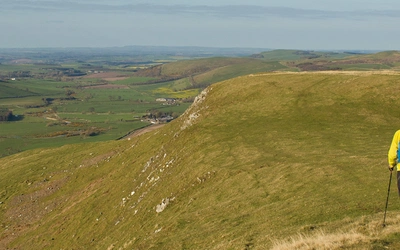
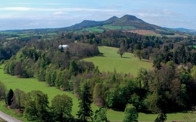
Away from the elegant Border towns like Moffat and Melrose, the Southern Uplands are one of the least visited parts of Britain. The Southern Upland Way, the UK's most remote waymarked trail, passes through the Galloway Hills, Carsphairn range, Lowthers, Ettrick Hills, Manor Hills, Minch Moor and Lammermuirs. Stop-offs are at small towns and hill villages, B&Bs and lonely inns, supplemented either by bothies and wild camping or vehicle pick-up. Along the way you'll find Castle Kennedy Gardens and the Covenanters memorials, Wanlockhead Lead Mines, pele towers and bastles, Traquair House, Melrose Abbey, Thirlestane Castle and ancient cairns.
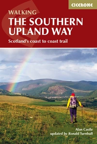
The Southern Upland Way
Scotland's Coast to Coast trail
£14.95
Guidebook to the Southern Upland Way, a coast to coast walk through Galloway and the Scottish Borders. One of Scotland's Great Trails, the 347km (215 mile) route links Portpatrick on the west coast to Cockburnspath on the east, through diverse landscapes and rich natural and historical interest. It can be completed in around a fortnight.
More information
Where is it and how far is it?
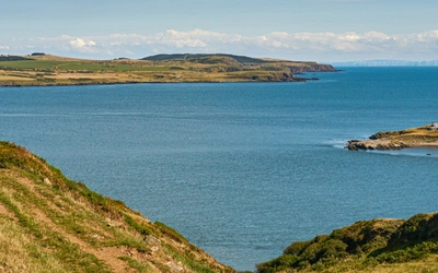
The 347km (215 mile) long Southern Upland Way, Scotland’s longest Great Trail, starts out from the west coast of Scotland at the picturesque old harbour of Portpatrick and continues eastward across the Galloway Hills, past the dramatic Loch Trool, over the Lowther, Ettrick and Lammermuir Hills before finishing at Cockburnspath.
How long does it take?
For many, the challenge will be to walk the Southern Upland Way from coast to coast as a continuous walk across Scotland. It forms the basis of a superb walking holiday of about two weeks duration.
Why should I walk the Southern Upland Way?
The best long-distance walking trails have two characteristics that make them great: a succession of dramatic landscapes coupled with a broad selection of interesting places to visit along the way. The Southern Upland Way, Scotland’s Coast to Coast Walk, scores highly on both.
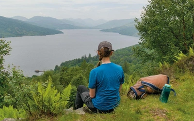
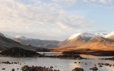
As the route cuts across the grain of the country many different landscapes are unveiled: coastal cliffs, high moorland, rolling hills, remote mountains, forests, lochs, mountain streams, majestic rivers and sylvan valleys abounding in wildlife. The way passes through regions that are exceedingly rich in archaeological and historical associations, from prehistoric standing stones to monuments commemorating the Killing Times of the 17th-century Covenanters. There are formal gardens and stately homes to visit en route as well as some of the more elegant towns of Dumfries & Galloway and the Borders, such as Moffat and Melrose, the latter with its famous abbey – so many places of interest to stimulate and delight the visitor.
How many stages are there?
14 walking stages of 9-19 miles, plus an optional rest day in Moffat.
What is the route highlight?
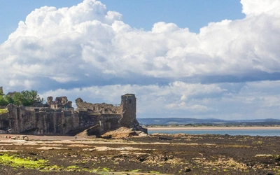
Melrose, which with its ancient abbey ruins, formal gardens and Walter Scott associations is a great place to linger a while.
What time of year is best?
You can walk the Southern Upland Way at any time of the year, although during the winter months on the upland sections of the Trail, you will need the usual winter hillwalking gear, together with the appropriate experience. When the hills are plastered in snow and ice then crampons and ice axes must be carried.
Most walkers should do the Southern Upland Way in the spring, summer or autumn months, from April to October, when the days are longer and the weather conditions are (usually) less severe. Only the hardiest, suitably experienced backpackers should consider walking the route in winter. Spring, when the birds are in full song and when the wildflowers are at their best, is particularly rewarding for nature lovers.
What are the accommodation options?
Accommodation is limited on the Southern Upland Way, and you will need to be creative in a couple of areas in order to avoid lengthy days of up to 54km (33 miles). The closure of Tibbie Shiels Inn, as well as all the Youth Hostels close to the route, has been a blow to walkers. The best solution at present is to arrange transport pick-ups at various points, with return the following morning. The alternative is backpacking the route, carrying your tent, food and cooking equipment. Scotland’s access laws allow wild camping almost anywhere along the route – a huge choice of idyllic camps; there are also the five bothies available as wet-weather fallbacks.
Fun facts about the trail?
- Britain’s oldest post office, dating from 1763, will be seen on the High Street of Sanquha
- Wanlockhead at 425m (1394ft) is Britain’s highest village.
- The highest point of the Southern Upland Way is at 712m (2335ft) on the Lowther Hills.
Plus, you get a certificate...
Attractive high quality completion certificates are available free of charge to all those who have walked the entire route of the Southern Upland Way, whether in a single crossing, or as a series of shorter walks. They make excellent mementoes of your achievement and are nice souvenirs of your walking holiday. They are available from the Countryside Ranger Services of either Dumfries & Galloway or the Scottish Borders or via the Southern Upland Way website.
Route Summary
| Stage | Start | Distance (km) | Ascent (m) |
|---|---|---|---|
| 1 | Portpatrick | 21.9 | 350 |
| 2 | Castle Kennedy | 15 | 300 |
| 3 | New Luce | 28.8 | 450 |
| 4 | Bargennan | 28.7 | 600 |
| 5 | Craigenbay pick-up point 1 | 25.2 | 550 |
| 6 | Stroanpatrick pick-up point 2 | 29.2 | 700 |
| 7 | Sanquhar | 21 | 1000 |
| 8 | Dalveen Pass pick-up point 3 | 24.2 | 550 |
| 9 | Beattock/Moffat | 25.6 | 750 |
| 10 | Scabcleuch pick-up point 4 | 27.8 | 800 |
| 11 | Traquair | 29.6 | 850 |
| 12 | Melrose | 16.1 | 350 |
| 13 | Lauder | 23.4 | 550 |
| 14 | Longformacus | 30.1 | 650 |
| Total | - | 347km | 8500m |
Here's an idea...
Why not combine the Southern Upland Way with one of the other long-distance paths in southern Scotland?
- A week long holiday in south-west Scotland could be had by walking the Southern Upland Way from Portpatrick to New Luce, then south into the Machars to Whithorn along the Whithorn Pilgrim Way.
- A companion trip to this could be a week or 10 days in the Borders and Northumbria along the Southern Upland Way from Moffat to Melrose, from where St Cuthbert’s Way will lead you to Lindisfarne, Holy Island.
- The Southern Upland Way also connects with the excellent Borders Abbeys Way at Melrose and the two trails combined would also make a worthwhile walking holiday.
- Finally, the new Annandale Way from Annan itself to Moffat, combined with the eastern half of the Southern Upland Way, allows for a very fine and rather shorter coast-to-coast crossing of 215km (135 miles).
The Southern Upland Way
Scotland's Coast to Coast trail
£14.95
Guidebook to the Southern Upland Way, a coast to coast walk through Galloway and the Scottish Borders. One of Scotland's Great Trails, the 347km (215 mile) route links Portpatrick on the west coast to Cockburnspath on the east, through diverse landscapes and rich natural and historical interest. It can be completed in around a fortnight.
More information