The Borders Abbeys Way: what you need to know
The Borders Abbeys Way is one of Scotland's Great Trails. It takes a fascinating tour of Scotland’s ruined Borders abbeys: four ravaged Gothic masterpieces, sitting in the enchanting landscape of the central Scottish borders, that sat on the front line in a series of devastating wars that lasted nearly 400 years. Here's what you need to know.
The Borders Abbeys Way
The abbeys of Melrose, Dryburgh, Kelso and Jedburgh in the Scottish Borders
£14.95
Guidebook to the Borders Abbeys Way, a 68 mile circuit in the Scottish Borders, taking in 4 of Britain's grandest ruined medieval abbeys. Beginning and ending in Tweedbank, the route, which is described over 6 stages, is as rich in history as it is in pastoral charm. Relatively flat, it is suitable for people with a moderate level of fitness.
More information
How long is the Borders Abbeys Way?
The Borders Abbeys Way covers a distance of 68 miles (109km).
Where does the Borders Abbeys Way start and finish?
The Borders Abbey Way is a circular route that can be started anywhere. However, Melrose is close to the Borders railway terminus at Tweedbank which is the start and end point for the route in this guide.
How long does it take to walk the Borders Abbey Way?
The route is normally completed in 6 days, during which the average distance walked per day is 11.3 miles.
How difficult is the Borders Abbeys Way?
The Borders Abbeys Way is suitable for people with a moderate level of fitness.
When is the best time of year to walk the Borders Abbeys Way?
This multi-day walk can be done at any time of year, although between early spring and the end of autumn you will have more hours of daylight.
How to travel to and from the Borders Abbeys Way?
- The Way can be reached within an hour by rail from the centre of Edinburgh.
- By bus it is just over an hour from Berwick-upon-Tweed, an hour and a half from Carlisle, and three hours from Newcastle.
- Frequent local buses connect each town along the Way.
- Tweedbank railway station is 600 metres from the official Borders Abbeys Way route.
- Galashiels Transport Interchange is the main transport hub for the area and is one stop from Tweedbank on the railway line.
- The Interchange is well served by long-distance and local buses and the Borders Railway.
Where can I find accommodation on the Borders Abbeys Way?
A choice of accommodation and facilities is available on each Stage of the Way and all the main settlements have B&B or hotel accommodation. There are three campsites along the Way with the usual facilities. These are located at Melrose, Jedburgh and Hornshole, near Hawick.
Are there decent facilities and luggage transfer services available on the Way?
Yes, in each town and village along the route there is a choice of good-quality restaurants and cafés. Each stage begins and ends at a town or village and luggage transfer services are available. There are regular bus links between the settlements on each stage of the route so it’s easy to plan stand-alone day walks, returning to the point of departure, as an alternative to a complete circuit.
What is the route terrain like?
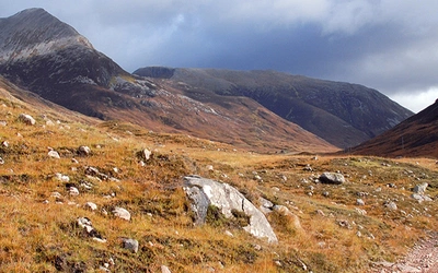
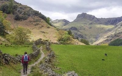
The Way comprises paths alongside the Tweed and Teviot rivers, forest tracks, historic drove roads and disused railway lines, and traverses farmland and open hills. Most of the route is off-road, although there are some stretches walking on quiet, minor roads. The gradients are mostly gentle, and the altitude is never more than 338 metres, yet the views are frequently impressive.
What are the Borders Abbey Way highlights?
Six days allows ample time to explore the abbeys and other historic sites studded along the way, and to enjoy the pleasant towns of Melrose, Kelso, Jedburgh and Hawick and the villages of Denholm and Newtown Saint Boswells.
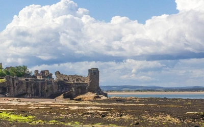
What is the history of the abbeys?
The abbeys and other historical sites encountered along the route tell the tale of a series of conflicts between the kingdoms of England and Scotland that took place between the mid 12th and early 17th centuries; a time when the Borders region was a dangerous and lawless frontier. The repeated vandalism and eventual destruction of the abbeys, the construction of fortified tower houses and the marauding militias known as reivers, were a product of this turbulent socio-political milieu. A walk on the Borders Abbeys Way will connect you with this fascinating period of history; indeed, some of the paths on the Way are the very same routes that monks and abbey staff used to travel between the Borders abbeys, and no doubt were also used by the notorious reivers.
What are the Borders Abbeys Way stages?
Stage 1 - Tweedbank to Newtown St Boswells via Melrose
- Distance: 4.8 miles (7.7km)
- Total Ascent: 160m
The first stage of the Borders Abbeys Way starts near Tweedbank railway terminus and continues to Newtown St Boswells via the popular and scenic town of Melrose. Melrose Abbey is undoubtedly the main attraction at Melrose, but there is also an interesting museum containing artefacts excavated from Trimontium Roman fort at nearby Newstead. The route is relatively flat and there are some pleasant views of the River Tweed. The section from Newstead to Newtown St Boswells is mostly on a road closed to public traffic.
Stage 2 - Newtown St Boswells to Kelso
- Distance: 6.1 miles (9.7km)
- Total Ascent: 155m
After leaving Newtown St Boswells, Stage 2 passes through a wooded glen adjacent to the River Tweed, which has been identified as an ancient semi-natural woodland site by Scottish Natural Heritage (SNH). The Way then crosses a footbridge to Dryburgh Abbey and continues to Kelso via the hamlet of Clintmains on minor roads, farm tracks and riverside paths. This is the longest stage of the Way, but it is relatively flat. Most of the road walking occurs after Clintmains.
Stage 3 - Kelso to Jedburgh
- Distance: 8 miles (12.8km)
- Total Ascent: 185m
This stage of the route follows the course of the River Teviot and then Jed Water to Jedburgh. The route passes the remains of Roxburgh Castle, once one of the most important fortifications in southern Scotland, and through the hamlet of Roxburgh (no facilities available). This stage is relatively flat and includes a pleasant mix of riverside paths, a section of former railway and a short section of Dere Street, a Roman road that once connected York with Scotland. There are some impressive views of the undulating central Borders countryside and the approach into Jedburgh passes below some picturesque sandstone cliffs.
Stage 4 - Jedburgh to Hawick
- Distance: 13.1 miles (21.1km)
- Total Ascent: 547m
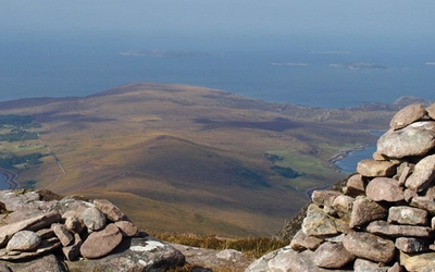
The route climbs steeply after leaving Jedburgh, then climbs at a gentler gradient before another steeper climb to the southern flank of Black Law (338m). On a clear day the panoramic views from the summit of Black Law – a short distance uphill from the Way – are a just reward for the short diversion. Although it is waymarked, the path on Black Law is indistinct in places and may be difficult to follow in fog. From Black Law the Way leads to the picturesque village of Denholm, ideally placed for lunch halfway between Jedburgh and Hawick. The section from Denholm to Hawick is flat.
Stage 5 - Hawick to Selkirk
- Distance: 12.6 miles (20.3km)
- Total Ascent: 583m
Leaving Hawick, the Way ascends steeply out of the town on a minor road before levelling to more gently undulating terrain grazed by livestock, with impressive views to the east. The route then skirts the edge of Drinkstone Hill and passes through a relatively large conifer plantation (Ashkirk Forest) and Woll Golf Course, before joining a minor road and ascending to Bishop’s Stone (337m), the highest point on the Borders Abbeys Way, and through a landscape of rushes, sedges and moor grass redolent of the Southern Uplands further west. The route then descends through Hartwoodmyres Forest and traverses farmland before entering The Haining, a neglected country estate on the edge of Selkirk. This stage ends at Market Place in the village centre.
Stage 6 - Selkirk to Tweedbank
- Distance: 8.9 miles (14.4km)
- Total Ascent: 336m
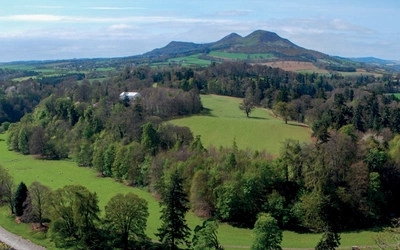
The beginning of this stage of the route provides some striking views to the north. The Way ascends gently from Selkirk town to Selkirk Hill, a haven for a variety of birds and plants, then continues through farmland, making use of an old drove road, before descending at a gentle gradient to skirt Cauldshiels Loch and pass Abbotsford House, the grand former residence of Sir Walter Scott. The Way then follows the banks of the Tweed downriver to Tweedbank. This final stage of the Way finishes 600 metres from Tweedbank railway terminus.
The Borders Abbeys Way
The abbeys of Melrose, Dryburgh, Kelso and Jedburgh in the Scottish Borders
£14.95
Guidebook to the Borders Abbeys Way, a 68 mile circuit in the Scottish Borders, taking in 4 of Britain's grandest ruined medieval abbeys. Beginning and ending in Tweedbank, the route, which is described over 6 stages, is as rich in history as it is in pastoral charm. Relatively flat, it is suitable for people with a moderate level of fitness.
More information