Classic Galloway: from Merrick to the Coast

If you like your wild landscapes really wild, if you like your lakes to have whooper swans in the middle and no ice-cream vans around the edge, if you like to have one foot on bare rock and the other one deep in a peat bog, if you like your granite with goats on, then the Galloway Hills are the place to go, says Ronald Turnbull. Read on for an account of why Galloway should be your next hiking destination.
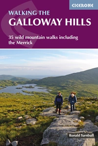
Walking the Galloway Hills
35 wild mountain walks including the Merrick
£14.95
Guidebook describing mountain walks in the Galloway Hills of southern Scotland, covering Trool, Minnoch, Doon and Talnotry. Offering solitude and rugged natural beauty, this rocky, heathery wilderness presents some great hiking opportunities suitable for experienced hillwalkers. Includes summaries of longer backpack/bothy trips.
More informationThe Galloway Hills – the Galloway Highlands, they used to be called – are small, but special. They stretch just 20km west to east, and 40km north to south (15 miles by 25) – almost the same size as Snowdonia. Within that area – much of it pathless – Galloway has 23 summits over 2000ft, including four Corbetts (2500-footers).
Little visited by most of us, they've been well loved by a select sort of discriminating hill goer. The outlaws and vagabonds of the 18th century, Faas and Macatericks, loved to lurk here on the fringes of civilisation. The fastnesses of Dungeon were just right for raiding the small farms of the lowlands or grabbing passing hikers and looting our expensive Gore-tex and electronics before dumping us in the convenient swampy corner of Loch Neldricken.
Before that, outlaw King Robert the Bruce hung out in these hills with his 200 mixed mercenary warriors out of Ireland. The convicted murderer and future king relaxed on a comfy boulder on the Rhinns of Kells while planning how to lure the English into an ambush at the edge of Loch Trool. Even John Buchan's hero, Richard Hannay, pursued by the police, a band of sinister foreigners and a 1914-model light aircraft, ‘fixed on Galloway as the best place to go…’
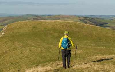
Walk from Loch Trool over Merrick and Craignaw – a comprehensive experience of the Galloway hill range...
For those in a hurry, this substantial walk might be enough to satisfy a visit to Galloway. It can be completed in a day – 18km (11 miles) with 1100m of ascent. No need to make a night of it, unless watching the sun rise over Loch Enoch from the summit of the Merrick is desired.
The path up Merrick is well used by Galloway standards – it has a signboard at its start point at Bruce's Stone and the path begins with a jumble of peat and boulders above the rocky Buchan Burn. It quickly ascends through a band of Sitka spruce. Lower ground around the Galloways is overgrown with these trees. The main Merrick path is a quick way up through the plantation, a prelude to the walk's more scenic sections. For added challenge, the tree-free start over the Fell of Eschoncan can be taken. This small but strenuous path rises in steep bracken immediately above Bruce's Stone, created for the first Merrick hill race. Over the years, runners' feet have kept the route open, though it can be tricky to trace in high summer.
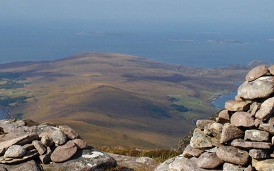
Bennan'stop is surprisingly rocky and rugged for a flat area. Slabs of ocean-bottom greywacke rock are tilted at about 30 degrees. You walk through a gap in a slab-top line of low crag and find five meters of downhill bare rock. Step onto it and run down, counting on the softness of the bog at the bottom. But it's at Benyellary, after rejoining the main Merrick path, that the walk takes on classic status. This marks the start of a high-level ridge walk along the Neive of the Spit, offering views across the Ayrshire plains to the sea on one side and into the granitic heartland of Galloway with its little lochs on the other. The goal is to reach Benyellary when the sun is low, creating a golden haze in the air and casting purple shadows in the Gloon corrie.
The Merrick, known locally as 'The Merrick', features prominently on maps, specifically at the "Broads of the Merrick." The ascent should be taken slowly, not because of its steepness, but to reach the summit at the perfect sunset moment. From Merrick’s top, it's possible to enjoy one of the UK's longest views: 139.5 miles (224.5km) south to Snowdon. However, the immediate focus should be on the sunset behind the Isle of Arran, lighting the Firth of Clyde in shades of purplish grey. The view in the opposite direction is equally impressive.
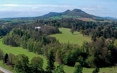
The wide valleys of Eskdale, Annandale, Nithsdale and the Glenkens divide the higher ground. Here are deep green oakwoods, generously watered by the region’s rainfall. Yes, you will occasionally be needing a waterproof jacket in Galloway. But that rainfall gathers into the wonderful rivers, wide between their wooded banks, and the same silver-grey as the salmon swimming up them.
Almost as wide as the rivers themselves are the open streets of the stone-built towns. Two centuries ago, this was a rich and prosperous landscape, sending tens of thousands of cows southwards into England every autumn. This wealth combined with the easy-to-work red sandstone and classic granite to give rise to the area’s handsome high streets.
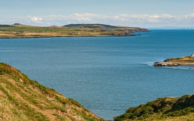
But possibly the greatest glory of Dumfries & Galloway is its coast. Warmed by the Gulf Stream, the 10 shoreline is green and intricate, with palm trees, rocky cliffs and little sandy beaches. Here you look across the Solway’s gleaming mudflats or even more shining sea to the blue shadow that is Ireland, or the Isle of Man, or the humped hills of England. Closer at hand you might just spot a porpoise or some seals.
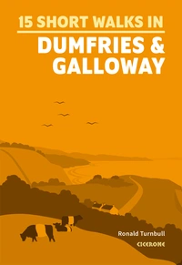
15 Short Walks in Dumfries and Galloway
£9.95
Discover 15 of the best short walks around Dumfries and Galloway. Each walk comes with easy-to-read Ordnance Survey maps, clear route description and lots of images, plus information on local beauty spots and tasty refreshment stops. No challenging terrain or complicated navigation means walks can be enjoyed by everyone.
More informationYou'll find a selection of fantastic Galloway routes in our guides to Walking the Galloway Hills and Short Walks in Dumfries and Galloway. Ideal for year-round walking, you'll find routes with clear route description and OS mapping that vary from short and easy to long and challenging.