Five best short walks on the Shetland Islands: cliffs, beaches and ancient ruins
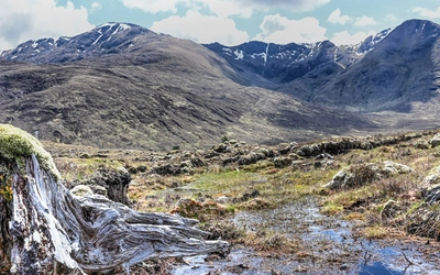
Closer to Bergen than to Edinburgh, the Shetland Islands sit at the very northern edge of Britain — a windswept archipelago of dramatic sea cliffs, white-sand beaches and vast open moorland that feels unlike anywhere else in the British Isles. These five short walks, each taking under three hours and requiring no specialist navigation skills, are taken from the Cicerone guidebook 15 Short Walks on the Shetland Islands by outdoor writer and wildlife enthusiast Graham Uney.
From the puffin-filled headlands of Sumburgh to the Norse ruins of Jarlshof and the extraordinary tombolo beach of St Ninian's Isle, each route reveals a different facet of Shetland's wild and ancient landscape. All the walks listed here and in the Cicerone guidebook are suitable for families and casual walkers. Whether you visit in summer for the seabirds and the extraordinary long daylight hours, or in winter for the drama of Atlantic storms and the fire festival of Up Helly-Aa in January, Shetland rewards walkers in every season.
How to get to the Shetland Islands?
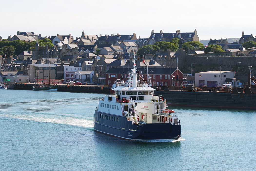
Shetland is accessible by overnight ferry from Aberdeen or by direct flights from Edinburgh, Glasgow and Inverness to Sumburgh Airport. Car hire is available at the airport and in Lerwick, the island's main town and an ideal base for exploring the walks in this guide.
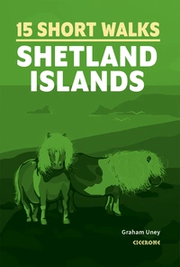
15 Short Walks on the Shetland Islands
£9.95
Guidebook to 15 of the best short walks on the Shetland Islands. Each walk comes with easy-to-read Ordnance Survey maps, clear route description and lots of images, plus information on beauty spots and refreshment stops. No challenging terrain or complicated navigation means walks can be enjoyed by everyone.
More informationShetland is packed with amazing things to see. Probably the most immediately obvious, whether you arrive by sea or by air, is the stunning coastline. Here there are massive sea cliffs, deep voes, sheltered bays, islands, skerries, and some of the finest white-sand beaches in the world.
— Graham Uney, Short Walks on the Shetland Islands
Lerwick town trail
Summary: An easy walk around the old town of Lerwick, taking you round a spectacular coastal headland to the site of an ancient village
Start/finish: VisitScotland iCentre, Market Cross, Lerwick
Time: 2hr
Distance: 7 km (4¼ miles)
Climb: 95m
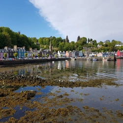
The ideal introduction to Shetland, this easy town trail takes in the full range of what makes Lerwick one of Scotland's most distinctive small towns. Starting at the tourist information centre on Market Cross, the route winds through the narrow flagstone lanes of the old town — a tight-knit grid of merchants' houses, working boatyards and covered passages known as closes, built by Dutch traders in the 17th century — before heading out along the coast to a rocky peninsula with sweeping views across the sound to the island of Bressay and south along the Shetland Mainland.
The route then visits Clickimin Broch, a well-preserved Iron Age stone tower sitting on a small loch just outside the town centre. Occupied from around 700 BC through to the early centuries AD, Clickimin is one of the most accessible prehistoric sites in Shetland and one of the finest examples of broch architecture in Scotland.
The return passes through Fort Charlotte, a 17th-century artillery fort built to defend Lerwick's harbour against Dutch attack and still largely intact, before threading back through the old town. The Shetland Museum and Archives, passed along the way, is well worth a visit for its collection of Viking artefacts, traditional fishing boats and Shetland textile history. Entry is free.
Best time to visit: Year-round; summer brings the longest daylight hours, with dusk falling barely at all in late June. The old town and museum are enjoyable in any weather, making this a reliable option on days when the coastal walks are too exposed.
The Ward of Bressay with views of Noss
Summary: A wonderful, easy-to-follow walk up the highest hill on Bressay, giving magnificent views across to Mainland and the island of Noss
Start/finish: Bressay Pier at Maryfield
Time: 2½hr
Distance: 9 km (5½ miles)
Climb: 245m
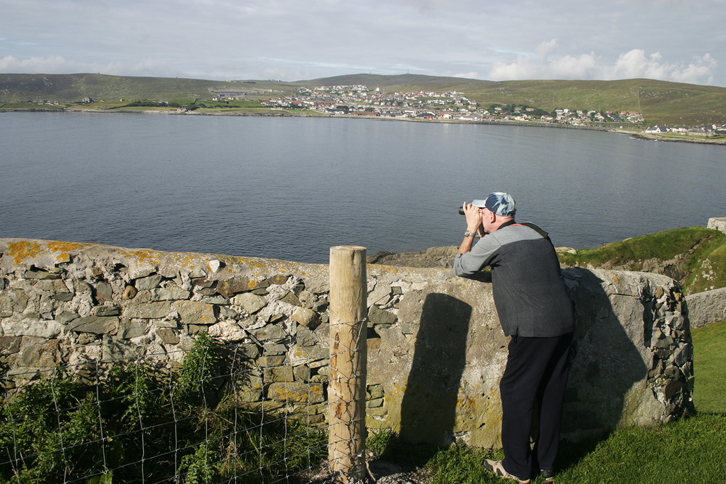
One of the most rewarding short walks accessible from Lerwick, this route takes full advantage of Bressay's position directly across the sound from the Shetland capital. The ferry crossing from Lerwick takes just five minutes, and the walk begins as soon as you step off the pier at Maryfield, making this an easy and satisfying half-day out with no car required.
The first section follows the quiet public road along the Bressay shoreline, with views back across the sound to Lerwick's waterfront throughout. The route then joins the access track to the radio masts on the summit of the Ward of Bressay, the island's highest point at 226 metres. The track is good underfoot for its entire length, making navigation straightforward and the climb more gradual than the ascent figure suggests.
From the summit, the views are exceptional on a clear day. Lerwick and the Shetland Mainland spread out to the west, while to the east lies the island of Noss — a National Nature Reserve and one of the great seabird spectacles in Britain, with over 150,000 birds nesting on its sandstone cliffs each summer, including gannets, puffins, guillemots and great skuas.
Best time to visit: Late spring and summer for the best chance of clear summit views and for seabird activity on Noss visible from the Ward. Consider combining with a visit to Noss itself: a small inflatable ferry operates from Bressay to Noss in summer, subject to weather conditions. Check NatureScot for current Noss ferry times before your visit
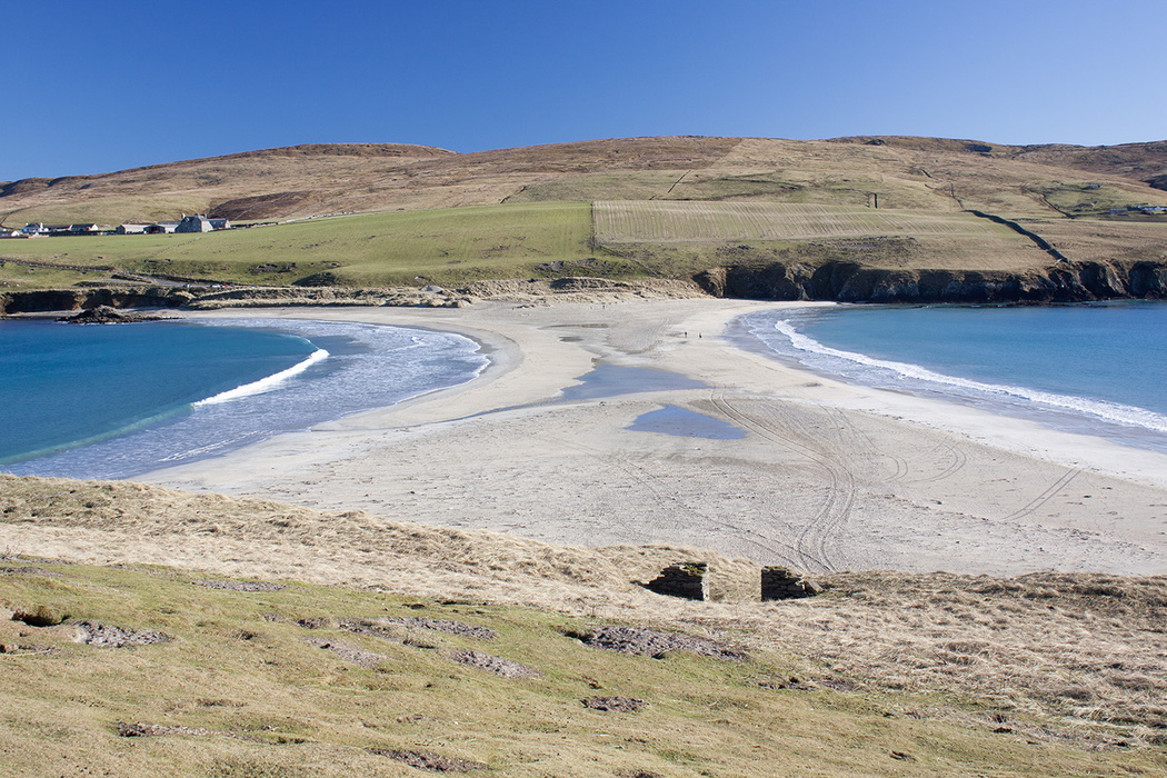
St Ninian's Isle
Summary: A fabulous walk across a famous sand tombolo, followed by exciting clifftop views once on the island
Start/finish: Beach car park below Bigton
Time: 2hr
Distance: 5.5 km (3½ miles)
Climb: 170m
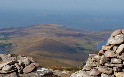
A tombolo is a sand spit connecting an island to the mainland, and at 600 metres long with the Atlantic washing gently on both sides on a calm day, St Ninian's is the largest active tombolo in Britain. The crossing alone makes this walk memorable, but the clifftop circuit of the island beyond delivers some of the finest coastal scenery in Shetland.
St Ninian's Isle itself has an additional layer of history. In 1958, a Lerwick schoolboy helping with an archaeological dig beneath the ruins of a 12th-century chapel uncovered a hoard of 28 silver Pictish objects, dating from around 800 AD and thought to have been buried to protect them from Viking raiders. The St Ninian's Isle Treasure, as it became known, is now held at the National Museum of Scotland in Edinburgh, with replicas on display at the Shetland Museum in Lerwick.
The clifftops on the island are unfenced throughout, so care is needed, particularly with children and dogs. After rain, some sections of the grass path can be boggy underfoot.
Best time to visit: Late spring and summer for the calmest crossing conditions and the best coastal light. The tombolo is a particularly atmospheric early morning walk before other visitors arrive. Avoid in strong westerly winds, when the crossing can feel very exposed.
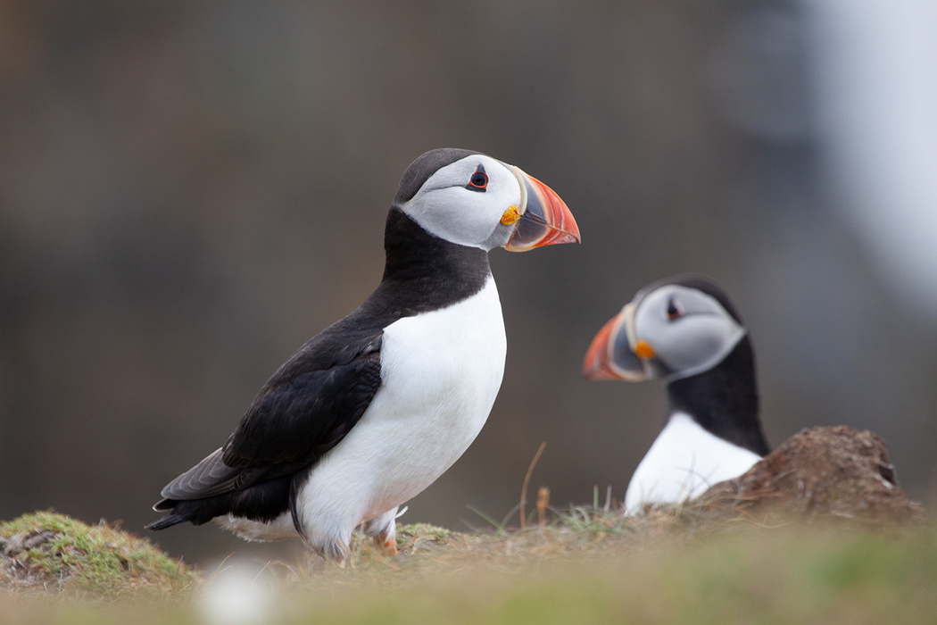
Sumburgh Head and Jarlshof
Summary: The impressive seabird cliffs at Sumburgh Head, and the chance to visit the most important archaeological site in Shetland
Start/finish: Sumburgh Hotel
Time: 2½hr
Distance: 6 km (3¾ miles)
Climb: 220m
This walk belongs at the very top of any Shetland itinerary, combining two of the most compelling attractions in the islands in a single short route.
The walk begins at Jarlshof, a site managed by Historic Environment Scotland and widely regarded as the most important archaeological site in Shetland. Occupied for around 4,000 years, its ruins span the full sweep of human settlement in the islands, from prehistoric homes through to a 17th-century laird's house. Entry fee applies; allow time to explore properly before setting out along the coast.
From Jarlshof the route follows the coastal path to Sumburgh Head, with spectacular views opening up as you climb. The headland is an RSPB nature reserve, and in summer the cliffs come alive with seabirds in huge numbers, including puffins, guillemots, kittiwakes and fulmars, nesting on the rock faces and grassy clifftops directly above the crashing sea.
The return crosses Compass Hill, whose distinctive landforms make for an interesting contrast to the coastal drama below, with sweeping views across the whole of South Mainland on the descent back to Sumburgh.
Best time to visit: Late spring and summer for the seabirds, which are present from around mid-April through to early August. Jarlshof is open year-round but with reduced winter hours — check Historic Environment Scotland's website before visiting.
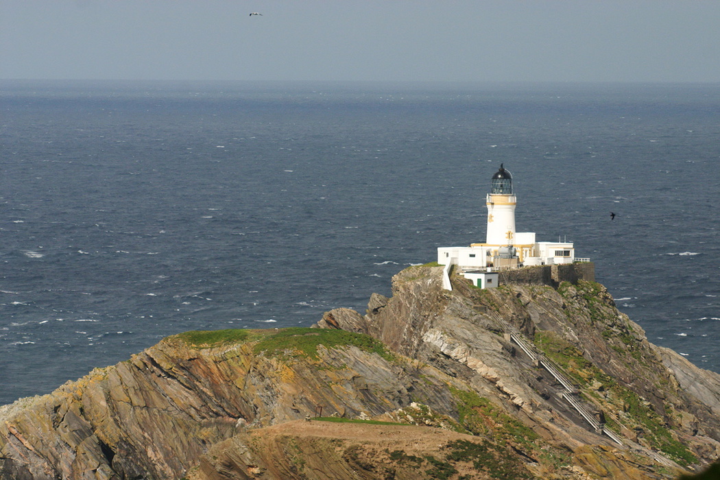
Unst: Hermaness
Summary: A well-marked walk across the wild moorland at Hermaness to one of Britain’s most important seabird breeding colonies
Start/finish: Hermaness car park above the Shore Station
Time: 3hr
Distance: 8.5 km (5¼ miles)
Climb: 220m
Do not leave Shetland without doing this walk. A circular route at the very northern tip of the British Isles, Hermaness is among the most important seabird breeding sites in the world — and one of the most viscerally memorable walks in Scotland. The path crosses wild, open moorland on good grass tracks and wooden boardwalks, with no difficult terrain, before arriving without warning at the cliff edge.
What greets you there is extraordinary. Hundreds of thousands of seabirds nest on the vast cliff face, from gannets, puffins, guillemots, kittiwakes, to fulmars, among them, and you will smell and hear them long before you see them. From the clifftop, the gannetry on the island of Muckle Flugga is clearly visible across the water, along with its lighthouse marking the most northerly point in Britain.
The moorland crossing is an experience in its own right. Hermaness is the world's most important breeding ground for the great skua (known locally as the bonxie) and these fierce, powerful birds patrol their nesting territories aggressively throughout the summer, dive-bombing anyone who strays too close. Give them a wide berth and keep moving.
Getting there is part of the adventure. It requires two ferry crossings from the Shetland Mainland to Yell and then to Unst — a journey that makes arriving at Hermaness feel genuinely earned.
Best time to visit: Late spring and summer, when the seabirds are present in full numbers. The moorland boardwalks are open year-round but the cliffs are at their most dramatic — and most populated — from May through to early August.
15 Short Walks on the Shetland Islands
£9.95
Guidebook to 15 of the best short walks on the Shetland Islands. Each walk comes with easy-to-read Ordnance Survey maps, clear route description and lots of images, plus information on beauty spots and refreshment stops. No challenging terrain or complicated navigation means walks can be enjoyed by everyone.
More informationYou'll find all these routes (and 10 more) in our guide to Short Walks on the Shetland Islands, which contains clear route descriptions, OS mapping, plus facilities, parking and highlights for every route. Each route has been carefully selected to showcase the best of the area. No challenging terrain or complicated navigation means the walks can be enjoyed by everyone.
About Graham Uney, author of this guidebook:
Graham Uney's love of wild places and wildlife has taken him to all corners of the world. Today, having had 19 books published, he continues to work on new titles, as well as finding time to focus on his mountaineering instruction business (www.grahamuneymountaineering.co.uk). From his home in Cumbria, Graham offers a wide range of skills courses for walkers, mountaineers, and climbers, including providing training and assessment courses for Mountain Leaders.