The Cumbria Way: everything you need to know
Cumbria's timeless beauty has inspired generations with its lakes, riverside woodland and high fell. For hiking enthusiasts, the Cumbria Way offers one of Britain's easiest and most scenic long-distance routes, perfect for a week-long adventure. Read on to find out key information about the popular route.
Walking The Cumbria Way
Ulverston to Carlisle - main route with mountain alternatives
£16.95
A guidebook to the 73 mile Cumbria Way, an easy long-distance walk though the heart of the Lake District National Park, from Ulverston in the south to Carlisle in the north, with good transport links to either end. The route is largely low-level but this guide offers alternative mountain days to climb some of the famous fells en route.
More information
How long is the Cumbria Way?
The Cumbria Way covers a distance of 117km (73 miles).
Where does it start and finish?
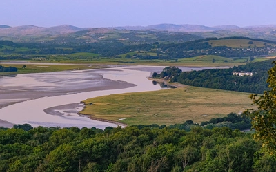
The Cumbria Way route start point is Ulverston, not far from the shores of Morecambe Bay, and finishes in the city of Carlisle.
How long does it take to walk the Cumbria Way?
This depends on whether you'd like to take it easy or go for more challenging, longer days. The official route is 5 days long, but there are other options outlined alongside the main route in our Cumbria Way guidebook, those being 6 or 9 days long, and including an alternative mountain route too.
How difficult is the Cumbria Way?
Overall, the Cumbria Way is largely a low-level walk through the valleys and therefore suitable for most experienced walkers. The mountain route included in our Cumbria Way guidebook is not an official variant but offers a more challenging, high-level alternative for those who prefer the summits to the valleys and the passes. But to be enjoyable, any long-distance walk needs to be taken at a pace that allows you to cover the necessary distance in the allotted time, yet leaves time to enjoy the scenery, take in nearby attractions and stop for breaks.
When is the best time of year to walk the Cumbria Way?
April and May are best for wildflowers and vivid colours. The days are still short but, if you’re a photographer, the sun creates a much better light with pleasing shadows to give depth to your pictures. Also, the campsites and B&Bs won’t be at full capacity and will be more reasonably priced. Summer is warmer, meaning you’ll need less clothing in your rucksack, and the long days give you more time to get to your destination. Autumn is still good, with the woods, and there are lots of them on the route, displaying beautiful fiery colours. Often the British weather is quite settled at this time. Winter days are short so you’d need to break down the route into more sections and you’d need to pack far more clothes and equipment. Snow and ice would add to the difficulties.
Where can I find accommodation on the Cumbria Way?
There is a great range of accommodation available in the Lake District. Most stage starts and finishes on this route, being sizeable tourist destinations, will be no exception to this rule. Even in Great Langdale there are three pubs, a handful of places offering B&B and some campsites.
What are the route highlights?
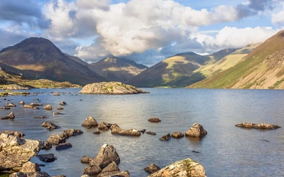
The Cumbria Way takes in all that is best in the Lake District – views of the majestic fells, lakeshore promenades and strolls through woodland, past waterfalls, picturesque cottages and fine inns.
What are the Cumbria Way stages?
Stage 1 - Ulverston to Coniston
- Distance: 25km (15.5 miles)
- Total Ascent: 615m (2017ft)
The tree-lined stream out of Ulverston makes a pleasant start to Stage 1 but the early part of the route is bitty, across pastures that can be muddy after rain and through farmyards and along country lanes. By the time you come to Gawthwaite you think you’re not going to make it, but the navigation soon gets simpler and before you know it you’re walking beside the idyllic Beacon Tarn. And the day ends in a glorious promenade by the peaceful shores of Coniston Water.
Stage 2 - Coniston to Great Langdale
- Distance: 19km (11.3 miles)
- Total Ascent: 550m (1804ft)
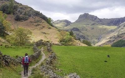
Throughout the early part of the day on Stage 2 there are subtly changing views across the verdant fields and woods to the crags of the Yewdale Fells. Although the lake of Tarn Hows is artificial it’s beautiful all the same, with wide views across its waters to the Langdale Pikes and Helvellyn. Two waterfalls, Colwith Force and Skelwith Force, can be visited on the next section but the best views of the day come beyond Skelwith when the route enters the great glacial valley of Great Langdale.
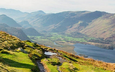
Stage 3 - Great Langdale to Keswick
- Distance: 25.5km (16 miles)
- Total Ascent: 645m (2116ft)
This stage tackles the high mountain pass barring the way out of Great Langdale into Borrowdale but the scenery is magnificent from the start. The winding path to Stake Pass is steep but short and soon you’re walking through the undulating moraines and contemplating the equally steep winding path down into Langstrath. The paths around Derwent Water are a delight and the slopes of Skiddaw beckon you on towards Keswick and the prospect of a bar meal and a comfortable bed for the night.
Stage 4 - Keswick to Caldbeck
- Distance: 23km (14.5 miles)
- Total Ascent: 900m (2952ft)
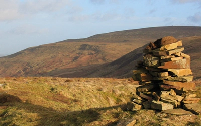
Stage 4 sees you leave the Lake District behind. The route will take you alongside the infant River Caldew to the summit of the official Cumbria Way at High Pike, where a 360-degree panorama includes Skiddaw, Blencathra, the pale hills of Dumfries and Galloway beyond the Solway Firth and the North Pennines. And laid out beneath your feet is the grassy ridge that eases you down to the fields of Caldbeck. This friendly village waits to replenish your strength for the last section to the city of Carlisle.
Stage 5 - Caldbeck to Carlisle
- Distance: 25km (15.5 miles)
- Total Ascent: 190m (623ft)
In this last stage, it's time to say goodbye to the Cumbrian Fells and head for the city. On the way, you’ll see several historic bridges and an ancient ecclesiastical castle. It would be a shame to get the first train out of Carlisle when you finish your walk, this is is a fine city and should not be missed.
Note: above is a possible itinerary, the stages can be stretched or condensed as required.
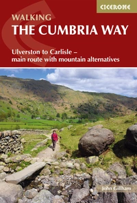
Walking The Cumbria Way
Ulverston to Carlisle - main route with mountain alternatives
£16.95
A guidebook to the 73 mile Cumbria Way, an easy long-distance walk though the heart of the Lake District National Park, from Ulverston in the south to Carlisle in the north, with good transport links to either end. The route is largely low-level but this guide offers alternative mountain days to climb some of the famous fells en route.
More informationWhere can I find out more?
For the entire map on one route: Harvey Maps - The Cumbria Way
For information on accommodation and baggage transfer: www.cumbriaway.co.uk
Check you're prepared before you set off on an adventure: Adventure Smart
For daily Lake District weather: Lake District Weatherline