An introduction to the Cotswold Way
The Cotswold Way, conceived by Gloucestershire County Council in response to a suggestion from the Ramblers' Association in the early 1950s, has evolved into one of the UK's most celebrated long-distance walks. Launched in May 1970 as part of the council's European Conservation Year initiative, it quickly became known for its remarkable waymarking efforts, largely carried out by dedicated volunteers from the Ramblers and Cotswold Voluntary Warden Service. By 2007, the Cotswold Way earned National Trail status, securing funding that led to the iconic acorn symbols guiding walkers along its entire route. If you're considering your first long-distance trek, the Cotswold Way offers the perfect introduction – an accessible, scenic path through some of England’s most picturesque countryside.
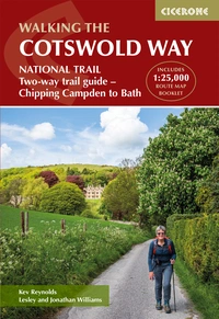
The Cotswold Way
NATIONAL TRAIL Two-way trail guide - Chipping Campden to Bath
£17.95
Guidebook to walking the Cotswold Way National Trail. Between Chipping Campden and Bath, the 102 mile route explores the Cotswolds AONB. Described in both directions over 14 stages, the Cotswold Way can be walked year round and is suitable for beginner trekkers. Includes separate OS 1:25,000 map booklet of the route.
More information
How long is the Cotswold Way?
The Cotswold Way covers a distance of 102 miles (163km).
Where does it start and finish?
This quintessentially English trail starts in Chipping Campden and finishes in Bath but can easily be walked in either direction.
How long does it take to walk the Cotswold Way?
It's usually recommended to walk the trail in a two-week holiday, although it can be walked in as little as 5 days.
When should you go?
This walk can be enjoyed all year round. However, careful planning may be required as tourists flock to the area, particularly during the Cheltenham Festival (March) and Badminton Horse Trials (late April/May).
Where should you stay?
Camping is tricky along this route so you will find it easier to stay in B&Bs, hostels or hotels. There is an accommodation listing on the National Trail website and there is an index available in the Cicerone Guide.
Why should you walk it?
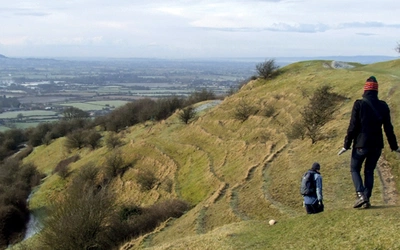
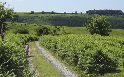
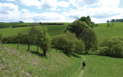
The Cotswold Way is an ideal trek for first time trekkers - the lowland walking is not technically demanding and the route is well waymarked. But it's not a boring trek, taking in the beautiful Area of Outstanding Natural Beauty, historic battlefields and dramatic views across the Severn Vale.
What are the stages of the Cotswold Way?
| Stage | Location | Distance miles (km) | Approx Time |
|---|---|---|---|
| 1 | Chipping Campden to Stanton | 10 (16) | 4–5hr |
| 2 | Stanton to Winchcombe | 8 (12.5) | 3½–4hr |
| 3 | Winchcombe to Cleeve Hill | 6½ (10.5) | 2½–3hr |
| 4 | Cleeve Hill to Dowdeswell (A40) | 6 (10.5) | 2½–3hr |
| 5 | Dowdeswell (A40) to Birdlip | 9½ (15) | 4–5hr |
| 6 | Birdlip to Painswick | 7 (11) | 3–3½hr |
| 7 | Painswick to Middleyard (King’s Stanley) | 9½ (15) | 4–5hr |
| 8 | Middleyard (King’s Stanley) to Dursley | 6½ (10.5) | 3–3½hr |
| 9 | Dursley to Wotton-under-Edge | 7 (11) | 3–3½hr |
| 10 | Wotton-under-Edge to Hawkesbury Upton | 8 (12.5) | 3½–4hr |
| 11 | Hawkesbury Upton to Tormarton | 8 (12.5) | 3½–4hr |
| 12 | Tormarton to Cold Ashton | 6 (9.5) | 2½–3hr |
| 13 | Cold Ashton to Bath | 10 (16) | 4–5hr |
The Cotswold Way page on the National Trails website has lots of useful information.
The Cotswold Way
NATIONAL TRAIL Two-way trail guide - Chipping Campden to Bath
£17.95
Guidebook to walking the Cotswold Way National Trail. Between Chipping Campden and Bath, the 102 mile route explores the Cotswolds AONB. Described in both directions over 14 stages, the Cotswold Way can be walked year round and is suitable for beginner trekkers. Includes separate OS 1:25,000 map booklet of the route.
More information