Mud, sweat and tears: Trekking in the Rwenzori Mountains
Jan Bakker takes on the challenge of trekking in Uganda’s spectacular and demanding Rwenzori Mountains – in some surprising kit.
Trekking in wellies? I had to chuckle a little when I was given kit advice for a trek in the Rwenzori Mountains, often referred to as Mountains of the Moon. But then again, the Norwegians hike their boggy fells in rubber boots. And I learned that Rwenzori means ‘rain maker’ so I should probably take this advice seriously.
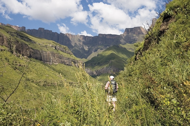
I have trekked on many different types of terrain and in many climates on this planet. This is my first time doing a high-altitude trekking expedition right on the equator. I’m in the lush mountain village of Kilembe in western Uganda. It’s pretty much the exact centre of the African continent and the main trailhead for the muddy jungle trails into Africa’s tallest mountain range. The plan is to climb its highest point, Margherita Peak. This summit is part of the Mount Stanley massif, named after British explorer Henry Morton Stanley, who was the first non-African to confirm the existence of these snow-capped mountains in the heart of Africa. Margherita Peak measures 5109m above sea level, making it Africa’s fourth highest peak.
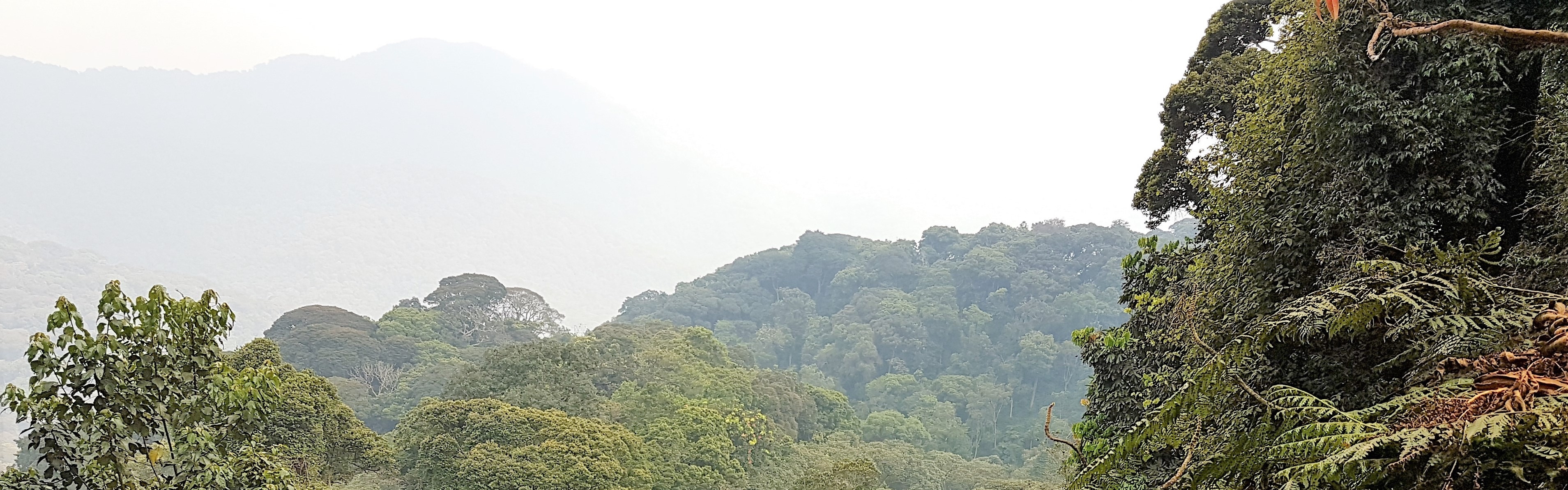
The boundary of the Rwenzori Mountains, a UNESCO-listed national park, is shockingly clear. Agricultural land is abruptly replaced by dense primary forest. I enter an entirely different world where the sounds of cultivation – dogs barking, a chain saw, people shouting commands – are exchanged for ambient jungle sounds – insects buzzing, birds singing, monkeys grunting.
I’m trekking with my sister, Anita, who’s a teacher in outdoor education. Over the years, she has become one of my best adventure buddies. Normally, we venture out independently but in this case we are obliged to settle for a ‘package’. We are doing the Kilembe Trail, which is managed by Rwenzori Trekking Services and access to this trail is only possible through them. They have blazed the trail through thick vegetation and established several shelters and simple huts in strategic locations. We’re a bit embarrassed by the number of porters that accompany us on this expedition; I believe there are 10 of them all together. But it’s good to remember that our trip provides them with a badly needed income. After a brief visit to the office of the Uganda Wildlife Authority we set off on a well-worn path with nearly 4km of vertical gain ahead of us.
We quickly reach the Sine hut at an altitude of around 2600m. It’s been easy cruising so far, but it looks like from here we are going to exchange our walking boots for the ridiculed wellies. The mud fest has started. Bernard, our local guide, explains that the rainy season has lasted longer than usual. Most of the trails have not dried or drained the excess rain water yet.
Bad trail sections are haphazardly covered with boards and large tree branches. Slipping or losing your balance here is not an option.
The path steepens and our final approach to the Kalalama Camp involves scrambling on tree roots to avoid sliding back down. Anita and I marvel at the immaculate Kalalama hut. It’s neatly painted in bright yellow and lime and looks brand new. Our crew provides us with a brilliant, hearty meal and we hit the sack straight afterwards.
The biggest challenge
It’s an early departure as we continue on the steep spur through the dense forest. This area on the mountain is the Heather Rapanea Zone. It’s a mystical place. The valley is filled with lichen-covered Giant Heather looking like Gandalf in Lord of the Rings. Huge limestone cliffs on both sides disappear into the clouds. The path is not the kind where you can look around you and admire the surroundings while walking. Every step requires concentration; a mis-step and you’ll either be soaked or covered in mud. It’s energy draining and possibly the most challenging trekking I’ve done in my life. We manage to stay dry and arrive at Mutinda Camp at an altitude of 3582m. Three different huts are connected with boardwalks as the camp is built on a pool of mud. Both Anita and I are avid campers, but we’re glad this is a hut-to-hut trek. A thunder storm rolls in and we tuck ourselves into our sleeping bags, listening to the roaring sound of the rain on the tin roof.
In the next two days we aim to reach the first base camp for a climb up the 4843m high Mount Baker. The landscape opens and we cross large sections of swamp with Giant Lobelia poking out. Bringing wellington boots is probably the best trekking advice I’ve ever had! And they are surprisingly comfortable. Not a single blister yet, despite the uneven terrain and long walking days. We spend a cold night at Bugata Camp, our first night above 4000m. The basic huts are perched on a windy ledge with potentially magnificent views, weather permitting. Unfortunately, we are not that lucky. The following day is a relatively short walk and via the 4450m high Bamwanjara Pass we roll into Hunwick’s Camp. It’s an alien, yet amazing, location with views of the spiky summits of Mount Stanley and Mount Baker.
The day of the Mount Baker climb is a dreary one. The entire mountain is shrouded in clouds and we set out in a drizzle.
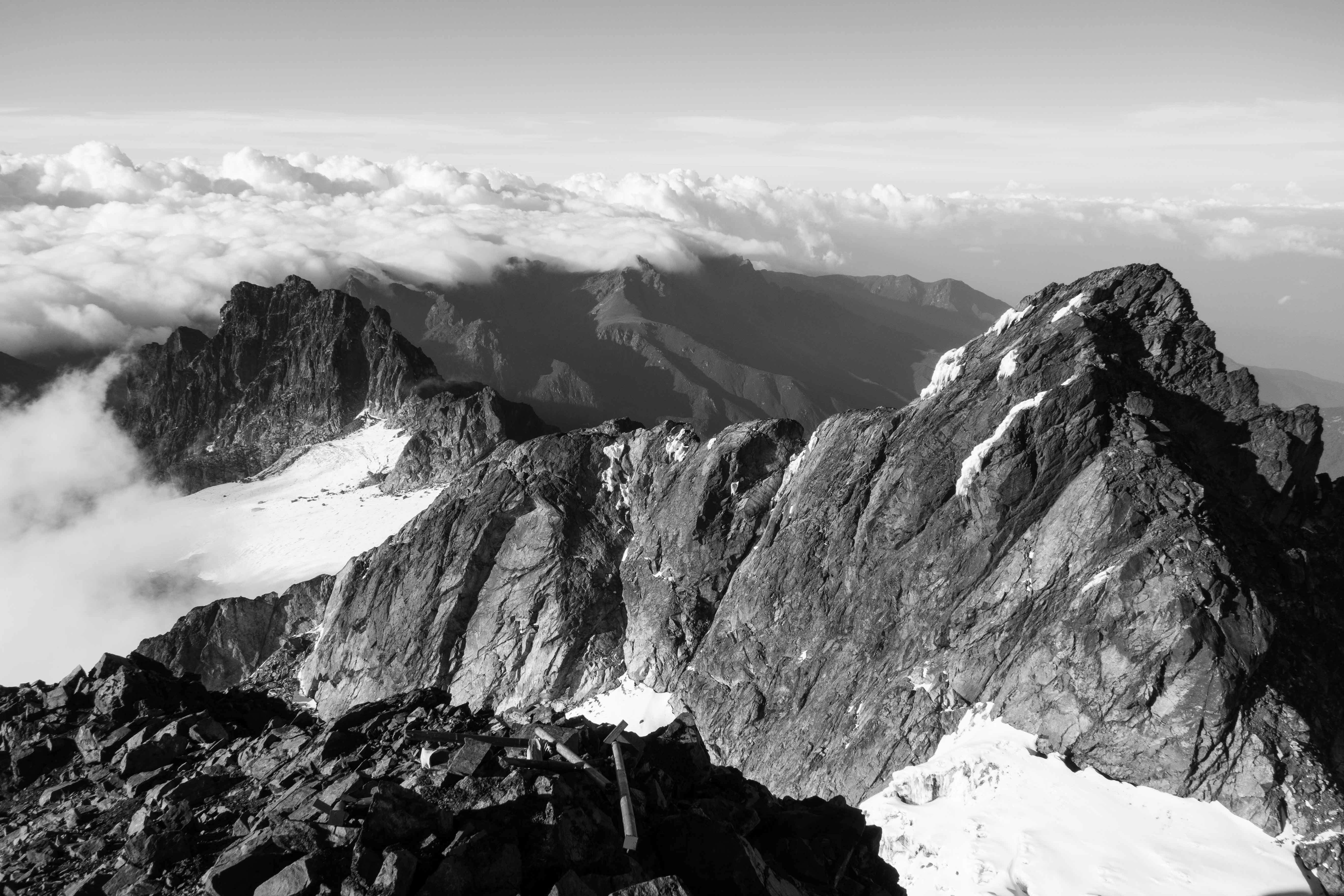
From our camp a day earlier the ridgeline looked complex, like a dragon’s spine.
At the bottom of the first scramble we look up at the wet, smooth rock, covered in moss. On top of that we find out that the flanks of Mount Baker are a proper labyrinth of small gullies, cliffs and gnarled rock. There is no obvious route. Bernard brought a rope and we’re happy to use it to get past some dicey sections. Closer to the summit, fixed (but pretty worn) ropes provide some protection. Four hours after leaving Hunwick’s Camp we reach the summit of this immense pile of rubble. Margherita Peak should be located straight across but there is zero visibility. The descent is extremely challenging, both physically and mentally. I can’t recall a climb where going down takes as much time as going up. This must be one of the toughest mountains I’ve done in my climbing career.
Spectacular location
The next stop is Margherita Camp, a spectacular location in the shadow of the cathedral-like towers of Mount Stanley. This is the original camp from where the Duke of Abruzzi made the first ascent of the mountain. We intend to follow his footsteps to Margherita Peak, crossing two of its glaciers and finish off with a scramble to the top. An early start is necessary as the snow softens during the day and bad weather rolls in in the afternoon. The alarm clock rudely wakes us up at 3am. After trying to fuel the body with some porridge it’s game on. Anita and I feel strong and our quick pace takes us to the first glacier where we strap on the crampons. It’s an easy traverse and we move on to the main glacier. The snout is a steep climb on blue ice. I realise I should have sharpened the front points of my crampons as I struggle kicking them into the ice.
When we step on the top of the ice field we hear a dull voompsound, as if the glacier has collapsed a few centimetres. It might not be far from the truth. The Margherita Glacier has lost most of its ice cover in the past five decades and it continues to recede, causing its instability. With squeezed buttocks we continue to ascend while behind us the sun rises over the rain forest. It’s a surreal thought to walk on a glacier at 0 degree latitude. The tower on our left is Alexandra Peak (5091m) and we traverse to the final scramble of its twin sister, Margherita Peak. It’s still sunny but from the Congolese side we see thick clouds creeping up the slopes. After taking the summit pictures we move down rapidly. Our small rope party swiftly negotiates the rock and ice, back to the safety of Margherita Camp and further down to the thicker air of Hunwick’s Camp.
It’s still a long way down back to Kilembe, although we don’t backtrack our steps. From Hunwick’s Camp a heavily eroded trail zigzags up Oliver’s Pass, a rather unwelcome 500m climb after summit day on Margherita Peak. Make-shift ladders allow us to overcome some vertical sections. From the pass it’s a slippery descent to Kiharo Camp following the Nyanwambo River. The muddy approach was technically challenging but descending this type of terrain on wellies is simply extreme. Multiple times we cross the river that is gradually becoming a raging torrent the further down we go. The discomfort is worth it. The misty valley is hauntingly beautiful with low-level clouds whirling around the limestone pillars. We reach our camp back in the Heather Rapanea Zone and spend the rest of the afternoon at the roaring camp fire with the unsung heroes of this trek, the porters.
The final stretch to Kilembe is a whopping 2000m drop in elevation. After an 8-hour, knee battering descent we walk into the village, in search for a fridge with well-deserved cold beers.