Article

Cicerone guidebooks for this area include the National Parks of the Yorkshire Dales and the North York Moors, and the heritage coast and moorlands of Northumberland and the Borders.
34 Books Available
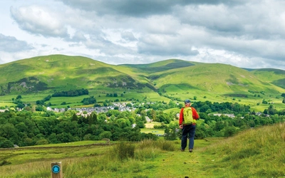
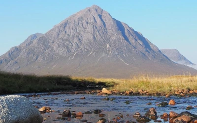
The upland and moors of the Pennines create a natural divide between the east and west of northern England, providing some fine walking country with extensive views. This section covers an extensive and comprehensive range of walking, mountain biking, cycling, trail running and long-distance hiking guidebooks for the Pennines, County Durham, Northumberland and the Yorkshire Dales.
The Pennines stretch in a north-south line through the north of England, and the 50 suggested classic full-day walks in this book explore the best of the rolling hills and high moorland, accessed from the old mill towns and attractive stone-built villages nestling in the valleys. Further exploration of the Pennines can be made by selecting guidebooks for particular regions.
For walks almost guaranteed to be in near solitude, Walking in the North Pennines has a splendid selection of 50 day walks in England's most remote Area of Outstanding Natural Beauty, crossing the borders of Cumbria, County Durham, and Northumberland. There are also separate guidebooks for Walking in Northumberland, with 36 graded walks with something for everyone – walks on Northumberland's immense empty beaches, walks to castles and hills in the Cheviots, and routes taking in Lindisfarne, Hadrian's Wall and Kielder. Walking in County Durham allows further exploration of this county touched by a legacy of early industrialisation, and surprisingly remote and beautiful valleys in 40 walks.
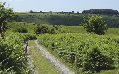
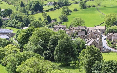
The Yorkshire Dales is an outstanding National Park, where the steep sided dales are home to wild upland, grazing sheep, dry stone walls and beautiful stone villages that time seems to have almost forgotten. The Dales are served by a selection of guidebooks. Two cover an extensive selection of day walks – Walking in the Yorkshire Dales North and East has 43 walks including the Howgills, Mallerstang, Swaledale, Wensleydale, Coverdale and Nidderdale. The South and West volume meanwhile covers Wharfedale, Littondale, Malhamdale, Dentdale and Ribblesdale, with 44 routes including the Yorkshire Three Peaks circular challenge walk. For runners, there's a book full of routes for Trail and Fell Running in the Yorkshire Dales, each of the 40 routes is between 5 and 24 miles including Whernside, Ingleborough and Pen-y-Ghent. For those on a bike, Cycling in the Yorkshire Dales has 23 great circular rides as well as the 2014 Tour de France route. Meanwhile in Mountain Biking in the Yorkshire Dales you can find 30 varied routes throughout all the Dales, as well as a MTB version of the Yorkshire Three Peaks.
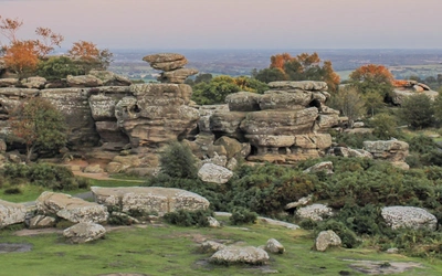
To the east of the Yorkshire Dales lies another upland area, the North York Moors. The guidebook to walking on the North York Moors provides 50 routes, coastal, clifftop, moorland and deep valleys, and includes the famous Lyke Wake Walk, a 40 mile challenge walk. For long distance walkers, there are other options in the area, including the Cleveland Way National Trail (which includes the Yorkshire Wolds Way national trail further south). It's worth noting that the Coast to Coast walk passes through the North York Moors on sections of the Cleveland Way.