Walking on the Isles of Scilly: a complete planning guide
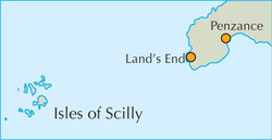
The Isles of Scilly are as close to a tropical paradise as anywhere gets in the British Isles: turquoise seas, white sand beaches and rugged granite headlands rising from the Atlantic 45km west of Land's End. This planning guide draws on Paddy Dillon's Cicerone guidebook to help you plan 11 day walks (3 to 14km) and 4 boat trips across St Mary's, Tresco, St Agnes, Bryher and St Martin's, including when to go and how to reach the islands by ship, plane or helicopter from Penzance. (Last updated: July 2026 · Guidebook edition: 5th edition, reprinted April 2026)
Walking on the Isles of Scilly, quick facts
- Location: Isles of Scilly, Cornwall, England (Britain's smallest National Landscape)
- Total routes: 11 day walks and 4 boat trips
- Distance range: 3–14km / 2–9 miles per walk
- Typical duration: half-day to full-day
- Difficulty: Easy to moderate, all low-level routes, suitable for most walkers
- Terrain: coastal paths, sandy bays, granite headlands, heathland and historic field systems
- Islands covered: St Mary's, Tresco, St Martin's, St Agnes, Bryher (plus boat-trip visits to Samson, Annet, the Western and Norrard Rocks, St Helen's, Teän and the Eastern Isles)
- Navigation: step-by-step route descriptions, 1:25,000 OS mapping and GPX downloads
- Best season: mild climate suitable for year-round walking; book ahead for August
- Guidebook: Walking in the Isles of Scilly, Paddy Dillon, 5th edition (April 2021, reprinted April 2026)
- App access: The guide has also been optimised for mobile in our app.
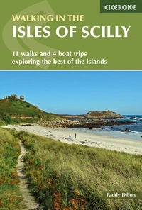
Walking in the Isles of Scilly
11 walks and 4 boat trips exploring the best of the islands
£9.95
A guidebook to 11 easy walks (2.5 to 16km) and 4 boat trips on the Scilly Isles. The routes explore Tresco, St Martin's, St Mary's and Bryher, as well as some of the smaller islands, all designated as an AONB. The guide includes information on the history, geology and ecology of the islands, which are designated as Heritage coast.
More informationWhat is walking on the Isles of Scilly like?
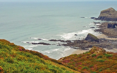
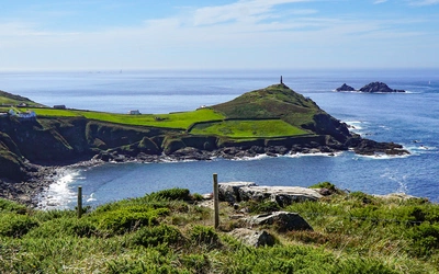
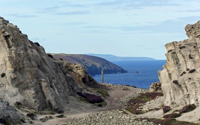
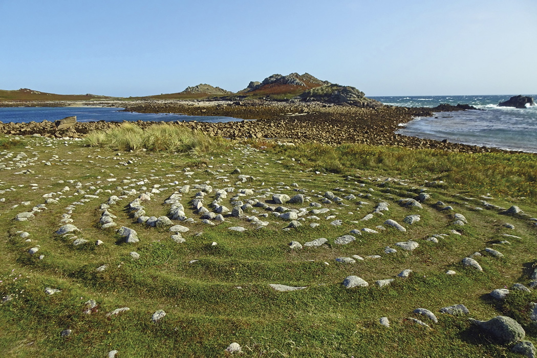
There are no mountains here and no extensive moorland, but the coastline more than compensates: blocky granite tors, tilted slabs and rounded boulders shaped by permafrost long after the last Ice Age, white sand beaches, and heathery headlands that open onto seascapes far bigger than the islands' modest scale suggests. Where a mainland coastal guide might promise dramatic cliffs, Scilly offers something gentler but no less absorbing: a landscape of granite, flowers and birds, wrapped in a Marine Park of some 125km² and bordered by wrecking rocks that have claimed more than one passing ship.
Walking in the Isles of Scilly is Paddy Dillon's Cicerone guidebook to the smallest of Britain's National Landscapes: a scatter of five inhabited islands and around fifty more named islets, 45km off Land's End, with a combined land area of just 16km². The book describes 11 day walks and 4 boat trips across St Mary's, Tresco, St Martin's, St Agnes and Bryher, giving walkers a complete route through what the guidebook itself calls a self-contained little world, easy to underestimate on the map and endlessly rewarding on foot.
This guidebook's distinguishing feature is its inclusion of boat trips alongside the walks. Four separate excursions extend the coverage to islands and rock groups, such as Annet, the Western Rocks, Samson and the Norrard Rocks, that have no viable walking routes of their own but are very much part of the Scilly experience.
This planning guide answers the most common questions walkers have before setting out. For complete stage-by-stage route descriptions and mapping, see the Walking in the Isles of Scilly guidebook.
The 11 routes at a glance
The guidebook's 11 walks are arranged in a broadly clockwise tour of the archipelago, moving outward from St Mary's to the smaller inhabited islands, with four boat trips woven in to reach the uninhabited groups.
- St Mary's (Walks 1 to 4): Hugh Town Trail, the Garrison Wall, the St Mary's coast path and the island's nature trails. This is the natural starting point, combining a town trail with longer coastal walking.
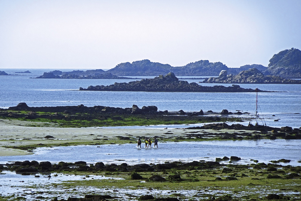
- The Gugh and St Agnes (Walks 5 and 6): two closely linked islands connected by a tidal sandbar, walked together or separately depending on the tide.
- Boat Trip 1: Annet and the Western Rocks, a wildlife-focused excursion to the archipelago's most exposed islands.
- Samson and Bryher (Walks 7 and 8): an uninhabited island explored on foot and a small inhabited island of open heathland and quiet coastal paths.
- Boat Trip 2: the Norrard Rocks.
- Tresco (Walks 9 and 10): the island coast path and a dedicated walk through the sub-tropical Tresco Abbey Garden
- Boat Trip 3: St Helen's and Teän.
- St Martin's (Walk 11): the outermost of the main inhabited islands.
- Boat Trip 4: the Eastern Isles.
Who is Walking in the Isles of Scilly suitable for, and how difficult are the routes?
All 11 walks are graded easy to moderate, and the guidebook itself notes that none could really be described as difficult; the main risk is rushing through them and missing what makes the islands interesting. There are no significant climbs and no technical navigation, so the routes suit families, less experienced walkers and anyone who prefers a relaxed pace over strenuous mileage.
That said, walkers should take sensible precautions: stout shoes or boots for uneven, rocky sections, waterproofs in case of rain, and caution around unprotected cliffs and breaking waves, particularly in windy conditions. Strong sun is a genuine consideration given the islands' exceptional sunshine hours, so lightweight covering clothing or high-factor sunscreen is worth packing.
What are the four boat trips, and do I need to be a serious walker to enjoy them?
Four of the guidebook's outings are boat trips rather than walks, covering Annet and the Western Rocks, the Norrard Rocks, St Helen's and Teän, and the Eastern Isles. These groups have little or no viable walking of their own, either because they are uninhabited, environmentally sensitive, or simply too small, but they are an integral part of exploring the wider archipelago.
The boat trips are run commercially from Hugh Town, most through the St Mary's Boatmen's Association, alongside dedicated wildlife cruises, historical tours and seabird specials in season. No walking fitness is required beyond boarding a launch, which makes these excursions accessible to anyone staying on the islands, including those combining a walking holiday with more sedentary sightseeing. Bear in mind that stormy weather can lead to sudden cancellation of boat services, so it is worth allowing flexibility in your itinerary rather than booking a boat trip for your final day.
When is the best time to walk in the Isles of Scilly?
- Spring (March to May): Wildflowers are at their best and migrant birds are arriving; a good season for the guided wildlife walks run in the high season.
- Summer (June to August): Long sunshine hours and the islands' mildest weather, but August gets busy, and accommodation should be booked well in advance.
- Autumn (September to October): A quieter shoulder season with migrant birds passing through again and generally settled conditions; a strong choice for walkers who prefer fewer crowds.
- Winter (November to February): The mild climate makes walking possible year-round, though some boat services and flights reduce in frequency, and stormy weather can disrupt inter-island travel at short notice.
What accommodation is available on the Isles of Scilly?
All the islands except Tresco have campsites, and self-catering cottages, chalets, B&Bs and guesthouses are widely available. There are eight hotels in total: five around Hugh Town on St Mary's and one each on Bryher, Tresco and St Martin's, plus one hostel-type option on St Mary's. Accommodation on Tresco is handled separately through the island's own Island Office rather than the general Isles of Scilly Tourist Information Centre.
August is the peak month and can see the islands run out of beds, so advance booking is strongly recommended for a summer visit. The guidebook's appendix carries full contact details for tourist information and accommodation across all the islands.
Getting there and back
There is no way to bring a car to the Isles of Scilly, and none is needed once you arrive. Access is by ship, plane or helicopter from the Cornish mainland:
- By ship: the Scillonian III sails once each way between Penzance and St Mary's, Monday to Saturday from March to November, with some Sunday sailings in July and August. The crossing takes around 2¾ hours. A new vessel, the Scillonian IV, is expected to enter service in 2027.
- By plane: Skybus flights operate to St Mary's from Exeter, Newquay and Land's End, with the Land's End route taking as little as 15 minutes. There are no Sunday flights.
- By helicopter: Penzance Helicopters operates flights from Penzance to St Mary's and Tresco, taking around 15 minutes.
- By rail and road: the rail network terminates at Penzance, reached from London Paddington and from across the country via CrossCountry services. The A30 is the last stretch of road, ending at Land's End; long-term car parking should be arranged in advance at Penzance or the regional airports.
Once on the islands, a Community Bus circuits St Mary's, and the St Mary's Boatmen's Association, along with island-specific operators, run inter-island launches to Bryher, Tresco, St Martin's and St Agnes.
What are the route highlights?
- Hugh Town harbour and the Garrison fortifications on St Mary's
- Tresco Abbey Garden, a sub-tropical garden of around 3000 plant species
- The tidal sandbar linking St Agnes and the Gugh
- Wildlife-rich boat trips to Annet, the Western Rocks and the Eastern Isles
- The evening Gig Races: women's crews on Wednesdays, men's on Fridays, racing to The Quay at Hugh Town
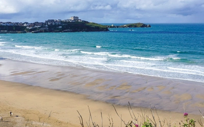
- White sand beaches and granite headlands across every inhabited island
Walking in the Isles of Scilly
11 walks and 4 boat trips exploring the best of the islands
£9.95
A guidebook to 11 easy walks (2.5 to 16km) and 4 boat trips on the Scilly Isles. The routes explore Tresco, St Martin's, St Mary's and Bryher, as well as some of the smaller islands, all designated as an AONB. The guide includes information on the history, geology and ecology of the islands, which are designated as Heritage coast.
More informationPlan your Isles of Scilly walks with the Cicerone guidebook
The Walking in the Isles of Scilly guidebook by Paddy Dillon contains everything you need to plan and complete all 11 walks and 4 boat trips across the archipelago.
- 11 day walk descriptions plus 4 boat trip chapters, covering St Mary's, Tresco, St Martin's, St Agnes and Bryher
- Step-by-step route directions supported by 1:25,000 OS mapping
- GPX files available to download separately for use with GPS devices and other mapping apps
- Background chapters on the islands' geology, ancient and later history, and Duchy of Cornwall land ownership
- Practical travel and planning information covering island transport, boat services and places to stop for food
- Coverage of island wildlife, wildflowers and the Isles of Scilly Marine Park
- Full appendix listings for accommodation and tourist information across all the islands
Available as a printed guidebook (£9.95) or digital eBook. The route is also available in the Cicerone App.
About Paddy Dillon, guidebook author
Paddy Dillon is a prolific walker and guidebook writer, with over 100 guidebooks to his name and contributions to 40 other titles. He has written for several outdoor magazines and other publications and has appeared on radio and television.
Paddy uses a tablet computer to write as he walks. His descriptions are therefore precise, having been written at the very point at which the reader uses them.
Paddy is an indefatigable long-distance walker who has walked all of Britain's National Trails and several European trails. He has also walked in Nepal, China, Korea and the Rocky Mountains of Canada and the US.