7 top tips for planning cycling routes

Not everyone has access to a local network of traffic-free, shared-use paths or miles of quiet country lanes, but don’t be deterred as there are great rides to be found almost everywhere. Richard Barrett has these top tips for working with route planning apps and some things to look out for.
In the UK, you can cycle on designated shared-use paths, bridleways and all public roads apart from motorways, which are indicated by blue road signs. The Highway Code says you must not cycle on public footpaths or pavements, although it does occasionally make sense, and is increasingly accepted as good practice, to resort to a pavement alongside a busy road in rural areas.
Although they are put there for our use, don’t feel obligated to stick doggedly to shared-use paths and cycle lanes, which frequently have hazards such as wandering dogs, broken glass and potholes. Their use is not compulsory in the UK and in urban areas; following them still typically involves stopping to cross every side road despite recent updates to the Highway Code, which now mandates that traffic turning off a main road into a side road gives way to pedestrians and cyclists who have already started to cross.
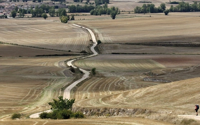
But although you are allowed to cycle on all roads apart from motorways, believe me there are many roads that should be avoided. This is either because your speed will be significantly lower than other traffic or because a drivers’ view of you will obscured because of numerous bends and undulations. Good planning is all about minimising the need to ride on such roads and seeking out safer and more enjoyable alternatives.
A few basics
- In busy urban areas, plan rides in an anti-clockwise direction so you are predominately making left turns at junctions, rather than having to cross oncoming traffic
- In winter months, try to avoid riding into a rising or setting sun as the glare on windscreens compromise a driver’s ability to see you clearly, even when displaying a rear light
- Consider the prevailing wind direction and avoid exposed stretches of road where you would be riding directly into an energy-sapping headwind or risk being buffeted by crosswinds
- Check the weather forecast before you set out and adjust your route according to the conditions. Avoid high and exposed routes if strong winds are forecast and stay home if there is any chance of ice.
Use available resources
Cicerone, other guidebook publishers, cycling organisations and possibly even your local council all offer cycling routes and you will find plenty more on cycling forums online. But always ask yourself: 'Who is this route designed for?' The last thing you want if you’re just taking out the family for a gentle pootle is to encounter inclines that the local king of the mountains thrives on. And vice-versa, an avid cyclist is unlikely to find much on their county council’s webpages that promote inclusive active travel. It’s horses for courses, as they say.
Use technology
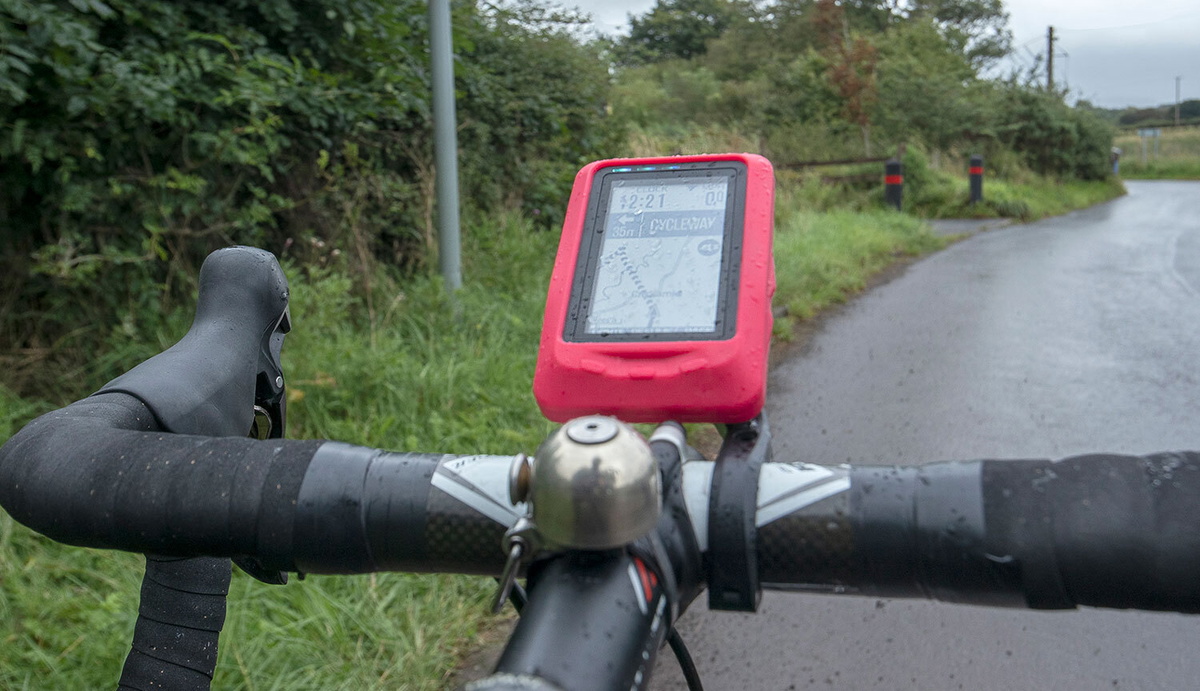
There are still old school cyclists who swear by paper maps and route cards and shy away from technology that uses global positioning systems (GPS) and digital mapping technology. Personally, I don’t quite understand them as at heart it’s still all about maps, you always have total control over the final route, and if you still insist on having a route card, most systems automatically generate one that can be printed out.
These days most cyclists are wedded to our favourite online or smartphone route planning app and GPS device and will argue black and blue that the one we favour is the best out there. There is a bewildering array of apps available including Garmin Connect, Cycle Travel, EasyRoute, Google Maps, MapMyRide, Komoot, Ride with GPS and Strava.
Most offer the same core route planning functionality and a diverse selection of other features that, if you’re at all like me, you discover by accident after years of use. Typically, all give you some core functionality for free simply by registering as a user and full functionality for a monthly subscription.
My personal favourites are Ride with GPS, which has now replaced Garmin as the go-to app in the groups I ride with, and Cycle Travel, which has a very clear and intuitive interface for plotting routes and is a joy to use for plotting longer tours. Plus it’s developed in Oxfordshire by a polymath called Richard who walks the talk and regularly pops up on online cycling forums explaining arcane technical issues and how he might or might not cater for often bizarre enhancements that someone suggests.
I particularly like the fact that it incorporates regularly updated data about road traffic volumes alongside a host of other quantitative and qualitative evaluation criteria about the terrain and the surroundings as a basis for scoring each length of road that you could possibly use for your desired journey. Other apps, I’m told, tend to rely more on how frequently other users have incorporated a particular stretch of road into their rides, which is perhaps a less robust approach.
In addition, Cycle Travel has lots of other nice little features, such being able to select the type of map to use as the base map, (including Ordnance Survey 1:50,000 if you become a supporter) and the ability to automatically split a long multi-day tour into daily stages that are easier to manage on your GPS device.
I’ve used Cycle Travel in the worked examples below, but the reality is most apps do a pretty good job when it comes to automated route planning. It’s what you then do with what the app has suggested that makes the difference.
Tips for working with route planning apps and some things to look out for before you finalise your route and download it to your GPS device:
Work on that desktop rather than the mobile
I would suggest using a computer to plan your route. If you’ve ever tried to use a route planner for cycling on a smartphone, you will find that even the deftest fingers and largest iPhone screen can’t compare to using a full-sized computer screen and mouse or trackpad. In addition, some smartphone apps lack some of the functionality of the desktop version.
Do not blindly follow National Cycle Network routes
The National Cycle Network, a UK-wide network of signed shared-use paths and routes that was developed and is managed by the charity Sustrans and their volunteers, is a wonderful asset for cyclists and others interested in active travel. Route planning apps tend to be drawn to them. However, be aware that NCN routes may not always be exactly what you are looking for as they were typically designed to take in local facilities and attractions that councils and others that funded their development considered would benefit from having more cyclists pass through them.
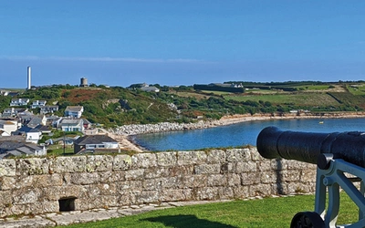
For instance, if you are planning to cycle from Land’s End to John O’Groats, you might decide to follow NCN 3 into Penzance, riding 14.5 miles and climbing 240m. But if you decide to forego the attractions, such as Mousehole, along the coast and follow a more direct route along quiet roads inland, you would save yourself 3 miles (20%) of the distance and 20m of climbing. If I’m set to be in the saddle for a fortnight, I know which way I’m going.

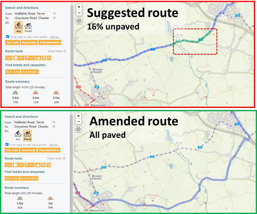
Check that you’ve not been sent down a track
In some apps choosing to use bike route overlays can favour routing along traffic-free bridleways and canal towpaths in preference to paved surfaces. This may be OK if you’re riding a mountain bike or gravel bike, but not if you’re out on your expensive carbon road bike with skinny tyres.
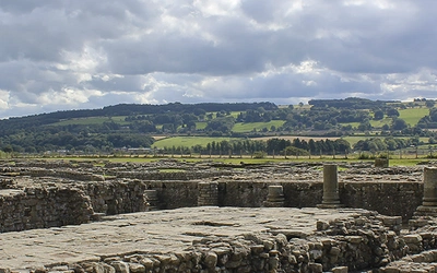
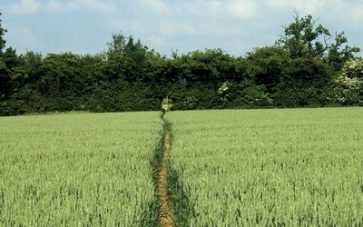
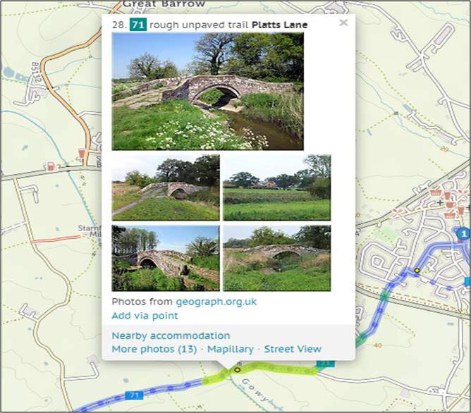
Except for periods of near-drought, local riders around me studiously avoid Local Route 71 to the west of Chester although it goes across the wonderful Hockenhull Platts. This is a series of three Grade II listed packhorse bridges that originally formed part of the medieval road from London to Holyhead. In the 17th century the surface of the road was disintegrating so badly that posts were set into the road to prevent the passage of carts. Today, except for brief periods in the summer, the road is a quagmire.
So if you want to stick to paved roads and paths, ensure you check the ‘Use paved roads’ box.
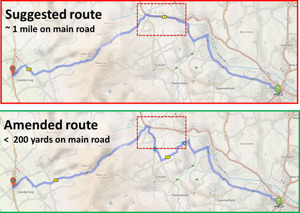
Look to minimise the time spent on main roads
The route between our home in Mold and a favourite climb in the Clwydian Range that most route planning apps automatically generate avoids the busy A541 best as they can, leaving just short of a 1-mile stretch of it to deal with. A confident rider might decide that is good enough for them. But if you err on the cautious side, always study the suggested route looking for ways to totally eradicate following main roads.
One way to achieve that is to reroute that particular section, by inserting a control point and dragging the route around until you find a point where minor roads cross the main road at a crossroad. That is not possible in the example shown. However, amending the route to follow the quieter roads to the south of the main road reduces the distance to less than 200 yards.
Consider detouring around town centres
Unless you need to, avoid going through town centres, which some route planning apps tend to favour because of the presence of traffic-free, shared-use paths. But until cyclists have priority over traffic, cycling through town centres means frequently waiting at junctions and traffic lights, which all make for slow progress. In fact going around conurbations is often just as quick as going through them and far more pleasant.
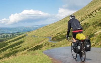
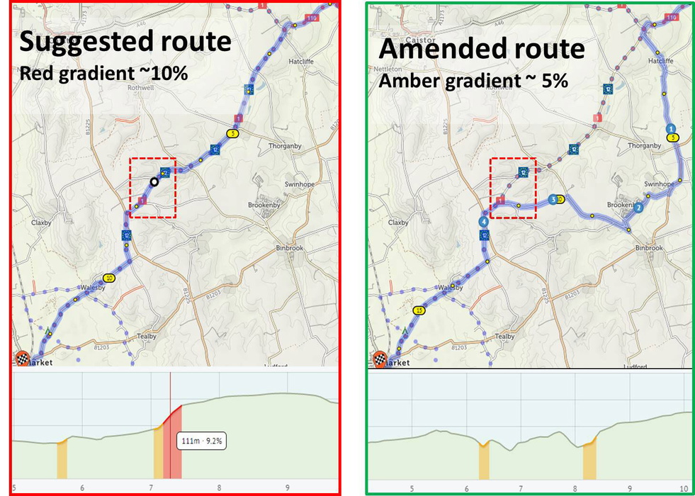
Avoid the crazy gradients
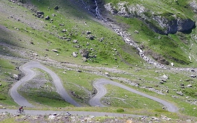
If you use a route planning app to automatically generate a route across Lincolnshire between the north coast and Market Rasen, it will almost undoubtedly follow NCN 1 across the south end of the Lincolnshire Wolds for the last few miles into the town. It is wonderful countryside with rolling hills, hidden valleys and unspoilt villages nesting on the banks of gentle streams. But if you don’t enjoy climbing, it’s also got a nasty hill where the gradient nearly gets into double figures and gets colour-coded red in the route profile.
You could avoid crossing the Wolds altogether, although that would add considerably to the distance. But adding a control point and dragging the route to the south of NCN 1 avoids the steepest section, leaving more modest inclines that are now colour coded amber, while adding only an extra couple of miles to the journey.
Insert your stop-off points
Route planning apps don’t mind whether you’re fed or not, nor if you’ve missed any nearby attractions. If you zoom into most base maps, you will generally find some points of interests such as pubs and hotels, but Cycle Travel has many more including cafés, shops and a selection of overnight accommodation. And if this isn’t enough you can always go to the cycling cafes app, where a growing community of cyclists is mapping all the cafés they have enjoyed while out riding.
Finally, check out any unknowns
If you are planning a particularly important route, perhaps where other less experienced riders might be accompanying you, it is always worth checking out any stretches of road that are unfamiliar. You can do this online using Google Street View, which is a wonderful tool for figuring out whether a road has a good surface or what happens at the end of a stretch of shared use path.
Similarly, I really like Geograph where a community of users has collated geographically representative images of every square kilometre of Great Britain and Ireland. Both of these are integrated in Cycle Travel so when you right-click on a point on your route you are immediately taken to that point of Street View or shown a selection of images from the immediate vicinity. Our example above shows the packhorse bridges at Hockenhull Platts from Geograph.
Now you’re good to go. Enjoy your ride and if the route didn’t quite work out as you intended, tweak your GPX file when you get back and it’ll be ready for the next time.