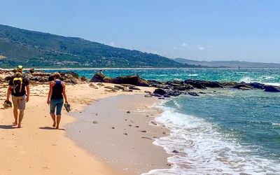
An Introduction to the Andalucían Coast to Coast Walk
Find out more about this 21-day coast to coast trail across Andalucía. It was twenty years in the making and is a true adventure through incredible landscapes. Find out more about this walk, including a detailed summary of every stop, below.
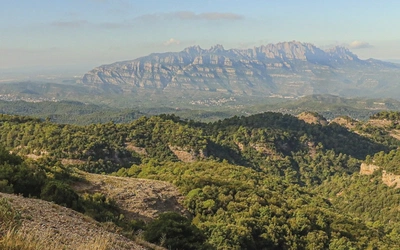
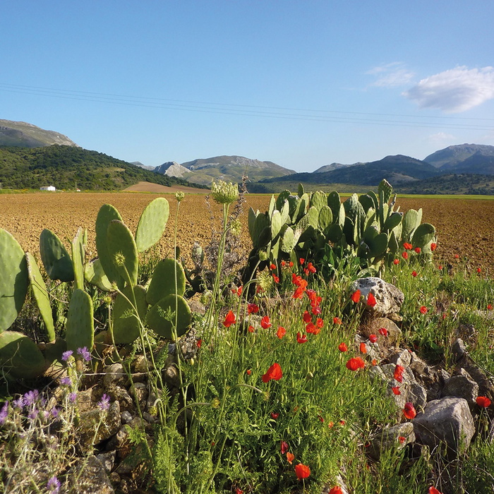
This 416km, 21-day trail leads you through stunning hilltop villages, past fascinating archaeological sites, along Berber footpaths, across Roman bridges, through deep gorges and over high passes. Should you walk the route in its entirety you’ll have journeyed from sea to ocean through the heart of one of the most beautiful tracts of mountains in Europe.
The Andalucian Coast to Coast Walk
From the Mediterranean to the Atlantic through the Baetic Mountains
£14.95
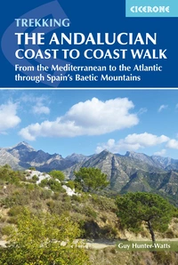
Guidebook to the Andalucian Coast to Coast Walk, a 416km, 21-day route from Maro on the Mediterranean coast to Bolonia, on the Atlantic. The route, which passes through 7 Natural Parks, links some of Andalucía's most beautiful villages and passes historical sites of both Roman and Moorish origins, including Ronda and Tarifa.
More informationWhere is the Andalucían Coast to Coast Walk?
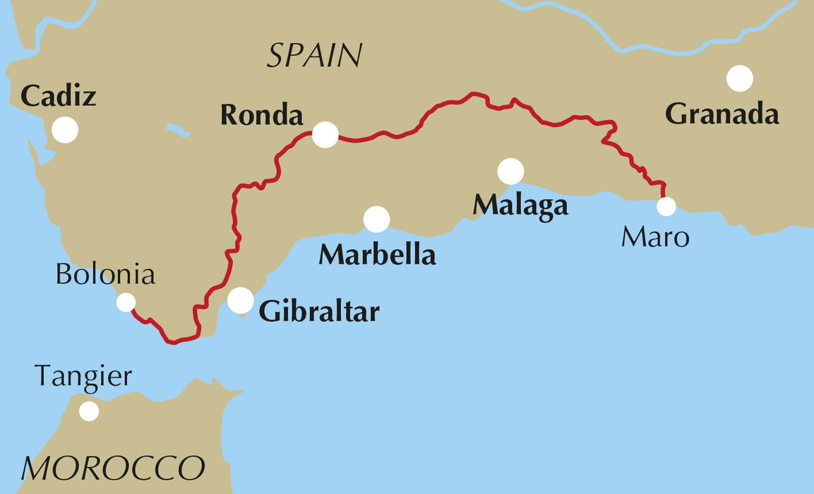
The Andalucían Coast to Coast Walk was inspired by a wish to create a long-distance walk linking the two great seas which cradle Andalucía. The route extends from Maro on the Mediterranean coast to Bolonia on the Atlantic, traversing the region’s mountainous interior and connecting seven of Andalucía’s most beautiful protected areas.
How hard is the Andalucían Coast to Coast walk?
This is a village to village walk, with an average daily distance of 20km and the longest day clocking in at a little over 26km. This means that each stage of the walk can comfortably be covered in a day with time to spare for exploring the beautiful villages through which the walk passes. There are few campsites along the way so most walkers who tackle the route choose to stay in hotels and pensions in the destination villages where there are plenty of options for all budgets.
When should you go to Andalucía?
As a general rule, the best time to walk in Andalucía is from March through to June and from September to late October. This is when you’re likely to encounter mild, sunny weather: warm enough to dine al fresco yet not so hot as to make temperature an additional challenge. Wildflowers are at their best in late April/early May and this is the time when many walking companies plan their walks.
Most walkers avoid July and August when temperatures regularly reach the mid to high 30s, making walking much more of a challenge. If you’re prepared to risk seeing some rain then winter is a wonderful time to be out walking in Andalucía, especially from December to February when rainfall is generally less than in November, March and April.
How do you get there?
Málaga is the closest airport to the walk’s start point and has charter flights from all major cities in the UK as well as scheduled flights with British Airlines and Iberia.
For the middle to end section of the walk Jerez or Seville would be closer than Málaga while for the final five days Gibraltar would be the nearest airport.
Useful Note
Visitors to inland Andalucía often express surprise at how little English is spoken, where even in restaurants and hotels a working knowledge of English is the exception rather than the norm. In addition, the Spanish spoken in southern Spain – Andaluz – can be difficult to understand even if you have a command of basic Spanish: it’s spoken at lightning speed, with the end of words often left unpronounced. It’s worth picking up a phrasebook before you travel. And be prepared to gesticulate: you always get there in the end.
Other long-distance routes through Andalucía
The GR7/E4 footpath begins in Tarifa and ends in Athens, traversing the whole of Andalucía in its early stages. About a third of the way across southern Spain, the footpath divides into a northern and a southern variant, the latter looping all the way round the southern flank of the Sierra Nevada. The total length of all the Andalucían stages of the route is around 1200km.
The GR249 or ‘La Gran Senda de Málaga’ is a more recent creation. The route describes a huge loop via the mountainous interior and the Mediterranean coast of one of Spain’s most beautiful provinces. The route covers about half the distance of the Andalucían GR7, some 650km in total.
Stage Summary - The Andalucían Coast to Coast Walk
| Stage | Locations | Distance | Time |
|---|---|---|---|
| 1 | Maro – Frigiliana | 15.2km | 5hr 35min |
| 2 | Frigiliana – Cómpeta | 18.5km | 6hr |
| 3 | Cómpeta – Sedellla | 14km | 4hr 30min |
| 4 | Sedella – Alcaucín | 17.3km | 6hr 40min |
| 5 | Alcaucín – Ventas de Zafarraya | 18.5km | 5hr 30min |
| 6 | Ventas de Zafarraya – Riogordo | 23.4km | 6hr 30min |
| 7 | Riogordo – Villanueva de Cauche | 16.3km | 4hr 45min |
| 8 | Villanueva de Cauche – Villanueva de la Concepción | 15km | 4hr 30min |
| 9 | Villanueva de la Concepción – Valle de Abdalajís | 21.3km | 6hr |
| 10 | Valle de Abdalajís – Carratraca | 25.8km | 7hr 30min |
| 11 | Carratraca – El Burgo | 22.8km | 6hr 45min |
| 12 | El Burgo – Ronda | 26.3km | 7hr 15min |
| 13 | Ronda – Montejaque | 11.7km | 3hr 50min |
| 14 | Montejaque – Cortes de la Frontera | 19.5km | 6hr |
| 15 | Cortes de la Frontera – El Colmenar | 15.8km | 5hr |
| 16 | El Colmenar – Jimena de la Frontera | 25km | 7hr |
| 17 | Jimena de la Frontera – Castillo de Castellar | 22.1km | 5hr 40min |
| 18 | Castillo de Castellar – Los Barrios | 24.5km | 6hr 45min |
| 19 | Los Barrios – El Pelayo | 25.5km | 7hr 5min |
| 20 | El Pelayo – Tarifa | 17.4km | 4hr 55min |
| 21 | Tarifa – Bolonia | 20.5km | 5hr |
| Total | Maro – Bolonia | 416.4km | 21 days |
Route Summary
Stage 1: Maro – Frigiliana
Difficulty: Medium/Difficult
Distance: 15.2km
Ascent/Descent: 930m/660m
The Coast to Coast Walk’s start point is the beach which lies just beneath Maro, one of the prettiest villages of the Costa Tropical, next to the Mediterranean Sea.After climbing up to the village the day begins in gentle mode as you follow a broad forestry track that runs north from the Cueva de Nerja towards the Sierra de Almijara.
Stage 2: Frigiliana – Cómpeta
Difficulty: Medium/Difficult
Distance: 18.5km
Ascent/Descent: 915m/615m
The second day of the Coast to Coast Walk links two of La Axarquía’s prettiest villages and takes you through another stunning slice of the Sierra de Almijara. Leaving Frigiliana by way of its pretty Calle Real a steep but short climb takes you up to a track that runs westwards beneath the high massif of El Fuerte.
After passing through the hamlet of El Acebuchal the track loops over a ridge to reach the next valley. From the valley floor steel yourself for long climb to the stage’s highest point, the Collado pass, though from here it’s downhill all the way to Cómpeta.
Stage 3: Cómpeta – Sedellla
Difficulty: Medium
Distance: 14km
Ascent/Descent: 575m/520m
The third leg of the Coast to Coast Walk leads you on through another beautiful slice of the Sierra de Almijara. The stage begins with a gentle stroll through the irrigated terraces that stretch west from Cómpeta past avocados, prickly pears, agaves and groves of olives and almonds. Passing through the pretty village of Canillas de Albaida you next descend to the Río Cájula whose leafy valley you follow north, close to the river.
Next comes a long climb across more open terrain to the high pass of Cruz del Muerto where vast vistas open out to the villages of the eastern and western Axarquía, to La Maroma’s southern flank and south to the Mediterranean. Continuing along a broad forestry track that runs on west you finally descend to Sedella via a steep, zigzagging path to reach the village’s tiny main square.
Stage 4: Sedella – Alcaucín
Difficulty: Difficult
Distance: 17.3km
Ascent/Descent: 1050m/860m
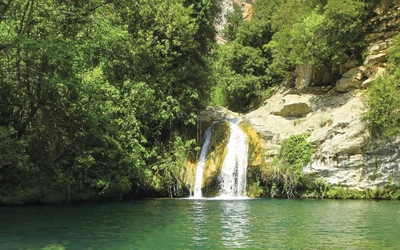
The Sedella to Alcaucín stage is among the most memorable sections of the Coast to Coast Walk, leading you up to a high footpath that hugs the spectacular, southern flank of La Maroma massif. You’re faced with a long, steep climb at the beginning of the stage following forestry tracks but your efforts are amply rewarded by a stunning middle section of trail where a snaking path leads past magnificent rock formations and two remote springs, the Pisadico and the Collado de la Gitana. Both springs make great spots for breaking the journey.
Stage 5: Alcaucín – Ventas de Zafarraya
Difficulty: Medium/Difficult
Distance: 18.5km
Ascent/Descent: 650m/250m
Day 5 of the Coast to Coast Walk skirts round the northwestern flank of La Maroma massif past deep barrancos (ravines) before dropping down to Ventas de Zafarraya in a long, lazy loop. This is one of the few sections of the Coast to Coast Walk where you loop away from your Atlantic-bound course, heading east for a few kilometres.
The nature of the terrain changes abruptly as you leave the final reaches of the Sierra de Almijara to drop down to the cultivated plain to the east of Ventas de Zafarraya. The village, which sees few visitors, has a couple of simple hostels and restaurants while its large population of migrant workers gives it a peculiarly North African flavour
Stage 6: Ventas de Zafarraya – Riogordo
Difficulty: Medium/Difficult
Distance: 23.4km
Ascent/Descent: 345m/865m
This longish leg of the Coast to Coast Walk leads down to Riogordo across the southern flank of the Sierra de Alhama. The first section of the walk follows the course of the old railway line that once connected Ventas de Zafarraya and Málaga.
Passing through Guaro you pick up the old drovers’ path that leads from Málaga to Granada. At this stage you’re following a section of the southern branch of the GR7 and the GR249. After looping round the flank of the Sierra de Enmedio there’s a steep climb to the top of the Puerto de Sabar before you gently descend to Riogordo along a leafy track.
Stage 7: Riogordo – Villanueva de Cauche
Difficulty: Medium/Difficult
Distance: 16.3km
Ascent/Descent: 710m/410m
The seventh leg of the Coast to Coast Walk follows farm tracks and quiet country roads westwards to the tiny village of Villanueva de Cauche. The day begins with a steep climb through olive groves to the top of a high ridge north of El Colmenar. Arriving at the hamlet of Cortijo los Moriscos you pick up the Cañada Real de Alhama a Antequera, the old drovers’ way, which leads down across open farmland to the Río de Guadalmedina.
From here you’re faced with the second steep climb of the day as you head up towards the southern flank of the Sierra de Caramolos. You then follow a quiet road to the day’s highest point from where you descend for 4km to the tiny village of Villanueva de Cauche.
Stage 8: Villanueva de Cauche – Villanueva de la Concepción
Difficulty: Medium
Distance: 15km
Ascent/Descent: 390m/490m
After passing beneath the A-45 motorway that cuts south towards Málaga you climb across open fields beneath the rugged flank of the Sierra de las Cabras, following the old drovers’ path of La Cañada Real de la Fuente de los Remedios a Colmenar.
Angling back to the southwest you pick up another stunning section of the cañada real (a drovers’ path, created by royal decree, for the passage of livestock) that once led from Málaga to Madrid. This ancient cart track is lost at the point where you pass beneath Cortijo de Garrayo. It’s here that you reach the Puente de Garrayo which appears like a phantom from another age in the midst of a vast field of wheat.
Beyond the bridge the old drovers’ path becomes clearer as it runs southwest towards Villanueva de la Concepción before crossing the extraordinary Puente del Paraiso. Passing a number of small farms views open out to the deeply weathered karst formations of El Torcal before a narrow footpath leads you up to Villanueva.
Stage 9: Villanueva de la Concepción – Valle de Abdalajís
Difficulty: Medium/Difficult
Distance: 21.3km
Ascent/Descent: 490m/650m
After running west beneath El Torcal’s jagged limestone ridge you later angle north to pick up a section of the ancient drovers’ path which joined Málaga with Antequera. After a long climb towards the Sierra de Chimenea the route runs westwards once again along a more level section of track to reach La Fuente de la Higuera. From here there are soaring views south across La Axarquía and on to the Mediterranean.
Stage 10: Valle de Abdalajís – Carratraca
Difficulty: Difficult
Distance: 25.8km
Ascent/Descent: 1100m/910m
The route begins with a steady climb along the flank of the Sierra de Abdalajís to La Fuente de la Viuda then on past the sheer cliff face of the Sierra de Huma. As you approach El Chorro, now descending, sheer rock faces rise higher and higher to the north where you’ll see large numbers of griffon vultures (Gyps fulvus) riding the thermals high above the gorge.
From the railside settlement of El Chorro you’re faced with a steep climb up to the reservoir above the village from where water is fed down to the village’s hydro-electric plant. Cutting past the archaeological site of Bobastro, you soon leave the tarmac road behind as you continue towards Carratraca, by way of farm tracks. Later you pick up a narrow path which winds slowly westwards before looping down to the village.
Stage 11: Carratraca – El Burgo
Difficulty: Medium/Difficult
Distance: 22.8km
Ascent/Descent: 785m/750m
The day begins with a long uphill pull as you leave Carratraca and follow broad forestry tracks up to Puerto Martínez, the highest point of the stage. From the top of the pass you have a short section of tarmac to negotiate but you’ll encounter few cars on this remote, country road. Cutting away from the asphalt you pick up the old drovers’ path that led from Málaga to Ronda.
Stage 12: El Burgo – Ronda
Difficulty: Difficult
Distance: 26.3km
Ascent/Descent: 755m/590m
The longish twelfth day of the Coast to Coast Walk leads through a wild swathe of the Sierra de las Nieves Natural Park to the hilltop town of Ronda, the largest town that you encounter between the two seas. Much of the stage is by way of forestry and farm tracks yet until you get within a couple of kilometres of Ronda you’ll encounter few walkers or vehicles.
The early section of the stage entails a long, steady climb parallel to the beautiful valley of the Río Turón. You then follow a narrow footpath which loops down then crosses the Turón’s upper reaches before leading you up to the remote farmstead of Cortijo de Lifa. A final steep climb leads to the highest point of the stage, the Puerto de Lifa. At 1169m it’s nearly twice the altitude of your point of departure.
Stage 13: Ronda – Montejaque
Difficulty: Medium
Distance: 11.7km
Ascent/Descent: 410m/450m
The thirteenth and shortest day of the Coast to Coast Walk begins in spectacular fashion as you drop steeply down the side of the town’s mesmerising tajo or gorge. After cutting across the broad bowl of the valley immediately south of the town along a quiet country lane you then climb steeply up to the Puerto de las Muelas. Beyond the pass you descend through pine forest before reaching the open farmland of the Guadiaro valley.
Stage 14: Montejaque – Cortes de la Frontera
Difficulty: Medium/Difficult
Distance: 19.5km
Ascent/Descent: 635m/705m
The fourteenth day of the Coast to Coast Walk is mostly by way of the isolated Líbar valley where you encounter just two remote farmsteads in some five hours of walking. The valley has a beauty all of its own and is flanked by some of the most remarkable karst limestone formations in Andalucía. Once you’ve negotiated a steep climb out from Montejaque the track that runs along the valley floor makes for easy walking yet the mountains to either side are wild and rugged.
Stage 15: Cortes de la Frontera – El Colmenar
Difficulty: Medium
Distance: 15.8km
Ascent/Descent: 515m/890m
The fifteenth day of the Coast to Coast Walk runs southwards down the Guadiaro valley into the heart of the Alcornocales Natural Park. Leaving the railside settlement you cross the Río Guadiaro then follow farm tracks south, parallel to the river, to La Casa del Conde. From here a narrow path zigzags down to the Puente de los Alemanes which spans the point where the Guadiaro valley abruptly narrows to become a steep-sided gorge, just metres wide at its narrowest point.
Beyond the bridge you’re faced with a steep climb up a narrow path which levels as it runs close to the gorge’s western flank. Here you’re guaranteed plenty of avian action from the colony of griffon vultures (Gyps fulvus) that inhabits the upper reaches of the gorge’s precipitous cliffs.
Stage 16: El Colmenar – Jimena de la Frontera
Difficulty: Difficult
Distance: 25km
Ascent/Descent: 670m/815m
The challenging sixteenth day of the Coast to Coast Walk offers ample recompense for the effort you’ll expend. The walk leads through a wild and rugged swathe of sierra where the likelihood of spotting eagles and deer is excellent while your destination, Jimena de la Frontera, numbers among Andalucía’s most beautiful villages.
Leaving El Colmenar a steep path leads up to the village’s arboretum. Next comes an easy section of track walking as you skirt the eastern flank of El Robledal, high above the Río Guadiaro. Crossing the upper reaches of the Arroyo Garganta de Casilla you’re faced with a steep climb through the forest to the highest point of the stage where you link up with the GR7.
Stage 17: Jimena de la Frontera – Castillo de Castellar
Difficulty: Medium
Distance: 22.1km
Ascent/Descent: 285m/125m
Although much of the seventeenth leg of the Coast to Coast Walk is by way of the flat valley floor of the Guadiaro valley, this is still a reasonably challenging, full-day walk. Leaving Jimena you drop steeply downhill then cross the Hozgarganta river. After a short section of tarmac, a broad dirt track leads you southwards, sticking close to the Algeciras to Ronda railway line. There are few passing trains and the hedgerows to either side of the track are home to abundant birdlife.
Eventually you cut west across the railway line then follow a steep, cobbled track up across densely forested hillsides to the citadel fortress of Castillo de Castellar. This eerily beautiful enclave numbers among the architectural and historical highlights of the Coast to Coast Walk.
Stage 18: Castillo de Castellar – Los Barrios
Difficulty: Medium/Difficult
Distance: 24.5km
Ascent/Descent: 340m/565m
Day 18 of the Coast to Coast Walk leads down from Castillo de Castellar to the floor of the Guadiaro valley before running on south towards Los Barrios. At the beginning of the stage you follow an ancient footpath known locally as La Calzada then the old road which cuts through the oak forest of the estate of La Almoraima.
Arriving at the outskirts of Castellar de la Frontera you continue parallel to the railway via broad farm tracks. Eventually you cross the railway line where you meet the A-405 where a cycle path leads you to the outskirts of Estación de San Roque.
Stage 19: Los Barrios – El Pelayo
Difficulty: Medium/Difficult
Distance: 25.5km
Ascent/Descent: 575m/350m
This long and averagely challenging stage leads south from Los Barrios to link in with a forestry track which loops up and over the thickly wooded hillsides of the Sierra de Ojén. The area is home to abundant wildlife and contains pristine tracts of ancient woodland which have been given doubly protected status within the Natural Park of Los Alcornocales.
As you climb from Los Barrios vast views open out across the Bay of Algeciras towards Gibraltar and, on a clear day, to the distant peaks of the Moroccan Rif. After the long ascent during the first half of the stage the latter section is plain sailing as you descend towards the Strait and the roadside settlement of El Pelayo.
Stage 20: El Pelayo – Tarifa
Difficulty: Medium
Distance: 17.4km
Ascent/Descent: 165m/405m
From the roadside hamlet of El Pelayo the Coast to Coast Walk leads on to Tarifa, the windy city whose fort and isthmus mark the boundary between the Atlantic Ocean and the Mediterranean sea. After picking up a narrow footpath that cuts across a leafy copse just beneath the Huerta Grande log cabin complex you follow a broad dirt track for some 3km towards a high ridge topped by wind generators.
Reaching the sea you head on along a beautiful path that weaves through the coastal scrub, a few metres in from the sea, which leads you to the tiny hamlet of Guadalmesí. From here you link in with the broad, coastal drovers’ path which leads you on past several small coves where you could swim or break for a picnic. The stage ends in Tarifa which you enter through the old town walls to reach the central square, La Plaza de Oviedo.
Stage 21: Tarifa – Bolonia
Difficulty: Medium
Distance: 20.5km
Ascent/Descent: 40m/45m
The final leg of the Coast to Coast Walk follows the ocean’s edge nearly all the way from Tarifa to Bolonia. Leaving the old town by the causeway linking the old fortified town with El Castillo de Santa Catarina you first walk the length of the beach of Los Lances.
After rounding Punta de la Peña you head on across the bay of Valdevaqueros, still close to the water’s edge. Leaving the bay, the path winds between rocks then loops up to easier ground just above the sea as you pass round the second, smaller headland of Punta Paloma. From here the path runs past a series of smaller coves before reaching Bolonia’s stunning arc of sandy beach.