Cycling the Camino de Santiago: a complete planning guide
Every year thousands of cyclists set off from St Jean-Pied-de-Port in the French Pyrenees to follow the Camino Francés, the medieval pilgrim road that has drawn walkers and riders to Santiago de Compostela for over a thousand years. Covering 770km (479 miles) across northern Spain in 18 stages, the route can be ridden off-road on a mountain bike or on quiet asphalt roads on a touring cycle, and takes most riders around two weeks to complete. (Last updated: July 2026 · Guidebook edition: Third edition, 2019, reprinted 2022 with updates)
Cycling the Camino de Santiago, quick facts:
- Distance: 770km (479 miles)
- Duration: Around 2 weeks (road route can be ridden faster, in as little as 8–10 days)
- Start: St Jean-Pied-de-Port, French Pyrenees
- Finish: Santiago de Compostela, Galicia
- Stages: 18, averaging around 43km each (28–55km/17–34 miles per stage)
- High point: The Pyrenean pass above Roncesvalles, crossed on Stage 1
- Difficulty: Suitable for any reasonably fit cyclist; the off-road route has steep, rough sections, while the road route climbs steadily on quiet asphalt
- Terrain: Off-road gravel tracks and mountain paths (camino route) or quiet asphalt roads (road route), through the Pyrenees, the Navarre and Rioja hills, the Castilian meseta and the Galician hills
- Waymark: Yellow arrows and scallop shell symbols throughout
- Accommodation: Pilgrim albergues, hostales, pensiones and hotels, available in most towns and villages
- Best season: April to October, avoiding the heat of July and August
- Guidebook:Cycling the Camino de Santiago: The Way of St James – Camino Francés by Mike Wells, third edition, Cicerone Press

Cycling the Camino de Santiago
The Way of St James - Camino Frances
£14.95
Guidebook detailing the 850km cycle route from St Jean-Pied-de-Port in southern France to Santiago de Compostela, following the original pilgrim route, with optional road variants. Suitable for most abilities and bikes, the route is presented in 18 stages averaging 45km each, with notes on the religious significance and local sites of interest.
More information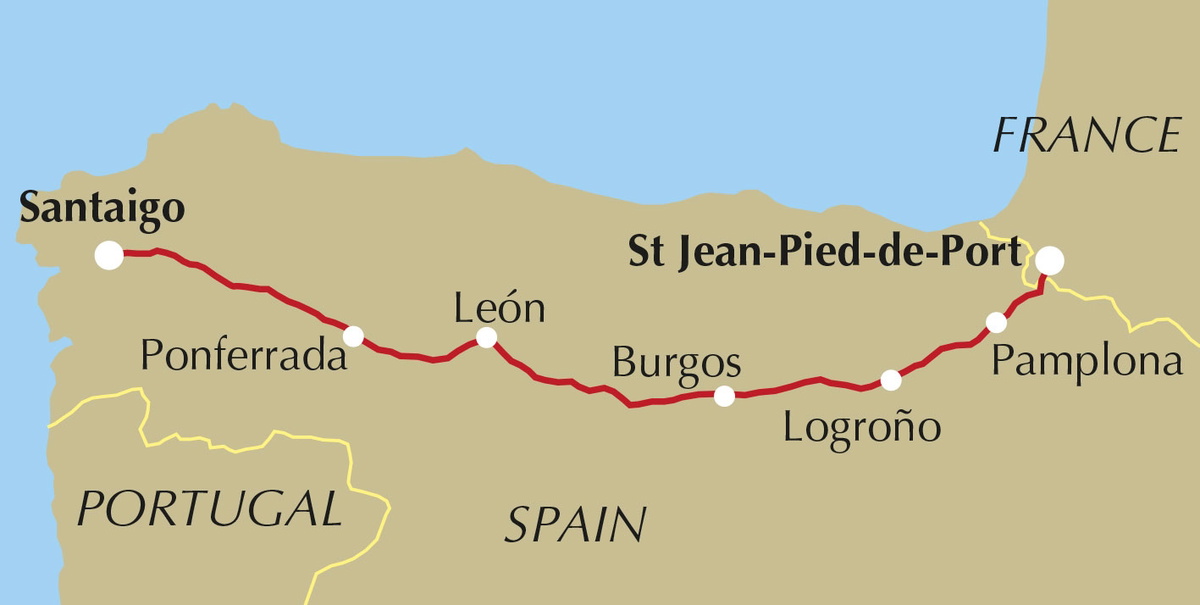
What is the Camino de Santiago cycling route?
Cycling the Camino de Santiago means following the Camino Francés, the most historic and popular of the pilgrim routes to Santiago de Compostela. The route runs 770km from St Jean-Pied-de-Port on the French side of the Pyrenees to the cathedral city of Santiago de Compostela in Galicia, crossing the wine country of Navarre and La Rioja, the vast high plains of the Castilian meseta, and the green hills and valleys of Galicia before reaching the tomb of St James.
Unlike a standard long-distance cycle route, the Camino was originally waymarked for walkers. This guidebook describes two parallel ways of covering the same ground: a camino route that follows the walkers' bridleways and gravel tracks and is best suited to mountain or gravel bikes, and a largely asphalt-surfaced road route aimed at touring cyclists, which shares the same start and finish points on every stage. Both are legally open to cyclists, since the tracks used by walkers are classified as bridleways.
Around half of those on the Camino travel for religious or spiritual reasons, while many cyclists are drawn simply by the challenge and the chance to cross the Pyrenees and the Montes de León under their own power, or by the cathedrals, historic cities and local food and wine along the way. This planning guide answers the most common questions cyclists have before setting out. For complete stage-by-stage route descriptions and mapping, see the Cicerone Cycling the Camino de Santiago guidebook.
How long is the Camino de Santiago cycling route?
The full route covers 770km (479 miles) in 18 stages, averaging around 43km a day, from St Jean-Pied-de-Port to Santiago de Compostela. A fit cyclist can complete the road route in around 10 days riding roughly 80km a day, or the off-road camino route in around 2 weeks at 55km a day; faster riders can complete the road route in as little as 8 days. Because accommodation is available at frequent intervals along both routes, daily distances can easily be adjusted to suit.
| Stage | Distance (camino route) | Ascent | Descent |
|---|---|---|---|
| 1 St Jean-Pied-de-Port to Roncesvalles | 28km | 1106m | 345m |
| 2 Roncesvalles to Pamplona | 42.5km | 491m | 982m |
| 3 Pamplona to Estella | 45km | 814m | 848m |
| 4 Estella to Logroño | 48.5km | 863m | 904m |
| 5 Logroño to Santo Domingo de la Calzada | 50km | 797m | 540m |
| 6 Santo Domingo de la Calzada to Villafranca Montes de Oca | 34km | 579m | 274m |
| 7 Villafranca Montes de Oca to Burgos | 38.5km | 406m | 493m |
| 8 Burgos to Castrojeriz | 40km | 327m | 368m |
| 9 Castrojeriz to Carrión de los Condes | 43.5km | 323m | 301m |
| 10 Carrión de los Condes to Sahagún | 39km | 216m | 219m |
| 11 Sahagún to León | 55km | 258m | 253m |
| 12 León to Astorga | 47.5km | 346m | 316m |
| 13 Astorga to Ponferrada | 54km | 824m | 1150m |
| 14 Ponferrada to O Cebreiro | 53km | 1046m | 285m |
| 15 O Cebreiro to Sarria | 38km | 611m | 1479m |
| 16 Sarria to Palas de Rei | 47km | 943m | 827m |
| 17 Palas de Rei to Arzúa | 28km | 431m | 595m |
| 18 Arzúa to Santiago de Compostela | 38.5km | 739m | 869m |
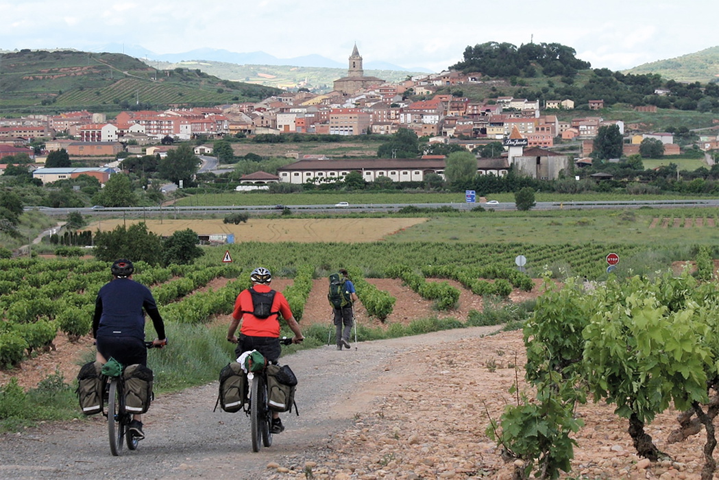
Stage 1, climbing over the Pyrenees from St Jean-Pied-de-Port to Roncesvalles, and Stage 14, climbing steeply through the Bierzo basin to O Cebreiro, are the two toughest days on the camino route, each involving over 1000m of ascent. Stage 15, descending from O Cebreiro to Sarria, has the steepest descent of the whole route at almost 1500m.
Which route should I choose: the camino or the road?
This is the one question that's specific to cycling the Camino, since the guidebook describes two complete, parallel routes rather than a single line on the map.
The camino route follows the same gravel tracks, bridleways and sendas used by walking pilgrims, and is best ridden on a mountain bike or gravel bike with off-road tyres, disc brakes and a wide gear range. It's more physically demanding, with steep, rough sections, particularly in the Pyrenees and over the Montes de León, but it keeps riders on the historic pilgrim way and among the walking peregrinos.
The road route uses quiet asphalt roads, largely the N-135, N-111, N-120 and N-547, which have become very lightly trafficked since Spain's motorway network was completed. It reaches similar altitudes to the camino route but climbs more steadily, with no undue difficulty, and suits any touring cycle fitted with panniers. Both routes start and finish at the same point on every stage, so riders can mix and match, using the road route to bypass the toughest off-road sections while still following the camino route where conditions allow.
Who is the Camino de Santiago suitable for?
The route is suitable for any reasonably fit cyclist. The road route in particular has no sections that present undue difficulty, since it climbs steadily on quiet, well-surfaced roads. The camino route is more demanding, with a few steep, rough stages, especially where cyclists deviate from the walkers' path to avoid narrow, rocky tracks unsuitable for riding.
Both routes are well used by walkers and cyclists, so riders need to be considerate: using a bell, calling out, and passing slowly when approaching walkers from behind, particularly on the many shared stretches of the camino route. Riders looking for a gentler introduction, or those on a hybrid or touring bike rather than a mountain bike, should lean towards the road route.
Can I cycle a shorter section of the Camino?
Yes. Because the route is so well served by intermediate airports, railway stations and accommodation, it lends itself to being split into shorter trips as well as ridden in full.
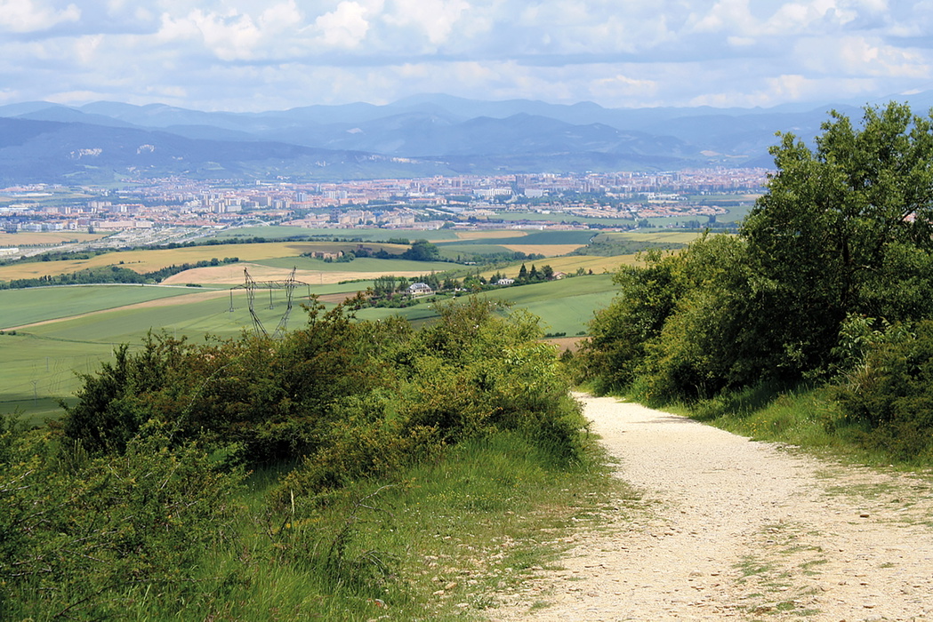
- Airports with rail or road access exist at Pamplona (Stage 2), Logroño (Stage 4), Burgos (Stage 7) and León (Stage 11), all requiring a connecting flight through a hub such as Madrid, Barcelona or Frankfurt.
- Railway stations are also found at Frómista (Stage 9), Sahagún (Stage 10), Astorga (Stage 12), Ponferrada (Stage 13) and Sarria (Stage 15), making it straightforward to join or leave the route partway.
- Cyclists wanting only the final leg into Galicia, and still to qualify for a Compostela certificate, need to start at Ponferrada (Stage 13), since cyclists and horse riders must complete 200km to Santiago to qualify, compared with 100km for walkers.
When is the best time to cycle the Camino de Santiago?
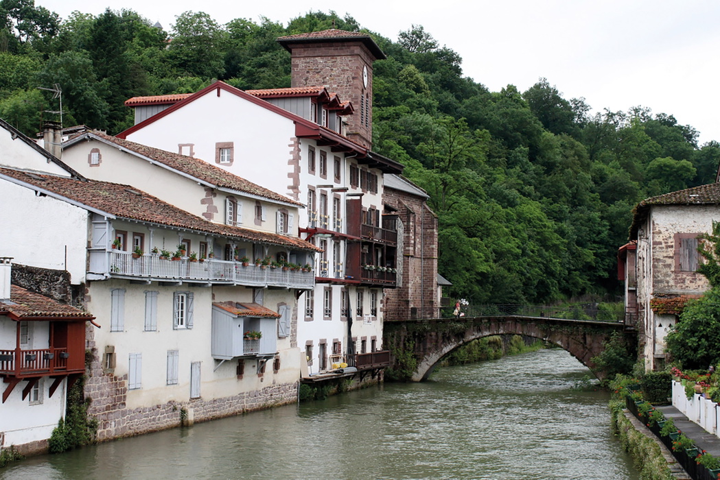
The route can be cycled at any time of year, but is best attempted between April and October, when the days are longer, the weather is warmer, and snow is unlikely on the higher sections. July and August are hot (temperatures can reach up to 40°C on the meseta) and very busy with walking pilgrims, so spring and autumn are the most pleasant times to travel. Spring and autumn mornings can be cold before sunrise, particularly on the meseta and in the mountains, so gloves and a hat are worth carrying even outside winter.
What accommodation is available?
Accommodation is plentiful along both routes and includes:
- Albergues (pilgrim hostels): the most common and cheapest option, run by municipalities, religious organisations or private owners, typically €7–12 for a dormitory bed. Almost every village has at least one, and cyclists should be aware that in high season some busy albergues give priority to walkers over cyclists.
- Hoteles, hostales, pensiones and casas rurales: offering private rooms, ranging from simple guesthouses to five-star paradores in restored historic buildings.
- Camping: rarely used by pilgrims, since albergue accommodation is so widely available and cheap, though campsites do exist for those who prefer them.
Booking ahead is rarely necessary outside July and August. The guidebook's Appendix A gives a facilities summary table for every stage, and tourist offices along the route can supply further local listings.
Getting there and back
Getting to the start: St Jean-Pied-de-Port is reached by a local railway line from Bayonne. From the UK, Eurostar carries a limited number of cycles from London to Paris, connecting with TGV services from Paris Gare Montparnasse to Bayonne, which also carry cycles by advance booking. Flying into Biarritz and cycling to Bayonne is a useful alternative.
Getting home: The simplest return is by air from Santiago airport, 12km from the city and passed on Stage 18, though cycles need partial dismantling and repackaging for most airlines. Cyclists not wanting to fly with their bike can use the Correos Paq Bicicleta postal service to send it home, or the Alsa bus service from Santiago to Bilbao, connecting onward by ferry or train.
What bike and equipment do I need?
Bike choice depends on which route you plan to ride. The camino route is best suited to a mountain bike or gravel bike with a wide gear range (a typical rear cassette of 11–36 teeth with front chainrings of 26/36/48), off-road tyres and disc brakes; front suspension helps absorb vibration on rougher sections. The road route can be ridden on any road-going cycle (hybrid, tourer or racing bike) fitted with panniers and good-quality touring tyres with a deeper tread than everyday road tyres.
Cyclists not wanting to bring their own bike can hire one in Pamplona, Burgos or Santiago, with delivery to the start and collection at the finish, and bag transfer services allow riders to travel without panniers. Whichever bike is used, mudguards, a bell, lights (essential outside June and July, since Spain's clocks run an hour ahead of its true time zone) and a basic toolkit with two spare tubes are recommended.
Do I need a pilgrim credential?
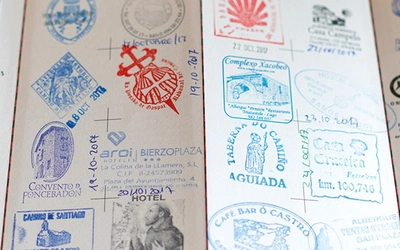
Yes, if you want to stay in albergues, get discounted entry to monuments, or receive a Compostela certificate in Santiago. The pilgrim credential (or pilgrim passport) is available before departure from national Camino confraternities, including the Confraternity of St James in Britain, or can be picked up at the Pilgrim Information Office in St Jean-Pied-de-Port or at Roncesvalles abbey.
The credential needs to be stamped at least once a day (twice a day for cyclists starting in Ponferrada) at albergues, hotels, town halls, tourist offices, churches or cathedrals along the way. On arrival in Santiago, the completed credential is presented at the Pilgrim Reception Office to receive the Compostela, the modern successor to the medieval indulgence.
What are the route highlights?
- Roncesvalles, the historic abbey reached after the Pyrenean crossing on Stage 1
- Pamplona, the partly Basque-speaking Navarrese city famous for the running of the bulls
- The vineyards of La Rioja, passed close to on Stage 5
- Burgos, with its Gothic cathedral and links to El Cid
- León, with nine centuries of architecture from a Romanesque basilica to a Gaudí-designed palace
- O Cebreiro, the mountain village marking the entry into Galicia
- Santiago de Compostela itself, and the shrine of St James inside its 11th-century cathedral
Plan your ride with the Cicerone guidebook
The Cycling the Camino de Santiago guidebook by Mike Wells contains everything you need to plan and complete the route, from St Jean-Pied-de-Port to Santiago de Compostela.
- Two complete, parallel route descriptions for all 18 stages: an off-road camino route and an asphalt road route
- 1:100,000 stage maps and elevation profiles for every stage
- GPX files available to download for both route variants
- Comprehensive refreshment and accommodation information for every stage, plus a facilities summary table
- A list of cycle shops with repair facilities along the route
- Practical advice on preparation, bike choice, pilgrim credentials and getting to and from the start and finish
- Background sections on the history, culture and religious significance of the Camino, Spanish architectural styles, and local food and drink
- A language glossary and details of useful contacts
Available as a printed guidebook (£14.95) or digital eBook (£14.95). More information and to buy.
Cycling the Camino de Santiago
The Way of St James - Camino Frances
£14.95
Guidebook detailing the 850km cycle route from St Jean-Pied-de-Port in southern France to Santiago de Compostela, following the original pilgrim route, with optional road variants. Suitable for most abilities and bikes, the route is presented in 18 stages averaging 45km each, with notes on the religious significance and local sites of interest.
More informationAbout Mike Wells, guidebook author:
Mike Wells is an author of both walking and cycling guides. He has been walking long-distance footpaths for 25 years, after a holiday in New Zealand gave him the long-distance walking bug. Within a few years, he had walked the major British trails, enjoying their range of terrain from straightforward downland tracks through to upland paths and challenging mountain routes. He then ventured into France, walking sections of the Grande Randonnée network (including the GR5 through the Alps from Lake Geneva to the Mediterranean), and Italy to explore the Dolomites Alta Via routes. Further afield, he has walked in Poland, Slovakia, Slovenia, Norway and Patagonia.
Mike has also been a keen cyclist for over 20 years. After completing various UK Sustrans routes, such as Lôn Las Cymru in Wales and the C2C route across northern England, he then moved on to cycling long-distance routes in continental Europe and beyond. These include cycling both the Camino and Ruta de la Plata to Santiago de la Compostela, a traverse of Cuba from end to end, a circumnavigation of Iceland and a trip across Lapland to the North Cape. He has written a series of cycling guides for Cicerone following the great rivers of Europe.