An introduction to the Rota Vicentina
If you have a penchant for dramatic cliffs and awesome ocean scenery with secluded sandy bays, are fascinated by gangly storks nesting on sea stacks, are able to walk around 20km per day, appreciate fresh fish and charming guesthouses and hostels… without forgetting ancient oak forests, brilliant carpets of wildflowers, sweet oranges, mouthwatering traditional Portuguese cuisine and inimitable custard tarts, then the Rota Vicentina is definitely for you. And rest assured it will quickly become one of your favourite treks.
Portugal's Rota Vicentina
The Historical Way and Fishermen's Trail
£18.95
Guidebook to walking Portugal's Rota Vicentina, a stunning yet remarkably little-visited 220km route down the south-western Atlantic coast, through the Alentejo and Algarve districts. The route, which is suitable for all fit walkers and is not technically difficult, is described across 12 stages, making it perfect for a 2-week holiday.
More information
Essential facts:
What? Relatively little-known hiking trail
Where? The south of Portugal
Start point? Santiago do Cacém
End point? Cabo de São Vicente
Distance? 224km
Completion time? Around 2 weeks
Why this route? A stunning yet remarkably little-visited route with awesome ocean scenery
Where is the Rota Vicentina?
Starting well south of Lisbon, the long-distance Rota Vicentina links the rural town of Santiago do Cacém with Cabo de São Vicente, Portugal's southwesternmost extremity jutting out into the vast Atlantic Ocean.
The route traverses two beautiful and fascinating regions of southern Portugal, the Alentejo and the Algarve. The Alentejo is reputedly the least developed of Portugal, which, for visitors, translates as an excellent walking country, a feature it has in common with the Algarve. Both of these regions offer walkers a remarkable range of landscapes and habitats, from rolling hills to splendid wooded river valleys, then olive groves and cultivated fields which back the exciting Atlantic coast.
The Historical Way or the Fishermen's Trail?
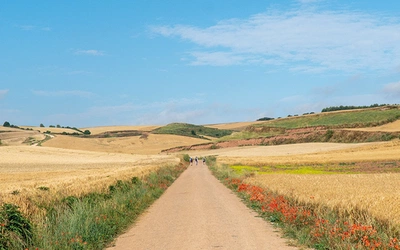
The Rota Vicentina consists of two marked routes: the Caminho Histórico or the Historical Way and the Trilho dos Pescadores or the Fishermen’s Trail. The former links Santiago do Cacém on an inland route over rolling hills to Odeceixe before moving closer to the coast the rest of the way south to Cabo de São Vicente. The shorter Fishermen’s Trail mostly sticks to breathtaking clifftops from Porto Covo down as far as Odeceixe. The Portugal's Rota Vicentina guidebook uses a savvy combination of the best of both routes.
How long is the Rota Vicentina?
The route Cicerone describes is 224km in 12 day stages. Each stage concludes in a hospitable village with excellent facilities. Thanks to local transport, days can be varied, and walkers can easily put together their own itineraries to suit individual holiday schedules.
What are the accommodation options?
Walkers can find an excellent range of high-standard alojamento (accommodation) for all budgets all along the Rota Vicentina. These start with the many hostels, some known as pousada de Juventude. The next step ‘up’ is immaculately kept private rooms (quartos) known as alojamento locale, residential or hospodars. The choice continues through to mid-range hotels and boutique B&Bs in historic buildings.
Advance reservation is only usually necessary at top-end places (which may be booked ahead by agencies for groups or self-guided clients) or around public holidays.
Camping is not allowed anywhere along the Fishermen’s Trail of the Rota Vicentina, and elsewhere, it is only permitted in designated camping grounds.
How difficult is the Rota Vicentina?
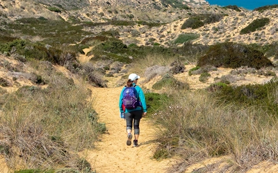
Covering level ground for the most part, the Rota Vicentina is suitable for all fit walkers and has no technical difficulties. The walking follows a string of clear paths, lanes and country dirt roads with abundant waymarks and signposting. The odd steep section is included but overall it’s easy to average walking. The sun is one factor to take into account as shade is at a premium and the wind should not be underestimated as this is the Atlantic coast and spending a day being battered can be tiring albeit exhilarating.
Is it well waymarked?
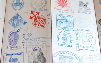
The Rota Vicentina is pretty well-marked and checked on a regular basis by volunteers. Waymarking for the Historical Way sections consists of adjoining red/white painted stripes, which are green/blue for the Fishermen’s Trail. Where the way changes direction so do the stripes; whereas crossed stripes mean ‘wrong way’. The markings are found on poles, rocks, tree trunks, buildings and fences. Rota Vicentina signposts supplement these with destination and distance.
As a general rule, unless the route description specifies otherwise, don’t continue for more than a kilometre or so without seeing a waymark. Should this happen, retrace your steps to the last one and hunt around.
When is the best time to go?
Generally speaking, the September to June period is feasible for walking the Rota Vicentina. The spring months of March to May/early June and then the late summer-autumn period of September to November are arguably the best times of year to walk the route. Despite cooling sea breezes, late June to August are generally stiflingly hot and not recommended as the route has a dearth of shade; the possibility of heatstroke should not be underestimated. It is best to wait until the extreme heat of the summer has abated.
The midwinter months can be mild and quite superb, albeit, of course, windy and chilly, although temperatures don’t usually drop below 10°C at night. Rainfall tends to be heaviest from December to January. Bottom line: don’t be put off in the winter but do wrap up warmly and take reliable rain gear.
How to travel to the Rota Vicentina?
Portugal has excellent reliable trains and a capillary network of buses; up-to-date timetables (horários) can be consulted on company websites. The easiest way to reach the trek start, Santiago do Cacém, is on a Rede Expressos bus from Lisbon’s Terminal Rodoviário at Sete Rios. It’s a 146km/2hr journey.
What are the route's highlights?
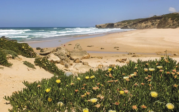
A huge chunk of this trek is in Parque Natural do Sudoeste Alentejano e Costa Vicentina, where plant and bird life are protected. This encompasses the most extensive consolidated sand dunes in Portugal, along with stunningly rugged headlands, eroded cliffs of coloured rock, and wild beaches for swimmers and surfers alike. Moreover, the park area guarantees that this beautiful coastline remains pristine. One of its great beauties is that it feels remote and you can walk for hours without meeting anyone. Even the villages and resort towns are low-key and quiet in the low season – a walking season. Naturally, as summer approaches, temperatures and prices rise as visitors pour in, but in any case, it’s too hot for walking then.
What are the stages of the Rota Vicentina?
Stage 1: Santiago do Cacém to Moinhos do Paneiro
Distance: 21km
Ascent/Descent: 280m/315m
The Rota Vicentina strikes out as the red/white-marked Historical Way leaving Santiago do Cacém to head due south on a series of clear lanes and paths. Walkers are led across rolling rural landscapes dotted with farms and through vast cork oak woods typical of the Alentejo region, with occasional promising glimpses of the coast and the sparkling Atlantic Ocean (three days off).
Stage 2: Moinhos do Paneiro to Cercal do Alentejo
Distance: 20km
Ascent/Descent: 160m/215m
The Rota Vicentina presses on with easy-going rambling mostly on lanes through well-kept farmland in rolling countryside with cork oak woods as far as the vast expanse of the Barragem de Campilhas reservoir. A little further on, the day’s destination, Cercal do Alentejo, is a typical rural town with low-set whitewashed houses and good amenities.
Stage 3: Cercal do Alentejo to Porto Covo
Distance: 18km
Ascent/Descent: 185m/290m
Today the Rota Vicentina enters the vast Parque Natural do Sudoeste Alentejano e Costa Vicentina and stays in it all the way down to Cabo de São Vicente. This varied stage initially heads west through farmland gradually dropping to the coastal plain and the Atlantic coast. It’s very exciting to reach the ocean!
Stage 4: Porto Covo to Vila Nova de Milfontes
Distance: 20km
Ascent/Descent: 160m/160m
A simply spectacular day out on the coast in the company of the magnificent Atlantic Ocean, inviting beaches, dramatic cliffs, bright wildflowers and hardy sea birds. Alternating with clifftop paths are inland tracks traversing the undeveloped plain parallel to the coast.
Stage 5: Vila Nova de Milfontes to Almograve
Distance: 15km
Ascent/Descent: 130m/150m
The opening section of this stage is not terribly interesting as it follows busy roads before crossing the broad Rio Mira on a sleek bridge constructed in 1974. However this is easily avoidable thanks to a handy family-run boat taxi from the jetty below the castle at Vila Nova de Milfontes.
Stage 6: Almograve to Zambujeira do Mar
Distance: 22km
Ascent/Descent: 110m/100m
The opening section as far as Cabo Sardão, approximately halfway, is especially wonderful thanks to the surprising number of stork nests on precipitous cliff edges and sea stacks, undeniably one of the top highlights of the Rota Vicentina.
Stage 7: Zambujeira do Mar to Odeceixe
Distance: 18km
Ascent/Descent: 280m/310m
An excellent varied stage that spends just about all day close to the ocean with dramatic cliffs and visits to inviting beaches, without forgetting quite a fair few ups and downs and some narrow steep hands-on stretches. Spectacular scenery is the flavour of the day.
Stage 8: Odeceixe to Aljezur
Distance: 18km
Ascent/Descent: 100m/100m
Taking a break from the dramatic coast it traverses flatter countryside inland, following the banks of irrigation channels for hours on end in the company of frogs and even the occasional turtle.
Stage 9: Aljezur to Arrifana
Distance: 12km
Ascent/Descent: 170m/160m
This relatively short stage makes its roller-coaster way across lovely open hilly landscapes with flourishing flowering shrub vegetation and watercourses. The day ends at marvellous seaside Arrifana – not a village as such but a fishing harbour overlooked by a historic fort and a handful of cafés and places to stay near a wonderful beach popular with surfers.
Stage 10: Arrifana to Carrapateira
Distance: 24km
Ascent/Descent: 390m/480m
Today’s stage is lengthy and rather tiring. It begins by dropping to a beautiful wild beach before rambling across undulating farmland and through woodland on a long-winded return to a superb stretch of coast with standout beaches and an inviting settlement.
Stage 11: Carrapateira to Vila do Bispo
Distance: 22km
Ascent/Descent: 290m/220m
This interesting day is spent inland on rugged terrain
Stage 12: Vila do Bispo to Cabo de São Vicente
Distance: 14km
Ascent/Descent: 80m/90m
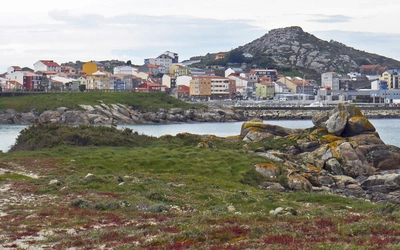
Cabo de São Vicente (Cape Saint Vincent) is an awe-inspiring spot to finish the marvellous Rota Vicentina trek.