Walking on Madeira - everything you need to know
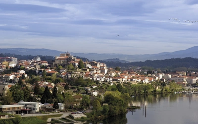
Madeira is a small island of 750km² (290 square miles). It lies at 32°46’N/17°03’W in the subtropical Atlantic Ocean, about 600km (370 miles) from Morocco in North Africa, and about 950km (590 miles) from Portugal, to which it belongs. A compact and mountainous island, Madeira is criss-crossed by old paths and tracks, and is remarkably scenic and accessible. Here is everything you need to know to plan your next hiking trip to the island.

Walking on Madeira
60 mountain and levada routes on Madeira and Porto Santo
£17.95
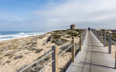
A walking guide to the islands of Madeira and Porto Santo. Selection of varied day walks exploring Madeira's network of levadas (water channels) as well as routes across steep and rugged mountains, with slopes of bare rock or laurisilva 'cloud' forest. The neighbouring island of Porto Santo offers easy walking and a sandy beach.
More information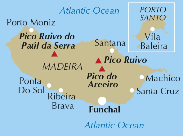
How to get to Madeira
Whilst many opt for package trips to Madeira, flight-only deals are possible, using the national carrier, Air Portugal (www.flytap.com), other national carriers such as British Airways (www.britishairways.com), or budget operators such as Easyjet (www.easyjet. com) and Jet2 (www.jet2.com). Shop around as prices vary enormously. To fly to Porto Santo it is usually necessary to fly to Madeira first, then take a 15-minute ‘hop’ to the island.
How do you get around the island?
While a car is essential for walks on the plateau of Paúl da Serra, most of the walks in this guidebook are linear, in deference to the steepness of the terrain. Madeira has a comprehensive and remarkably cheap bus network, providing vital lifelines to the most distant villages. Buses were used extensively to research the walking routes in this guide. It is well worth visiting the various bus offices or their kiosks to pick up more information.
When is the best time to visit Madeira?
Madeira is generally hot and humid, but not excessively so, and is an all-year-round destination. That said, the summer months can be too hot, and winter brings more rain and a slight risk of snow in the mountains. Madeira is a subtropical island and, depending on the direction of the wind and the amount of moisture it carries, there can occasionally be prolonged or torrential rain, causing rivers and levadas to flood, which can result in rockfalls and landslides.
What about accommodation?
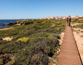
Accommodation in Madeira is mostly concentrated around the ‘Hotel Zone’ to the west of Funchal and a large hotel complex at Garajau, but there is plenty more around the island. Most towns and several villages offer small hotels and pensions, providing great opportunities for long-distance walks from one place to another. Campsites are very limited, and wild camping is technically forbidden.
What are levadas?
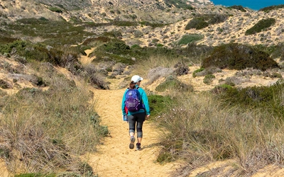
Early in the 15th century, short and simple water channels were dug to divert streams out of valleys onto sunny slopes where areas had been cleared for cultivation. In general, the higher levadas collect water for use in hydro-electric power stations, but there is no waste, as the outflowing water is then used for irrigating crops. Water is of course also treated for human consumption. As the levadas need constant maintenance, they are equipped with paths that have long been used by walkers. However, not all levadas are the same, and while some are easy to follow, others cross sheer cliffs, where the narrow and uneven paths are very dangerous: a slip or trip can result in death or serious injury. The intricate network of very narrow levadas that ultimately take water into fields and terraces, isn’t really suitable for walking.
Levada da Serra: Campo do Pomar to Camacha
Summary: The levada path is clear, level, and easy to follow; it is generally well-wooded with some cultivated areas. Beginner walkers should opt for the levada paths that are flat and easy to follow.
Start/Finish: ER-201 road above São João de Latrão/Camacha
Time: 3hrs 15mins
Distance: 10km (6¼ miles)
Total ascent/descent: 120m
The Levada da Serra do Faial can be walked in a day but most walkers break halfway and head for Camacha. The full length of the well-wooded levada path measures 23km (14¼ miles) and rises from 750m (2460ft) above the Estádio da Madeira, to 800m (2690ft) above Camacha. The levada itself was drained many years ago and in recent years a water pipeline has been buried beneath the path.
Pico do Cedro and Pico do Areeiro
Summary: Mostly good mountain paths, linking with a mountain road.
Start/Finish: Pico do Areeiro
Time: 3hr
Distance: 7.5km (4¾ miles)
Total ascent/descent: 400m
From certain vantage points, Pico do Areeiro and Pico do Cedro look smooth, seeming to offer easy walking. This is partly true, if following the skyline crest, but there are cliffs falling into the Curral valley, and awkward slopes dropping to the nearest road. A circular walk has only become practicable in recent years, following the construction of a mountain road and forest tracks.
Pico do Areeiro to Pico Ruivo
Summary: Mountainous, with a narrow path, several flights of steps and five tunnels. Steep, rocky and exposed slopes are often protected by fencing, but a head for heights and steady feet are required.
Start/Finish: Pico do Areeiro
Time: 6hr
Distance: 12km (7½ miles) there and back
Total ascent/descent: 1300m
The most popular mountain walk on Madeira is from Pico do Areeiro to Pico Ruivo. It is not suitable in bad weather, being prone to rock-falls, and the route would upset vertigo sufferers. Apart from that, the engineering of the path is superb. It is almost entirely carved from rock and offers close-up views of mountains while linking the highest peaks. The walk is there-and-back, possibly using a more rugged alternative (currently closed), but it could be finished at Achada do Teixeira instead, with reference to Walk 25.
Following the devastating fires in the mountains in August 2024, several paths were damaged, and some had to be closed. For up-to-date information see ifcn.madeira.gov.pt/146-destaques/avisos/627-percursos-pedestres-avisos.html.
The Institute of Forests and Nature Conservation now charges €3 per person for walking some of the more popular waymarked and signposted ‘PR’ trails, and this scheme is likely to be expanded to cover ALL the waymarked and signposted ‘PR’ trails in 2025. For details see simplifica.madeira.gov.pt/ services/78-82-259. It has been claimed that walkers who don’t pay the charges could be fined €50.
Walking on Madeira
60 mountain and levada routes on Madeira and Porto Santo
£17.95
A walking guide to the islands of Madeira and Porto Santo. Selection of varied day walks exploring Madeira's network of levadas (water channels) as well as routes across steep and rugged mountains, with slopes of bare rock or laurisilva 'cloud' forest. The neighbouring island of Porto Santo offers easy walking and a sandy beach.
More information