The Picos de Europa: what you need to know
The Pyrenees, the Sierra Nevada, the Guadarrama to the north of Madrid… the list of mountain ranges in Spain is as extensive as the country itself. But in the minds of many, the Picos de Europa are the jewel in the Spanish crown.
Walking in the Picos de Europa
42 walks and treks in Spain's first National Park
£17.95
Guidebook describing walks and multi-day hikes in the Picos de Europa, a striking limestone range that forms part of the Cantabrian Mountains in northern Spain. Routes vary in difficulty and some include an element of scrambling. Includes notes on transport, bases, accommodation and equipment, plus history, geology, plants and wildlife.
More information
Where are the Picos de Europa?
The Picos de Europa straddle the autonomous regions of Asturias, Cantabria and Castilla y León in Northwest Spain. The limits of the Picos mountains are marked out to the east and west by the spectacular gorges of the rivers Deva and Sella, respectively, whilst the range itself is split into three distinct massifs by the north–south course of the rivers Duje and Cares. The three massifs are known quite simply as the Macizo Oriental (Eastern), the Macizo Central and the Macizo Occidental (Western).
Why should I go to the Picos?
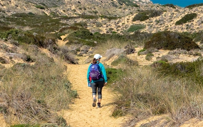
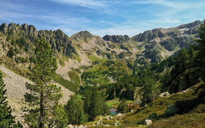
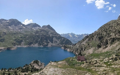
This tiny gem, only 30km by 25km in size, climbs to over 2500m in numerous places, but plunges to below 100m in others, offering, as a result, walking for all tastes. From gentle strolls along fertile valley bottoms, to hikes along gorges that slice through towering walls and peaks, to exacting high-mountain adventures over dry, cratered limestone, the variety of walks in the Picos de Europa means that there is something here for everyone.
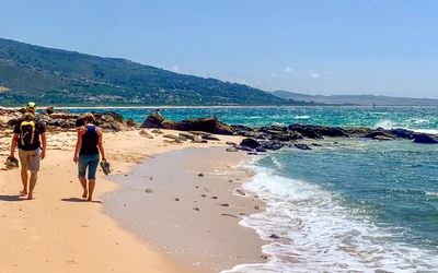
Barely 20km south of the sea and 20km north of the plains of Castille, the Picos witness the intriguing effects of the Atlantic and Mediterranean climates rubbing up one against the other. Apparently exclusive habitats happily survive in close proximity, with north-facing slopes swathed in mature beech forest directly opposite rugged hillsides of thick Mediterranean scrub. Add to the equation the first-rate options for accommodation, the rich and varied cuisine, the favourable northern Spanish climate, plus the chance to mix demanding mountain days with long afternoons lazing on the beach, and you have all of the ingredients for an unforgettable holiday.
When is the best time to visit the Picos de Europa?
Depending on the routes you hope to follow, there is no closed season for walking in the Picos de Europa. Valley walks can be done in mid-winter, and even if there is snow in the high mountains, this only adds to the scenery. However, for many visitors from the UK or the rest of Europe, the season running from early May to the end of October is probably the best.
July and August are busy months in the Picos and it is unlikely that you will be alone in the mountains. The opposite is true for the rest of the year, and with coverage for mobile phones patchy to poor, you would be very unwise to venture into the Picos alone or in poor weather.
How do you get to the Picos de Europa?
Access to the Picos de Europa from the UK or Europe is not difficult and can be made either by air or by road through France. From the UK it is also possible to travel to Spain by ferry. Brittany Ferries currently run twice-weekly services from Plymouth or Portsmouth to Santander (www.brittany-ferries.co.uk) and three times a week from Portsmouth to Bilbao. The closest airports to the Picos de Europa are those of Asturias (OVD), Santander (SDR) and Bilbao (BIO).
How do you travel around the Picos de Europa?
Bus services in and around the Picos de Europa are not good, with the exception of the summer service from Cangas de Onís to Covadonga, and from there on up to the Covadonga lakes. Much less frequent is the service between Cangas de Onís and Arenas de Cabrales on the north side of the range, or the service from Panes to Potes and then on to Fuente Dé on the south side. In short, it pays to have your own transport in order to be able to move around freely.
How difficult is hiking in the Picos de Europa?
From gentle strolls along fertile valley bottoms, to treks along gorges that slice through towering walls and peaks, to exacting high-mountain adventures over dry, cratered limestone, the variety of walks in the Picos de Europa means that there is something here for everyone. Bearing in mind factors such as distance, height gain and loss as well as the terrain, the walks within our guidebook have been graded as easy, moderate, difficult, or very difficult.
What are the accommodation options in the Picos de Europa?
There is a wide range of accommodation options in the valleys surrounding the Picos, from luxury hotels to simple hostels (albergues), and from self-catering cottages to cabins on campsites. For longer walks or for strategic reasons, you may want to stay in one of the mountain huts.
Full details of the huts in the Picos can be found in the guidebook, and whilst they are not of the hotel-like standards of those in the Alps, the refuges in the Picos de Europa offer meals and accommodation at reasonable prices. All nine huts currently operate through a centralised booking system and will require payment in advance.
What about language and currency?
European Spanish is spoken everywhere, although people in the villages in Asturias might mix this with their local language, Asturiano. In hotels, hostels, restaurants and many bars, somebody will speak some English. In an increasing number of places young members of catering and hotel staff will speak fairly good English.
The currency in Spain is the euro. Credit cards are used for many types of payment in shops, supermarkets, hotels, restaurants and for online booking of mountain huts. However, cash is still the norm in bars and cafés. Payment through phone apps has not caught on yet to any significant extent but is still possible where credit cards are accepted. There are cashpoint machines in all the major towns.
Which area of the Picos de Europa should I go to?
Cangas de Onís
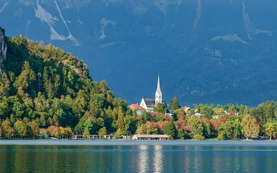
The walks in the Cangas de Onís sector all lie in the Western Massif, with a good number of them starting out quite high up at the Lagos de Covadonga, one of the foremost destinations for visitors to the Picos. From there, a number of routes venture up into the high mountains, although almost always on paths that are not as steep as those in the other sectors. This can make some of these outings attractive to less experienced walkers.
Cangas de Onís, the main town in the sector, offers all the services you would expect, including banks, supermarkets, shops, a post office, and a tourist information office. Cangas makes an excellent base for routes not just in the immediate area, but also in the Cabrales and Sajambre sectors. On the down side, because it is popular, Cangas de Onís can be quite crowded during the summer season.
Cabrales
The walks in the Cabrales sector lie in the northern reaches of the Eastern and Central massifs. Unlike those in the Onís sector, many walks in Cabrales involve considerable height gain and loss, as well as long sections of rough, sometimes trackless, high-mountain terrain.
The main town, Arenas de Cabrales, is conveniently situated at the entrance to the Cares Gorge. This makes it a major gateway for walking in the Central and Eastern Massifs, and for access to delightful mountain villages such as Tielve, Sotres or Tresviso.
Liébana
One of the main attractions of the Liébana valley is the almost Mediterranean climate, due to the valley lying in a marked rain shadow. It is also home to a wealth of gentler walks in and around the tiny villages that dot the northern slopes of the valley in particular. The cable car at Fuente Dé can also whisk you up to 1800m in a matter of minutes and give you easy access to the high-mountain terrain of the Central Massif of the Picos.
Valdeón
Valdeón is an ideal base for activities in the southern part of the Western and Central massifs and is the starting point for the Cares Gorge walk. Wilder and far more remote than the other valleys of the Picos, the effort needed to reach Valdeón is amply rewarded once there. Compared to other areas, there are fewer facilities and services here and you may need to plan in terms of food and supplies before you get there. There are very limited bus services to Valdeón, so a car is obligatory.
Sajambre
Sajambre is the smallest sector in the guide, but what it lacks in size it makes up for in other ways. The villages cluster around Oseja, the capital, and are surrounded by ancient beech woods and sheer rock walls. The walks range from strolls along centuries-old drove roads, to long days in middle- and high-mountain terrain.
Oseja de Sajambre has enough basic services to make a short stay comfortable, with a small supermarket, a chemist’s and three bars, two of which have basic restaurant services. In such a small place, accommodation is limited, although there are several rural houses for rent in both Oseja and Soto. There is no campsite and the nearest petrol stations are some way away in Riaño or Cangas de Onís.

What maps should I use? Is GPS available?
Over these last few years, the benefits of GPS when it works have become apparent, as have the problems when it doesn’t. The benefits hardly need stating, but the vertical cliffs, gorges and woods make the Picos too steep for GPS to be fully reliable. In short, you need to take a paper map with you, and you need to know how to use it in combination with a reliable compass.
- Editorial Alpina, Picos de Europa Parque Nacional, 1:25,000
- Adrados Ediciones, Parque Nacional de los Picos de Europa, Mapa topográfica excursionista con la reseña de los itinerrarios de Pequeño y Gran Recorrido (PR y GR) 1:50,000
- Digital maps: Bob Boulan, Picos de Europa (and go to Adquirir el mapa)
Walking in the Picos de Europa
42 walks and treks in Spain's first National Park
£17.95
Guidebook describing walks and multi-day hikes in the Picos de Europa, a striking limestone range that forms part of the Cantabrian Mountains in northern Spain. Routes vary in difficulty and some include an element of scrambling. Includes notes on transport, bases, accommodation and equipment, plus history, geology, plants and wildlife.
More information