Hiking in the Pyrenees: 7 treks under 2 weeks
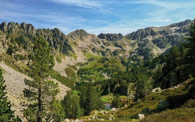
The Pyrenees, bordering France and Spain and rising over 3000m, stretch over 400km from the Atlantic to the Mediterranean and offer a diverse range of walking experiences. The GR10, GR11 and Haute Route Pyrénées (HRP) are fantastic long-distance trails that explore this magnificent mountain range, but most walkers cannot spare the time to be away from home for the 35–50 days required to complete them. With that in mind, here are seven stunning Pyrenean routes, each taking between four days and two weeks, that showcase the best the Pyrenees has to offer.
Shorter Treks in the Pyrenees
7 great one and two week circular treks
£18.95
Guidebook detailing seven circular treks of 4-12 days in the beautiful Pyrenees. The varied routes cover both sides of the French-Spanish border and include both the High Pyrenees and the lower, more gentle mountains of the Basque Country and Catalonia. Variants are suggested for those wishing to shorten or extend the treks.
More informationThe seven routes featured below are circular so that a minimum of time is wasted with transport. Most of the time you will be walking on good, well way marked footpaths, but these are alpine mountains and on some of the routes there are boulder fields to cross and some sections where use of hands will be needed when crossing high passes. Route 3, in particular, is at the highest difficulty that the ‘average walker’ would contemplate with a heavy pack. The routes are designed to be walked when they are free of snow and only those who are competent in walking/climbing in snow and ice conditions should consider walking them before the winter snow has melted (see ‘Weather and when to go’, below). Several of the routes are designed so that they can be done as one long trek or split into two shorter treks.
| Route no | Start/finish | Distance | Total ascent |
|---|---|---|---|
| Route 1 | St-Jean-Pied-de-Port | 194km | 8100m |
| Route 2 | Etsaut | 141km | 7900m |
| Route 3 | Cauterets | 186km | 10,600m |
| Route 4 | Barèges | 70km | 3900m |
| Route 5 | Refugi dera Restanca | 89km | 4700m |
| Route 6 | Ax-les-Thermes | 125km | 6500m |
| Route 7 | Eyne | 224km | 11,000m |
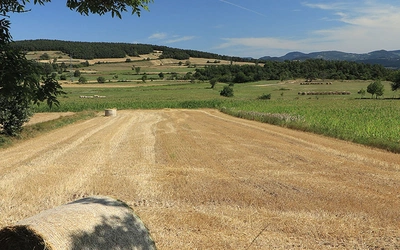
Route 1: Tour of the Basque Country
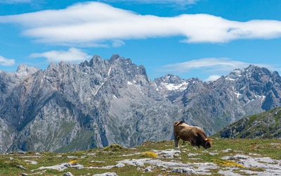
This is a demanding 194km high-level traverse of the mountains and steep rolling hills in the Basque Country at the west end of the Pyrenees. There are long, steep climbs from the villages that offer overnight accommodation and long walks along easy grassy ridges. The ridges are exposed, and you are likely to have to contend with sun or cloud and rain. This is the only route in this guide that traverses the highest mountains in the region and the views of the Basque countryside are spectacular.
Much of the route is on well-waymarked sections of the GR10, GR11 and Camino de Santiago, so navigation is generally straightforward. Griffon vultures are thriving in the Basque Country and you will have close views of these magnificent birds on all stages of the route. You should see many other species of birds of prey, with the red kite also being a common sight.
There is no problem finding wild campsites, but you are advised to camp high, in the realm of sheep and horses, rather than in the valleys with cows and the rules of ‘civilisation’. There are spectacular exposed wild campsites on the high ground throughout the route, but you should be prepared to carry water to a dry camp as the opportunity to camp beside water is limited. Resupplying along the route is easy as there are food shops throughout.
The route will normally be free of snow by April and it is best to visit the area in spring or autumn rather than in high summer when it could be very hot and accommodation tends to be fully booked by tourists – May or June are recommended.
Basque will be the main language on the Spanish side of the border with Spanish as a second language. Surprisingly, you will probably find English more useful than French. The locals on the French side of the border will speak either Basque or French as a first language, but you can expect everyone to speak French.
Route 2: Pic du Midi d’Ossau and the limestone peaks of the western Pyrenees
The magical view of the Pic du Midi d’Ossau across Lac Gentau from the Refuge d’Ayous is the classic view of the Pyrenees, appearing on the cover of many guidebooks to the area. As far as short treks are concerned, the Tour du Pic du Midi d’Ossau is the pick of the Pyrenean routes. Here it is combined with the most spectacular sections of the La Senda de Camille (Stages 2 to 5), through the magnificent limestone scenery on the Spanish side of the border, to produce a fabulous 141km eight-stage trek. Included is a descent of the intriguing Chemin de la Mâture, a passage hewn out of vertical limestone cliffs.
The Spanish sections of the La Senda de Camille are adequately waymarked and there is excellent waymarking on Stages 1 and 8 which follow the GR10. However, waymarking is sparse on the French section of Stage 2 and navigational skills will be required. There is little waymarking on Stages 6 and 7 but you are on well-walked paths.
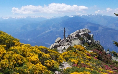
Route 3: Tour de Vignemale and La Alta Ruta de Los Perdidos
This is a magnificent 186km high-level trek around Vignemale and Monte Perdido, combining sections of the GR10, GR11 and Pyrenean Haute Route and featuring six of the ‘honeypots’ of the Pyrenees; Cauterets, Vignemale, Gavarnie, Pineta, Ordesa and the Picos del Infierno.
Deep alpine valleys and canyons, high snow-covered passes, steep cliffs, mountains with the biggest glaciers in the Pyrenees, waterfalls, cascading streams and mountain tarns make this the most spectacular but also the most demanding walk in this guide. There is ‘easy’ scrambling at the maximum difficulty most walkers would contemplate with a heavy pack. Some of the passes, which can hold snow well into summer, are serious undertakings until the snow has melted. In particular the Brèche de Tuquerouye (Stage 4) would present a serious risk before snowmelt. Unless you are experienced and suitably equipped for snow and ice conditions you would be advised not to attempt the route before July in a low snow year or August in a high snow year. It is strongly advised to do the walk in a clockwise direction, as described in this guide, as the descents from Collado de Añisclo and Brèche de Tuquerouye would be very difficult when heavily laden.
On several stages you will pass refuges during the day, allowing the stages to be split into two and giving time to explore the surrounding mountains or climb some of the easier peaks. This area is extremely busy during July and August and you should book accommodation as far in advance as possible. There are plenty of opportunities for spectacular wild campsites throughout the trek.
Route 4: Réserve Naturelle de Néouvielle
This 70km short trek takes you through the spectacular scenery of the granite massif centred on the Réserve Naturelle de Néouvielle. This is a land of deep alpine valleys and rocky peaks, but it is the multitude of lakes and tarns that provide the highlights of the trek. Much of the route is on the GR10 or GR10C on good mountain paths with red/white waymarking.
There are opportunities to climb several peaks on the route, including Pic du Midi de Bigorre (2872m) and Pic de Bastan (2715m). There is also the possibility of staying at other refuges on the route and taking your time to explore these impressive valleys and mountains.
Camping is not allowed in the Réserve Naturelle de Néouvielle except at three designated aires de bivouac (at Lac de l’Oule and Lac d’Orédon on Stage 3, and at Lac d’Aubert on Stage 4), but you will find excellent wild campsites outside the reserve.
This route should be feasible from July to September. Late July/August in particular is recommended, to give time for the lakes to warm up for reasonably comfortable swimming.

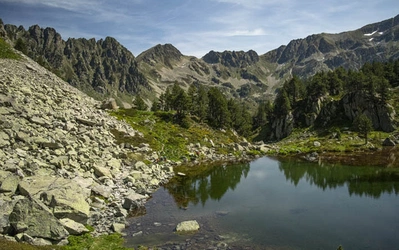
Route 5: Carros de Foc
The Carros de Foc is an understandably popular 89km trek in the magnificent Parc Nacional d’Aigüestortes i Estany de Sant Maurici, in the Spanish part of western Catalonia. This is another granite massif dotted with hundreds of lakes and tarns in an area of rough boulderfields and high granite peaks. The route started as a challenge race visiting the nine refuges in the area in 24 hours but has become well-walked hut-to-hut route. There is a great deal of flexibility in planning, with most walkers taking 5–7 days for the trek.
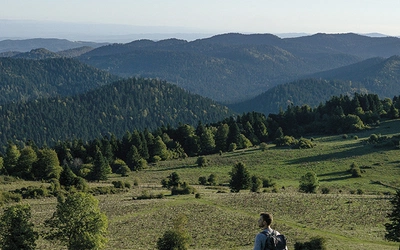
Route 6: Tour des Montagnes d’Ax and the Tour des Pérics
The Ariège is a relatively unknown area at the eastern end of the High Pyrenees. This 125km trek combines the magnificent Alpine mountains of the Tour des Montagnes d’Ax on either flank of the Vallée de l’Ariège with the Tour des Pérics in the gentler picturesque mountains of the Cerdagne in the French part of Catalonia.
The route is very well waymarked where it follows sections of the GR10, GR7 and Tour du Capcir, but other sections will require navigational skills, especially in bad weather.
Route 7: The icons of Catalonia: Puigmal and Canigou
The final trek in the guide covers both the Spanish and French parts of Catalonia at the eastern end of the Pyrenees and includes ascents of the two most climbed peaks in the Pyrenees: Puigmal and Canigou. Despite rising to almost 3000m, the mountain ridges are gentler than those of the High Pyrenees, more reminiscent of the Scottish Highlands, although the valleys still have an alpine feel. Much of the time is spent on spectacular high-level traverses of steep mountain slopes.
This route has been designed as a spectacular high-level traverse of the steep slopes of the mountain range with the option of climbing many of the peaks. The route combines sections of the Tour du Canigou, GR10, GR11 and HRP as well as other long-distance paths. Traverses of Puigmal and Canigou are included as separate stages so that you can climb them with a day-pack.
Although you can expect warm sunny weather most of the time, you should be aware that this mountain range, particularly the western end, has a reputation for terrific late-afternoon/evening thunderstorms. Despite rising to almost 3000m, snowmelt is typically about a month ahead of the High Pyrenees; in a low snow year the route should be feasible from May, and from June in a high snow year. In a typical year the route should be feasible from May until October, but not all the accommodation will be open in May or October. These mountains will be very busy and can be very hot in peak holiday season. The month of June, when the flowers are in bloom and there is plenty of water (very relevant to those who are camping), can make for a particularly good choice.
Shorter Treks in the Pyrenees
7 great one and two week circular treks
£18.95
Guidebook detailing seven circular treks of 4-12 days in the beautiful Pyrenees. The varied routes cover both sides of the French-Spanish border and include both the High Pyrenees and the lower, more gentle mountains of the Basque Country and Catalonia. Variants are suggested for those wishing to shorten or extend the treks.
More information