Everything you need to know about Spain’s Sendero Histórico, the GR1
The Sendero Histórico (or GR1) is a trail that combines great scenery with a gentle lesson in Spain’s fascinating history. Traversing the north of Spain it sits in the shadow of world’s most famous walk, the Way of Saint James (the ‘Camino di Santiago’), and offers a completely different experience
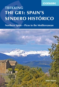
Spain's Sendero Historico: The GR1
Northern Spain - Picos to the Mediterranean
£17.95
Guidebook to the 1250km of Spain's Sendero Historico (GR1), traversing northern Spain from Puerto de Tarna in the province of León in the west to the Mediterranean near L'Escala in Catalonia, through fascinating, varied landscapes and the Pyrenees foothills. Described in 53 stages, about 25km each in length, with detailed mapping.
More informationHow long is the GR1?
The Sendero Historico (or GR1) is a 1250km trail that combines great scenery with a gentle lesson in Spain’s fascinating history. Spain has an impressive selection of long-distance paths and experienced Spanish walkers would tell you that this is the best of them – little known outside Spain as it may be.
Where does the route start and end?
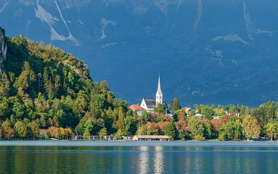
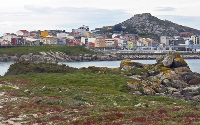
Travelling from west to east across Spain, the Sendero starts at the Puerto de Tarna, a pass on the regional border between the Asturias and Castilla y León, heads east along the southern flank of the Cantabrian Mountains, the plain of Navarre and the foothills of the Pyrenees (‘Prepirinio’ in Spanish) and then finishes on the Mediterranean coast at Sant Martí d’Empúries near L’Escala.
How difficult is the Sendero Histórico?
Although it’s a long walk, some 1250km, and mountainous, involving over 39,000m of climb, it’s not difficult. If you’re reasonably fit, the only thing you need to enjoy it is time.

How does it compare to other routes in Europe?
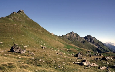
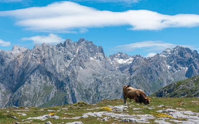
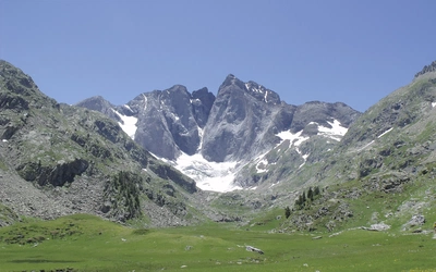
The GR1 starts near the Picos de Europa – the limestone massif that sits right in the middle of the Cantabrian Mountains, heading into Montaña Palentina and the Riaño Mountains. Although not as famous as the Picos these mountains have their own iconic peaks such as the Peña Espigüete (2451m) and Curavacas (2524m). Traversing the north of Spain it sits in the shadow of world’s most famous walk, the Way of Saint James (the ‘Camino di Santiago’), and offers a completely different experience. The ‘Camino’ had one aim: to get pilgrims to Santiago de Compostela as quickly as possible. It’s a sort of medieval motorway. The GR1, on the other hand, is a relatively modern invention and it’s in no rush. There is nothing direct about this route. Designed for walkers, it meanders through some of the best scenery northern Spain has to offer and, at the same time, visits key locations in the development of modern Spain.
What are the trails like?
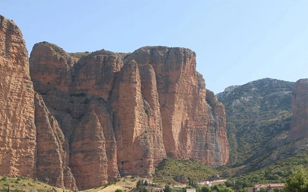
The GR1 follows paths originally designed to link village with village that were, until recently, the main thoroughfares as the vast majority of goods were carried by people, mules and donkeys. Many of these trails are in their original state and make for perfect walking. They are gently graded and designed for getting heavy loads steadily up and over hills. Quite often the work in constructing these routes is apparent with walls (above or below), conduits to remove water and even some of the original paving still in place.
When is the best time to walk?
Much of the route is accessible all year round but there are good and not so good times to go. Factors to consider are rainfall in the winter including snow in the Cantabrian Mountains, and the heat in the summer particularly crossing the plain in Navarre. The condition of the trail will also vary from season to season and even if there isn’t a lot of snow some stretches will be so muddy that walking in winter can be uncomfortable.
The best months for most of the walk are April, May and June and September/October. July and August are good months for walking in the Cantabrian Mountains but not on lower parts of the route.
How can I break up the route?
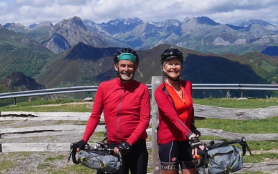
This guidebook is designed to provide the prospective traveller with all the information needed to plan a trip along the GR1. The complete end-to-end trail is highly recommended but it does take around 53 days to complete. Most walkers will need to break their GR1 exploration down into chunks and to this end the route is described in seven sections, each with a start or endpoint that can be easily reached by train or bus. The route is described west to east. You could, of course, choose to walk it the other way, but finishing at the Mediterranean adds a certain amount of drama to the trip.
Spain's Sendero Historico: The GR1
Northern Spain - Picos to the Mediterranean
£17.95
Guidebook to the 1250km of Spain's Sendero Historico (GR1), traversing northern Spain from Puerto de Tarna in the province of León in the west to the Mediterranean near L'Escala in Catalonia, through fascinating, varied landscapes and the Pyrenees foothills. Described in 53 stages, about 25km each in length, with detailed mapping.
More information