The Wye Valley Walk: a complete planning guide
The Wye Valley Walk follows the River Wye for 219km (136 miles) from its source high on the remote uplands of Plynlimon in Mid Wales, all the way to the tidal estuary below Chepstow's clifftop castle. It is one of the most admired river trails in Britain, and with good reason: the walk weaves across the Wales-England border five times, passes through Iron Age hillforts, medieval market towns and limestone gorges, and ends at a river whose tides are the third highest in the world. Most walkers complete it in 10 to 12 days. (Last updated: April 2026 · Guidebook edition: 2nd edition, 2024)
Wye Valley Walk quick facts:
- Distance: 219km (136 miles); 235km including the Prologue from Llanidloes
- Duration: 10 to 12 days (7 days at a fast pace; 12 to 13 days at a leisurely pace)
- Start: Rhyd-y-benwch, Plynlimon, Mid Wales (Prologue starts at Llanidloes)
- Finish: Chepstow, Monmouthshire
- Stages: 17 (plus a Prologue stage from Llanidloes)
- Highest point: Nantyhendy Hill, 480m (Stage 2)
- Total ascent: 4790m (15,715ft) excluding Prologue
- Difficulty: Moderate; suitable for most reasonably fit walkers
- Terrain: Riverside paths, open upland moorland, rolling farmland, limestone gorges and ancient woodland
- Waymark: Leaping salmon disc
- Best season: April to October; accessible year-round in the valley sections
- Guidebook:The Wye Valley Walk by Ruth Waycott and the Wye Valley Walk Partnership, 2nd edition, 2024

The Wye Valley Walk
From Plynlimon to Chepstow
£16.95
The Wye Valley Walk follows the River Wye for 219km (136 miles) through the beautiful and varied landscape of the Welsh borders. Typically taking 10 days to walk, the route starts at the river's source on Plynlimon and follows the Wye valley to Chepstow. The Wye Valley Walk is a perfect mix of river and hill walking, suitable for any reasonably fit walker.
More information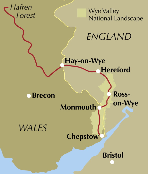
What is the Wye Valley Walk?
The Wye Valley Walk is a 219km long-distance trail tracing the course of the River Wye from its source on the slopes of Plynlimon in the Cambrian Mountains to the point where it flows into the Severn estuary just below Chepstow. From crystal-clear upland stream to wide tidal river, the Wye descends 680m over the course of the walk, and the landscape changes completely as it goes. Few long-distance routes in Britain offer such a thorough journey through a river's entire life.
Legend has it that the Wye, one of three rivers rising on Plynlimon, chose the prettiest route to the sea. Walking it, you will be well placed to judge whether the legend is justified. The path doesn't stick faithfully to the riverbank throughout: as the guidebook notes, walking beside a river reveals only one side of its character. You have to climb up the valley sides, gain height and distance, to really appreciate a river in its landscape. That instinct to pull back and look shapes the whole walk.
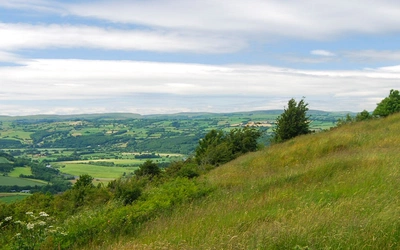
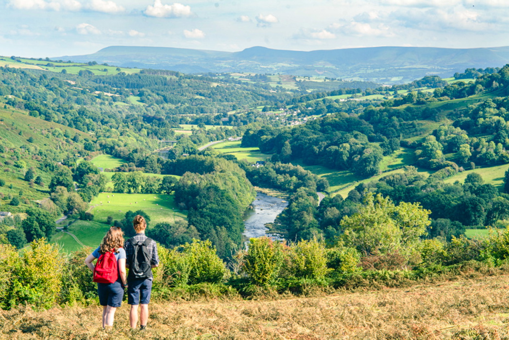
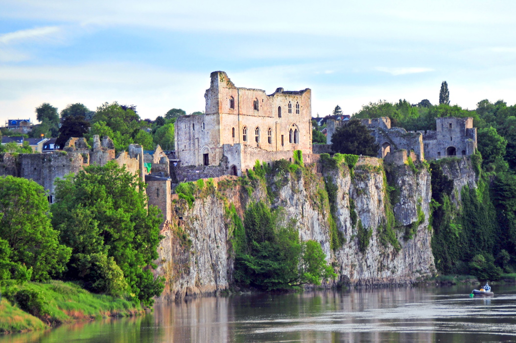
The route crosses the Wales-England border five times, passes through the market towns of Rhayader, Builth Wells and Hay-on-Wye, follows the Herefordshire Plain through cider orchards and red-earthed farmland to the city of Hereford, and then enters the Wye Valley National Landscape for a spectacular 85km finale of limestone gorges, Iron Age hillforts, ancient woodland and riverside ruins. Tintern Abbey, Symonds Yat Rock and Chepstow Castle all feature in this final section. For anyone who wants a long-distance walk rich in history and landscape variety, the Wye Valley Walk is among the best of its kind in Britain.
This planning guide answers the most common questions walkers have before setting out. For complete stage-by-stage route descriptions, OS mapping and accommodation details, see the Cicerone Wye Valley Walk guidebook.
How long is the Wye Valley Walk?
The Wye Valley Walk covers 222km (138 miles) across 17 stages, from Rhyd-y-benwch on Plynlimon to Chepstow. A Prologue stage of 13km from Llanidloes to Rhyd-y-benwch adds an optional opening day for those arriving by public transport, bringing the full total to 235km (146 miles).
Stages vary considerably in length, from the short 7.7km of Stage 9 (Bredwardine to Byford) to the demanding 19.6km of Stage 1 from Rhyd-y-benwch to Llangurig. This variation gives walkers the flexibility to build the route around their available time and energy.
| Stage | Distance | Ascent | Time |
|---|---|---|---|
| Prologue: Llanidloes to Rhyd-y-benwch | 13km (8 miles) | 335m | 3hr 45min |
| 1: Rhyd-y-benwch to Llangurig | 19.6km (12.25 miles) | 405m | 5hr 45min |
| 2: Llangurig to Rhayader | 19.4km (12 miles) | 535m | 6hr 45min |
| 3: Rhayader to Newbridge | 15.5km (9.75 miles) | 425m | 4hr 45min |
| 4: Newbridge to Builth Wells | 10.8km (6.75 miles) | 130m | 2hr 45min |
| 5: Builth Wells to Erwood | 11.9km (7.5 miles) | 465m | 3hr 50min |
| 6: Erwood to Glasbury | 14km (8.75 miles) | 70m | 3hr 15min |
| 7: Glasbury to Hay-on-Wye | 8.2km (5 miles) | 165m | 2hr 50min |
| 8: Hay-on-Wye to Bredwardine | 14km (8.5 miles) | 440m | 4hr 45min |
| 9: Bredwardine to Byford | 7.7km (4.75 miles) | 80m | 2hr 20min |
| 10: Byford to Hereford | 15.7km (9.75 miles) | 135m | 4hr 40min |
| 11: Hereford to Fownhope | 11km (6.75 miles) | 80m | 4hr |
| 12: Fownhope to Ross-on-Wye | 17.2km (10.75 miles) | 275m | 5hr 30min |
| 13: Ross-on-Wye to Kerne Bridge | 8.7km (5.5 miles) | 375m | 3hr |
| 14: Kerne Bridge to Symonds Yat | 11km (6.75 miles) | 250m | 3hr |
| 15: Symonds Yat to Monmouth | 8.8km (5.5 miles) | 90m | 2hr |
| 16: Monmouth to Tintern | 18.7km (11.5 miles) | 400m | 5hr 30min |
| 17: Tintern to Chepstow | 9.6km (6 miles) | 470m | 3hr 45min |
| Total (without Prologue) | 221.8km (137.75 miles) | 4790m | 68hr 25min |
Stage 2 (Llangurig to Rhayader) is the most challenging in terms of sustained ascent, crossing Nantyhendy Hill at 480m, the highest point on the entire route. Stage 6 (Erwood to Glasbury) is the easiest, descending gently beside the widening river with only 70m of ascent.
Who is the Wye Valley Walk suitable for?
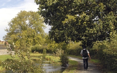
The Wye Valley Walk is suitable for most reasonably fit walkers. The route is not a mountain trail: there are no exposed ridges requiring specialist navigation, no technical terrain, and the waymarking is reliable throughout. Good walking boots, waterproofs and basic map-reading ability are all you need for the majority of the route.
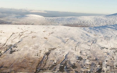
That said, the walk is not without its demands. The early upland stages on Plynlimon involve open moorland, potentially boggy ground, limited shelter and real remoteness. The route crosses some steep riverside paths in the Wye Valley National Landscape, and sections can be slippery after rain. Walking alone in the upland sections is not recommended without informing someone of your plans and knowing how to use a map and compass.
Dog walkers are welcome, though the route crosses considerable stretches of farmland with livestock. Dogs should be kept on a lead through fields of sheep and cattle, and some stiles may require lifting smaller dogs over. The guidebook notes that much work has been done to replace stiles with gates, but be prepared for some exceptions.
How difficult is the Wye Valley Walk?
The route is rated moderate overall. The terrain varies significantly between sections: Stages 1 to 5 cross upland moorland in Mid Wales, with the most sustained ascent of the walk; Stages 6 to 11 follow the gentler Herefordshire Plain; and Stages 12 to 17 through the Wye Valley National Landscape involve more climbing than the middle section suggests, with steep paths above the limestone gorges.
Stages 1 and 2 are the most demanding, covering exposed upland ground with limited facilities. Stage 16 (Monmouth to Tintern) involves 400m of ascent in 18.7km and is physically testing despite being near the end of the walk. Stage 17 (Tintern to Chepstow) climbs high above the river to reach the Eagle's Nest viewpoint and the paths of the Piercefield estate before the final descent to Chepstow, making for a memorable but strenuous finish.
High water alternative routes are provided in the guidebook for sections prone to flooding, particularly relevant in winter and early spring when the Wye regularly overflows its banks. Checking river levels before setting out is recommended at riverlevels.uk.
Can I walk the Wye Valley Walk in sections?
Yes, and the route lends itself well to this approach. The guidebook notes that walkers often split the walk into several trips tied to railway stations, and the most natural breaks are:
- Prologue to Builth Wells (Stages 1 to 5): nearest stations at Caersws (Prologue start) and Builth Road or Cilmeri (near Builth Wells)
- Builth Wells to Hereford (Stages 5 to 11): Hereford has direct rail connections on the Welsh Marches Line
- Hereford to Chepstow (Stages 11 to 17): Chepstow station on the Gloucester to Newport line
The guidebook also includes suggested itineraries of 8, 11, 13 and 18 days, making it straightforward to tailor the route to available time. Alternatively, walkers based in the region often complete single stages at a time using local buses, which serve most towns and villages on the route.
Which direction should I walk the Wye Valley Walk?
The guidebook is written north to south, from source to sea, and most walkers choose this direction. Following the river downstream feels natural, and finishing at Chepstow means arriving at a town with a railway station, pubs and restaurants, rather than a remote forestry car park. There is no practical obstacle to walking south to north if preferred, but the logistics of reaching and leaving the remote start point at Rhyd-y-benwch are worth thinking through in advance.
When is the best time to walk the Wye Valley Walk?
The walk is accessible year-round, but conditions vary considerably by season and by section.
- Spring (April to May): the valley sections are at their finest, with bluebells, wild garlic and cider orchards in blossom. The upland sections may still be wet after winter, but the long days and mild temperatures make this one of the best times to walk. The Hay Festival at the end of May fills local accommodation across a wide radius.
- Summer (June to August): long days and reliable weather, with wildflower meadows and skylarks on the upland sections. The popular Wye Valley National Landscape sections can be busy at weekends. Carry water on hot days, particularly between Hay-on-Wye and Hereford where refreshment stops can be sparse.
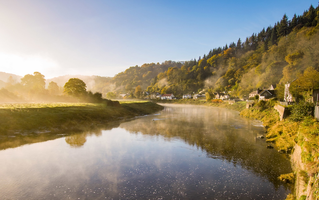
- Autumn (September to October): arguably the finest conditions. The ancient woodlands between Monmouth and Chepstow turn orange and gold, and the atmospheric river mist known locally as "dragon's breath" forms on still autumn mornings when the water is warmer than the air. September is the sweet spot: quieter than summer, still warm enough for comfortable walking.
- Winter (November to March): frosty mornings and clear views reward those willing to walk in shorter days. The valley sections from Hereford southward are walkable in most conditions, but the upland moorland can be snow-covered, and flooding is a genuine risk on riverside sections. Check the Wye River levels before setting out.
What accommodation is available on the Wye Valley Walk?
Accommodation along the route ranges from shepherd's huts in apple orchards to a castle youth hostel at St Briavels and a Michelin-starred restaurant with rooms near Whitebrook, five minutes off the path. Two YHA hostels sit on the route, at Welsh Bicknor and St Briavels. B&Bs and small hotels are available throughout, and most are accustomed to walkers arriving tired, wet and muddy.
Booking well in advance is strongly recommended, particularly for popular sections and during events. The Hay Festival (end of May) and the Royal Welsh Show (July) fill accommodation within a 40km radius of those towns. Some B&B owners will collect walkers from the route and drop them back the following morning, which significantly expands the options beyond those directly on the path.
There is no camping at regular intervals along the route, as wild camping is not permitted in England and Wales. Campsites are not always conveniently located at stage ends, so walkers planning to camp should check the guidebook's Stage Facilities Planner carefully before committing to a camping itinerary. Baggage transfer services operate along the route. Full details are in Appendix B and at wyevalleywalk.org.
Getting to and from the Wye Valley Walk
Getting to the start: There is no public transport directly to the start of the walk at Rhyd-y-benwch. The nearest town is Llanidloes, 13km away. Most walkers arrange a taxi from Llanidloes (the guidebook notes local taxi companies), a drop-off from friends, or walk the waymarked Severn Way from Llanidloes to Rhyd-y-benwch as the Prologue stage. Llanidloes is served by buses connecting to the railway stations at Caersws and Newtown on the Cambrian Line.
Leaving the finish: Chepstow has a railway station on the Gloucester to Newport line, making it straightforward to reach Bristol or Cardiff. The town has pubs, restaurants and accommodation for a celebratory night before travelling home.
Along the route: Railway stations at Builth Road or Cilmeri (Heart of Wales Line), and Hereford (Welsh Marches Line) allow walkers to exit or rejoin the route at natural halfway points. Buses serve most towns on the route, though services can be minimal in rural areas and may not run on Sundays.
The nearest airports are Liverpool, Birmingham and Manchester for the northern start, and Bristol and Cardiff for the southern finish.
What are the highlights of the Wye Valley Walk?
The walk moves through several distinct sections, each with its own character:
- Plynlimon and the upper Wye (Stages 1 to 2): wide open skies, boggy moorland and the first sight of the Wye as a tiny stream falling over rocky cascades. Red kite, buzzard and peregrine falcon are regular companions.
- The Welsh market towns (Stages 3 to 5): Rhayader and Builth Wells offer welcoming stops, with views to the Black Mountains opening up near Erwood.
- Hay-on-Wye (Stage 7 to 8): the world-famous "town of books" marks the crossing into England. The local festival and famous secondhand bookshops merit a rest day.
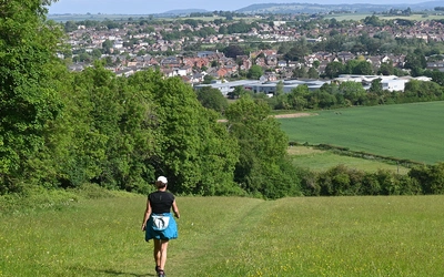
- The Herefordshire Plain (Stages 9 to 11): cider orchards, Hereford cattle and rolling red-earthed farmland lead to Hereford, with its 11th-century cathedral, the 800-year-old Mappa Mundi and a relaxed city centre to explore.
- The Wye Valley National Landscape (Stages 12 to 17): the 85km finale through limestone gorges, ancient woodland, Iron Age hillforts, Goodrich Castle, Symonds Yat Rock and Tintern Abbey. This section consistently draws the most praise from walkers completing the route.
What is the state of the River Wye?
The River Wye holds remarkable conservation designations: it is a Special Area of Conservation and the first major river in the UK to be designated a Site of Special Scientific Interest along its entire length. In 2010 it was voted the nation's favourite river. By 2023, however, local communities, wildlife organisations and national media were all raising serious concerns about its decline.
Salmon catches on the Wye have fallen by 94 per cent and the species is now on the IUCN Red List of Threatened Species. Water crowfoot, a key indicator of river health, has declined by 90 per cent. In May 2023, Natural England downgraded the river's SSSI status from "unfavourable recovering" to "unfavourable declining," citing falls in Atlantic salmon, aquatic plants and native white-clawed crayfish. The causes are complex: farm intensification, proliferation of poultry sheds, sewage discharges, higher temperatures and increased flooding events all play a role across a catchment that extends well beyond the protected National Landscape area.
There is reason for cautious optimism. Local campaigners have brought the river's condition into national public debate, and concerted collaborative action to restore the Wye catchment has begun. Walkers on the route will still find a beautiful and varied river: the problem is real, but the Wye has not stopped being worth walking. The guidebook addresses the issue honestly, and includes sections on wildlife and nature recovery, reintroductions of pine martens and beavers, and the ongoing work of the Wye Valley National Landscape team.
The Cicerone Wye Valley Walk guidebook by Ruth Waycott contains everything you need to plan and complete the route, from the remote uplands of Plynlimon to the tidal estuary at Chepstow. The 2nd edition (2024) includes:
- Full stage-by-stage route descriptions for all 17 stages and the Prologue
- OS mapping at 1:50,000 showing a corridor either side of the route
- A Stage Facilities Planner covering accommodation and refreshment options at every stage
- Suggested itineraries of 8, 11, 13 and 18 days to suit different paces and time available
- High water alternative routes for sections prone to flooding
- Downloadable GPX tracks for all stages
- Appendices covering accommodation, walking holiday companies, baggage transfer, passport stamping locations and useful contacts
Buy the Wye Valley Walk guidebook from Cicerone. Available as a printed guidebook (£16.95) or digital eBook (£16.95).
The Wye Valley Walk
From Plynlimon to Chepstow
£16.95
The Wye Valley Walk follows the River Wye for 219km (136 miles) through the beautiful and varied landscape of the Welsh borders. Typically taking 10 days to walk, the route starts at the river's source on Plynlimon and follows the Wye valley to Chepstow. The Wye Valley Walk is a perfect mix of river and hill walking, suitable for any reasonably fit walker.
More informationAbout Ruth Waycott, guidebook author
The Wye Valley Walk guidebook is written by Ruth Waycott on behalf of the Wye Valley Walk Partnership. Ruth has lived in the Wye Valley and walked its paths for nearly forty years. After two decades working in tourism and interpretation on both sides of the Wales-England border, she now works for the Wye Valley National Landscape team. She is the author of several books on the valley, including Overlooking the Wye, and regularly leads walks for local festivals and community groups. She loves introducing visitors to the stories and special places of the Wye.