Walking in the Brecon Beacons: a complete planning guide
Situated in an unspoilt area of South Wales, just north of the former coal-mining valleys, the Brecon Beacons National Park (Bannau Brycheiniog) is a place of beautiful and diverse landscapes. One of three national parks in Wales, more than half of its 519 square miles are over 1000ft above sea level and it boasts a rich mixture of majestic valleys, dramatic waterfalls and high mountain peaks and ridges. Whether you're after a classic ascent of Pen y Fan, a waterfall-hopping ramble through the gorges of Fforest Fawr or a remote wilderness day in the Black Mountain, walking in the Brecon Beacons rewards visitors of every level with some of the finest scenery in Britain. (Last updated: April 2026 · Guidebook edition: 3rd edition, April 2022)
Brecon Beacons quick facts:
- Location: Brecon Beacons National Park (Bannau Brycheiniog), South Wales, UK
- Total routes: 45 circular day walks (Walk 26 is there-and-back)
- Distance range: approximately 4 to 24km (3 to 15 miles) per walk
- Typical duration: 2 to 8+ hours depending on walk length and grade
- Difficulty: Grade 1 (easy) to Grade 4 (long mountain wilderness)
- Terrain: Valleys, ridges, waterfalls, wooded gorges and open mountain summits
- Highest point: Pen y Fan, 886m (2907ft)
- Navigation: Step-by-step descriptions, 1:50,000 OS mapping and GPX downloads included
- Maps required: OS Explorer OL12 (Western), OL11 (Central), OL13 (Eastern)
- Best season: Year-round; spring and autumn are ideal; winter conditions on high ground can be serious
- Guidebook:Walking in the Brecon Beacons by Andy Davies and David Whittaker
Walking in the Brecon Beacons
45 circular walks in the National Park
£14.95
Guidebook to 45 circular day walks in Wales' Brecon Beacons National Park. Exploring areas including Fforest Fawr, the Black Mountains and Waterfall Country, these walks cover both mountain and valley routes and visit classic ridges, dramatic waterfalls, wooded gorges and upland valleys.
More informationWhat is Walking in the Brecon Beacons?
Walking in the Brecon Beacons is a Cicerone guidebook presenting 45 circular day walks across all four geographic areas of the national park: Mynydd Du (the Black Mountain), Fforest Fawr (the Great Forest), the Brecon Beacons massif and Y Mynyddoedd Duon (the Black Mountains). The routes range from gentle valley rambles suitable for families to demanding mountain days on exposed ridges.
A striking feature of the park is the number of varied walks available in a relatively small area, meaning you don't have to travel great distances to sample entirely different landscapes. The routes in this guide mainly take you to wooded gorges and upland valleys that even locals may be unaware of, and they avoid stretches of road wherever possible.
How the park divides: the four areas
The park falls naturally into four geographic areas, each with its own distinct character.
Mynydd Du (the Black Mountain) occupies the western edge of the park and contains some of the remotest upland wilderness in England and Wales. The Carmarthen Fans rise sharply from glacial lakes and empty moorland stretches in every direction. This is the area to choose when you really want to get away from it all.
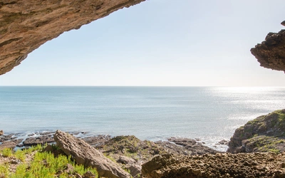
Fforest Fawr (the Great Forest) is a former royal hunting ground that combines upland walks with deeply incised river gorges and waterfalls to rival any in the UK. The waterfalls of the Mellte, Hepste and Nedd Fechan valleys are the highlight of this area, and Waterfall Country can keep a walker happily occupied for several days.
The Brecon Beacons are the highest summits in the park, with Pen y Fan falling just short of the 3000ft threshold at 886m. The distinctive flat-topped ridges of Pen y Fan, Corn Du, Cribyn and Fan y Big are formed from regularly bedded Brownstones and capped by isolated outliers of Plateau Beds. Although this area lacks the challenges of the narrow rocky ridges of the Lake District and Snowdonia, it provides opportunities for a real mountain expedition in exciting winter conditions.
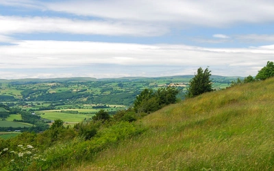
Y Mynyddoedd Duon (the Black Mountains) sit on the English border and have a softer feel without the coarse and rugged Welshness of Mynydd Du. Long, smooth ridges run roughly north to south, separated by quiet valleys, with Waun Fach (811m) the highest point. Llanthony Priory, the Sugar Loaf and Pen Cerrig-calch all feature among the routes here.
The 45 routes at a glance
The guidebook organises its routes across seven sections:
Section 1: North-eastern valleys and ridges (Walks 1 to 11) The classic Beacons area, with routes ascending Pen y Fan and Corn Du from Cwm Llwch, Cwm Sere and Cwm Cynwyn, as well as quieter circuit walks in Cwm Oergwm and around Gist Wen.
Section 2: Eastern valleys and ridges (Walks 12 to 16) Less-visited ground around Blaen-y-glyn, Craig y Fan Ddu and the Torpantau circuit, offering excellent ridge walking and fine views to the Usk Valley.
Section 3: South-western valleys and ridges (Walks 17 to 20) Approaches to Pen y Fan and Corn Du from the south, including the Neuadd Horseshoe combining three summits in a single day and the popular Pont ar Daf route.
Section 4: Fforest Fawr (Walks 21 to 25) Routes around Craig Cerrig-gleisiad nature reserve, Fan Fawr, Fan Frynych, Fan Llia and Fan Nedd, exploring the wilder and less-visited western plateau of the national park.
Section 5: Waterfall Country (Walks 26 to 30) The waterfalls of the Mellte, Hepste and Nedd Fechan rivers, including the spectacular walk behind Sgwd yr Eira waterfall and the Elidir Trail to Sgwd Gwladus and Sgwd Ddwli.
Section 6: The Black Mountain / Mynydd Du (Walks 31 to 39) The wildest and most remote section, taking in the Carmarthen Fans, glacial cwms, Carreg Cennen castle and the limestone upland around Cribarth.
Section 7: The Black Mountains / Y Mynyddoedd Duon (Walks 40 to 45) Ridge and valley routes in the eastern park, including the Sugar Loaf, Llanthony Priory, Lord Hereford's Knob and the Offa's Dyke Path.
How difficult is walking in the Brecon Beacons?
The guide uses a four-grade system to help walkers choose routes matched to their ability and the prevailing conditions.
Grade 1 routes are easy and short low-level walks with easy navigation, suitable for all walkers including families with children.
Grade 2 routes are easy but more demanding in terms of length and total ascent, with obvious route finding on mostly clear paths. A reasonable level of fitness is preferable.
Grade 3 routes are mountainous with possible strenuous ascents but easy route finding overall.
Grade 4 routes are long mountainous walks with possible strenuous ascents in a wilderness area, where navigation skills and a higher level of fitness are needed.
The Appendix A route summary table lists the grade, distance, total ascent and maximum elevation of every walk, making it straightforward to choose a route suited to the weather, your fitness and the time available.
What is the terrain like?
The rocks that shape the park belong to the Old Red Sandstone, deposited some 395 to 345 million years ago. The steep craggy slopes of the main Beacons ridges are formed from regularly bedded Brownstones, while the summits of Corn Du and Pen y Fan are capped by an isolated outlier of massively bedded Plateau Beds. This geology gives the park its characteristic stepped escarpments: the main scarp falls steeply from the summit plateau, flattens at around 540 to 600m on a secondary shelf, and then steepens again on the lower slopes cut in the Senni Beds.
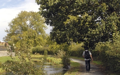
The valleys were originally cut by rivers into V-shapes, then remodelled by glaciers into the U-shaped cwms that define the Beacons landscape today. Many of the higher cwms still hold small lakes. The high ridges offer fast, open walking on grass and short heath, while the valley approaches involve a mixture of tracks, field paths and forest edges. Waterfall Country is notably different: narrow gorge paths with tree roots and slippery rock steps require care, especially after rain.
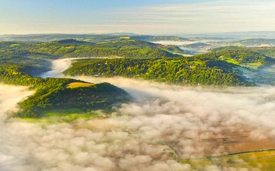
Conditions on the high ground can change rapidly at any time of year. In winter, ice and snow on the ridges call for appropriate footwear and, on the steeper slopes, ice axe and crampons. The park is renowned for attracting cloud when surrounding lowlands remain clear, and mist can descend quickly on the tops. Carrying a map, compass and the skills to use them is essential for any mountain walk.
Wildlife and natural history
Ravens, buzzards and red kites are numerous throughout the park and are constant companions on any walk into the hills. Red kites were once persecuted almost to extinction; a small population survived in Mid Wales, and a recovery programme begun in 1989 has successfully extended their range across the UK.
Curlews nest among the rushes of higher streams, dunlins breed among eroding peat hags at their most southerly breeding limit in the world, and golden plovers are another true wader of mountain moorland. Skylarks are constant companions in spring and summer on grassy uplands. Red and black grouse may be disturbed on open moorland such as Waun Llysiog.
Woodland birds include the pied flycatcher, nuthatch, redstart, treecreeper and all three species of woodpecker. Dippers and grey wagtails frequent the fast-flowing rivers of Waterfall Country, and goosanders and breeding dippers are among the birds of the Waterfall Country rivers.
Arctic-alpine plants survive on the steep cliffs of Craig Cerrig-gleisiad and on Pen y Fan, where grazing sheep cannot reach and altitude keeps temperatures low. These are already at their most southerly limit and are particularly vulnerable to climate change.
Brecon Beacons geology and history in brief
The park's rocks were laid down by rivers crossing an ancient desert plain, south of the equator, during the Devonian Period. By the time Europe drifted north and crossed the equator, the semi-arid floodplains were gradually submerged beneath tropical Carboniferous seas, and the resulting tilt of the rock strata creates the characteristic south-facing escarpments of the Beacons today.
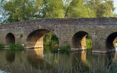
The area has been settled since Mesolithic times (around 6000 BC). Bronze Age cairn burial mounds crown the summits of Mynydd Du and Fforest Fawr, and Iron Age hill forts cluster in the Usk Valley. The Romans built a network of permanent forts linked by roads such as Sarn Helen, which still threads through the park. Norman castles followed at Brecon, Tretower, Crickhowell and elsewhere after the invasion of 1088. The limestone pavements of the western park bear the remains of more than 171 disused lime kilns, and the valleys of the Mellte and Sychryd once hosted gunpowder manufacture and silica mining for industrial furnace linings.
Getting to the Brecon Beacons
The Brecon Beacons National Park is within easy day-trip distance of Swansea, Cardiff, Bristol and the Midlands, and is around 200km (120 miles) from London. Cardiff International Airport is just over an hour from the park by road.
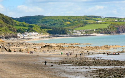
The main towns that make good bases for a walking holiday are Brecon, Crickhowell and Abergavenny, all of which lie in the picturesque Usk Valley. Llandovery on the western edge is a good base for Mynydd Du routes. Picturesque market towns including Hay-on-Wye lie just outside the park boundary.
In summer, the Beacons Bus service offers a car-free day in the mountains on Sundays and Bank Holidays from May to September, running from many places in South Wales and Herefordshire.
For accommodation ranging from grand country hotels to secluded campsites, and for up-to-date tourist information, visit the Brecon Beacons National Park website.
Maps and navigation
Three OS Explorer maps at 1:25,000 cover the park:
- OL12 Western area (Mynydd Du and western Fforest Fawr)
- OL11 Central area (Brecon Beacons massif and central Fforest Fawr)
- OL13 Eastern area (Black Mountains and eastern Beacons)
Note that place-name spellings may vary slightly between different maps.
The guidebook illustrates every route with extracts from 1:50,000 OS maps, with the main route marked in orange, alternative routes in blue and extensions in green.
GPX tracks for all 45 routes are available to download free at www.cicerone.co.uk/1089/GPX. If you did not buy the book through the Cicerone website, register your purchase in your Cicerone library to access GPX files and update information.
Plan your walk with the Cicerone guidebook
The Cicerone Walking in the Brecon Beacons guidebook, written by Andy Davies and David Whittaker and now in its third edition (April 2022), provides everything you need to explore the national park with confidence:
- 45 circular day walk descriptions across all four areas of the park
- Step-by-step route descriptions with 1:50,000 OS mapping for every walk
- Route summary table listing distance, total ascent, grade and maximum elevation for all walks
- Routes by interest appendix to help you choose walks by theme
- Difficulty grading from Grade 1 (easy valley walks) to Grade 4 (long mountain wilderness routes)
- Geology, wildlife, history and land-use commentary throughout
- Brief Welsh-English glossary to help with place names and terminology
- Useful contacts appendix including the national park authority and local tourist information
- Downloadable GPX files at cicerone.co.uk/1089
Available as a printed guidebook (£14.95) or digital eBook (£14.95).
Walking in the Brecon Beacons
45 circular walks in the National Park
£14.95
Guidebook to 45 circular day walks in Wales' Brecon Beacons National Park. Exploring areas including Fforest Fawr, the Black Mountains and Waterfall Country, these walks cover both mountain and valley routes and visit classic ridges, dramatic waterfalls, wooded gorges and upland valleys.
More informationAbout the authors
Andy Davies has been a professional photographer for over 20 years, specialising in wildlife and landscape photography. He moved to West Wales in 1999 and wrote and photographed Coastline Wales in 2008. He regularly takes his cameras underwater, specialises in high-definition timelapse video and pursues wildlife fine art photography. A former university lecturer, he combines photography and teaching in a series of workshops in West Wales and is an external tutor for Aberystwyth University in outdoor and wildlife photography. Andy also works for Aqua-Firma Worldwide as a marine nature conservation and photographic consultant and guide.
David Whittaker began walking and climbing in the mountains of Britain many years ago and has climbed most of the higher summits in England, Wales and Scotland, along with rock and winter climbs throughout the UK. He has trekked and climbed in the European Alps, Nepal, Tibet, Ladakh, New Zealand, Ecuador and Patagonia, and has walked and photographed the Brecon Beacons over the past fifty years. He led a unit of Forensic Dentistry at the University of Wales College of Medicine and is currently Emeritus Professor at Cardiff University. In 2003 he was appointed OBE for his work.