Walking the Severn Way: a complete planning guide
The River Severn pulls together threads of history, trade, commerce, civil war and the lives of ordinary folk to produce a tapestry that is finely woven and rich in colour. Tracing its course from the mist-shrouded bog of Plynlimon to the wide tidal waters of Severn Beach is a journey of 215 miles (344km) through five counties, taking most walkers three weeks to complete. It is a route that builds steadily, from the demanding mountain terrain of mid-Wales to the easy riverbank walking of the English lowlands, gathering pace, history and character with every mile. (Last updated: May 2026 · Guidebook edition: 3rd edition, May 2023)
The Severn Way quick facts:
- Distance: 344km / 215 miles (source to Severn Beach); optional Bristol Link adds a further 23.8km / 15 miles
- Duration: 3 weeks (22 stages); the route lends itself well to multi-visit itineraries
- Start: Rhyd-y-benwch car park, near Llanidloes, Powys (or variant start from Eisteddfa Gurig via Plynlimon)
- Finish: Severn Beach, South Gloucestershire (Bristol Link continues to Bristol city centre)
- Stages: 22 official stages, plus a variant start and optional Bristol Link
- High point: Plynlimon Fawr, 752m, on the optional variant start
- Difficulty: Moderate; demanding in the first three stages, easier thereafter
- Terrain: Riverside paths, moorland, agricultural pasture, canal towpaths, wooded gorges and tidal estuary
- Waymark: Severn Way waymark posts
- Accommodation: B&Bs, inns, hotels and campsites throughout; key hubs include Llanidloes, Welshpool, Shrewsbury, Worcester, Tewkesbury and Gloucester
- Best season: May to September
- Guidebook:Walking the Severn Way by Terry Marsh, 3rd edition (Cicerone)
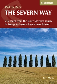
Walking the Severn Way
215 miles from the River Severn's source in Powys to Severn Beach near Bristol
£16.95
Guidebook to walking the Severn Way, a 215 mile (344km) walk through the Welsh borders. Beginning near the source of the River Severn in Powys, mid-Wales, and finishing in Bristol, the history-rich route is described over 22 stages (ranging from 3 to 14 miles), passing through the counties of Powys, Shropshire, Worcestershire and Gloucestershire.
More information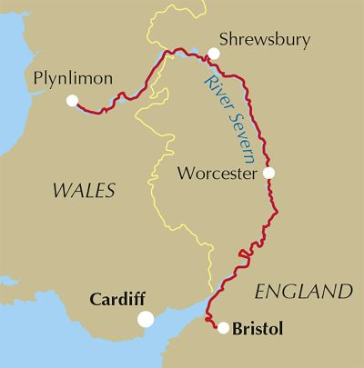
What is the Severn Way?
The Severn Way is a long-distance walking route that follows the course of the River Severn, the longest river in the UK, from its source on the Plynlimon plateau in mid-Wales to the Bristol Channel at Severn Beach in South Gloucestershire. The route passes through five counties: Powys, Shropshire, Worcestershire, Gloucestershire and South Gloucestershire, with an optional extension along the Bristol Link to the city centre. It is one of Britain's most geographically varied long-distance routes, offering the rare experience of following a single river from its tentative beginnings in remote upland bog to its wide tidal estuary.
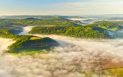
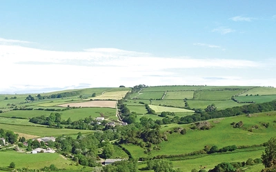
The landscape changes dramatically as the route progresses southwards. The early stages cross the demanding terrain of the Cambrian Mountains and the Hafren Forest, where the river is young and turbulent. By Shropshire, it has become a broad meandering watercourse cutting through floodplains lined with alder and willow. The famous Iron Bridge gorge marks a striking transition, and from there the character eases through well-wooded landscapes towards Bewdley, Worcester and eventually the flat, bird-rich grazing marshes near Slimbridge and Frampton-on-Severn. Beyond Gloucester, the river becomes tidal, with the second-highest tidal range in the world.
The Severn Way also carries considerable historical weight. The route passes through Shrewsbury, a town shaped by the Civil War; through Ironbridge, birthplace of the Industrial Revolution; through Worcester and Gloucester, cathedral cities with layers of Roman, medieval and Georgian history. The river itself was a working highway for centuries, and the bridges, ferries and weirs encountered along the way tell that story vividly. This planning guide answers the most common questions walkers have before setting out. For complete stage-by-stage route descriptions and mapping, see the Cicerone Walking the Severn Way guidebook.
How long is the Severn Way? What are its stages?
The Severn Way covers 344km (215 miles) in 22 stages, with a total ascent of 2740m (8985ft) and descent of 3340m (11,000ft). Despite following a river, the route is far from flat: the opening stages involve significant climbing, and even the gentler southern sections accumulate height in small undulations throughout. The optional Bristol Link adds a further 23.8km (15 miles).
| Stage | Distance | Ascent | Descent |
|---|---|---|---|
| Powys | |||
| 1: Rhyd-y-benwch to the source | 5.5km (3½ miles) | 340m (1120ft) | 65m (210ft) |
| Variant: Eisteddfa Gurig to source via Plynlimon | 8.9km (5½ miles) | 420m (1380ft) | 250m (815ft) |
| 2: Source to Llanidloes | 18.3km (11½ miles) | 295m (960ft) | 730m (2390ft) |
| 3: Llanidloes to Caersws | 15.5km (9¾ miles) | 330m (1080ft) | 375m (1230ft) |
| 4: Caersws to Newtown | 13.5km (8½ miles) | 325m (1070ft) | 345m (1130ft) |
| 5: Newtown to Welshpool | 23km (14½ miles) | 120m (400ft) | 150m (500ft) |
| 6: Welshpool to Crew Green | 18.3km (11½ miles) | 45m (140ft) | 60m (200ft) |
| Shropshire | |||
| 7: Crew Green to Montford Bridge | 13.9km (8¾ miles) | 70m (230ft) | 70m (230ft) |
| 8: Montford Bridge to Shrewsbury | 10.8km (6¾ miles) | 100m (320ft) | 105m (340ft) |
| 9: Shrewsbury to Atcham | 12.3km (7¾ miles) | 60m (200ft) | 70m (220ft) |
| 10: Atcham to Ironbridge | 19km (12 miles) | 225m (750ft) | 200m (660ft) |
| 11: Ironbridge to Bridgnorth | 14.8km (9¼ miles) | 205m (680ft) | 235m (770ft) |
| 12: Bridgnorth to Upper Arley | 16.5km (10¼ miles) | 165m (550ft) | 180m (600ft) |
| Worcestershire | |||
| 13: Upper Arley to Stourport-on-Severn | 11.9km (7½ miles) | 135m (440ft) | 140m (460ft) |
| 14: Stourport-on-Severn to Worcester | 20.5km (12¾ miles) | 160m (520ft) | 165m (540ft) |
| 15: Worcester to Upton-upon-Severn | 19.3km (12 miles) | 110m (370ft) | 110m (370ft) |
| 16: Upton-upon-Severn to Tewkesbury | 11km (7 miles) | 25m (90ft) | 25m (90ft) |
| Gloucestershire | |||
| 17: Tewkesbury to Gloucester Docks | 21.6km (13½ miles) | 125m (410ft) | 125m (410ft) |
| 18: Gloucester Docks to Upper Framilode | 21km (13 miles) | 50m (165ft) | 55m (180ft) |
| 19: Upper Framilode to Frampton-on-Severn | 14.6km (9 miles) | 50m (165ft) | 45m (150ft) |
| 20: Frampton-on-Severn to Sharpness | 14.4km (9 miles) | 50m (165ft) | 55m (180ft) |
| 21: Sharpness to Oldbury-on-Severn | 15.5km (9¾ miles) | 35m (120ft) | 40m (140ft) |
| 22: Oldbury-on-Severn to Severn Beach | 13km (8 miles) | 65m (210ft) | 70m (220ft) |
| Total: The Severn Way | 344.2km (215½ miles) | 2740m (8985ft) | 3341m (10963ft) |
| Bristol Link: Severn Beach to Bristol | 23.8km (15 miles) | 260m (850ft) | 250m (820ft) |
The most demanding stage is Stage 2, descending 730m (2390ft) from the source to Llanidloes. Stage 5 (Newtown to Welshpool) is the longest at 23km (14½ miles). Once the first three stages are behind you, the route's prevailing character becomes one of level walking through river valley landscapes.
Who is the Severn Way suitable for?
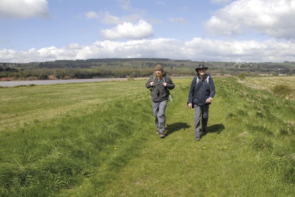
The Severn Way is suitable for fit and experienced walkers who are comfortable with multi-day walking and carrying a pack. The opening stages cross genuine mountain terrain and require appropriate clothing, footwear and navigational ability, particularly in poor weather. Anyone who has not previously done rough walking or carried a heavy pack should build up gradually before attempting the route.
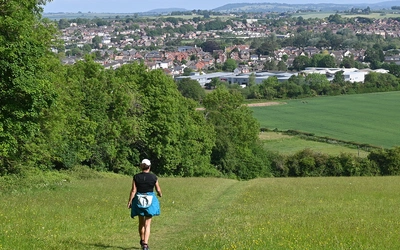
The southern stages of the Way, from Shropshire onwards, are accessible to a wider range of walkers. The terrain is easier, the waymarking more consistent, and the proximity of towns and villages means that shorter days can be planned with good transport access. Families with confident teenagers, and walkers returning to long-distance routes after a break, will find the Worcestershire and Gloucestershire stages particularly rewarding.
How difficult is the Severn Way?
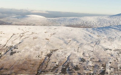
The route is best described as moderate overall, with a challenging opening section. The first three stages involve the most ascent and descent of the entire walk, and the summit approach to the source crosses open moorland with limited waymarking. Navigation skills and map-reading ability are required here. The variant start via Plynlimon Fawr (420m of ascent) is an additional option for strong walkers and adds a further dimension to an already demanding beginning.
From Llanidloes southwards, the difficulty eases considerably. The Powys stages between Llanidloes and the English border still involve undulating terrain with some tiring sections, but the general character becomes progressively easier as the river broadens and the route flattens. The one additional navigational note concerns the risk of flooding: sections north and south of Worcester can become slippery and difficult after flood events, particularly in winter and early spring.
Can I walk a shorter section of the Severn Way?
The Severn Way divides naturally into four county-based sections that work well as multi-day itineraries in their own right.
- Powys (Stages 1 to 6): Source to Crew Green, approximately 95km (59 miles). The most demanding and remote section, covering the Welsh stages of the walk. Start at Llanidloes (nearest station: Caersws) or the Rhyd-y-benwch car park.
- Shropshire (Stages 7 to 12): Crew Green to Upper Arley, approximately 87km (54 miles). Includes Shrewsbury and Ironbridge, with good rail and bus access throughout.
- Worcestershire (Stages 13 to 16): Upper Arley to Tewkesbury, approximately 63km (39 miles). Mostly easy river walking, passing through Worcester. The cities and large towns make logistics straightforward.
- Gloucestershire (Stages 17 to 22 plus Bristol Link): Tewkesbury to Severn Beach and Bristol, approximately 124km (77 miles). Tidal estuary and wetland walking, finishing at Severn Beach with an optional onward link to Bristol Temple Meads.
The guidebook was researched over four visits, and this four-section approach is explicitly recommended as a practical way to complete the route without rushing.
Which direction should I walk the Severn Way?
The Severn Way is described north to south, following the river's natural direction of flow from source to sea. This is the recommended direction and provides a satisfying sense of the river growing in scale and character as the walk progresses. Walking south also means working gradually from the demanding highland terrain of Plynlimon into the easier lowland stages, allowing fitness to build naturally.
Walking the route in reverse is possible logistically, but means beginning in the relative flatness of the estuary and finishing with the most challenging navigation on the upland stages. The guidebook is written for the north-to-south direction.
When is the best time to walk the Severn Way?
The Severn has a strong propensity to flood, and this shapes the timing of any walk along it more than on almost any other British long-distance route. The aftermath of flooding can leave stretches of sticky, glutinous mud strewn with river debris, particularly north and south of Worcester, and this can persist for some time after the waters have receded.
- May to September is the recommended window. Conditions are at their most reliable, the landscapes are at their most vibrant, and the upland stages are clear of any late-season snow risk.
- June and July offer the longest daylight hours, useful if tackling the longer stages or planning flexible daily distances.
- September is often a sweet spot: lower footfall, the risk of prolonged heat has passed, and the river valley landscapes take on early autumn colour.
- Winter and early spring bring a significantly higher flood risk and can make some sections very difficult. Sections near Worcester in particular may be impassable after significant rainfall events.
- Mountain weather affects the opening stages year-round. An intensely cold snap, even in summer, can make the moorland above the source genuinely serious. Always check the forecast before starting Stage 1 or the Plynlimon variant.
What accommodation is available on the Severn Way?
All the towns and villages used as stage start and finish points have some form of accommodation, ranging from inns and hotels to B&Bs and campsites. The key hub towns, where accommodation options are widest, are Llanidloes, Newtown, Welshpool, Shrewsbury, Bridgnorth, Stourport-on-Severn, Worcester, Tewkesbury, Gloucester and Bristol.
There is no single booking system or dedicated Severn Way accommodation guide. Careful planning is essential, particularly for the more rural stages in Powys where options are thinner on the ground. The guidebook's Appendix C lists facilities along the way, including accommodation, pubs and shops. County-level tourism websites can also help with searches for specific towns and villages.
One practical note from the guidebook: do not rely on map symbols as a guide to which pubs are currently open. A significant number have closed in recent years, and the route description notes which pubs are currently operating at each stage.
Getting to the start and back from the finish
The nearest railway station to the official start at Rhyd-y-benwch is Caersws, approximately a 20-minute bus ride from Llanidloes. The car park at Rhyd-y-benwch is 9.7km (6 miles) west of Llanidloes, and can also be reached via minor roads from the northern end of Llyn Clywedog.
For the variant start from Eisteddfa Gurig, access is by road from the A44.
At the finish in Severn Beach, the quickest return to Bristol is by train. Those who continue on the Bristol Link arrive at the city centre on foot, with Bristol Temple Meads offering direct rail services to London, Scotland, Wales, Manchester and Birmingham. National Express and Megabus coach services also operate from Bristol.
Public transport to and from the stage start and finish points is generally good throughout the route, though timing arrivals to coincide with infrequent rural services requires careful planning. Traveline (traveline.info) covers all the counties the route passes through, and each county council's transport pages are listed in the guidebook's Appendix B.
What are the highlights of the Severn Way?
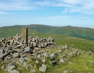
- The source of the Severn: An eerie, lonely place on the Plynlimon plateau, marked by a large post standing amid acres of sphagnum bog at an altitude of 610m (2001ft). A far cry from anything to come.
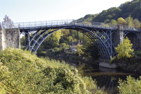
- Ironbridge Gorge: The river forces its way through the gorge with noticeable energy. The Iron Bridge itself, the world's first iron arch bridge, opened in 1779, is the route's most celebrated landmark.
- Shrewsbury: The Welsh Bridge, the English Bridge, the medieval street pattern and the Civil War connections make this one of the great walking towns in England.
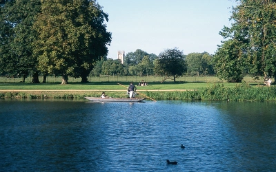
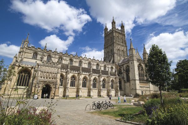
- Worcester and Gloucester: Two cathedral cities with deep river histories, passing through at natural break points in the journey.
- The Arlingham loop and Slimbridge: Around the great meanders south of Gloucester, large areas of sand are exposed at low tide and the grazing meadows near Slimbridge are internationally important for wintering wildfowl, including white-fronted geese.
- The final bridges: The two road bridges linking England and Wales at the southern end of the route are a dramatic signal that the end is near. The Severn Bridge (1966, now carrying the M48) and the Second Severn Crossing (1996, carrying the M4) taunt the weary walker before the official finish at Severn Beach.
Flooding on the Severn: what walkers need to know
Flooding on the Severn is not an occasional hazard but a regular feature of the route. In 1947, the river reached its highest recorded levels, cutting Shrewsbury off entirely; flood markers along the route remind walkers just how high the water can rise. The sight of caravans on stilts beside the river is noted in the guidebook as a regular, if slightly bizarre, feature of the landscape.
For walkers, the practical implications are twofold. First, the best months for the walk are May to September, when flooding is least likely. Second, even after floodwaters have subsided, sections of the route, particularly north and south of Worcester, may remain very difficult for some time due to deep, slippery mud and debris. Checking local conditions before setting out on any stage in the lower Powys and Worcestershire sections is always worthwhile after significant rainfall.
Plan your walk with the Cicerone guidebook
The Cicerone Walking the Severn Way guidebook by Dr Terry Marsh contains everything you need to plan and complete the route, from the source on Plynlimon to Severn Beach and beyond to Bristol. Now in its third edition (May 2023), the guidebook includes:
- Full route description across 22 stages, organised by county (Powys, Shropshire, Worcestershire, Gloucestershire)
- A variant start from Eisteddfa Gurig via Plynlimon Fawr for strong walkers wanting to take in the full mountain context of the source
- The Bristol Link, a 15-mile (23.8km) extension from Severn Beach into the heart of Bristol
- OS 1:50,000 mapping with route overlays for every stage
- Appendix A: full route summary table with distances, ascent and descent for every stage
- Appendix B: useful contacts including county transport and tourist information
- Appendix C: facilities along the Way, including accommodation, pubs, shops and services at key points
- Historical and geographical information woven into the route descriptions throughout
- GPX files available to download
Available as a printed guidebook (£16.95) or digital eBook (£16.95).
Walking the Severn Way
215 miles from the River Severn's source in Powys to Severn Beach near Bristol
£16.95
Guidebook to walking the Severn Way, a 215 mile (344km) walk through the Welsh borders. Beginning near the source of the River Severn in Powys, mid-Wales, and finishing in Bristol, the history-rich route is described over 22 stages (ranging from 3 to 14 miles), passing through the counties of Powys, Shropshire, Worcestershire and Gloucestershire.
More informationAbout Dr Terry Marsh, guidebook author:
Dr Terry Marsh is a Lancashire-born writer, photographer and historical geographer who has been writing guidebooks since the mid-1980s and is the author or revision editor of over 100 titles. He holds a Master of Arts degree with Distinction in Lake District Studies and a PhD in Historical Geography, and is a Life Member of the Outdoor Writers and Photographers Guild. His Cicerone guides include the award-winning Coast-to-Coast Path (first published 1993), The Shropshire Way and Great Mountain Days in the Pennines.