Trekking in the Indian Himalayas: a complete planning guide
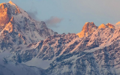
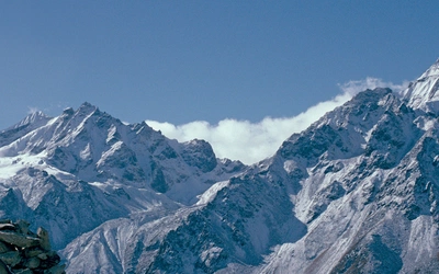
Uttarakhand is not somewhere you visit to tick something off a list. It is a region of deep river valleys, forested slopes, high bugyals (alpine meadows) and glaciated peaks where the mountains feel close enough to touch, and where environment, people and culture remain closely woven together. The eight treks in this guidebook range from 3 to 9 days and cover distances of 17 to 85km, taking in landscapes as varied as the snow-covered Kedarkantha summit, the sacred source of the Ganges at Gaumukh, and the remote glacier valleys of Kumaon. They are routes that reward your effort not only with extraordinary scenery but with an understanding of the landscapes you are moving through. (Last updated: June 2026 · Guidebook edition: First edition, October 2025)
Trekking in the Indian Himalayas, quick facts:
- Distance: 17–85km per trek
- Duration: 3–9 days per trek
- Stages: 3–9 stages per trek
- High point: 4313m (Tapovan, Trek 5)
- Difficulty: Easy to Moderate through to Moderate to Challenging
- Terrain: Alpine meadows, glacier-fed rivers, dense forests, high passes, rocky mountain trails, traditional villages
- Accommodation: Camping, homestays, government guesthouses and forest rest houses
- Best season: Late spring (April–early June) and autumn (mid-September–October); winter trekking possible on selected lower routes
- Permits: Required for most treks; Inner Line Permits needed for border-area routes
- Guides: Required for many treks, especially in national parks and border regions
- Guidebook:Trekking in the Indian Himalayas by Brian Furze, first edition 2025
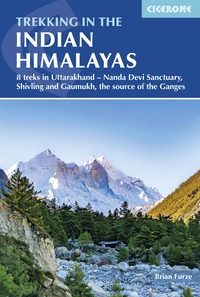
Trekking in the Indian Himalayas
8 treks in Uttarakhand - Nanda Devi Sanctuary, Shivling and Gaumukh, the source of the Ganges
£24.95
Guidebook to 8 treks in the Uttarakhand Himalaya, including the Nanda Devi Sanctuary, Shivling and the source of the Ganges. Ranging from 3 to 8 days, these guided trekking routes take in verdant valleys, alpine meadows, peaks, glaciers, holy sites and national parks, with the chance to see protected species such as snow leopard and musk deer.
More information
What is trekking in the Indian Himalayas?
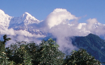
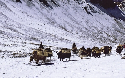
Trekking in the Indian Himalayas means trekking in Uttarakhand, a state in northern India often called the Abode of the Gods (Devbhumi) for the depth of its connections to Hindu and Sikh pilgrimage traditions. The eight routes in this guidebook cover the two main geographic regions of the Uttarakhand Himalaya: the Garhwal ranges in the west, home to iconic peaks like Shivling (6543m) and the Gangotri Glacier that feeds the sacred Ganges, and the Kumaon ranges in the east, where the long remote valleys leading to the Pindari and Milam glaciers pass through landscapes that were once busy Indo-Tibetan trading corridors.
What sets these treks apart from more established Himalayan destinations is the degree to which the landscape is still tied to everyday life. Villages along the routes are not geared around trekkers; they exist for other reasons, and that changes how you move through them. Pilgrimage routes intersect with trekking paths. Seasonal herding continues to shape how high-altitude meadows are used. Local guides and porters often have their own stories of these mountains, shaped by generations of connection to the land. As Brian Furze puts it in his introduction, trekking here is about moving in a landscape rather than simply through it.
Uttarakhand is also the right place for those who want genuine proximity to big Himalayan peaks without the logistics of a mountaineering expedition. Because the valleys are narrow in places, peaks like Nanda Devi (7816m), Dunagiri (7066m) and Kedarnath (6940m) feel extraordinarily close. From certain vantage points on the Nanda Devi trek, you stand on a ridge and the surrounding mountains press in on all sides in a way that is hard to convey and impossible to forget.
This planning guide answers the most common questions trekkers have before setting out for Uttarakhand. For complete stage-by-stage route descriptions and 1:75,000 mapping, see the Cicerone Trekking in the Indian Himalayas guidebook.
The 8 treks at a glance
The guidebook covers eight distinct treks across four mountain regions, ranging from a short 3-day high meadow route to a 9-day glacier journey. Every trek is described in full stages with route notes, elevation profiles and 1:75,000 mapping.
| Trek | Distance and duration | Ascent | Grade |
|---|---|---|---|
| 1 – Kedarkantha (circular from Sankri) | 17.2km over 4 days | 1830m | Easy to Moderate |
| 2 – Ruinsara Tal and Har ki Dun (circular from Taluka) | 60.7km over 6 days | 3315m | Moderate to Difficult |
| 3 – Dodital and Darwa Pass (circular from Agoda) | 39.3km over 3 days | 3325m | Moderate to Challenging |
| 4 – Dayara Bugyal (Raithal to Barsu) | 16.8km over 4 days | 1550m | Moderate |
| 5 – Tapovan and the Source of the Ganges (from Gangotri) | 38km over 5 days | 1615m | Moderate to Challenging |
| 6 – Nanda Devi Sanctuary and towards Dunagiri | 29.1km over 7 days | 2680m | Moderate |
| 7 – Pindari Glacier and Zero Point (from Loharkhet) | 62.2km over 7 days | 5275m | Moderate to Challenging |
| 8 – Milam Village and Milam Glacier (from Lilam) | 85.5km over 5–9 days | 5940m approx. | Moderate to Challenging |
The most technically demanding single stage is the approach to Tapovan via Gaumukh on Trek 5, which involves crossing the Gangotri Glacier and requires both a fit party and a competent guide. Trek 8 to Milam is the longest and most remote, following the old Indo-Tibetan trading route through the Johar Valley into Kumaon.
Who are these treks suitable for, and how difficult are they?
These treks are suitable for walkers with solid mountain experience who are prepared for high-altitude conditions. They are not technical climbs, but they are not casual walks either. The combination of altitude, remoteness and variable mountain weather means that experience, the right equipment and a qualified local guide are essential on most routes.
Trek 1 (Kedarkantha) is the most accessible, graded Easy to Moderate, and works as a genuine introduction to Himalayan trekking, including as a winter route when the slopes are snow-covered. Trek 4 (Dayara Bugyal) is also graded Moderate and offers high-meadow walking with panoramic views of the Gangotri range without the sustained altitude of the longer routes.
The Moderate to Challenging routes (Treks 3, 5, 7 and 8) involve higher elevations, longer daily stages and more demanding terrain. Trek 5 to Tapovan crosses the Gangotri Glacier. Trek 7 involves a cumulative ascent of 5275m over seven days to reach Pindari Glacier Zero Point at 3759m. Trek 8 to Milam Glacier is the longest and most remote, at 85.5km with approximately 5940m of ascent, and requires an Inner Line Permit because the route runs close to the Tibetan border.
Trekkers coming from an Alpine background will find the skills transferable, but should plan carefully for altitude. The guidebook recommends ascending no more than 300–500m per day above 2500m, with rest days built in for acclimatisation. Good fitness matters, but the ability to pace yourself and recognise early symptoms of altitude sickness matters more.

Do I need a guide?
In many cases, yes. Using a registered guide is legally required for treks in national parks, restricted border areas and certain high-altitude routes. This includes treks in Govind Pashu Vihar National Park, Gangotri National Park, Nanda Devi National Park and the border-area routes to Pindari and Milam glaciers.
Beyond the regulatory requirement, a local guide adds genuine value. A good guide will manage permits and logistics, set a safe pace, identify early signs of altitude sickness, and share stories of the landscapes and communities you are passing through. Many local guides have specialist knowledge of birds, plants or local history. Because guiding has become an important source of income for mountain communities in Uttarakhand, using a local guide or a commercial operator that employs locally is also a meaningful way of contributing to the communities whose landscapes you are visiting.
The guidebook provides detailed advice on the different guiding options, from independent trekking with local guides and small businesses to using the major commercial operators like India Hikes and Trek the Himalayas, as well as the state government agencies GMVN and KMVN.
When is the best time to trek in the Uttarakhand Himalayas?
The two main trekking seasons are late spring and autumn. Both offer stable conditions and clear mountain views.
- Spring (March–early June): Snow has cleared from most mid-altitude trails, temperatures are manageable and rhododendrons and wildflowers are at their best. Longer daylight hours allow more time on the trail. The most popular treks, including Kedarkantha and Dayara Bugyal, can be busy during this period. By late June, the monsoon begins to affect lower valleys.
- Monsoon (July–August): Heavy rainfall makes most high routes difficult and sometimes dangerous, with risks of landslides and washed-out trails. A small number of lower or sheltered routes are being developed for this season, but careful research and flexibility in plans are essential.
- Autumn (mid-September–October): Generally the best season for a first visit. The air is exceptionally clear after the monsoon, mountain views are at their finest and trails are quieter than in spring. Temperatures drop at higher altitude, but conditions are usually dry and stable. This is the sweet spot for most of the routes in the guidebook.
- Winter (December–February): Snow-covered landscapes and fewer trekkers create a quieter, more contained experience. Treks like Kedarkantha are specifically designed for winter and can be exceptional in clear weather. However, this season requires proper equipment, a competent guide and careful planning. Many higher routes are closed.
For most first-time visitors, mid-September to early October offers the best balance of reliable conditions, clear skies and manageable trail traffic.
What are the permits requirements for trekking in Uttarakhand?
Permit requirements for trekking in Uttarakhand are complex and subject to change, so checking the current situation at the time of planning is essential. The main permit types are:
- Inner Line Permits (ILP): Required for treks near the Tibetan border, including the Milam Glacier route (Trek 8) and Pindari Glacier (Trek 7). Obtainable through District Magistrate offices or through a registered trekking agency.
- Forest and National Park permits: Required for treks through Govind Pashu Vihar, Gangotri and Nanda Devi National Parks. Available at park entry points or district forest offices.
- High-altitude permits: Required for certain glacier and high-altitude routes including the Gaumukh–Tapovan approach.
Some permits are only issued through registered trekking agencies, which is another practical reason to use a local guide or operator. Carry original identification documents, passport photocopies and multiple passport-size photos; requirements can vary by route and season.

What accommodation is available on these treks?
Accommodation varies considerably depending on the route and its location.
In the main trekking centres (Sankri, Uttarkashi, Joshimath, Kathgodam and Munsyari), a range of hotels and guesthouses is available. Once you leave these centres, accommodation becomes simpler and more varied.
On most of the treks in this guidebook, you will be camping. Commercial operators typically provide tents, mats and sleeping bags at pre-established campsites; local guides may provide similar support depending on the arrangement you make with them. Brian Furze recommends confirming what is supplied and what you need to bring before you set out, and personally always carries his own sleeping bag and mat regardless.
In villages along the route, homestays are available on several treks, offering a bedroom, basic bathroom facilities and meals, typically dahl, rice, chapatti and vegetables. Electricity supply can be intermittent in remote villages. Some locations also have government guesthouses (Forest Rest Houses) providing simple hostel-type accommodation.
There is no tea-house trekking system comparable to Nepal along most of these routes. For most of the eight treks, full camping self-sufficiency or a supported guide arrangement is the realistic approach.
How do I get to the start of these treks?
The gateway to Uttarakhand from overseas is Indira Gandhi International Airport in Delhi. From Delhi, there are onward options by air, rail and road.
For the Garhwal treks (Treks 1–6), the main hubs are Dehradun (served by Jolly Grant Airport, rail connections and bus from Delhi), Rishikesh and Haridwar. From these centres, road travel continues to the trekking hubs of Uttarkashi, Joshimath and Sankri. Expect road journeys of six to eight hours or more from Dehradun to trailheads; mountain roads are slow and subject to landslips.
For the Kumaon treks (Treks 7–8), Kathgodam is the main railhead, accessible by train from Delhi. Road connections lead on to Almora, Bageshwar, Munsyari and Loharkhet. Pantnagar Airport provides an air option with limited services.
Commercial operators typically arrange shared vehicle transfers from a pick-up point in Dehradun or another gateway city; the cost is usually shared between the group. Independent trekkers can reach most trailheads by a combination of public bus and shared taxi, though this requires more planning. The guidebook includes detailed transport information for each trek.
What are the route highlights?
- Kedarkantha summit (Trek 1): A classic winter summit with wide views across the snow-covered Garhwal range from 3810m, accessible from Sankri in four days.
- Har ki Dun Valley and Ruinsara Tal (Trek 2): One of the most beautiful trekking valleys in Uttarakhand, ending at Ruinsara Tal lake at 3500m with views of Swargarohini, Bandarpunch and Black Peak.
- Dayara Bugyal (Trek 4): Classic high-meadow walking with the Gangotri Range as a continuous backdrop, at its most spectacular in late summer.
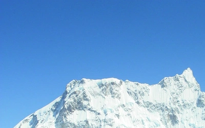
- Gaumukh and Shivling (Trek 5): The sacred source of the Ganges at the snout of the Gangotri Glacier, with Shivling (6543m) rising directly above the camp at Tapovan.
- Rishi Ganga Gorge and Nanda Devi (Trek 6): A ridge walk with Dunagiri pressing close on one side and views across the Rishi Ganga gorge toward the Nanda Devi Sanctuary on the other.
- Pindari and Milam glaciers (Treks 7–8): Two of the most accessible major glaciers in the Kumaon Himalaya, approached through long valleys with strong cultural and historical associations.

What role do spiritual and cultural traditions play on these routes?
Uttarakhand's mountains carry a depth of spiritual and cultural significance that shapes the trekking experience in ways that are hard to anticipate if you are coming from a purely landscape-focused tradition. The state is home to the Chota Char Dham pilgrimage circuit (Gangotri, Yamunotri, Kedarnath and Badrinath), which attracts millions of Hindu pilgrims each year, as well as Hemkund Sahib, one of the highest Sikh gurdwaras in the world. Several of the routes in this guidebook pass directly through or adjacent to these pilgrimage landscapes, and the presence of temples, offerings and fellow pilgrims is a constant part of the experience on routes like Tapovan (Trek 5).
Beyond the formal pilgrimage sites, local cultural traditions run through the everyday life of the villages you pass through. Sacred groves, known as devi bans, protect patches of forest as religious sanctuaries. Festivals marking the agricultural and pastoral calendar are tied to mountain ecology in ways that have supported conservation for generations. The Chipko movement, which began in Uttarakhand in 1973 when local women formed human chains around threatened trees to prevent commercial logging, is one of the most significant grassroots conservation movements in modern Indian history and grew directly from the relationship between communities and their mountain landscapes.
This cultural dimension is one of the things that distinguishes Uttarakhand from more visited Himalayan destinations. It is worth checking the dates of major Hindu and Sikh festivals before finalising travel plans: some periods bring large numbers of pilgrims to certain routes, while others offer quieter conditions. The guidebook covers the main considerations for each route.
Plan your trek with the Cicerone guidebook
The Cicerone Trekking in the Indian Himalayas by Brian Furze contains everything you need to plan and complete all eight routes, from your first research through to life on the trail.
- Eight treks described in full stage-by-stage detail with clear route notes, distance, ascent/descent and timing for each stage
- 1:75,000 mapping throughout, with elevation profiles for every route
- A route summary table with permit requirements, glacier crossings, guide requirements and difficulty grade for every trek at a glance
- Comprehensive planning chapters covering trekking seasons, transport from Delhi, permit types, types of guide and operator, food, accommodation and health and safety including altitude acclimatisation
- Background chapters on Uttarakhand's history, culture, languages, landscapes, plants and wildlife, and national parks and conservation areas
- Appendices covering additional treks and national parks, useful contacts, an English–Garhwali–Kumaoni–Hindi glossary, further reading and a full gear list
- GPX files available to download free at www.cicerone.co.uk/986/GPX
Available as a printed guidebook (£24.95) or digital eBook (£24.95).
Trekking in the Indian Himalayas
8 treks in Uttarakhand - Nanda Devi Sanctuary, Shivling and Gaumukh, the source of the Ganges
£24.95
Guidebook to 8 treks in the Uttarakhand Himalaya, including the Nanda Devi Sanctuary, Shivling and the source of the Ganges. Ranging from 3 to 8 days, these guided trekking routes take in verdant valleys, alpine meadows, peaks, glaciers, holy sites and national parks, with the chance to see protected species such as snow leopard and musk deer.
More informationAbout Brian Furze, guidebook author:
Brian Furze an educator and advocate for community-based trekking whose work has included the Indian Himalaya, particularly Uttarakhand, for many years. Through this, Brian promotes trekking that strengthens community resilience and fosters meaningful connections between visitors, local communities and place. For him, trekking is a form of mutual exchange, where local guides, porters, villagers and their landscapes are central to the experience of trekkers, not just peripheral or background. He continues to contribute to conversations about characteristics of ethical travel in high mountain regions that are facing significant change.
Brian lives in southeast Australia on the Murray River, within an hour of the Australian Alps. He discovered trekking more than 30 years ago, long enough ago to remember the sometimes painful experience of external frame backpacks, and has trekked in various locations, but continues to be particularly drawn to the Himalaya and the mountains and national parks of Australia.