Walking Ben Lawers, Rannoch and Atholl: a complete planning guide
Perthshire has a reputation for shortbread and nice cups of tea, but push back from the main street of Pitlochry and you'll find something altogether wilder. In the words of Ronald Turnbull, walk out from Blair Atholl, stay on the tops for four or five days, and when your feet next touch tarmac you're somewhere north of Aberdeen. These are jolly green giants: soft-edged, wildflower-rich, and absolutely not easy. From Ben Lawers and Schiehallion to the peat bogs of Rannoch Moor and the deep glens of Atholl, this is the hidden heart of the Highlands. Walking Ben Lawers, Rannoch and Atholl covers 80 routes ranging from 3km to 45km (2–28 miles) across the south-eastern Grampians, taking in 42 Munros, 22 Corbetts and 15 smaller hills. (Last updated: June 2026 · Guidebook edition: 2nd edition, August 2021)
Walking Ben Lawers, Rannoch and Atholl, quick facts:
- Location: Highland Perthshire, south-eastern Grampians
- Total routes: 80 (42 Munros, 22 Corbetts, 15 smaller hills, plus 2 historic passes)
- Distance range: 3–45km (2–28 miles) per route
- Typical duration: 1¼ to 13 hours
- Difficulty: Graded 1–5 on the Cicerone scale; routes for all abilities from easy riverside paths to remote high-level plateaus requiring compass navigation
- Terrain: Grassy plateaus, rounded ridges, wild moorland, ancient woodland, lochs and rivers, remote passes
- Highest point: Ben Lawers (1214m)
- Navigation: 1:50,000 OS Landranger mapping for lower routes; 1:100,000 mapping for mountain routes; Harvey 1:40,000 British Mountain Map (Schiehallion) and 1:25,000 Superwalker (Ben Lawers) recommended for mountain days
- Best season: April and May for low-level routes; May to August for Munro summits; October for autumn woodland colours
- Bases: Pitlochry, Aberfeldy, Killin, Blair Atholl, Crieff, Comrie, Dunkeld
- Guidebook: Walking Ben Lawers, Rannoch and Atholl by Ronald Turnbull, 2nd edition, August 2021

Walking Ben Lawers, Rannoch and Atholl
Mountains and glens of Highland Perthshire
£14.95
Walking guidebook to the highlands of Perthshire. Areas include Pitlochry, Rannoch, Aberfeldy, Ben Lawers and Ben Alder. 80 graded routes between Stirling and the Cairngorms explore grassy mountains and include 42 Munros, 22 selected Corbetts, 15 smaller hills and the Gaick and Minigaig passes. A range of walks for all abilities.
More information
What is Walking Ben Lawers, Rannoch and Atholl?
80 routes span 10 geographic sections, from gentle riverside walks in Comrie and Dunkeld to serious multi-hour mountain days in the wilds of Rannoch Moor and the Atholl passes.
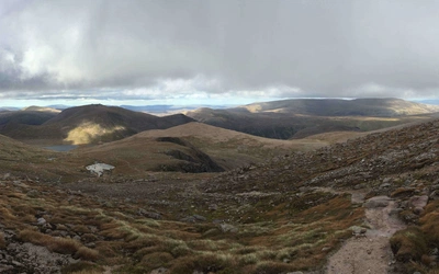
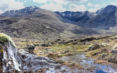
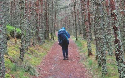
The landscape here differs markedly from Scotland's rockier north and west. Grassy, pebbly plateaus and rounded ridges characterise the higher ground, while the valleys are floored with some of the finest ancient woodland in the Highlands: the Birnam Oak, the Black Wood of Rannoch, the oaks and birches of Glen Lyon. The great rivers Tay and Garry run strong and clear through this country, and hidden shielings, bright burns and little waterfalls reward anyone who leaves the main glens. For walkers who have found the Cairngorms or the northwest too rocky and severe, these are the hills to discover next. And for those who find them too gentle? The long boggy ridges of Beinn a' Ghlo or the remote approaches to Ben Alder will quickly revise that view.
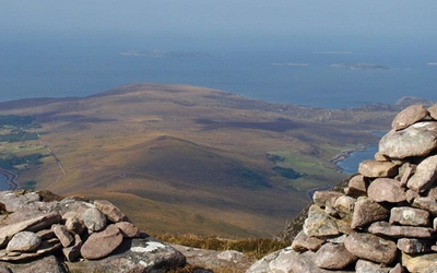
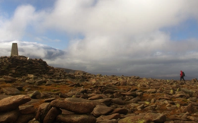
Schiehallion, the perfectly-formed quartzite cone at the geographic heart of the book, makes as good a centrepiece as any summit in Scotland. Standing on its summit, you can trace almost every range covered by this guide: Ben Lawers to the south, Beinn a' Ghlo to the northeast, the Bridge of Orchy hills to the west, and the flat brown expanse of Rannoch Moor stretching away towards Ben Nevis. This planning guide answers the most common questions walkers have before setting out. For complete route descriptions and mapping, see the Cicerone Walking Ben Lawers, Rannoch and Atholl guidebook.
The 80 routes at a glance
The guidebook's 80 routes span 10 geographic sections across Highland Perthshire, from easy riverside strolls to serious remote mountain days. Difficulty is rated on a scale of 1 (clear smooth paths, no steep sections) to 5 (featureless plateau, remote high ground, rocky terrain).
| Section | Routes | Distance range | Time range |
|---|---|---|---|
| Comrie and Crieff | 8 | 6–26km (3½–16½ miles) | 2–9 hrs |
| Killin and Glen Lochay | 10 | 2.5–27km (1½–17 miles) | 1¼–9 hrs |
| Glen Lyon | 7 | 7–28km (4½–17½ miles) | 2¾–10½ hrs |
| Bridge of Orchy | 8 | 11–30km (7–19 miles) | 5–10½ hrs |
| Perth and Dunkeld | 4 | 12.5–17.5km (8–11 miles) | 3¾–5½ hrs |
| Aberfeldy | 8 | 8.5–21km (5–13 miles) | 2½–7 hrs |
| Tummel and Loch Rannoch | 13 | 2.5–18km (1½–11 miles) | 1–6½ hrs |
| Rannoch Moor | 5 | 10–25km (6–15½ miles) | 3½–8½ hrs |
| Pitlochry and Blair Atholl | 11 | 5–39km (3–24 miles) | 1½–11 hrs |
| Drumochter | 6 | 24–45km (15–28 miles) | 8½–13 hrs |

Who is this guidebook suitable for?
The book is genuinely suitable for all abilities, but it is worth being clear about what that means in a Highland context. The low-level routes in Parts 5 and 6 (Perth, Dunkeld, Aberfeldy) and the shorter valley walks throughout are straightforward for any reasonably fit walker with good footwear. These have difficulty ratings of 1 or 2 and require no navigation beyond following a path.
The mountain routes are a different matter. As Ronald Turnbull points out in the introduction, these hills are noticeably larger and more remote than equivalent walks in Snowdonia or the Lake District. Walkers stepping up from those areas should factor in the greater distances to help and the rapid weather changes that are possible on any Scottish summit. A compass is essential on the higher routes, and ice axe competence is required for winter visits to the tops. The book's difficulty scale runs from 1 (clear smooth paths, no steep sections) to 5 (featureless plateau requiring compass bearings in mist, heather tramping, remote high ground, rocky ground). Most of the Munro routes sit at 3 or 4; several, including the Tarmachans, the Lyon side crossing, and A' Bhuidheanach Bheag, are rated 5.
There is no serious rock scrambling in this book, with the notable exception of Ben Alder's Long and Short Leachas ridges (both rated difficulty 5), which require a head for exposure. Dogs are welcome on many of the lower routes but should be kept on leads near livestock, and owners should be aware of the restrictions that apply during the deer stalking season from mid-August to 21 October.
When is the best time to walk in Ben Lawers, Rannoch and Atholl?
April and May are the finest months. Low-level routes offer excellent walking from April as the leaves break and the birds are at their noisiest. By May, most of the Munros are clear of snow and the days are long. The boggy cols are still firm underfoot in early May, making cross-country travel easier than later in the year.
June and July are enjoyable at all altitudes, though the views can be less rewarding in the heat haze that sometimes settles over the glens. Midges arrive in July: they come in smaller numbers than in the west, but they are worsening with each passing year. Keep moving, and when you stop, stop high.
August is still good on the summits, but the stalking season restrictions begin from mid-month on many estates across the area, from Glen Lyon to Rannoch Moor. Appendix B of the guidebook gives detailed advice on responsible access during this period. Midges persist until the first frost.
September is a transitional month: the midges usually clear by mid-September, the autumn colours begin and the air sharpens. Gales become more frequent as the month goes on.
October brings golden birch leaves to Glen Lyon, Birnam Wood and the banks of the Tay, and is excellent for the low-level woodland routes. The high tops are increasingly cold and can receive early snowfall.
Winter (November to March) is a season for experienced, well-equipped walkers only. Snow lies on the high tops from December to April. The alpine-style ascents of Meall nan Tarmachan and Ben Lawers in winter conditions, with 100km views through the cold, clear air, are among the finest experiences the Scottish Highlands offer. An ice axe and crampons are essential, and navigation skills must be solid.

What accommodation is available?
The area is well served by accommodation for a Highland destination, with several well-established bases offering a range of options.
Pitlochry is the most accessible base, with a good spread of B&Bs, hotels, a youth hostel and independent hostels. It has a railway station on the main Perth to Inverness line and sits within reach of Ben Vrackie, the Beinn a' Ghlo group and Blair Atholl. The town lives up to its shortbread-and-tea reputation, which is not necessarily a disadvantage after a long day on the hill.
Aberfeldy gives good access to Glen Lyon, the eastern Ben Lawers approaches and the Tummel routes. Killin, at the western end of Loch Tay, is the natural base for Ben Lawers and the Tarmachans. Blair Atholl suits walkers tackling Glen Tilt and Beinn a' Ghlo, with a campsite and hotel.
Dunkeld and Crieff are lower-level bases with good accommodation for those focusing on the woodland and valley routes.
For the remote Ben Alder group, walkers typically either camp or use the bothies: Benalder Cottage (unlocked, no facilities) and Culra Bothy (also unlocked). Both require a lengthy approach on foot or by mountain bike. There are no facilities of any kind on Rannoch Moor itself.
Full accommodation listings are given in Appendix C of the guidebook.
How do I get to Ben Lawers, Rannoch and Atholl?
By rail: Pitlochry has a direct rail connection on the ScotRail Highland Main Line from Perth and Inverness. Dunkeld and Birnam station serves the southern part of the area. Rannoch Station, remote on the West Highland Line, is the starting point for the Road to the Isles walk (Route 59) and is one of the most atmospheric railway arrivals in Britain.
By road: The A9 is the main artery north from Perth, giving fast access to Pitlochry, Blair Atholl and the Drumochter routes. The A827 connects Aberfeldy to Killin along the north shore of Loch Tay. The Bridge of Orchy area is reached via the A82 from Glasgow.
By bus: Pitlochry, Aberfeldy, Crieff, Comrie and Dunkeld are all served by Scottish Citylink and local bus services from Perth. Details are given in Appendix C of the guidebook. Several of the linear routes can be connected using bus or train: the guidebook notes these options for each relevant route.
Parking: Most routes have a starting car park or a roadside parking area; locations are given in the route information boxes.
What are the highlights of walking in Ben Lawers, Rannoch and Atholl?
- Ben Lawers (1214m): The highest summit in the southern Highlands outside the Cairngorms, with outstanding wildflower interest and a National Nature Reserve on its flanks. The summit summary section in the guidebook covers five separate ascent lines.
- Schiehallion: One of Scotland's most distinctive mountains, its quartzite summit ridge giving a 360-degree view of almost the entire book area. The end-to-end traverse (Route 46) is the classic approach.
- Beinn a' Ghlo: A complex, multi-topped massif above Blair Atholl with three Munros. The Around Beinn a' Ghlo route (Route 71, 39km/24 miles) is one of the great long days in the Highlands.
- Ben Alder and the Leachas ridges: Remote, serious, magnificent. The Long and Short Leachas are the only genuine scrambling in the book, both rated difficulty 5, approached via a 13–16km/8–10 mile walk-in to Culra Bothy.
- The Atholl Passes: The Minigaig and Gaick are ancient drove roads through the heart of the Grampians. The Minigaig the ancient way (Route 77, 45km/28 miles, 13 hours) is the longest route in the book.
- Big Tree Country: Birnam Wood's Birnam Oak, the Hermitage at Dunkeld, the Fortingall Yew (claimed to be the oldest living organism in Europe), and the Birks of Aberfeldy: Perthshire's trees are as much a highlight as its summits.
- Rannoch Moor: Bleak, boggy, trackless and unforgettable. The road to the Isles walk (Route 59) crosses the southern edge of the moor, visiting Rannoch Station, which has no road access and is served only by the West Highland Railway.
Plan your walk with the Cicerone guidebook
The Cicerone Walking Ben Lawers, Rannoch and Atholl by Ronald Turnbull contains everything you need to plan and walk any of the book's 80 routes across Highland Perthshire.
- 80 fully described routes, graded by both length (1–5) and difficulty (1–5), covering 42 Munros, 22 Corbetts, 15 smaller hills, and 2 historic cross-country passes
- Route information boxes at the head of each walk with distance, time, difficulty and start/finish details
- 1:50,000 OS Landranger mapping for lower-level routes and 1:100,000 mapping for mountain routes, alongside advice on which Harvey maps to carry on the hill
- Summit summary sections for Ben Lawers, Beinn Dorain and Ben Alder, pulling together multiple ascent options for each major peak
- Yellow-boxed suggestions for extensions, short-cuts and route combinations throughout
- Appendix A: complete route summary table for all 80 routes
- Appendix B: practical guidance on deer stalking season access across the estates
- Appendix C: comprehensive listings of shops, accommodation and public transport for all bases
Available as a printed guidebook (£14.95) or digital eBook (£14.95).
Walking Ben Lawers, Rannoch and Atholl
Mountains and glens of Highland Perthshire
£14.95
Walking guidebook to the highlands of Perthshire. Areas include Pitlochry, Rannoch, Aberfeldy, Ben Lawers and Ben Alder. 80 graded routes between Stirling and the Cairngorms explore grassy mountains and include 42 Munros, 22 selected Corbetts, 15 smaller hills and the Gaick and Minigaig passes. A range of walks for all abilities.
More informationAbout Ronald Turnbull, guidebook author:
Ronald Turnbull was born in St Andrews, Scotland, into an energetic fellwalking family. His grandfather was a president of the Scottish Mountaineering Club, and a more remote ancestor was distinguished as only the second climbing fatality in Snowdonia.
In 1995 Ronald won the Fell Running Association's Long-distance Trophy for a non-stop run over all the 2000ft hills of Southern Scotland; his other proud achievements include the ascent of the north ridge of the Weisshorn and a sub-2hr Ben Nevis race. He enjoys multi-day treks, through the Highlands in particular, and has made 21 different coast-to-coast crossings of the UK. He has also slept out, in bivvy bag rather than tent, on over 80 UK summits. Outside the UK he likes hot, rocky areas of Europe, ideally with beaches and cheap aeroplanes. Recently he achieved California's 220-mile John Muir Trail and East Lothian's 45-mile John Muir Way in a single season, believing himself the first to have achieved this slightly perverse double. He has also started trying to understand the geology of what he's been walking and climbing on for so long.
Ronald lives in the Lowther Hills of Dumfriesshire, and most of his walking, and writing, takes place in the nearby Lake District and in the Scottish Highlands. His recent books include The Book of the Bivvy, and walking/scrambling guides Loch Lomond and the Trossachs, The Cairngorms and Ben Nevis & Glen Coe, as well as Three Peaks Ten Tors, a slightly squint-eyed look at various UK challenge walks. He has nine times won Outdoor Writers & Photographers Guild Awards for Excellence for his guidebooks, outdoor books and magazine articles. He has a regular column in Lakeland Walker and also writes in Trail, Cumbria and TGO (The Great Outdoors). His current, hopelessly ambitious, project is to avoid completing the Munros for at least another 20 years. Ronald's weekly newsletter on mountains, hillwalking and history is at https://aboutmountains.substack.com/