Walking in Derbyshire: a complete planning guide
Derbyshire is a county the Victorian critic John Ruskin praised for its compact variety, a landscape small enough to take in at a glance: gritstone edges and moorland giving way to limestone dales and historic estates further south. This guide introduces walking in Derbyshire: why the county rewards a visit, how to plan a walk, and how Elaine Burkinshaw's Walking in Derbyshire, with its 60 easy to moderate routes, can help. Burkinshaw came to the county slowly, after years avoiding the Peak District that surrounds her Sheffield home and discovering the beauty of the county outside of the national park. (Last updated: July 2026 · Guidebook edition: 2nd edition, reprinted September 2024)
Walking in Derbyshire, quick facts:
- Location: Derbyshire, including the Peak District National Park and the Derbyshire Dales
- Total routes: 60 circular day and half-day walks
- Distance range: 4 to 16km (3 to 10 miles) per walk
- Typical duration: 1 to 6 hours, depending on route
- Difficulty: Easy to moderate, suitable for beginners, casual walkers and experienced hikers
- Terrain: Gritstone edges, limestone dales, open moorland, river valleys, rolling farmland and historic estate parkland
- Navigation: Step-by-step route instructions with OS 1:50,000 mapping
- Best season: Year-round; spring to early autumn generally offers the best weather and wildlife viewing
- Guidebook: Walking in Derbyshire by Elaine Burkinshaw, 2nd edition, Cicerone
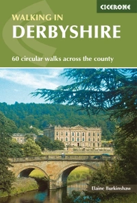
Walking in Derbyshire
60 circular walks across the county
£14.95
Walking guidebook to 60 circular day walks in Derbyshire and the Peak District. Includes the Derwent, Wye and Trent river valleys, near Derby, Matlock, Glossop, Bakewell and Ripley. Routes range from easy to moderate and are between 4 and 14km (2 to 10 miles). Walks focus on places of interest, from Stone Age forts to castles to grand estates.
More informationWhat is Walking in Derbyshire?
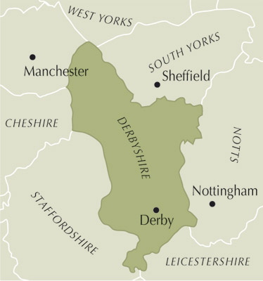
Walking in Derbyshire is a Cicerone guidebook bringing together 60 circular day and half-day walks spread right across the county, rather than confining itself to the Peak District alone. Author Elaine Burkinshaw set out to fill a gap she noticed as a local walker: while the Peak District, which covers roughly half the county and is Britain's first and most-visited national park, has been the subject of numerous walking books, comparatively few guides cover the whole of Derbyshire or give proper attention to the south of the county in its own right.
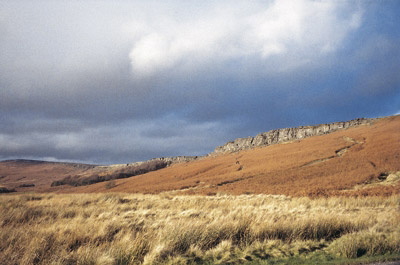
The walks range from the dramatic gritstone edges and wild moorland of the Dark Peak in the north to the limestone dales of the White Peak around Ashbourne and Castleton, and on into the gentler, less-walked farmland and parkland of south Derbyshire. Burkinshaw has deliberately kept every route easy to moderate, avoiding the more demanding terrain of the Dark Peak moors, which makes the collection well suited to families, less experienced walkers and anyone wanting to combine a walk with visiting a historic house or attraction along the way.
Derbyshire sits, in Burkinshaw's words, at "the crossroads of England, where highland meets lowland," and the guidebook makes the case that few English counties pack in so much variety within one boundary: sweeping gritstone edges and rugged moorland, sparkling rivers laced with limestone dales, and gentle rolling countryside further south, all within an hour's drive of roughly half the population of England. The poet Byron thought parts of it "as noble as in Switzerland or Greece," and the county's historic estates, market towns and plague village of Eyam add a depth of human history to match the scenery. This planning guide answers the most common questions walkers have before setting out. For complete stage-by-stage route descriptions and mapping, see the Cicerone Walking in Derbyshire guidebook.
The 60 routes at a glance
Burkinshaw's 60 walks cover the full county rather than concentrating on the better-known Peak District alone, and are grouped loosely around several distinct areas:
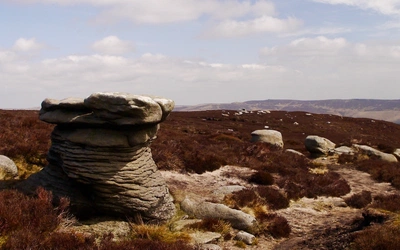
- The Dark Peak, in the north of the county, including gritstone-edge walks such as Baslow, Curbar and Froggatt Edges, Longshaw Estate and Carl Wark, and Hathersage and Stanage Edge
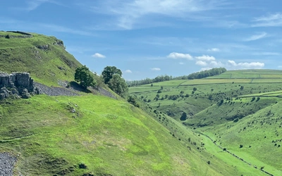
- The White Peak, the limestone dales running roughly from Ashbourne to Castleton, taking in Dovedale, Lathkill Dale and Bradford Dale, and the market towns of Bakewell, Tideswell and Ashbourne
- Northeast Derbyshire, with its industrial heritage and estates including Hardwick Hall, Bolsover Castle and the Midland Railway Centre
- South Derbyshire, including Calke Abbey, Melbourne Hall, Elvaston Castle and Shardlow
- The Derwent, Wye and Trent valleys, connecting many of the walks through the river systems that shaped the county's industrial development, from Cromford and Belper to Shardlow
Each walk is built around a named historical theme or attraction, from Stone Age forts to castles and grand estates, so the book works equally well as a walking guide and as a way of exploring Derbyshire's heritage on foot.
8 walks in Derbyshire
| Walk | Distance (km/miles) | Why it stands out |
|---|---|---|
| Chatsworth House | 13/8 | Passes the Cavendish family's Chatsworth estate, one of England's best-known stately homes and one of the guidebook's headline "must see" walks |
| Dovedale | 11.5/7 | Follows one of the White Peak's signature limestone valleys |
| Eyam | 10.5/6½ | Visits the "Plague Village," famed for its 1665 self-imposed quarantine during the Great Plague |
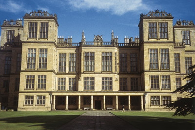
| Hardwick Hall | 14/9 | Takes in Bess of Hardwick's Elizabethan house, "more glass than wall" |
| Kedleston Hall | 5/3 | Reaches Kedleston Hall, one of the grand estates of less-visited south Derbyshire |
| Cromford | 9.5/6 | Explores Cromford, where Richard Arkwright built the world's first water-powered spinning mill, now part of the Derwent Valley Mills World Heritage Site |
| Errwood Hall and Goyt Valley | 9/5½ | Crosses the reservoirs and conifer plantations of the Goyt Valley in the Dark Peak |
| Buxton and its Country Park | 5/3 | Takes in Buxton, the spa town developed by the Dukes of Devonshire from the profits of the Fifth Duke's Ecton copper mines |
What historical sites can you visit walking in Derbyshire?
Derbyshire's walking takes in a real span of the county's history in one place: prehistoric monuments, Roman forts, medieval castles and abbeys, and the country estates and industrial sites of more recent centuries. Early routes visit Stone Age and Bronze Age sites such as Creswell Crags and Arbor Low Stone Circle, others take in Roman forts, medieval castles and abbeys, and later walks reach the country estates, spa towns and Industrial Revolution sites of Georgian and Victorian Derbyshire. Walking in Derbyshire reflects this span directly, arranging its 60 walks in a rough chronological order by historical theme rather than simply by area, so that working through the book takes you through layers of Derbyshire's history in turn.
This means walkers dipping in and out of the book can use its contents list to pick out a theme that interests them, whether that's prehistoric monuments, Tudor and Stuart history, or the industrial heritage of the Derwent Valley, rather than simply picking the walk nearest to where they're staying.
Who is Walking in Derbyshire suitable for?
This collection is aimed squarely at families, casual walkers, and those newer to walking, alongside more experienced hikers looking for gentler days out or a change from the Peak District's higher ground. Burkinshaw has avoided the more demanding terrain of the Dark Peak's moorland tops throughout, describing herself as "a rambler rather than a serious hiker or mountaineer," and each walk is built around visiting a specific attraction, which suits anyone wanting to combine walking with sightseeing rather than covering maximum distance or ascent.
How difficult are the walks?
Every walk in the book is graded easy to moderate, with distances ranging from 4 to 16km (3 to 10 miles). None of the routes venture onto the higher, rougher Dark Peak moorland that features in some other Peak District guidebooks, so underfoot conditions are generally on established paths, tracks and field paths rather than pathless moor. Walkers wanting the higher gritstone tops and remoter moorland of the Dark Peak, such as Kinder Scout, are better served by the dedicated Dark Peak guidebook; this collection prioritises accessibility and points of interest over height gained.
When is the best time to walk in Derbyshire?
- Spring (March to May): A good time for the White Peak dales, when wild flowers are emerging on the limestone grassland; can still be wet underfoot after winter rain
- Summer (June to August): The most popular season, particularly around honeypot sites such as Chatsworth House, Dovedale and Eyam; expect busier car parks and villages at weekends
- Autumn (September to October): Often the best all-round month, with settled weather, autumn colour in the dales, and quieter attractions
- Winter (November to February): Walks are possible year-round, though the higher gritstone edges and moorland fringes can be cold, wet and occasionally icy; the lower-lying White Peak dales and south Derbyshire routes tend to stay more accessible
Derbyshire's walks are described as available year-round, with no month ruled out entirely, though the exposed gritstone edges of the Dark Peak are more weather-dependent than the sheltered dales and parkland further south.
What accommodation is available?
Derbyshire's popularity as a walking and tourism destination means accommodation is well established around the main centres named in the guidebook, including Glossop, Buxton, Bakewell, Matlock, Ripley, Ashbourne and Derby. These towns offer a full range of options from B&Bs and guesthouses to hotels, and make practical bases for exploring several walks in the same area without needing to move on each day. For full accommodation listings, see the guidebook appendix.
Getting there and back
Derbyshire's position at the crossroads of England, within an hour's drive of roughly half the population of England, makes it well served by road and rail. Burkinshaw notes the county sits close to the conurbations of Sheffield, Manchester, Nottingham, Stoke and Derby, and several of the walks are built around towns with their own rail stations, including Glossop, Buxton, Bakewell (via Matlock), Matlock, Derby and Ashbourne. Given the number and geographic spread of the 60 walks, most walks are best reached by car, with parking noted at the start of each route; see individual route descriptions for public transport options.
What are the route highlights?
Derbyshire's walks pass some of England's best-known historic houses and landmarks, giving each outing a destination as well as a good day's walking:
- Chatsworth House, the Cavendish family seat, featured across several walks including Chatsworth House, Bakewell and Edensor
- Hardwick Hall, Bess of Hardwick's Elizabethan house, "more glass than wall"
- Eyam, the "Plague Village," famed for its 1665 self-imposed quarantine
- Dovedale, one of the White Peak's best-known limestone valleys
- Peveril Castle and Castleton, with its Norman castle ruins above the village
- Kedleston Hall, Calke Abbey and Melbourne Hall, three of south Derbyshire's grand estates
Walking in Derbyshire
60 circular walks across the county
£14.95
Walking guidebook to 60 circular day walks in Derbyshire and the Peak District. Includes the Derwent, Wye and Trent river valleys, near Derby, Matlock, Glossop, Bakewell and Ripley. Routes range from easy to moderate and are between 4 and 14km (2 to 10 miles). Walks focus on places of interest, from Stone Age forts to castles to grand estates.
More informationPlan your Derbyshire walks with the Cicerone guidebook
The Walking in Derbyshire guidebook by Elaine Burkinshaw contains everything you need to plan and complete all 60 walks, from the Peak District's gritstone edges to the historic estates of south Derbyshire.
- 60 circular walks across Derbyshire and the Peak District
- Step-by-step route descriptions with 1:50,000 scale route maps for each walk, plus recommended OS Explorer 1:25,000 maps for those wanting more detail in the field
- A route summary table in the appendix to help you choose a walk to suit your day
- Practical information for each walk, including terrain notes, refreshment stops, toilets and local facilities
- Coverage of historic landmarks and attractions along each route, from Stone Age monuments to grand country houses
- A pocket-sized format designed to be carried easily on the trail
- Free online route updates
Available as a printed guidebook (£14.95) or digital eBook.
About Elaine Burkinshaw, guidebook author
Although my husband, Andrew, and I currently live in South Yorkshire, we are only 200 metres from the Derbyshire border and very close to Nottinghamshire. Indeed, I have lived all my life in and around Sheffield and Manchester. Historic Walks in Derbyshire is my third walking guide, following Walking in Sherwood Forest and the Dukeries (Cicerone Press) and Discovery Walks in North East Derbyshire (Sigma Press), which were both inspired by a desire to explore new local walks as an alternative to the Peak District, to which the majority of walkers living in Sheffield are automatically drawn.