Walking in Lancashire: a complete planning guide
Make no mistake: Lancashire is one of the wealthiest counties in England when it comes to natural assets. Two National Landscapes, 160 kilometres of coastline, upland reservoirs, internationally important nature reserves and a food scene quietly accumulating Michelin stars while the rest of the country wasn't paying attention. The Cicerone guidebook Walking in Lancashire by Mark Sutcliffe brings together 40 circular day walks from 8 to 16km (5–10 miles) across the full breadth of the Red Rose County, plus the Bowland Traverse: a two-day, 46km (29-mile) trek across the wild heart of the Forest of Bowland. (Last updated: June 2026 · Guidebook edition: First edition, reprinted July 2025).
Walking in Lancashire, quick facts
- Location: Lancashire, North West England
- Total routes: 40 circular day walks plus the Bowland Traverse (a two-day, 46km/29-mile linear trek)
- Distance range: 8–16km (5–10 miles) per day walk
- Typical duration: 3–5 hours per day walk; 2 days for the Bowland Traverse
- Difficulty: Easy rambles to challenging upland hikes; suitable for beginners to experienced walkers
- Terrain: Gritstone moors, limestone edges, verdant valleys, open moorland, canal towpaths, coastline and woodland
- Highest point: Gragareth, 627m (Lancashire's county top, Walk 16)
- Navigation: 1:50,000 OS map extracts in the guidebook; free downloadable GPX tracks for all routes
- Best season: Year-round; May–June for wildflowers; cold clear days in winter for panoramic summit views
- Guidebook: Walking in Lancashire by Mark Sutcliffe, first edition (Cicerone, 2021)
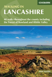
Walking in Lancashire
40 walks throughout the county including the Forest of Bowland and Ribble Valley
£14.95
Guidebook of 40 walks exploring the dales, moors, uplands and coasts of Lancashire, including Morecambe Bay, the Forest of Bowland, Ribble Valley and the West Pennine Moors. With routes for all seasons of the year and for a variety of abilities, these walks are within easy reach of Preston, Blackburn, Burnley, Lancaster and Clitheroe.
More informationWhat is Walking in Lancashire?
Walking in Lancashire is a day-walk collection covering the full breadth of the Red Rose County, with 40 circular routes arranged in three geographic sections: North Lancashire and the Bowland Fells, West Lancashire, and South Lancashire and the West Pennine Moors. The collection ranges from wild weekend adventures for committed hikers to shorter wildlife-rich walks for active families, with the Bowland Traverse (Walk 21) providing the one extended challenge: a two-day, 46km crossing of the Bowland Fells between Wennington and Giggleswick.
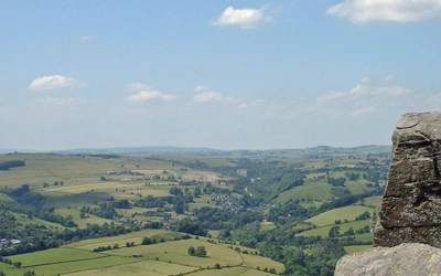
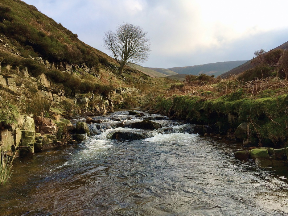
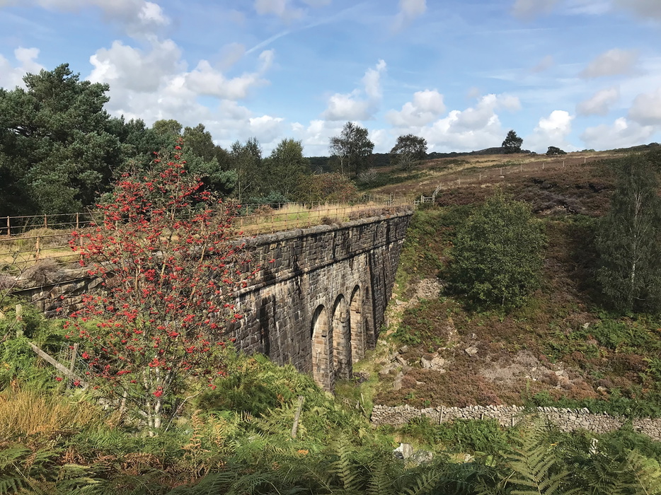
The beauty of Lancashire lies in the diversity of its landscapes. To the north, the Forest of Bowland National Landscape is a side of Lancashire that few people outside the county fully appreciate: beyond the industry and the urban sprawl, thousands of square kilometres of largely undiscovered country, its remote valleys and high fells little changed for centuries. The gritstone moors of the West Pennines, cut by steep-sided cloughs and punctuated by chains of upland reservoirs, roll south towards Blackburn and Bolton, while out west the flat fertile plain of the Fylde opens up to the big skies and wide tidal sands of Morecambe Bay. The gradients in the south can be punishing, the panoramas in the north increasingly rewarding: Pendle Hill, visible from most of Lancashire's principal towns, offers clear-day views to Snowdon, Scafell Pike and the Roaches in Staffordshire. For walkers used to the honeypots of the Lake District or the Peak District, much of this landscape will feel like a revelation.
The history of Lancashire
The county's history runs deeper than most visitors realise. The County Palatine of Lancashire was, in its medieval heyday, something closer to a semi-autonomous region. Edward III granted it special status in 1351, and its most famous holder, John of Gaunt, was de facto ruler of England during his father's illness. The ongoing dispute between John of Gaunt's descendants and those of his younger brother Edmund became, of course, the Wars of the Roses, whose legacy persists in everything from the Tudor Rose to the Loyal Toast. The seeds for the set-piece access confrontations of the 1930s on Kinder Scout were sown on the moors above Blackburn and Darwen nearly 50 years earlier, and the sense of fierce local pride and independence that drove those early battles is still palpable across the county today. This planning guide covers the most common questions walkers have before setting out. For complete route descriptions and mapping, see the Cicerone Walking in Lancashire guidebook.
The 40 routes at a glance
The guidebook divides its 40 walks into three geographic sections, reflecting Lancashire's varied character.
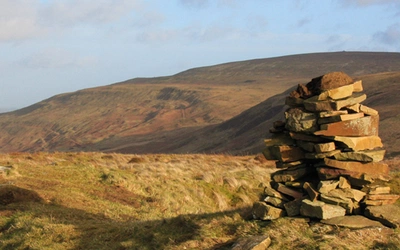
North Lancashire and the Bowland Fells (Walks 1–21) is the largest section and contains the most challenging terrain. Routes here explore the remote valleys and high fells of the Forest of Bowland AONB, including Clougha Pike (Walk 3), Ward's Stone (Walk 10), Whitendale Hanging Stones (Walk 13), and the iconic Parlick Pike and Fair Snape (Walk 7). This section also includes the coastal walks around Sunderland Point (Walk 18) and Silverdale and Warton Crag (Walk 19), along with Gragareth (Walk 16), the county's highest point at 627m. Walk 21, the Bowland Traverse, is the collection's sole multi-day route: a challenging 46km (29-mile) linear trek across the Bowland Fells from Wennington to Giggleswick, best completed over two days.
West Lancashire (Walks 22–26) covers the more pastoral middle section of the county, with routes around Hurst Green and Ribchester (Walk 22), Longridge Fell (Walk 23), and the wetlands of Rufford and Mere Sands Wood (Walk 26).
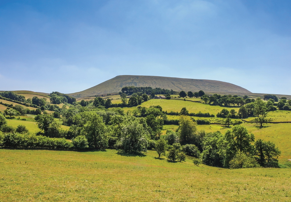
South Lancashire and the West Pennine Moors (Walks 27–40) takes in the gritstone uplands south and east of Blackburn and Burnley, including three routes on and around the iconic Pendle Hill (Walks 33–35), the reservoirs of Worsthorne Moor (Walk 39), and the high moorland of Wycoller and Boulsworth Hill (Walk 40).
Here is a sample of the walks available:
| Walk | Distance | Time | Area |
|---|---|---|---|
| Clougha Pike | 11.5km (7 miles | 4hr | Forest of Bowland |
| Parlick Pike and Fair Snape | 9.5km (6 miles) | 3hr | Forest of Bowland |
| Gragareth - Lancashire's county top | 13.5km (8¼ miles) | 5hr | North Lancashire |
| Silverdale and Warton Crag | 12.5km (7¾ miles) | 5hr | Morecambe Bay |
| The Bowland Traverse | 45.5km (28½ miles) | 2 days | Forest of Bowland |
| Anglezarke and Great Hil | 14km (9 miles) | 4hr | West Pennine Moors |
| Pendle Hill from Pendleton | 5.5km (9½ miles) | 4hr 30min | South Lancashire and the West Pennine Moors |
| Wycoller and Boulsworth Hill | 12.5km (7¾ mile | 4hr | South Lancashire and the West Pennine Moors |
Who is Walking in Lancashire suitable for?
These walks are suitable for a wide range of abilities, from active families and occasional walkers to seasoned hillgoers. The majority of the 40 day walks can be completed by any walker with a reasonable level of fitness, and many of the lower-level routes in West Lancashire and along the coast are genuinely beginner-friendly. That said, the collection has real ambition at the upper end: several routes in the Bowland Fells and on the West Pennine Moors involve sustained ascent, pathless terrain and exposed moorland that demands proper navigation skills and appropriate clothing.
Dogs are welcome on most routes, and many of the recommended pubs and cafés along the way are dog-friendly. Families with younger children will find the coastal routes around Morecambe Bay, the woodland and reservoir walks, and the lower-level Ribble Valley routes particularly well suited to a family day out.
How difficult are the walks?
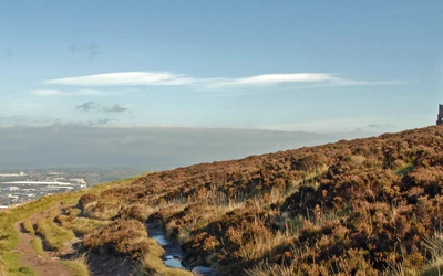
The walks span a broad difficulty range. Lower-level routes on canal towpaths, through woodland and across the coastal plain typically involve minimal ascent and well-maintained paths. The upland routes are a different matter. Higher-level routes that climb above 600m can be very challenging in winter conditions and require appropriate clothing and footwear, solid navigational skills and a basic knowledge of mountain safety. The Bowland Fells in particular are known for rapid weather changes: the Forest of Bowland receives heavy rainfall driven in from the Irish Sea, and mist can descend quickly on the higher ground.
The Bowland Traverse (Walk 21), at 46km (29 miles) over two days, is the most demanding route in the collection and should be treated as a genuine backcountry challenge. Navigation across pathless moorland on some sections requires competence with map and compass. As author Mark Sutcliffe notes, some of the early research walks for the first edition of this guide were undertaken during the 'Beast from the East' snowstorm in early 2018, and several had to be abandoned as thick drifts blocked the scheduled routes.
When is the best time to walk in Lancashire?
Lancashire is a year-round walking destination, though the weather demands respect in all seasons.
- Spring (March–May): One of the most rewarding times to visit. Wildflowers unfold progressively up the valley sides through February and March, with daffodils, primroses and bluebells providing colour from late February to mid-May. Migrant birds including ring ouzel, curlew and whimbrel arrive on the uplands in late spring, and the hen harriers of the Bowland Fells begin their spectacular sky-dancing courtship displays in May and June.
- May–June: Arguably the best months overall. Wildflowers are at their peak, the Pennine colour palette is at its most vibrant, and the longer days allow for unhurried exploration. Walking conditions on the uplands are generally good, though the ground can still be wet and boggy after a wet spring.
- Summer (July–August): Warm and often pleasant, though heatwaves can parch the upland peat quickly. The 2018 summer heatwave saw wildfire on the West Pennine Moors between Blackburn and Bolton: a reminder that conditions in Lancashire can swing from extreme to extreme.
- Autumn (September–October): Heather turns auburn on the moorland tops, the woodland canopy colours up, and rural shows and harvest festivals enliven the farming communities of the Ribble Valley and Bowland. A fine time to visit, especially for the lower-level routes.
- Winter (November–February): Snow is increasingly rare in the valley bottoms, though the Bowland Fells and West Pennine Moors regularly receive a frosting of snow and ice, and winter conditions up there need to be treated with respect. That said, some of these walks, especially Pendle Hill and Great Hill, are best undertaken on a cold, crisp mid-winter morning, when the views can be simply outstanding.
Getting to Lancashire and getting around
The county's major towns and cities are well served by rail. Preston is on the West Coast Main Line with fast connections to London, Manchester and Edinburgh. Lancaster, Blackburn, Burnley and Clitheroe all have rail connections, and the Bentham line running from Settle to Morecambe links several towns and villages on the northern edge of the Forest of Bowland AONB. Bus services across the county are on the whole reasonably reliable, though the overwhelmingly rural Forest of Bowland is more difficult to reach by public transport. For the remoter Bowland walks, a car is often the most practical option. Each route in the guidebook includes parking and public transport details.
Where should I base myself for walking in Lancashire?
Lancashire is well supplied with accommodation bases for walkers.
- Lancaster makes an excellent base for the northern Bowland and coastal routes, with a good range of city-centre accommodation and strong transport links.
- Clitheroe is the principal town of the Ribble Valley and provides ideal access to the Pendle and Bowland routes in the middle of the county.
- Preston, Blackburn, Burnley and Chorley all offer a comprehensive range of hotels and B&Bs in their leafier outlying suburbs, with good access to the West Pennine Moors routes.
- Slaidburn is the principal centre within the Forest of Bowland itself, but accommodation is quite limited there; most walkers base themselves in Clitheroe or Lancaster and drive in.
For the Bowland Traverse (Walk 21), the route runs between Wennington and Giggleswick, requiring either a two-car arrangement or use of the Bentham rail line for the return.
What are the route highlights?
- Pendle Hill (Walks 33–35): three routes exploring Lancashire's most iconic summit, rich in witchcraft history and offering views to Snowdon, Scafell Pike and the Roaches on a clear day
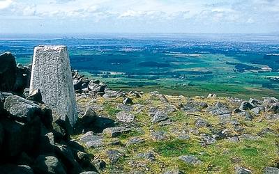
- Gragareth (Walk 16): Lancashire's county top at 627m, with extensive views over Morecambe Bay and the Cumbrian peninsulas
- The Bowland Traverse (Walk 21): a challenging two-day, 46km crossing of the Forest of Bowland between Wennington and Giggleswick
- RSPB Leighton Moss (Walk 19, Silverdale and Warton Crag): internationally important wetland reserve, home to bittern and bearded tit
- Clougha Pike (Walk 3): Andy Goldsworthy's land art sculptures on the fell edge, with panoramic views west to the coast
- Ward's Stone (Walk 10): Bowland's highest point and one of the most remote walks in the collection
- The Inn at Whitewell (Walk 14): one of England's most celebrated country inns, in the heart of the Upper Hodder Valley
Food, drink and the Lancashire food scene
Lancashire is increasingly acknowledged as one of the UK's leading food destinations, and the guidebook takes this seriously. Beyond the Michelin-starred establishments such as Northcote, the White Swan and Moor Hall, the county has a strong cluster of destination gastropubs in the Ribble Valley and Forest of Bowland: the Freemasons at Wiswell, the Parker's Arms in Newton and the Inn at Whitewell are all noted in the guidebook. Most welcome walkers and some are dog-friendly.
Beer drinkers are particularly well served. Thwaites, Moorhouses of Burnley, Bowland Brewery in Clitheroe, Farm Yard Ales in Lancaster and Northern Whisper Brewing Co. in Rossendale all produce excellent cask ales, and the county's village pubs take the craft seriously. Each route includes recommendations for local refreshment stops.
Walking in Lancashire
40 walks throughout the county including the Forest of Bowland and Ribble Valley
£14.95
Guidebook of 40 walks exploring the dales, moors, uplands and coasts of Lancashire, including Morecambe Bay, the Forest of Bowland, Ribble Valley and the West Pennine Moors. With routes for all seasons of the year and for a variety of abilities, these walks are within easy reach of Preston, Blackburn, Burnley, Lancaster and Clitheroe.
More informationPlan your walk with the Cicerone guidebook
The Cicerone Walking in Lancashire by Mark Sutcliffe contains everything you need to explore the county's walking country, from a gentle coastal stroll to a demanding two-day traverse of the Bowland Fells.
- 40 circular day walks ranging from 8 to 16km (5–10 miles), plus the two-day Bowland Traverse (46km/29 miles)
- Routes divided into three geographic sections: North Lancashire and the Bowland Fells, West Lancashire, and South Lancashire and the West Pennine Moors
- 1:50,000 OS map extracts for every route, with detailed route descriptions
- Parking and public transport information for each walk
- Pub, café and artisan food recommendations throughout
- Appendix A: full route summary table with distances and timings
- Appendix B: useful contacts including mountain rescue and access information
- Free GPX tracks for all routes, downloadable at cicerone.co.uk/1003/GPX
About Mark Sutcliffe, guidebook author
An experienced outdoor writer and editor, Mark Sutcliffe is a former editor of Country Walking and Lakeland Walker magazines and an occasional contributor to some of the UK's leading outdoor magazines, including Countryfile, Landscape and Trail. Mark has explored extensively in the UK and Europe on foot and has in-depth knowledge of the Forest of Bowland, where he spends much of his spare time hiking, bird watching and taking pictures. He completed the Yorkshire Three Peaks Challenge in 2016, raising funds for dementia research.